

List of streets and squares in Dublin
Encyclopedia
This is a list of notable streets and squares in Dublin
, Ireland.
Streets and squares in Dublin
This article deals with the streets and squares in Dublin and the Greater Dublin Area of Ireland.- Street naming :Most streets in Dublin carry names given during the period of English colonial rule. Some streets were renamed during the late colonial or Free State periods for Irish persons.Street...
, Ireland.
| Street or square name | Irish Irish language Irish , also known as Irish Gaelic, is a Goidelic language of the Indo-European language family, originating in Ireland and historically spoken by the Irish people. Irish is now spoken as a first language by a minority of Irish people, as well as being a second language of a larger proportion of... name |
Date |
Historical names |
Route number Roads in Ireland The island of Ireland, comprising Northern Ireland and the Republic of Ireland, has an extensive network of tens of thousands of kilometres of public roads, usually surfaced. These roads have been developed and modernised over centuries, from trackways suitable only for walkers and horses, to... |
Dublin postal district | Sections | Continuations | Termini and major cross-streets |
|---|---|---|---|---|---|---|---|---|
| Abbey Street Abbey Street Abbey Street is located on Dublin's Northside and is one of the principal shopping streets of Dublin, running from the Customs House in the east to Capel Street in the west... |
Sráid na Mainistreach | 1728 | 1 | Lwr, mid, upr | Mary's Abbey | Beresford St, Capel St | ||
| Ailesbury Road Ailesbury Road Ailesbury Road , Dublin 4, Ireland, is a tree-lined avenue linking Sydney Parade Station on Sydney Parade Avenue and the Church of the Sacred Heart, Donnybrook.... |
Bóthar Ailesbury, Bóthar Aelsbaire | R824 R824 road The R824 road is a regional road in south Dublin, Ireland. The road starts between Sandford and Clonskeagh, passes Donnybrook and finishes at the junction with the Merrion Road and Ailesbury Road close by to Sydney Parade.- Route :... |
4 | Sydney Parade Ave Sydney Parade Avenue Sydney Parade Avenue Sandymount, Dublin 4, Ireland runs from the land formerly known as Ailesbury Park opposite the Merrion Centre at the Merrion Road end, to the sea of Dublin Bay at the Strand Road.... , Merrion Rd Merrion Road Merrion Road in Dublin 4 is a road which runs from the RDS at Anglesea Road in Ballsbridge to Merrion, where it meets the Rock Road, Booterstown. It is home to the RDS, some well known hotels and is part of the Embassy Belt.... , Stillorgan Rd |
||||
| Amiens Street | Sráid Amiens | 1800 | The Strand (1728) | R105 R105 road The R105 road is a regional road in north Dublin, Ireland. It travels from the city centre to Howth, and the road loops at both ends.The official description of the R105 from the Roads Act 1993 Order 2006 reads:... |
1 | N Strand Rd North Strand Road North Strand Road is a street in the Northside of Dublin, Ireland.-Route:North Strand Road is a continuation of Amiens Street that runs northeast from the junction of Portland Row and Seville Place... |
Memorial Rd/Beresford Pl, Talbot St Talbot Street Talbot Street is a city-centre street located on Dublin's Northside and is one of the principal shopping streets of Dublin, running from Connolly station and the IFSC at Amiens Street in the east to Marlborough Street in the west. The street is named after Charles Chetwynd, 3rd Earl of Talbot,... , Portland Row/Seville Pl |
|
| Anglesea Road Anglesea Road Anglesea Road is a road joining Donnybrook with Ballsbridge, in Dublin, Ireland. It forms part of the R108 regional route in Southeast Dublin.It is the location of Anglesea Road cricket ground.... |
Bóthar Mon | R815 R815 road The R815 road is a regional road in Dublin, Ireland.The official definition of the R815 from the Roads Act 1993 Order 2006 states:-See also:*Roads in Ireland*National primary road*National secondary road... |
4 | |||||
| Anne Street South (South Anne Street) | Sráid Anna Theas | 1723 | South St Anne St | 2 | Harry St | Grafton St, Dawson St Dawson Street Dawson Street is one of the main streets of central Dublin, running parallel to Grafton Street, to which it is connected by Duke Street and South Anne Street... |
||
| Baggot Street | Sráid Bhagóid | 1773 | Gallows Road (1756), Blackrock Rd (Baggot St Upr, 1800) | R816 R816 road The R816 road is a regional road in Dublin, Ireland.The official definition of the R816 from the Roads Act 1993 Order 2006 states:The road is long.-See also:*Roads in Ireland*National primary road... |
2, 4 | Lwr, upr | Merrion Row, Pembroke Rd | Merrion St Upr Merrion Street Merrion Street is a major Georgian street on the southside of Dublin, Ireland which runs along one side of Merrion Square. The garden entrance of Leinster House is located on the street, as is Irish Government Buildings, formerly the Royal College of Science for Ireland... , Waterloo Rd/Eastmoreland Pl |
| Bayside Boulevard | 13 | S, n | Verbena Lawn | Dublin Rd, Bayside Sq, Verbena Ave | ||||
| Bridge Street | Sráid an Droichid | 1317 | R108 R108 road The R108 road is a regional road in Ireland, linking Drogheda in County Louth to the N2 in Phibsborough, Dublin.The official description of the R108 from the Roads Act 1993 Order 2006 reads:The road is long.... |
2 | Lwr, upr | Fr Mathew Bridge | Usher's Qy/Merchant's Qy, Cornmarket/High St | |
| Capel Street | Sráid Chéipil, Sráid Cáppil, Sráid Capel | 1697 | R803 R803 road The R803 road is a regional road in Dublin, Ireland.The official definition of the R803 from the Roads Act 1993 Order 2006 states:-See also:*Roads in Ireland*National primary road*National secondary road... (part) |
1 | Grattan Bridge Grattan Bridge Grattan Bridge is a road bridge spanning the River Liffey in Dublin, Ireland, and joining Capel Street to Parliament Street and the south quays.-History:... |
Ormond Qy, Mary's Abbey/Abbey St Upr Abbey Street Abbey Street is located on Dublin's Northside and is one of the principal shopping streets of Dublin, running from the Customs House in the east to Capel Street in the west... , Little Mary St/Mary St, Parnell St Parnell Street Parnell Street is located on Dublin's Northside and runs from Capel Street in the west to Gardiner Street and Mountjoy Square in the east, and is at the north end of O'Connell Street, where it provides the south side of Parnell Square.... , Bolton St |
||
| Carrickbrack Road Carrickbrack Road Carrickbrack Road is a road in Dublin, Ireland. It leads east-southeast from Sutton Creek around the southern part of Howth Head up to the eastern part of the headland near the summit to Thormanby Road. It is the main thoroughfare through the southern part of the headland. Greenfield Road links it... |
R105 R105 road The R105 road is a regional road in north Dublin, Ireland. It travels from the city centre to Howth, and the road loops at both ends.The official description of the R105 from the Roads Act 1993 Order 2006 reads:... |
13 | Greenfield Rd | Strand Rd, Thormanby Rd | ||||
| Clyde Road Clyde Road Clyde Road runs from Wellington Place to a junction with Pembroke Road and Herbert Park in Ballsbridge. It intersects Raglan Road, Elgin Road and Wellington Road.... |
Bóthar Cluaidh | 4 | Wellington Pl | Pembroke Rd, Raglan Rd, Pembroke Park | ||||
| College Green College Green College Green is a three-sided "square" in the centre of Dublin. On its northern side is a building known today as the Bank of Ireland which until 1800 was Ireland's Parliament House. To its east stands Trinity College Dublin, the only constituent college of the University of Dublin. To its south... |
Faiche an Choláiste | 1666 | Hoggen Green (1635), The Old Shore (1734) | N1 | 2 | Dame St Dame Street Dame Street is a large thoroughfare in Dublin, Ireland. The street is the location of many banks such as AIB, Ulster Bank and the Central Bank of Ireland. It is close to Ireland's oldest university, Trinity College, Dublin, founded in 1592, the entrance to which is a popular meeting spot.During... , Grafton St/Westmoreland St |
||
| Dame Street Dame Street Dame Street is a large thoroughfare in Dublin, Ireland. The street is the location of many banks such as AIB, Ulster Bank and the Central Bank of Ireland. It is close to Ireland's oldest university, Trinity College, Dublin, founded in 1592, the entrance to which is a popular meeting spot.During... |
Sráid an Dáma | 1610 | Teyngmouth St (1348), Damask St (1661) | N81 N81 road The N81 road is a national secondary road in Ireland, connecting the gates of Trinity College, Dublin to Tullow, County Carlow, north to south. The N81 continues past Tullow for another 8 km to terminate at the village of Closh, County Carlow, where it intersects the N80. The N81 is long... |
2 | College Green College Green College Green is a three-sided "square" in the centre of Dublin. On its northern side is a building known today as the Bank of Ireland which until 1800 was Ireland's Parliament House. To its east stands Trinity College Dublin, the only constituent college of the University of Dublin. To its south... , Lord Edward St |
Church La, Great Georges St S, Parliament St/Cork Hill | |
| Dawson Street Dawson Street Dawson Street is one of the main streets of central Dublin, running parallel to Grafton Street, to which it is connected by Duke Street and South Anne Street... |
Sráid Dhásain, Sráid Dásain, Sráid Dawson | 1723 | N1 | 2 | Nassau St, Molesworth St, St Stephen's Green | |||
| Dorset Street | Sráid Dorset, Sráid Dorsait | 1756 | Drumcondra La (1728) | N1, R804 R804 road The R804 road is a regional road in Dublin, Ireland.The official definition of the R804 from the Roads Act 1993 Order 2006 states:-See also:*Roads in Ireland*National primary road*National secondary road... |
1 | Lwr, upr | Drumcondra Rd, Bolton St | Binns Br (Royal Canal), N Circular Rd |
| Drumcondra Road | Bóthar Dhroim Conrach | N1 | 9 | Lwr, upr | Dorset St Lwr, Swords Rd | Binns Br (Royal Canal), Clonliffe Rd, Griffith Ave | ||
| East Wall Road East Wall Road East Wall Road runs from the junction of the East-Link drawbridge and North Wall Quay, along the side of the northern part of Dublin port to the junction of the North Strand Road and Poplar Row.The Point Theatre lay at its southern end before it was demolished to make way for the O2 in 2008. It... |
Bóthar an Phoirt Thoir, Bóthar an Phuirt Thoir | R131 R131 road The R131 road is a regional road in Dublin, Ireland.The official description of the R131 from the Roads Act 1993 Order 2006 reads:-See also:*Roads in Ireland*National primary road*National secondary road... |
1, 3 | East-Link East-Link (Dublin) The East-Link is a toll bridge in Dublin, Ireland, on the River Liffey, owned by Dublin City Council and operated by NTR plc. The lifting bridge, which links North Wall to Ringsend, is the last bridge on the Liffey, which opens out into Dublin Port and then Dublin Bay just beyond... Toll Bridge, Poplar Row |
North Wall Qy, Sheriff St Upr, Alfie Byrne Rd, North Strand Rd North Strand Road North Strand Road is a street in the Northside of Dublin, Ireland.-Route:North Strand Road is a continuation of Amiens Street that runs northeast from the junction of Portland Row and Seville Place... |
|||
| Eccles Street | Sráid Eccles | 1772 | 1 | Temple St N | Dorset St, Berkeley Rd | |||
| Ely Place | Plás Íle, Plás Ely | 1773 | 2 | Ely Pl, Ely Pl Upr | Merrion St Upr Merrion Street Merrion Street is a major Georgian street on the southside of Dublin, Ireland which runs along one side of Merrion Square. The garden entrance of Leinster House is located on the street, as is Irish Government Buildings, formerly the Royal College of Science for Ireland... |
Merrion Row/Baggot St Lwr | ||
| Fishamble Street Fishamble Street Fishamble Street is a street in Dublin, Ireland within the old city walls.The street joins Wood Quay at the Fish Slip near Fyan's Castle. It is mentioned in the 14th century as Vicus Piscariorum and as Fish Street. In 1577, Stanihurst named it as St John's Street... |
Sráid Sheamlas an Éisc | Fish St (1470), Fisher St (1570) | 2 | Essex Qy/Wood Qy, Essex St W, Lord Edward St/Christchurch Pl | ||||
| Fitzwilliam Square Fitzwilliam Square Fitzwilliam Square is a small but historic Georgian square in the south of central Dublin, Ireland. It was the last of the five Georgian squares in Dublin to be built.... |
Cearnóg Mhic Liam, Cearnóg Fitzwilliam | 1794 | N11 (west) | 2 | N, s, e, w | |||
| Gardiner Street Gardiner Street Gardiner Street is in Dublin, Ireland and stretches from the River Liffey at its southern end via Mountjoy Square to Dorset Street at its northern end... |
Sráid Gardiner, Sráid Ghairdinéir | 1792 | Old Rope Walk (1756) | R802 R802 road The R802 road is a regional road in Dublin, Ireland.The official definition of the R802 from the Roads Act 1993 Order 2006 states:-See also:*Roads in Ireland*National primary road*National secondary road... |
1 | Lwr, mid, upr | Synnott Place | Beresford Pl, Talbot St Talbot Street Talbot Street is a city-centre street located on Dublin's Northside and is one of the principal shopping streets of Dublin, running from Connolly station and the IFSC at Amiens Street in the east to Marlborough Street in the west. The street is named after Charles Chetwynd, 3rd Earl of Talbot,... , Parnell St Parnell Street Parnell Street is located on Dublin's Northside and runs from Capel Street in the west to Gardiner Street and Mountjoy Square in the east, and is at the north end of O'Connell Street, where it provides the south side of Parnell Square.... /Summerhill, Dorset Street |
| Gilford Road | Bóthar Gilford | 4 | Seafort Ave | Sandymount Green, Sandymount Ave, Park Ave, Strand Rd | ||||
| Grafton Street | Sráid Grafton | 1708 | N11 (part) | 2 | Westmoreland St | College Green College Green College Green is a three-sided "square" in the centre of Dublin. On its northern side is a building known today as the Bank of Ireland which until 1800 was Ireland's Parliament House. To its east stands Trinity College Dublin, the only constituent college of the University of Dublin. To its south... , Nassau St/Suffolk St, St Stephen's Green |
||
| Greenfield Road | R105 R105 road The R105 road is a regional road in north Dublin, Ireland. It travels from the city centre to Howth, and the road loops at both ends.The official description of the R105 from the Roads Act 1993 Order 2006 reads:... |
13 | Station Rd, Carrickbrack Rd Carrickbrack Road Carrickbrack Road is a road in Dublin, Ireland. It leads east-southeast from Sutton Creek around the southern part of Howth Head up to the eastern part of the headland near the summit to Thormanby Road. It is the main thoroughfare through the southern part of the headland. Greenfield Road links it... |
Dublin Rd/Howth Rd, Strand Rd | ||||
| Henrietta Street Henrietta Street Henrietta Street is a Dublin street, to the north of Bolton Street on the north side of the city, first laid out and developed by Luke Gardiner during the 1720s. A very wide street relative to streets in other 18th-century cities, it includes a number of very large red-brick city palaces of... |
Sráid Henrietta | 1724 | 1 | Bolton St, King's Inns King's Inns The Honorable Society of King's Inns , is the institution which controls the entry of barristers-at-law into the justice system of Ireland... |
||||
| Henry Street Henry Street (Dublin) Henry Street is located on Dublin's Northside and is one of the two principal shopping streets of Dublin , running from the Spire of Dublin and the General Post Office on O'Connell Street in the east to Liffey Street in the west... |
Sráid Anraí, Sráid Hanraoi, Sráid Henry | 1724 | 1 | Earl St N, Mary St | O'Connell St O'Connell Street O'Connell Street is Dublin's main thoroughfare. It measures 49 m in width at its southern end, 46 m at the north, and is 500 m in length... , Moore St, Liffey St Upr |
|||
| Herbert Park Herbert Park Herbert Park is the name of a road and a public park in Ballsbridge, Dublin.-History:The land used for the park was given to the city by the Earl of Pembroke whose family name was Herbert. In 1907, the World Fair known as the Irish International Exhibition was held in Ballsbridge... |
Páirc Hoirbeaird, Páirc Hoireabard, Páirc Herbert | 4 | Marlborough Rd | Pembroke Road, Morehampton Rd/Donnybrook Rd | ||||
| Herbert Road Herbert Road, Dublin Herbert Road in Sandymount, Ireland is a mostly residential road that links Tritonville Road with Lansdowne Road. Newbridge Avenue joins by the bridge, in front of Marian College and the former site of Sandymount High School next door. There are several hotels on the road. Noteworthy is the Mount... |
Bóthar Hoirbeaird, Bóthar Hoireabard, Bóthar Herbert | 4 | Landsdowne Rd, Tritonville Rd | |||||
| Heytesbury Street Heytesbury Street Heytesbury Street is a tree-lined inner city street in a fashionable area in Portobello, Dublin, Ireland named after William à Court, 1st Baron Heytesbury , Lord Lieutenant... |
Sráid Heytesbury | 1846 | 8 | Stamer St, New Bridge St | Pleasants St, Harrington St | |||
| Howth Road | Bóthar Bhinn Éadair | R105 R105 road The R105 road is a regional road in north Dublin, Ireland. It travels from the city centre to Howth, and the road loops at both ends.The official description of the R105 from the Roads Act 1993 Order 2006 reads:... |
3, 5 | Dublin Rd | Fairview, Collins Ave E, Brookwood Ave/Sybil Hill Rd, Station Rd/Main St (Raheny Raheny Raheny is a northern suburb of Dublin, the capital city of Ireland. It is an old area, centred around an old village, and is referenced back to 570 AD but after years of light settlement, with a main village and a coastal hamlet, grew rapidly in the 20th century, and is now a mid-density... ), James Larkin Rd, Kilbarrack Rd |
|||
| Kildare Street Kildare Street Kildare Street is a well-known street in Dublin, the capital city of Ireland close to the principal shopping area of Grafton Street and Dawson Street, to which it is joined by Molesworth Street. Some Irish government departments have their offices on this street but it is most famous for Leinster... |
Sráid Chill Dara | 1756 | Coote St | N11 | 2 | Leinster St S, Molesworth St, St Stephen's Green | ||
| Leeson Street Leeson Street Leeson Street is a thoroughfare near central Dublin, Ireland.Originally known as Suesey Street, it was renamed in 1728 after the Leesons, a family of local brewers, who branched into property development and subsequently became Earls of Milltown.... |
Sráid Líosain, Sráid Chill Mochargán | 1765 | Suesey St (1728) | N11 | 2, 4 | Lwr, upr | Morehampton Rd | St Stephen's Green, Grand Parade/Mespil Rd, The Appian Way, Wellington Pl |
| Marlborough Street Marlborough Street (Dublin) Marlborough Street, is a street in Dublin, Ireland. The current name is in honour of the Duke of Marlborough, known for his victory at Blenheim during the 18th century. In the late 19th century it was for a time called Tyrone Street after Tyrone House... |
Sráid Mhaoilbhríde, Sráid Maoilbhríde, Sráid Marlborough | Great Marlborough St (1728) | 1 | Eden Qy, Abbey St Lwr Abbey Street Abbey Street is located on Dublin's Northside and is one of the principal shopping streets of Dublin, running from the Customs House in the east to Capel Street in the west... , Earl St N/Talbot St Talbot Street Talbot Street is a city-centre street located on Dublin's Northside and is one of the principal shopping streets of Dublin, running from Connolly station and the IFSC at Amiens Street in the east to Marlborough Street in the west. The street is named after Charles Chetwynd, 3rd Earl of Talbot,... , Parnell St Parnell Street Parnell Street is located on Dublin's Northside and runs from Capel Street in the west to Gardiner Street and Mountjoy Square in the east, and is at the north end of O'Connell Street, where it provides the south side of Parnell Square.... |
||||
| Marrowbone Lane Marrowbone Lane Marrowbone Lane is a street off Cork Street in Dublin, Ireland. The name is a corruption of St. Mary Le Bone; it was known as Marrowbone Lane as far back as 1743.... |
Lána Mhuire Mhaith, Lána Mhuire | 1743 | R804 R804 road The R804 road is a regional road in Dublin, Ireland.The official definition of the R804 from the Roads Act 1993 Order 2006 states:-See also:*Roads in Ireland*National primary road*National secondary road... |
8 | Thomas Court | School St/Earl St S, Cork Street | ||
| Merrion Road Merrion Road Merrion Road in Dublin 4 is a road which runs from the RDS at Anglesea Road in Ballsbridge to Merrion, where it meets the Rock Road, Booterstown. It is home to the RDS, some well known hotels and is part of the Embassy Belt.... |
Bóthar Mhuirfean | R118 R118 road The R118 road is a regional road in south Dublin and Dun Laoghaire - Rathdown, Ireland.The official description of the R118 from the Roads Act 1993 Order 2006 reads:-See also:*Roads in Ireland*National primary road... |
4 | Pembroke Rd, Rock Rd | Anglesea Rd, Serpentine Ave | |||
| Merrion Square Merrion Square Merrion Square is a Georgian square on the southside of Dublin city centre. It was laid out after 1762 and was largely complete by the beginning of the 19th century. It is considered one of the city's finest surviving squares... |
Cearnóg Mhuirfean | 1769 | R118 R118 road The R118 road is a regional road in south Dublin and Dun Laoghaire - Rathdown, Ireland.The official description of the R118 from the Roads Act 1993 Order 2006 reads:-See also:*Roads in Ireland*National primary road... (north) |
2 | N, s, e, w | |||
| Merrion Street Merrion Street Merrion Street is a major Georgian street on the southside of Dublin, Ireland which runs along one side of Merrion Square. The garden entrance of Leinster House is located on the street, as is Irish Government Buildings, formerly the Royal College of Science for Ireland... |
Sráid Mhuirfean | 1723 | Merrion La (1728) | 2 | Lwr, upr | Merrion Square W Merrion Square Merrion Square is a Georgian square on the southside of Dublin city centre. It was laid out after 1762 and was largely complete by the beginning of the 19th century. It is considered one of the city's finest surviving squares... , Ely Place |
Fenian St, Clare St/Merrion Square Merrion Square Merrion Square is a Georgian square on the southside of Dublin city centre. It was laid out after 1762 and was largely complete by the beginning of the 19th century. It is considered one of the city's finest surviving squares... , Merrion Row/Baggot St Lwr |
|
| Molesworth Street | Sráid Theach Laighean | 1756 | 2 | Dawson St Dawson Street Dawson Street is one of the main streets of central Dublin, running parallel to Grafton Street, to which it is connected by Duke Street and South Anne Street... , Kildare St Kildare Street Kildare Street is a well-known street in Dublin, the capital city of Ireland close to the principal shopping area of Grafton Street and Dawson Street, to which it is joined by Molesworth Street. Some Irish government departments have their offices on this street but it is most famous for Leinster... |
||||
| Mountjoy Square | Cearnóg Mhuinseo | 1792 | R802 R802 road The R802 road is a regional road in Dublin, Ireland.The official definition of the R802 from the Roads Act 1993 Order 2006 states:-See also:*Roads in Ireland*National primary road*National secondary road... (west) |
1 | N, s, e, w | |||
| Naas Road | Bóthar an Náis | R110 R110 road The R110 road is a regional road in Ireland which goes from St Stephen's Green to Red Cow, Dublin. Its route is completely within the Dublin urban area.... , N7 |
8, 12 | Tyrconnell Rd | Davitt Rd, Kylemore Rd/Walkinstown Rd, M50 motorway M50 motorway (Ireland) The M50 motorway is a motorway in Ireland running in a C-shaped ring around the north-eastern, northern, western and southern sides of the capital city, Dublin. The northern end of the route is located at the entrance to the Dublin Port Tunnel. Anti-clockwise it heads northwest through the tunnel... , Fonthill Rd S/Belgard Rd, Citywest Rd, ? |
|||
| Nassau Street | Sráid Thobar Phádraig, Sráid Nassau | 1756 | St Patrick's Well La (1728) | N11 | 2 | Suffolk St, Leinster St S | Grafton St, Dawson St Dawson Street Dawson Street is one of the main streets of central Dublin, running parallel to Grafton Street, to which it is connected by Duke Street and South Anne Street... , Kildare St Kildare Street Kildare Street is a well-known street in Dublin, the capital city of Ireland close to the principal shopping area of Grafton Street and Dawson Street, to which it is joined by Molesworth Street. Some Irish government departments have their offices on this street but it is most famous for Leinster... |
|
| Newbridge Avenue | Ascaill an Droichid Nua | 4 | Sandymount Rd | Herbert Rd Herbert Road, Dublin Herbert Road in Sandymount, Ireland is a mostly residential road that links Tritonville Road with Lansdowne Road. Newbridge Avenue joins by the bridge, in front of Marian College and the former site of Sandymount High School next door. There are several hotels on the road. Noteworthy is the Mount... , Tritonville Rd |
||||
| North Circular Road North Circular Road, Dublin The North Circular Road - designated as R101 regional road - is an important thoroughfare on the northside of Dublin, in Ireland. The regional road was long considered the northern boundary of the city and still separates the city centre from the inner suburbs. It is also known for its Pevsner... |
Cuarbhóthar Thuaidh | 1800 | R101 R101 road R101 road may refer to:* R101 road * R101 road... , N2 |
1, 7 | Portland Row | Summerhill Parade, Dorset St Lwr, Phibsborough Rd, Cabra St, Prussia St/Old Cabra Rd, Infirmary Rd | ||
| North Strand Road North Strand Road North Strand Road is a street in the Northside of Dublin, Ireland.-Route:North Strand Road is a continuation of Amiens Street that runs northeast from the junction of Portland Row and Seville Place... |
Bóthar na Trá, Thuaidh | 1803 | The Strand (1728, 1756) | R105 R105 road The R105 road is a regional road in north Dublin, Ireland. It travels from the city centre to Howth, and the road loops at both ends.The official description of the R105 from the Roads Act 1993 Order 2006 reads:... |
1, 3 | Amiens St, Annesley Bridge Rd | Portland Row/Seville Pl, Poplar Row/East Wall Rd East Wall Road East Wall Road runs from the junction of the East-Link drawbridge and North Wall Quay, along the side of the northern part of Dublin port to the junction of the North Strand Road and Poplar Row.The Point Theatre lay at its southern end before it was demolished to make way for the O2 in 2008. It... |
|
| Nutley Lane Nutley Lane Nutley Lane , Dublin, Ireland is a road leading westwards from the Merrion Road at St. Vincent's Hospital and the Merrion Centre uphill past Elm Park Golf Club to the N11 Stillorgan Road at Montrose, the headquarters of the national broadcaster RTÉ... |
Lána Nutley, Lána Nothaile | 4 | Greenfield Park | Merrion Rd Merrion Road Merrion Road in Dublin 4 is a road which runs from the RDS at Anglesea Road in Ballsbridge to Merrion, where it meets the Rock Road, Booterstown. It is home to the RDS, some well known hotels and is part of the Embassy Belt.... , Stillorgan Rd |
||||
| O'Connell Street O'Connell Street O'Connell Street is Dublin's main thoroughfare. It measures 49 m in width at its southern end, 46 m at the north, and is 500 m in length... |
Sráid Uí Chonaill | 1924 | Drogheda St (1728-1809), Sackville St (1809-1924) | N1, N2 | 1 | Lwr, upr | O'Connell Bridge O'Connell Bridge O'Connell Bridge is a road bridge spanning the River Liffey in Dublin, and joining O'Connell Street to D'Olier Street, Westmoreland Street and the south quays.-History:... , Parnell Sq E |
Bachelors Walk/Eden Qy, Henry St/Earl St N, Parnell St Parnell Street Parnell Street is located on Dublin's Northside and runs from Capel Street in the west to Gardiner Street and Mountjoy Square in the east, and is at the north end of O'Connell Street, where it provides the south side of Parnell Square.... |
| Park Avenue | Ascaill na Páirce | 4 | Gilford Rd, Sydney Parade Ave Sydney Parade Avenue Sydney Parade Avenue Sandymount, Dublin 4, Ireland runs from the land formerly known as Ailesbury Park opposite the Merrion Centre at the Merrion Road end, to the sea of Dublin Bay at the Strand Road.... |
|||||
| Parliament Street | Sráid na Parlaiminte, Sráid na Feise | 1766 | Essex Bridge (→1887, lower portion only) | 2 | Grattan Bridge Grattan Bridge Grattan Bridge is a road bridge spanning the River Liffey in Dublin, Ireland, and joining Capel Street to Parliament Street and the south quays.-History:... |
Essex Qy/Wellington Qy, Lord Edward St/Dame St Dame Street Dame Street is a large thoroughfare in Dublin, Ireland. The street is the location of many banks such as AIB, Ulster Bank and the Central Bank of Ireland. It is close to Ireland's oldest university, Trinity College, Dublin, founded in 1592, the entrance to which is a popular meeting spot.During... |
||
| Parnell Square | Cearnóg Parnell | Rutland Square | N1, N2 (e, w) | 1 | N, e, w | Parnell St Parnell Street Parnell Street is located on Dublin's Northside and runs from Capel Street in the west to Gardiner Street and Mountjoy Square in the east, and is at the north end of O'Connell Street, where it provides the south side of Parnell Square.... |
||
| Parnell Street Parnell Street Parnell Street is located on Dublin's Northside and runs from Capel Street in the west to Gardiner Street and Mountjoy Square in the east, and is at the north end of O'Connell Street, where it provides the south side of Parnell Square.... |
Sráid Parnell | Great Britain St (1795-?) | R803 R803 road The R803 road is a regional road in Dublin, Ireland.The official definition of the R803 from the Roads Act 1993 Order 2006 states:-See also:*Roads in Ireland*National primary road*National secondary road... , N1 (part), N2 (part) |
1 | Little Britain St, Summerhill | Capel St, Jervis St, Moore St, Parnell Sq/O'Connell St O'Connell Street O'Connell Street is Dublin's main thoroughfare. It measures 49 m in width at its southern end, 46 m at the north, and is 500 m in length... , Gardiner St Gardiner Street Gardiner Street is in Dublin, Ireland and stretches from the River Liffey at its southern end via Mountjoy Square to Dorset Street at its northern end... |
||
| Pearse Street Pearse Street, Dublin Pearse Street is one of the longest streets in Dublin and varies in use along its length. Its western end meets College Street near Townsend Street. Trinity College, Dublin forms its southern side here, with a Garda station to the north. As one proceeds east, Tara Street joins it along with a fire... |
Sráid an Phiarsaigh, Sráid Piarsach | Moss La, Great Brunswick Street (1795-?) | R118 R118 road The R118 road is a regional road in south Dublin and Dun Laoghaire - Rathdown, Ireland.The official description of the R118 from the Roads Act 1993 Order 2006 reads:-See also:*Roads in Ireland*National primary road... , R802 R802 road The R802 road is a regional road in Dublin, Ireland.The official definition of the R802 from the Roads Act 1993 Order 2006 states:-See also:*Roads in Ireland*National primary road*National secondary road... , |
2 | College St, Ringsend Rd | D'Olier St, Tara St, Westland Row/Lombard St E, Erne St, Macken St, MacMahon Br (Grand Canal) | ||
| Pembroke Road | Bóthar Pheambróg, Bóthar Pembróc, Bóthar Penfro | 1835 | Blackrock Rd (1800) | R118 R118 road The R118 road is a regional road in south Dublin and Dun Laoghaire - Rathdown, Ireland.The official description of the R118 from the Roads Act 1993 Order 2006 reads:-See also:*Roads in Ireland*National primary road... |
4 | Baggot St Upr, Merrion Rd Merrion Road Merrion Road in Dublin 4 is a road which runs from the RDS at Anglesea Road in Ballsbridge to Merrion, where it meets the Rock Road, Booterstown. It is home to the RDS, some well known hotels and is part of the Embassy Belt.... |
Northumberland Rd, Clyde Rd Clyde Road Clyde Road runs from Wellington Place to a junction with Pembroke Road and Herbert Park in Ballsbridge. It intersects Raglan Road, Elgin Road and Wellington Road.... , Shelbourne Rd, Ball's Br (River Dodder River Dodder The River Dodder is one of the three main rivers of the Dublin region in Ireland, the others being the Liffey, of which the Dodder is the largest tributary, and the Tolka.-Course and system:... ) |
|
| Raglan Road | Bóthar Raglan, Bóthar Raiglean, Bóthar Rhaglan | 1857 | 4 | Pembroke Rd, Clyde Rd Clyde Road Clyde Road runs from Wellington Place to a junction with Pembroke Road and Herbert Park in Ballsbridge. It intersects Raglan Road, Elgin Road and Wellington Road.... |
||||
| St John's Road East (St John's Road) | Bóthar Eoin Thoir, Bóthar San Eoin Thoir, Bóthar Eoin | 4 | ||||||
| St Stephen's Green | Faiche Stiabhna, Faiche Stiofáin | 1250 | N11 (n, s, w), R110 R110 road The R110 road is a regional road in Ireland which goes from St Stephen's Green to Red Cow, Dublin. Its route is completely within the Dublin urban area.... (south) |
2 | N, s, e, w | |||
| Sandymount Avenue Sandymount Avenue, Dublin Sandymount Avenue joins Merrion Road to Gilford Road in Sandymount, Dublin. Sandymount railway station is located roughly halfway along it at a level crossing. It is a residential area.... |
Ascaill Dhumhach Thrá, Ascaill Dumhaighe | 4 | Simmonscourt Rd | Merrion Rd Merrion Road Merrion Road in Dublin 4 is a road which runs from the RDS at Anglesea Road in Ballsbridge to Merrion, where it meets the Rock Road, Booterstown. It is home to the RDS, some well known hotels and is part of the Embassy Belt.... , Gilford Rd |
||||
| Serpentine Avenue | Ascaill na Lúb | 4 | Merrion Rd Merrion Road Merrion Road in Dublin 4 is a road which runs from the RDS at Anglesea Road in Ballsbridge to Merrion, where it meets the Rock Road, Booterstown. It is home to the RDS, some well known hotels and is part of the Embassy Belt.... , Tritonville Road/Claremont Rd |
|||||
| South Circular Road | An Cuarbhóthar Theas, Cuarbhóthar Theas | 1773 | R811 R811 road The R811 road is a regional road in Dublin, Ireland.The official definition of the R811 from the Roads Act 1993 Order 2006 states:-See also:*Roads in Ireland*National primary road... |
8 | Harrington St | ?, Clanbrassil St, Dolphin's Barn, Suir Rd, Emmet Rd, Inchicore Rd, Con Colbert Rd (N4 road), Chapelizod Rd | ||
| Stillorgan Road | Bóthar Stigh Lorgan | N11 | 4, 18 | Donnybrook Rd, Bray Rd | Anglesea Br (River Dodder River Dodder The River Dodder is one of the three main rivers of the Dublin region in Ireland, the others being the Liffey, of which the Dodder is the largest tributary, and the Tolka.-Course and system:... ), Nutley La Nutley Lane Nutley Lane , Dublin, Ireland is a road leading westwards from the Merrion Road at St. Vincent's Hospital and the Merrion Centre uphill past Elm Park Golf Club to the N11 Stillorgan Road at Montrose, the headquarters of the national broadcaster RTÉ... /Greenfield Park, Mount Merrion Ave, Leopardstown Rd/Newtownpark Ave, Kill La |
|||
| Sydney Parade Avenue Sydney Parade Avenue Sydney Parade Avenue Sandymount, Dublin 4, Ireland runs from the land formerly known as Ailesbury Park opposite the Merrion Centre at the Merrion Road end, to the sea of Dublin Bay at the Strand Road.... |
Ascaill Pharáid Sydney, Ascaill Pharáid Sidní | 4 | Near Merrion Rd Merrion Road Merrion Road in Dublin 4 is a road which runs from the RDS at Anglesea Road in Ballsbridge to Merrion, where it meets the Rock Road, Booterstown. It is home to the RDS, some well known hotels and is part of the Embassy Belt.... , Ailesbury Rd Ailesbury Road Ailesbury Road , Dublin 4, Ireland, is a tree-lined avenue linking Sydney Parade Station on Sydney Parade Avenue and the Church of the Sacred Heart, Donnybrook.... , Park Ave, Strand Rd |
|||||
| Talbot Street Talbot Street Talbot Street is a city-centre street located on Dublin's Northside and is one of the principal shopping streets of Dublin, running from Connolly station and the IFSC at Amiens Street in the east to Marlborough Street in the west. The street is named after Charles Chetwynd, 3rd Earl of Talbot,... |
Sráid Talbot, Sráid Thalbóid | 1821 | Cope St N (1795) | 1 | Earl St N | Marlborough St, Gardiner St Lwr Gardiner Street Gardiner Street is in Dublin, Ireland and stretches from the River Liffey at its southern end via Mountjoy Square to Dorset Street at its northern end... , Amiens St |
||
| Temple Bar | Barra an Teampaill, Barra Temple | 1707 | 2 | Essex St E, Fleet St | Temple La, Bedford Row/Anglesea St | |||
| Templeogue Road | Bóthar Teach Mealóg | N81 | 6 | Terenure Place, Tallaght Road | Terenure Road West, Fergus Road, Olney Crescent, Rathdown Park, Lakelands Park, Rathdown Avenue, Terenure College, Fortfield Road, Springfield Road, Templeville Road R112 road The R112 road is a regional road in south Dublin, Ireland. It begins at the junction with the N4 road at Chapelizod and arcs southeastwards, then eastwards across the middle of south Dublin, ending at the Mount Merrion junction of the N11. The road is single carriageway, with cycle lanes on some... , Springfield Avenue R112 road The R112 road is a regional road in south Dublin, Ireland. It begins at the junction with the N4 road at Chapelizod and arcs southeastwards, then eastwards across the middle of south Dublin, ending at the Mount Merrion junction of the N11. The road is single carriageway, with cycle lanes on some... , Rosehall, Riverside Cottages, Old Bridge Road R817 road The R817 road is a suburban road in south Dublin, Ireland connecting Harold's Cross to Ballyboden via Kimmage, Templeogue, and Ballyroan.The official definition of the R817 from the Roads Act 1993 Order 2006 states:... (Templeogue Bridge), Cypress Grove Road R817 road The R817 road is a suburban road in south Dublin, Ireland connecting Harold's Cross to Ballyboden via Kimmage, Templeogue, and Ballyroan.The official definition of the R817 from the Roads Act 1993 Order 2006 states:... , Corrybeg, Cheeverstown, Templeogue House, Hillcrest, Wellington Road (Spawell Roundabout), M50 motorway M50 motorway (Ireland) The M50 motorway is a motorway in Ireland running in a C-shaped ring around the north-eastern, northern, western and southern sides of the capital city, Dublin. The northern end of the route is located at the entrance to the Dublin Port Tunnel. Anti-clockwise it heads northwest through the tunnel... |
|||
| Templeville Road R112 road The R112 road is a regional road in south Dublin, Ireland. It begins at the junction with the N4 road at Chapelizod and arcs southeastwards, then eastwards across the middle of south Dublin, ending at the Mount Merrion junction of the N11. The road is single carriageway, with cycle lanes on some... |
Bóthar Baile an Teampaill | R112 R112 road The R112 road is a regional road in south Dublin, Ireland. It begins at the junction with the N4 road at Chapelizod and arcs southeastwards, then eastwards across the middle of south Dublin, ending at the Mount Merrion junction of the N11. The road is single carriageway, with cycle lanes on some... |
6W | Springfield Avenue, Greentrees Road | Templeogue Road, Templeville Park, Fortfield Park, Templeville Avenue, Cypress Grove Road R817 road The R817 road is a suburban road in south Dublin, Ireland connecting Harold's Cross to Ballyboden via Kimmage, Templeogue, and Ballyroan.The official definition of the R817 from the Roads Act 1993 Order 2006 states:... , Wainsfort Road R817 road The R817 road is a suburban road in south Dublin, Ireland connecting Harold's Cross to Ballyboden via Kimmage, Templeogue, and Ballyroan.The official definition of the R817 from the Roads Act 1993 Order 2006 states:... , Wainsfort Crescent, Glendown Road, Grosvenor Court, Wellington Road |
|||
| Thormanby Road | R105 R105 road The R105 road is a regional road in north Dublin, Ireland. It travels from the city centre to Howth, and the road loops at both ends.The official description of the R105 from the Roads Act 1993 Order 2006 reads:... (part) |
13 | Main St, Carrickbrack Rd | |||||
| Tritonville Road | Bóthar Tritonville | 4 | Irishtown Rd | Londonbridge Rd/Church Ave, Claremont Rd/Serpentine Ave | ||||
| Werburgh Street | Sráid San Werburgh, Sráid San Werburga, Sráid Werburgh, Sráid Bhairbre | 1257 | 2 | Bride St | Christchurch Pl/Lord Edward St, Bull Alley St/Golden La | |||
| Westland Row Westland Row Westland Row is a street on the south side of Dublin city, Ireland, dating from the year 1776. It was originally known as Westlands after William Westland who owned property in the area in the 18th century.... |
Rae an Iarthair | 1773 | Westland's | 2 | Lombard Street Lombard Street There are several famous Lombard Streets:* Lombard Street , famed for its twists and turns* Lombard Street, London, leading from the Bank of England to Gracechurch Street... |
Pearse Street/Lincoln Place | ||
| Winetavern Street | Sráid an Fhíona | 1329 | Taverner's St (1311) | 2 | O'Donovan Rossa Bridge O'Donovan Rossa Bridge O'Donovan Rossa Bridge is a road bridge spanning the River Liffey in Dublin, Ireland and joining Winetavern Street to Chancery Place and the north quays.... , St Michael's Hill |
Merchant's Qy/Wood Qy, High St/Christchurch Pl | ||
External links
- Dublin Street Names: Dated and Explained by Rev. C. T. M'Cready online at Chapters of Dublin
- Streetnames of Dublin at Archiseek Architecture of Ireland
- Dublin City Street Names page at Dublin City CouncilDublin City CouncilDublin City Council is the local authority for the city of Dublin in Ireland. It has 52 members and is the largest local authority in Ireland. Until 2001, it was known as Dublin Corporation.-Legal status:...
website - Sráidainmneacha Bhaile Átha Cliath — English-Irish list of Dublin street names at Leathanach baile Shéamais Uí Bhrógáin
- Dublin Streetnames in Irish — photographs of multiple or incorrect Irish translations of Dublin street names.
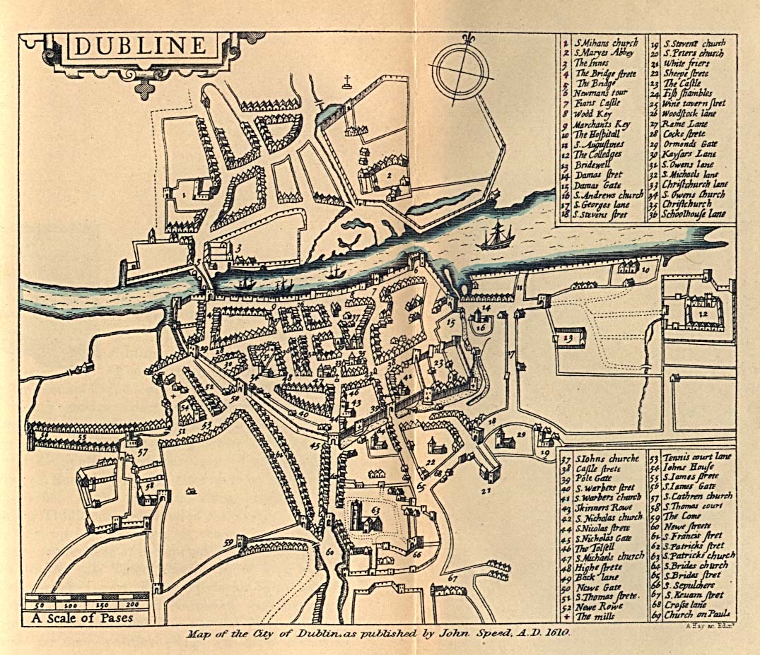
- 1610 Map of Dublin published by John SpeedJohn SpeedJohn Speed was an English historian and cartographer.-Life:He was born at Farndon, Cheshire, and went into his father's tailoring business where he worked until he was about 50...
(Perry-Castañeda Library Map CollectionPerry-Castañeda Library Map CollectionThe Perry-Castañeda Library Map Collection is an extensive map collection owned by the Perry-Castañeda Library at The University of Texas at Austin....
)