

List of bridges in Toronto
Encyclopedia
This is a list of bridge
Bridge
A bridge is a structure built to span physical obstacles such as a body of water, valley, or road, for the purpose of providing passage over the obstacle...
s in the city of Toronto
Toronto
Toronto is the provincial capital of Ontario and the largest city in Canada. It is located in Southern Ontario on the northwestern shore of Lake Ontario. A relatively modern city, Toronto's history dates back to the late-18th century, when its land was first purchased by the British monarchy from...
, Canada
Canada
Canada is a North American country consisting of ten provinces and three territories. Located in the northern part of the continent, it extends from the Atlantic Ocean in the east to the Pacific Ocean in the west, and northward into the Arctic Ocean...
.
Don River
Bridges over the Don River ravine, listed from south to north- Cherry Street Bridge
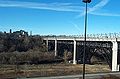
- Gardiner ExpresswayGardiner ExpresswayThe Frederick G. Gardiner Expressway, colloquially referred to as "the Gardiner", is a municipal expressway in the Canadian province of Ontario, connecting downtown Toronto with its western suburbs...
- pedestrian and bicycle bridge on the Waterfront TrailWaterfront TrailThe Waterfront Trail refers to an interconnected series of trails along the shores of Lake Ontario in Canada, currently beginning in Niagara-on-the-Lake, Ontario and extending to Brockville, Ontario, with an extension along Former Highway 2, to the Quebec provincial border...
- Don Valley ParkwayDon Valley ParkwayThe Don Valley Parkway is a controlled-access six-lane municipal expressway in Toronto connecting the Gardiner Expressway in downtown Toronto with Ontario Highway 401, the Macdonald–Cartier Freeway. North of Highway 401, it continues as Ontario Highway 404. The parkway runs through...
northbound on ramp from Gardiner Expressway - Don Valley Parkway southbound on ramp to Gardiner Expressway
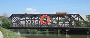
- Five lane railway bridge, part of the Corridor (VIA)
- Eastern Avenue bridge
- Don Valley Parkway off ramp to westbound Eastern Avenue
- Queen Street Viaduct
- Dundas StreetDundas Street (Toronto)Dundas Street, also known as Highway 5 west of Toronto, is a major arterial road connecting the centre of that city with its western suburbs and southwestern Ontario beyond...
- Gerrard Street
- pedestrian bridge connecting east and west sides of Riverdale Park
- Railway bridge
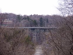
- Prince Edward ViaductPrince Edward ViaductThe Prince Edward Viaduct System, commonly referred to as the Bloor Viaduct or the viaduct, is the name of a truss arch bridge system in Toronto, Ontario, Canada that connects Bloor Street East, on the west side of the system, with Danforth Avenue on the east...
carrying Bloor StreetBloor StreetBloor Street is a major east–west residential and commercial thoroughfare in Toronto, in the Canadian province of Ontario. Bloor Street runs from the Prince Edward Viaduct westward into Mississauga, where it ends at Central Parkway. East of the viaduct, Danforth Avenue continues along the same...
- Rosedale Valley Bridge
- Bloor Bayview Ramp for Don Valley Parkway access
- Railway bridge
- Pottery Road
- Railway bridge
- Beechwood Drive bridge, part of Don Valley bicycle trail
- Railway Bridge
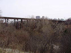
- Leaside Bridge
East Don River
- Don Mills Road
- Bridge providing road access to E.T. Seton Park
- Don Valley Parkway
- Railway bridge
- Bridge in Flemingdon Park Golf Club (south)
- Bridge in Flemingdon Park Golf Club (north)
- Eglinton Avenue bridge
- Railway bridge, north-south line - 3 crossings
- Railway bridge, east-west line
- Lawrence Avenue
- Don Valley Parkway
- Donalda Golf and Country Club - 11 bridges
- York Mills Road bridge
- Don Mills Road bridge
- Duncan Mill Road bridge
- Pedestrian bridge
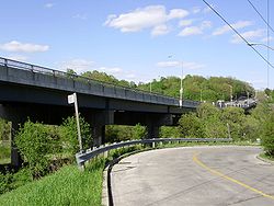
- Hogg's Hollow BridgeHogg's Hollow BridgeHogg's Hollow Bridge, originally known as the Yonge Boulevard Viaduct, is a set of four separate highway bridges that span the Don River Valley in Toronto, Ontario and carries 14 lanes of Highway 401...
, MacDonald-Cartier Freeway (401) - Sheppard Avenue & Leslie Street Intersection
- Railway bridge
- Finch Avenue East just west of Leslie Street
- Cummer Avenue bridge
- Steeles Avenue East just west of Bayview Avenue
- Steeles Avenue East just east of Leslie Street
Taylor Massey Creek
Taylor Massey Creek is a tributary of the East Don River.- Don Valley Parkway bridge
- O'Connor Drive bridge
- Victoria Park Avenue bridge
- Pharmacy Avenue bridge
West Don River
- Overlea Blvd bridge
- Railway bridge
- Eglinton Avenue East bridge
- Bayview Avenue north of Lawrence Avenue East
- Sheppard Avenue Bridge east of Bathurst Street
Humber River
- Finch Avenue and Islington Avenue - twin intersecting bridges Humber RiverHumber River (Ontario)The Humber River is one of two major rivers on either side of Toronto, Ontario, Canada, the other being the Don River to the east. It was designated a Canadian Heritage River on September 24, 1999....
- Highway 27
- Martin Grove Road
- Kipling Avenue
- Albion Road
- The Queensway
- Steeles Avenue West over the Humber River (west of Islington Avenue)
- Scarlett Road
- St Phillip's Road
- Old Mill Bridge spanning Humber River, connecting Old Mill Rd. and Catherine St.
Other
- Cherry Street BridgeCherry Street Strauss Trunnion Bascule BridgeThe Cherry Street Strauss Trunnion Bascule Bridge is a bascule bridge in Toronto, Ontario, Canada. Located in the industrial Port Lands area, it carries Cherry Street over the Toronto Harbour Ship Channel and opens to allow ships to access the channel and the turning basin beyond. The bridge was...
over the Keating Shipping Channel - Unwin Avenue over the Hearn Generating StationHearn Generating StationThe Richard L. Hearn Generating Station is a decommissioned electrical generating station in Toronto. The plant was originally fired by coal, but later converted to burn natural gas. It is still owned by Ontario Power Generation, a publicly owned electrical generation company...
outlet - Kingston Road over the Rouge RiverRouge River (Ontario)The Rouge River is a two river system. Little Rouge and Rouge River are in the east and the northeast parts of Toronto and begin in the Oak Ridges Moraine in Richmond Hill and Whitchurch-Stouffville...
- Mount Pleasant Road north of Blythwood Road over Blythwood Ravine Park
- Markham Road between Lawrence Avenue East and Eglinton Avenue East (West Highland CreekWest Highland CreekWest Highland Creek is a river in Scarborough, part of Toronto, Ontario, Canada, a tributary of Highland Creek in the Lake Ontario drainage basin...
, part of the Highland CreekHighland Creek (Toronto)Highland Creek is a river in the Scarborough district of Toronto, Ontario, emptying into Lake Ontario at the eastern end of the Scarborough Bluffs. It is home to several species of fish including trout, carp, and bass. It is a meandering river which, like most rivers in Toronto , travels through a...
watershed) - Bathurst Street over Cedarvale ParkCedarvale Park (Toronto)Cedarvale Park is a park located in Toronto, Ontario, Canada. It is bordered by very steep hills, and is located in the Cedarvale neighbourhood of Toronto. The Spadina subway line tunnels underneath it, between St. Clair West and Eglinton West stations...
(Castle Frank BrookCastle Frank BrookCastle Frank Brook is a buried creek and south-west flowing tributary of the Don River in central and north-western Toronto, Ontario, originating near the intersection of Lawrence Avenue and Dufferin Street....
) - Rouge River BridgeRouge River BridgeRouge River Bridge is a series of spans carrying traffic on Highway 401 over the Rouge River .Technially not bridges, but rather several spans of highway overpasses over the Rouge River....
carrying Highway 401 over the Rouge River - Bridge carrying Tywn Rivers Drive over the Rouge River
- Bridge carrying Kirkham Road over the Rouge River - closed
- Bridges (2) carrying Meadowvale Road over the Rouge River
- Bridge carrying Steeles Avenue over the Rouge River
- Railway bridge and pedestrian bridge over the mouth of the Rouge River
- Sewells Road Suspense Bridge carries single lane of traffic over Rouge River
Overpasses
List of bridges or overpasses over other roadways:- Don Mills Road over Highway 401
- Lawrence Avenue East over the Don Valley ParkwayDon Valley ParkwayThe Don Valley Parkway is a controlled-access six-lane municipal expressway in Toronto connecting the Gardiner Expressway in downtown Toronto with Ontario Highway 401, the Macdonald–Cartier Freeway. North of Highway 401, it continues as Ontario Highway 404. The parkway runs through...
- Lawrence Avenue West over Allen RoadAllen RoadWilliam R. Allen Road, known more commonly as Allen Road, The Allen Expressway or simply The Allen and formerly as the Spadina Expressway, is a short expressway/freeway in Toronto, Ontario, which runs from Kennard Avenue in the north, to Eglinton Avenue West in the south...
- Glencairn Avenue over Allen RoadAllen RoadWilliam R. Allen Road, known more commonly as Allen Road, The Allen Expressway or simply The Allen and formerly as the Spadina Expressway, is a short expressway/freeway in Toronto, Ontario, which runs from Kennard Avenue in the north, to Eglinton Avenue West in the south...
- Finch Avenue East over the Highway 404
- Sheppard Avenue East over the Highway 404
- Steeles Avenue East over the Highway 404
- Wynford Drive over the Don Valley ParkwayDon Valley ParkwayThe Don Valley Parkway is a controlled-access six-lane municipal expressway in Toronto connecting the Gardiner Expressway in downtown Toronto with Ontario Highway 401, the Macdonald–Cartier Freeway. North of Highway 401, it continues as Ontario Highway 404. The parkway runs through...
- Flemington Road over Allen Road
- Wilson Heights Blvd over Transit Road
- Mount Pleasant Road over Rosedale Valley Road
- Glen Road over Reservation Park Drive
- Governor's Road over Mud Creek
- Bloor Street East over Rosedale Valley Road
- Queen Street East over Don Valley ParkwayDon Valley ParkwayThe Don Valley Parkway is a controlled-access six-lane municipal expressway in Toronto connecting the Gardiner Expressway in downtown Toronto with Ontario Highway 401, the Macdonald–Cartier Freeway. North of Highway 401, it continues as Ontario Highway 404. The parkway runs through...
- Gerrard Street East over Don Valley ParkwayDon Valley ParkwayThe Don Valley Parkway is a controlled-access six-lane municipal expressway in Toronto connecting the Gardiner Expressway in downtown Toronto with Ontario Highway 401, the Macdonald–Cartier Freeway. North of Highway 401, it continues as Ontario Highway 404. The parkway runs through...
- Dundas Street East over Don Valley ParkwayDon Valley ParkwayThe Don Valley Parkway is a controlled-access six-lane municipal expressway in Toronto connecting the Gardiner Expressway in downtown Toronto with Ontario Highway 401, the Macdonald–Cartier Freeway. North of Highway 401, it continues as Ontario Highway 404. The parkway runs through...
- Dundas Street West over Kipling Avenue
- Bloor Street West over Kipling Avenue
- Bloor Street West over Highway 427
- Dundas Street West over Highway 427
- Burnhamthorpe Road over Highway 427
- Rathburn Road over Ontario Highway 427
- Dixon Road over Highway 27 (Ontario)Highway 27 (Ontario)Highway 27, formerly known as King's Highway 27, was a provincially maintained highway in southern Ontario that is now cared for by the city of Toronto, York Region and Simcoe County. It is considered an undivided expressway in Toronto's municipal expressway network...
- Highway 401 off ramp over Yonge StreetYonge StreetYonge Street is a major arterial route connecting the shores of Lake Ontario in Toronto to Lake Simcoe, a gateway to the Upper Great Lakes. It was formerly listed in the Guinness Book of Records as the longest street in the world at , and the construction of Yonge Street is designated an "Event of...
- Highway 401 over Bathurst Street south of Wilson Avenue
- Highway 401 over Wilson Avenue east of Bathurst Street
- Albion Road over Weston Road
- Highway 401 over Wendell Avenue
- Highway 400 over Wilson Avenue
- Highway 400 over Finch AvenueFinch AvenueFinch Avenue is an arterial thoroughfare and concession road which travels east–west through the city of Toronto. The road also has short extensions into Peel and Durham Regions as Peel Regional Road 2 and Durham Regional Road 37.-History:...
West - Sheppard Avenue West over Ontario Highway 400
- Highway 400 over Steeles AvenueSteeles AvenueSteeles Avenue is an east-west street that forms the northern city limit of Toronto and the southern limit of York Region, Ontario, Canada. It stretches across the western Greater Toronto Area from Milborough Townline in Halton Region east to the Scarborough-Pickering limit. It runs for within...
West - Highway 400 over Jane Street
- Dufferin Street over Gardiner ExpresswayGardiner ExpresswayThe Frederick G. Gardiner Expressway, colloquially referred to as "the Gardiner", is a municipal expressway in the Canadian province of Ontario, connecting downtown Toronto with its western suburbs...
- Westbound Lake Shore Blvd W. over Gardiner ExpresswayGardiner ExpresswayThe Frederick G. Gardiner Expressway, colloquially referred to as "the Gardiner", is a municipal expressway in the Canadian province of Ontario, connecting downtown Toronto with its western suburbs...
- Eastern Avenue west of Don Valley ParkwayDon Valley ParkwayThe Don Valley Parkway is a controlled-access six-lane municipal expressway in Toronto connecting the Gardiner Expressway in downtown Toronto with Ontario Highway 401, the Macdonald–Cartier Freeway. North of Highway 401, it continues as Ontario Highway 404. The parkway runs through...
- Finch AvenueFinch AvenueFinch Avenue is an arterial thoroughfare and concession road which travels east–west through the city of Toronto. The road also has short extensions into Peel and Durham Regions as Peel Regional Road 2 and Durham Regional Road 37.-History:...
West over Highway 427 - Morningstar Drive over Highway 427
- Rexdale Blvd over Ontario Highway 427
- Browns Line over Lake Shore Blvd West
- Spanbridge Road over Don Valley ParkwayDon Valley ParkwayThe Don Valley Parkway is a controlled-access six-lane municipal expressway in Toronto connecting the Gardiner Expressway in downtown Toronto with Ontario Highway 401, the Macdonald–Cartier Freeway. North of Highway 401, it continues as Ontario Highway 404. The parkway runs through...
- St. Dennis Driver over Don Valley ParkwayDon Valley ParkwayThe Don Valley Parkway is a controlled-access six-lane municipal expressway in Toronto connecting the Gardiner Expressway in downtown Toronto with Ontario Highway 401, the Macdonald–Cartier Freeway. North of Highway 401, it continues as Ontario Highway 404. The parkway runs through...
- Eglinton AvenueEglinton AvenueEglinton Avenue, originally known as the Richview Sideroad within Etobicoke, is an east-west arterial thoroughfare in Toronto and Mississauga, in the Canadian province of Ontario. Within Toronto, Eglinton Avenue is the only road which crosses through all six former boroughs...
over Don Valley ParkwayDon Valley ParkwayThe Don Valley Parkway is a controlled-access six-lane municipal expressway in Toronto connecting the Gardiner Expressway in downtown Toronto with Ontario Highway 401, the Macdonald–Cartier Freeway. North of Highway 401, it continues as Ontario Highway 404. The parkway runs through... - Van Horne Avenue over Highway 404
- McNicoll Avenue over Highway 404
Railway overpasses
List of bridges over railway lines (to avoid need for at grade level crossings):- Highway 27 (Ontario)Highway 27 (Ontario)Highway 27, formerly known as King's Highway 27, was a provincially maintained highway in southern Ontario that is now cared for by the city of Toronto, York Region and Simcoe County. It is considered an undivided expressway in Toronto's municipal expressway network...
south of Steeles Avenue West over CN tracks - Markham Road north of Sheppard Avenue East over CPCanadian Pacific RailwayThe Canadian Pacific Railway , formerly also known as CP Rail between 1968 and 1996, is a historic Canadian Class I railway founded in 1881 and now operated by Canadian Pacific Railway Limited, which began operations as legal owner in a corporate restructuring in 2001...
tracks - Eglinton Avenue East between Midland Avenue and Kennedy Road over CN tracks
- Lawrence Avenue East between Midland Avenue and Kennedy Road over CN tracks
- Ellesmere Road between Midland Avenue and Kennedy Road over CN tracks
- CN tracks over Black Creek Drive north of Weston Road
- CN tracks over Queen Street West between Gladstone Avenue and Dufferin Street
- Spadina Avenue over tracks north of Gardiner Expressway
Railway tracks
- railway tracks at Leslie Street south of Ontario Highway 401
- railway tracks over Wickett Creek south of Eglinton Avenue East and Leslie Street
- railway tracks over Wickett Creek east of Leslie Street on Eglinton Avenue East
- railway tracks over Baview Avenue at Don Valley Brick Works
- railway tracks over Rouge River at Lake Ontario
- railway tracks over Sheppard Avenue East between Brimley Road and Midland Avenue
- railway tracks over Rouge River at Morningside Heights
- railway tracks over Rouge River near Meadowvale Road and Plug Hat Road
- railway tracks over Humber River at Lambton Park
- railway tracks over Humber River between The Queensway and Gardiner Expressway
- railway tracks over Humber River at Old Mills Inn
- railway tracks over Humber River at Weston Golf and Country Club
- railway tracks over Don Mills Road south of Barber Green Road
- railway tracks over Leslie Street south of Highway 401
- railway tracks over Finch Avenue East west of Leslie Street
Pedestrian bridges
- Amsterdam BridgeAmsterdam Bridge, TorontoAmsterdam Bridge is a bridge on the waterfront in Toronto, Canada. The steel structure is a cable footbridge that crosses over the Simcoe Street Slip from York Quay to Rees Street Slip.Below the bridge is a docking facility for boats.-Name:...
- Glen Cedar Road Bridge
- Glen Manor Drive Bridge (connecting Pine Glen Road and Williamson Road over Glen Stewart Ravine in the BeachesThe BeachesThe Beaches is a neighbourhood and popular tourist destination located in Toronto, Ontario, Canada. It is located on the east side of the "Old" City of Toronto. The original boundaries of the neighbourhood are from Fallingbrook Avenue on the east to Kingston Road on the north, to Woodbine Avenue...
neighbourhood) - Glen Road Bridge (over Rosedale Valley Road)
- Heath Street East (over Mud Creek Ravine)
- Humber Bay Arch BridgeHumber Bay Arch BridgeThe Humber Bay Arch Bridge is a pedestrian and bicycle through arch bridge south of Lake Shore Boulevard West in Toronto, Canada...
- Lake Shore Boulevard Bailey Bridge
- MacLennan Avenue pedestrian bridge ("The Ramp", over railway tracks and Carstowe Road)
- Mimico Creek Bridge (Santiago CalatravaSantiago CalatravaSantiago Calatrava Valls is a Spanish architect, sculptor and structural engineer whose principal office is in Zürich, Switzerland. Classed now among the elite designers of the world, he has offices in Zürich, Paris, Valencia, and New York City....
) - Old Finch Avenue Bailey BridgeOld Finch Avenue Bailey BridgeThe Old Finch Avenue bridge is a Bailey bridge in Toronto. The Finch bridge is used for limited vehicular traffic on Old Finch Avenue in north-east Toronto to cross the Rouge River...
- Wallace Avenue Footbridge
Other bridges over waterways
Numerous bridges on the Toronto IslandsToronto Islands
The Toronto Islands are a chain of small islands in the city of Toronto, Ontario. Comprising the only group of islands in the western part of Lake Ontario, the Toronto Islands are located just offshore from the city centre, and provide shelter for Toronto Harbour...
including:
- Algonquin Island bridge
- South Island Bridge
- Centre Island Bridge (on Avenue of the Islands)
- Olympic Island Bridge (2)