

Eglinton Avenue
Encyclopedia
Toronto
Toronto is the provincial capital of Ontario and the largest city in Canada. It is located in Southern Ontario on the northwestern shore of Lake Ontario. A relatively modern city, Toronto's history dates back to the late-18th century, when its land was first purchased by the British monarchy from...
and Mississauga, in the Canadian province of Ontario
Ontario
Ontario is a province of Canada, located in east-central Canada. It is Canada's most populous province and second largest in total area. It is home to the nation's most populous city, Toronto, and the nation's capital, Ottawa....
. Within Toronto, Eglinton Avenue is the only road which crosses through all six former boroughs. The road begins at 6th Line in Milton
Milton, Ontario
Milton is a town in Southern Ontario, Canada, and part of the Halton Region in the Greater Toronto Area. Milton received a tremendous amount of awareness following the release of the results of the 2006 Census, which indicated that Milton is the fastest growing municipality in the Greater Golden...
as Lower Baseline, becomes Eglinton Avenue as it crosses into Mississauga, then crosses through Toronto to end at Kingston Road
Kingston Road (Toronto)
Kingston Road is the southernmost major road along the eastern portion of Toronto, specifically in the districts of East York and Scarborough. Until 1998, it formed a significant portion of Highway 2...
.
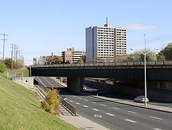
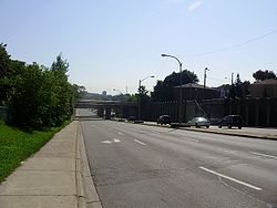
Route description
.jpg)
Allen Road
William R. Allen Road, known more commonly as Allen Road, The Allen Expressway or simply The Allen and formerly as the Spadina Expressway, is a short expressway/freeway in Toronto, Ontario, which runs from Kennard Avenue in the north, to Eglinton Avenue West in the south...
to Don Mills Road. The Eglinton West
Eglinton West
Eglinton West, also known as Little Jamaica, is a neighbourhood and retail district of Toronto, Ontario, Canada situated along Eglinton Avenue West from Allen Road to Keele Street, in the former borough of York. There are a large number of Jamaican businesses along this strip. There are also...
area near Oakwood–Vaughan to Keele Street
Keele Street
Keele Street is a north-south road in Toronto and York Region in Ontario, Canada. It stretches 47km, running from Bloor Street in Toronto to the Holland Marsh. South of Bloor Street, the roadway is today known as Parkside Drive, but was originally part of Keele Street...
is home to a number of Caribbean and West Indian stores.
Eglinton Avenue is one of the few east-west routes north of Bloor Street that crosses Toronto uninterrupted in a more or less straight line across the entire city. Eglinton was also the only street to cross through all six municipalities that made up Metro Toronto
Metropolitan Toronto
The Municipality of Metropolitan Toronto was a senior level of municipal government in the Toronto, Ontario, Canada area from 1954 to 1998. It was created out of York County and was a precursor to the later concept of a regional municipality, being formed of smaller municipalities but having more...
: East York
East York
East York can refer to:*East York, Pennsylvania, United States*East York, Ontario, Canada...
, Etobicoke, North York, Scarborough
Scarborough, Ontario
Scarborough is a dissolved municipality within the city of Toronto, Ontario, Canada. Geographically, it comprises the eastern part of Toronto. It is bordered on the south by Lake Ontario, on the west by Victoria Park Avenue, on the north by Steeles Avenue East, and on the east by the Rouge River...
, Toronto, and York
York, Ontario
York is a dissolved municipality in Toronto, Ontario, Canada. Geographically, it is located northwest of Old Toronto, southwest of North York and east of Etobicoke, where it is bounded by the Humber River. Formerly a separate city, it was one of six municipalities that amalgamated in 1998 to form...
.
Sites along Eglinton
- Erin Mills Town CentreErin Mills Town CentreThe Erin Mills Town Centre is a shopping mall located in the Erin Mills area of Mississauga, Ontario Canada, at the corner of Erin Mills Parkway and Eglinton Avenue West. The mall is owned and managed by Cadillac Fairview. It opened in 1989. There was once a Cineplex Odeon movie theater but the...
- Centennial Park
- Eglinton Flats
- Eglinton Square
- The Golden Mile
- Yonge Eglinton Centre
- Canada SquareCanada Square ComplexCanada Square is a complex of three interconnected office buildings located at Yonge Street and Eglinton Avenue in Toronto, Ontario, Canada, including a small shopping concourse and a multiplex cinema.-2200 Yonge Street:...
- Eglinton ParkEglinton Park (Toronto)Eglinton Park is a public park located in the North Toronto neighbourhood of Toronto, Ontario, Canada, a few blocks west of the Eglinton Subway Station. It is bounded on the south end by Eglinton Avenue West, on the north by Roselawn Aveunue...
- TVOntarioTVOntarioTVOntario, often referred to only as TVO , is a publicly funded, educational English-language television station and media organization in the Canadian province of Ontario. It is operated by the Ontario Educational Communications Authority, a Crown corporation owned by the Government of Ontario...
Headquarters - Sunnybrook Park
- Ontario Science CentreOntario Science CentreOntario Science Centre is a science museum in Toronto, Ontario, Canada, near the Don Valley Parkway about northeast of downtown on Don Mills Road just south of Eglinton Avenue East...
- Little JamaicaEglinton WestEglinton West, also known as Little Jamaica, is a neighbourhood and retail district of Toronto, Ontario, Canada situated along Eglinton Avenue West from Allen Road to Keele Street, in the former borough of York. There are a large number of Jamaican businesses along this strip. There are also...
History
The road name originates from Eglinton CastleEglinton Castle
Eglinton Castle was a large Gothic castellated mansion in Kilwinning, North Ayrshire, Scotland.-The castle :The ancient seat of the Earls of Eglinton, it is located just south of the town of Kilwinning...
in Scotland
Scotland
Scotland is a country that is part of the United Kingdom. Occupying the northern third of the island of Great Britain, it shares a border with England to the south and is bounded by the North Sea to the east, the Atlantic Ocean to the north and west, and the North Channel and Irish Sea to the...
. Like most roads in Toronto, Eglinton was rebuilt from a country road into an arterial thoroughfare
Thoroughfare
A thoroughfare is a place of transportation intended to connect one location to another. Highways, roads, and trails are examples of thoroughfares used by a variety of general traffic. On land a thoroughfare may refer to anything from a rough trail to multi-lane highway with grade separated...
in the mid 1950s. The eastern segment through Scarborough was known as Highway 5A between 1937 and 1953, when it was renumbered as Highway 109 for a year. Because of its time as a provincial highway, the right of way through Scarborough was widened considerably. A right of way was also acquired to bridge the gap in Eglinton. Until the mid fifties, Eglinton did not cross either of the valleys of the Don River. The road ended at Laird or Brentcliffe and resumed west of Victoria Park Avenue
Victoria Park Avenue
Victoria Park Avenue is a major north-south route in eastern Toronto, Ontario, Canada. It marks the border between the Old City of Toronto and Scarborough.-History:Victoria Park Avenue was originally a pioneer road for settlement of Scarborough...
(then known as Dawes Road). The Department of Highways would drop the Highway 109 designation before this gap was closed, placing the property in the hands of the newly formed Metropolitan Toronto
Metropolitan Toronto
The Municipality of Metropolitan Toronto was a senior level of municipal government in the Toronto, Ontario, Canada area from 1954 to 1998. It was created out of York County and was a precursor to the later concept of a regional municipality, being formed of smaller municipalities but having more...
. Metro built the new Eglinton Avenue, first between Dawes Road and Don Mills Road in 1955, and later between Don Mills Road and Leaside in 1956.
The structure over the GO rail line and East Don River is known as the Harvey C. Rose Bridge, and honours the Chief engineer
Chief Engineer
In marine transportation, the chief engineer is a licensed mariner in charge of the engineering department on a merchant vessel. "Chief engineer" is the official title of someone qualified to oversee the entire engine department; the qualification is colloquially called a "chief's...
of the Toronto and York Roads Commission, later the Metropolitan Toronto Commission of Roads.
Richview Expressway proposal
The western section ended at the Humber RiverHumber River (Ontario)
The Humber River is one of two major rivers on either side of Toronto, Ontario, Canada, the other being the Don River to the east. It was designated a Canadian Heritage River on September 24, 1999....
until the 1970s. On the opposite side, Richview Sideroad followed the same alignment as far as the Toronto–Peel boundary. In 1943, city planner Norman Wilson
Norman D. Wilson
Norman Douglas Wilson was a Toronto-based transportation engineer who designed the Toronto subway, and created a design of a subway for Winnipeg in the late 1950s.-References:*...
indicated the possible future need for an new urban highway to connect Eglinton Avenue with the Richview Sideroad. These plans would mature into the Richview Expressway with the formation of Metropolitan Toronto
Metropolitan Toronto
The Municipality of Metropolitan Toronto was a senior level of municipal government in the Toronto, Ontario, Canada area from 1954 to 1998. It was created out of York County and was a precursor to the later concept of a regional municipality, being formed of smaller municipalities but having more...
in 1954. Part of the requirements for the Richview Expressway was staged construction of a parallel arterial road. This was approved in 1963, and construction began on Eglinton Avenue from west of Weston Road
Weston Road
Weston Road is a north-south street in west end Toronto, Ontario, Canada. The route is named for the former Village of Weston, which was located near Weston Road and Lawrence Avenue West....
to Royal York Road
Royal York Road
Royal York Road, historically known as Church Street or New Church Street, is a north-south arterial road in Toronto, Ontario, Canada. It is a concession road, 5 concessions west of Yonge Street, and runs through many residential neighbourhoods, most notably Mimico and the Kingsway...
. With its completion in 1970, the four lane Richview Sideroad was renamed Eglinton Avenue West.
In Toronto, the right-of-way to construct the Richview Expressway remains but the project has never come to fruition, save for high-speed ramps from Eglinton to Highway 401 and Highway 427 at that complicated interchange. Local opposition has made the proposed expressway unlikely, though the land remains owned by the city.
Transit

Buses
The Eglinton WestEglinton West (TTC)
Eglinton West is a station on the Yonge–University–Spadina line of the subway system in Toronto, Ontario, Canada. It is located on Allen Road/Everden Road at 1300 Eglinton Avenue West....
(at Allen Road
Allen Road
William R. Allen Road, known more commonly as Allen Road, The Allen Expressway or simply The Allen and formerly as the Spadina Expressway, is a short expressway/freeway in Toronto, Ontario, which runs from Kennard Avenue in the north, to Eglinton Avenue West in the south...
), Eglinton
Eglinton (TTC)
Eglinton is a station on the Yonge–University–Spadina line of the subway system in Toronto, Ontario, Canada. It is at 2190 Yonge Street at Eglinton Avenue. It is one of the larger stations of the Toronto Transit Commission , with several shops located on the concourse level...
(at Yonge Street
Yonge Street
Yonge Street is a major arterial route connecting the shores of Lake Ontario in Toronto to Lake Simcoe, a gateway to the Upper Great Lakes. It was formerly listed in the Guinness Book of Records as the longest street in the world at , and the construction of Yonge Street is designated an "Event of...
), and Kennedy
Kennedy (TTC)
Kennedy is the terminal subway station of the Bloor-Danforth and Scarborough RT lines of the Toronto subway and RT. It is located at 2455 Eglinton Avenue East, just east of Kennedy Road. The station opened in 1980 in what was then the Borough of Scarborough with the Bloor-Danforth platform, and the...
TTC
Toronto Transit Commission
-Island Ferry:The ferry service to the Toronto Islands was operated by the TTC from 1927 until 1962, when it was transferred to the Metro Parks and Culture department. Since 1998, the ferry service is run by Toronto Parks and Recreation.-Gray Coach:...
stations are located along Eglinton. In Toronto, the street is currently served by the 32 Eglinton West and 34 Eglinton East TTC bus routes. Also, the eastern portion east of Kennedy Subway Station is served by routes 86 Scarborough and 116 Morningside.
In Mississauga, MiWay's route 35 Eglinton serves almost the entire length of the road, 34 Credit Valley serves the section west of Square One, and 7 Airport serves the section east of Square One; also sections of the road are served by routes 17 Timberlea, 89 Meadowvale-Subway and 109 Meadowvale Express during peak hours.
Bus rapid transit
In Mississauga, a grade-separated bus rapid transit line is undergoing construction since November 2010. Of the 12 BRT stations being built, four of them are planned to be built along Eglinton Avenue: Etobicoke Creek, Spectrum, Orbitor and Renforth. All of these stations are located at the Airport Corporate Centre at the east end of Mississauga, just south of Toronto Pearson International AirportToronto Pearson International Airport
Toronto Pearson International Airport is an international airport serving Toronto, Ontario, Canada; its metropolitan area; and the Golden Horseshoe, an urban agglomeration that is home to 8.1 million people – approximately 25% of Canada's population...
. Renforth Station will become a hub for TTC, GO Transit
GO Transit
GO Transit is an inter-regional public transit system in Southern Ontario, Canada. It primarily serves the Greater Toronto and Hamilton Area conurbation, with operations extending to several communities beyond the GTHA proper in the Greater Golden Horseshoe...
, and MiWay buses; meanwhile, the other three will be served exclusively by MiWay.
Subway
The provincial government of Bob RaeBob Rae
Robert Keith "Bob" Rae, PC, OC, OOnt, QC, MP is a Canadian politician. He is the Member of Parliament for Toronto Centre and interim leader of the Liberal Party of Canada....
started the Eglinton West line in 1994, as a way of appeasing politicians in Etobicoke and York (as North York would receive the Sheppard Subway), even though the official transit plan only recommended an Eglinton busway for the near future. The Eglinton subway was abandoned by Rae's successor Mike Harris
Mike Harris
Michael Deane "Mike" Harris was the 22nd Premier of Ontario from June 26, 1995 to April 15, 2002. He is most noted for the "Common Sense Revolution", his Progressive Conservative government's program of deficit reduction in combination with lower taxes and cuts to government...
, after a tunnel had been started from Eglinton West station.
The Eglinton Crosstown LRT, part of the TTC's Transit City
Transit City
Transit City was a plan for developing public transport in Toronto, Ontario, Canada. It was first proposed and announced by then-Toronto Mayor David Miller and Chair of the Toronto Transit Commission Adam Giambrone on March 16, 2007...
light rail expansion program announced in 2007 called for an underground line to run from Jane Street to Laird Avenue, with above ground sections running to Pearson International Airport
Toronto Pearson International Airport
Toronto Pearson International Airport is an international airport serving Toronto, Ontario, Canada; its metropolitan area; and the Golden Horseshoe, an urban agglomeration that is home to 8.1 million people – approximately 25% of Canada's population...
in the west and to Kennedy Station
Kennedy (TTC)
Kennedy is the terminal subway station of the Bloor-Danforth and Scarborough RT lines of the Toronto subway and RT. It is located at 2455 Eglinton Avenue East, just east of Kennedy Road. The station opened in 1980 in what was then the Borough of Scarborough with the Bloor-Danforth platform, and the...
in Scarborough in the east. The provincial government's MoveOntario 2020
MoveOntario 2020
MoveOntario 2020 is a plan proposed by the Government of Ontario that would fund 52 rapid-transit projects throughout the Greater Toronto and Hamilton Area in Ontario, Canada.-History:...
capital funding announcement in June 2007 funded the line.
Toronto mayor Rob Ford
Rob Ford
Robert Bruce "Rob" Ford is the 64th and current Mayor of Toronto, Ontario, Canada. He was first elected to city council in the 2000 Toronto municipal election, and was re-elected to his council seat in 2003 and again in 2006...
announced the cancellation of Transit City on the day that he took office. The redesigned Eglinton–Scarborough Crosstown line along with a Sheppard line extension was announced four months later, with the support of Metrolinx and Ontario Premier
Premier of Ontario
The Premier of Ontario is the first Minister of the Crown for the Canadian province of Ontario. The Premier is appointed as the province's head of government by the Lieutenant Governor of Ontario, and presides over the Executive council, or Cabinet. The Executive Council Act The Premier of Ontario...
Dalton McGuinty
Dalton McGuinty
Dalton James Patrick McGuinty, Jr., MPP is a Canadian lawyer, politician and, since October 23, 2003, the 24th and current Premier of the Canadian province of Ontario....
.
The new redesign puts the 19km Eglinton portion completely underground, integrates the Scarborough RT portion, and will run contigously from Black Creek Drive
Black Creek Drive
Black Creek Drive is a north-south arterial road in Toronto, Ontario that extends from Highway 400 at Jane Street, near Ontario Highway 401 to Weston Road in the south. Originally intended to be a freeway extension of Ontario Highway 400, it was built instead as an arterial road after public...
in the west to McCowan Road in the east.