
List of National Natural Landmarks in Wyoming
Encyclopedia
From List of National Natural Landmarks, these are the National Natural Landmark
s in Wyoming
. There are 6 in total: 3 are canyons, one is a depression, one is a cliff, and the last is a stream that divides and flows into two oceans.
National Natural Landmark
The National Natural Landmark program recognizes and encourages the conservation of outstanding examples of the natural history of the United States. It is the only natural areas program of national scope that identifies and recognizes the best examples of biological and geological features in...
s in Wyoming
Wyoming
Wyoming is a state in the mountain region of the Western United States. The western two thirds of the state is covered mostly with the mountain ranges and rangelands in the foothills of the Eastern Rocky Mountains, while the eastern third of the state is high elevation prairie known as the High...
. There are 6 in total: 3 are canyons, one is a depression, one is a cliff, and the last is a stream that divides and flows into two oceans.
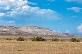
| Name | Image | Date | Location | County | Description | |
|---|---|---|---|---|---|---|
| 1 | The Big Hollow The Big Hollow (Wyoming) The Big Hollow is a wind eroded deflection basin located to the west of Laramie, Wyoming in the United States. It is the second largest wind eroded depression in the world. The Big Hollow is the largest deflation basin in North America. The Big Hollow is younger than the alluvial valley floors... |
November 1980 | Laramie Laramie, Wyoming Laramie is a city in and the county seat of Albany County, Wyoming, United States. The population was 30,816 at the . Located on the Laramie River in southeastern Wyoming, the city is west of Cheyenne, at the junction of Interstate 80 and U.S. Route 287.... 41.313209°N 105.721307°W |
Albany | A large wind eroded deflection basin Blowout (geology) Blowouts are sandy depressions in a sand dune ecosystem caused by the removal of sediments by wind.Blowouts occur in partially vegetated dunefields or sandhills. A blowout forms when a patch of protective vegetation is lost, allowing strong winds to "blow out" sand and form a depression... . |
|
| 2 | Como Bluff Como Bluff Como Bluff is a long ridge extending east-west, located between the towns of Rock River and Medicine Bow, Wyoming. The ridge is an anticline, formed as a result of compressional geological folding. Three geological formations, the Sundance, the Morrison, and the Cloverly Formations, containing... |
 |
May 1966, November 1973 | Rock River Rock River, Wyoming Rock River is a town in Albany County, Wyoming, in the United States. As of the 2000 census, the town population was 235.-Geography:Rock River is located at .... 41.881384°N 106.076217°W |
Albany | A ridge noted for multiple significant fossil discoveries from the late Jurassic of the Mesozoic Era. |
| 3 | Crooked Creek Natural Area | 1966 | Big Horn | A rich source of fossils of Early Cretaceous Cretaceous The Cretaceous , derived from the Latin "creta" , usually abbreviated K for its German translation Kreide , is a geologic period and system from circa to million years ago. In the geologic timescale, the Cretaceous follows the Jurassic period and is followed by the Paleogene period of the... land vertebrates. |
||
| 4 | Red Canyon Red Canyon (Fremont County, Wyoming) Red Canyon is a canyon located in Fremont County, Wyoming in the United States. The uplift of the nearby Wind River Range 60 million years ago exposed sedimentary rocks that were eroded by streams. The canyon exposes a number of geologic formations including the Phosphoria Formation from the... |
November 1980 | Lander Lander, Wyoming Lander is a city in, and the county seat of, Fremont County, Wyoming, United States. Named for transcontinental explorer Frederick W. Lander, Lander is located in central Wyoming, along the Middle Fork of the Popo Agie River. A tourism center with several dude ranches nearby, Lander is located just... 42.672087°N 108.658175°W |
Fremont | A canyon exposing a number of sedimentary formations as well as 10,000 years of human habitation. | |
| 5 | Sand Creek Sand Creek (Albany County, Wyoming) Sand Creek is a stream noted for the "most spectacular examples of cross-bedded sandstone and topple blocks in North America". Sand Creek flows from the Laramie Mountains in Larimer County, Colorado into Albany County, Wyoming where it joins the Laramie River.... |
December 1984 | 40°59′49"N 105°46′14"W | Albany | The most spectacular examples of cross-bedded sandstone and “topple blocks” in North America. NNL area extends across Colorado border. | |
| 6 | Two Ocean Pass Two Ocean Pass Two Ocean Pass is a mountain pass on North America's Continental Divide, in the Teton Wilderness, which is part of Wyoming's Bridger-Teton National Forest. The pass is notable for Parting of the Waters, where one stream, North Two Ocean Creek, splits into two distributaries, Pacific Creek and... |
October 1965 | Teton Wilderness Teton Wilderness Teton Wilderness is located in Wyoming, United States. Created in 1964, the Teton Wilderness is located within Bridger-Teton National Forest and consists of 585,238 acres . The wilderness is bordered on the north by Yellowstone National Park and to the west by Grand Teton National Park and the John... 44.04293°N 110.17495°W |
Teton Teton County, Wyoming Teton County is a county located in the U.S. state of Wyoming. As of 2010, the population was 21,294. Its county seat is Jackson. Teton County contains the affluent Jackson Hole skiing area... |
A pass located on the continental divide. Here, at a place called Parting of the Waters Parting of the Waters Parting of the Waters is an unusual hydrologic site at Two Ocean Pass on the Continental Divide, within the Teton Wilderness Area of Wyoming's Bridger-Teton National Forest. Two Ocean Pass separates the headwaters of Pacific Creek, which flows Westerly to the Pacific Ocean, and Atlantic Creek,... , North Two Ocean Creek splits into its two distributaries which form the headwaters of Pacific Creek and Atlantic Creek. Waters from these two creeks ultimately flow the Pacific and Atlantic ocean drainages, respectively. |
|