
List of National Historic Landmarks in South Dakota
Encyclopedia
The List of National Historic Landmarks in South Dakota contains the landmarks designated by the U.S. Federal Government for the U.S. state
of South Dakota
.
There are 16 National Historic Landmarks (NHLs) in South Dakota, one of which is shared with Iowa
and listed by the National Park Service as primarily in that state. They are distributed over 13 of South Dakota's 66 counties.
U.S. state
A U.S. state is any one of the 50 federated states of the United States of America that share sovereignty with the federal government. Because of this shared sovereignty, an American is a citizen both of the federal entity and of his or her state of domicile. Four states use the official title of...
of South Dakota
South Dakota
South Dakota is a state located in the Midwestern region of the United States. It is named after the Lakota and Dakota Sioux American Indian tribes. Once a part of Dakota Territory, South Dakota became a state on November 2, 1889. The state has an area of and an estimated population of just over...
.
There are 16 National Historic Landmarks (NHLs) in South Dakota, one of which is shared with Iowa
Iowa
Iowa is a state located in the Midwestern United States, an area often referred to as the "American Heartland". It derives its name from the Ioway people, one of the many American Indian tribes that occupied the state at the time of European exploration. Iowa was a part of the French colony of New...
and listed by the National Park Service as primarily in that state. They are distributed over 13 of South Dakota's 66 counties.
Current NHLs
| Landmark name | Image | Date desig. | Locality |
County | Description | |
|---|---|---|---|---|---|---|
| Arzberger Site Arzberger Site Arzberger Site, also known as 39HU6 is an archaeological site in Hughes County, South Dakota, near Pierre, South Dakota. It was declared a National Historic Landmark in 1964.At the time of the designation in 1964, it was stated:... |
 |
Pierre Pierre, South Dakota Pierre is the capital of the U.S. state of South Dakota and the county seat of Hughes County. The population was 13,646 at the 2010 census, making it the second least populous state capital after Montpelier, Vermont... |
Hughes Hughes County, South Dakota As of the census of 2000, there were 16,481 people, 6,512 households, and 4,310 families residing in the county. The population density was 22 people per square mile . There were 7,055 housing units at an average density of 10 per square mile... |
Archaeological site Archaeological site An archaeological site is a place in which evidence of past activity is preserved , and which has been, or may be, investigated using the discipline of archaeology and represents a part of the archaeological record.Beyond this, the definition and geographical extent of a 'site' can vary widely,... of a fortified village. |
||
| Battle Mountain Sanitarium, National Home for Disabled Volunteer Soldiers National Home for Disabled Volunteer Soldiers The National Asylum for Disabled Volunteer Soldiers was established on March 3, 1865, in the United States by Congress to provide care for volunteer soldiers who had been disabled through loss of limb, wounds, disease, or injury during service in the Union forces in the Civil War... |
Hot Springs Hot Springs, South Dakota Hot Springs is a city in Fall River County, South Dakota, United States. As of the 2010 census, the city population was 3,711. It is the county seat of Fall River County... |
Fall River Fall River County, South Dakota As of the census of 2000, there were 7,453 people, 3,127 households, and 1,976 families residing in the county. The population density was 4 people per square mile . There were 3,812 housing units at an average density of 2 per square mile... |
||||
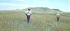
| Bear Butte Bear Butte Bear Butte is a geological butte feature located in western South Dakota, United States, that was established as a State Park in 1961. An important landmark and religious site for the Plains Indians tribes long before Europeans reached South Dakota, Bear Butte is called Mathó Pahá, or Bear... |
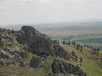 |
Sturgis Sturgis, South Dakota Sturgis is a city in Meade County, South Dakota, United States. The population was 6,627 as of the 2010 census. It is the county seat of Meade County. Sturgis is famous for being the location of one of the largest annual motorcycle events in the world, which is held annually on the first full week... |
Meade Meade County, South Dakota As of the census of 2000, there were 24,253 people, 8,805 households, and 6,700 families residing in the county. The population density was 7 people per square mile . There were 10,149 housing units at an average density of 3 per square mile... |
http://tps.cr.nps.gov/nhl/detail.cfm?ResourceId=1388&ResourceType=Site | ||
| Blood Run Site Blood Run Site The Blood Run Site is an archaeological site on the border of the US states of Iowa and South Dakota. The site was essentially populated for 8,500 years, within which earthworks structures were built by the Oneota Culture and occupied descendant tribes such as the Ioway, Otoe, Missouri, and shared... |
 |
Shindler, SD Shindler, South Dakota Shindler is an unincorporated community in the northeastern corner of Lincoln County, South Dakota, United States. According to the 2010 Census, the population was 584.-Geography:... and Granite, IA Granite, Iowa Granite is an unincorporated community in Lyon County, Iowa, United States, near the historic Blood Run Site and the Gitchie Manitou State Preserve.-Geography:... |
Lincoln, SD Lincoln County, South Dakota As of the census of 2000, there were 24,131 people, 8,782 households, and 6,665 families residing in the county. The population density was 42 people per square mile . There were 9,131 housing units at an average density of 16 per square mile... and Lyon, IA Lyon County, Iowa -2010 census:The 2010 census recorded a population of 11,581 in the county, with a population density of . There were 4,848 housing units, of which 4,442 were occupied.-2000 census:... |
An archaeological site Archaeological site An archaeological site is a place in which evidence of past activity is preserved , and which has been, or may be, investigated using the discipline of archaeology and represents a part of the archaeological record.Beyond this, the definition and geographical extent of a 'site' can vary widely,... overlapping into Iowa |
||
| Bloom Site Bloom Site Bloom Site is an archaeological site in Hanson County, South Dakota, near Bloom, South Dakota. It was declared a National Historic Landmark in 1964.At the time of the designation in 1964, it was stated:... |
 |
Bloom | Hanson Hanson County, South Dakota As of the census of 2000, there were 3,139 people, 1,115 households, and 848 families residing in the county. The population density was 7 people per square mile . There were 1,218 housing units at an average density of 3 per square mile... |
This fortified Fortification Fortifications are military constructions and buildings designed for defence in warfare and military bases. Humans have constructed defensive works for many thousands of years, in a variety of increasingly complex designs... archaeological Archaeology Archaeology, or archeology , is the study of human society, primarily through the recovery and analysis of the material culture and environmental data that they have left behind, which includes artifacts, architecture, biofacts and cultural landscapes... site preserves the remains of about 25 rectangular house House A house is a building or structure that has the ability to be occupied for dwelling by human beings or other creatures. The term house includes many kinds of different dwellings ranging from rudimentary huts of nomadic tribes to free standing individual structures... s dating to c.1000 CE Common Era Common Era ,abbreviated as CE, is an alternative designation for the calendar era originally introduced by Dionysius Exiguus in the 6th century, traditionally identified with Anno Domini .Dates before the year 1 CE are indicated by the usage of BCE, short for Before the Common Era Common Era... . The site also once contained several burial Burial Burial is the act of placing a person or object into the ground. This is accomplished by excavating a pit or trench, placing an object in it, and covering it over.-History:... mounds, which were later destroyed by cultivation Tillage Tillage is the agricultural preparation of the soil by mechanical agitation of various types, such as digging, stirring, and overturning. Examples of human-powered tilling methods using hand tools include shovelling, picking, mattock work, hoeing, and raking... . Site was perhaps occupied by ancestors of the Mandan. |
||
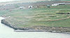
| Crow Creek Site | 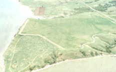 |
Chamber- lain Chamberlain, South Dakota Chamberlain is a city in Brule County, South Dakota, United States. The population was 2,387 at the 2010 census. It is the county seat of Brule County. Chamberlain is home to the Akta Lakota Museum and Cultural Center, which profiles the lives of nomadic Plains Indians... |
Buffalo | http://tps.cr.nps.gov/nhl/detail.cfm?ResourceId=532&ResourceType=Site | ||
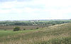
| Deadwood Historic District Deadwood Historic District Deadwood Historic District is a historic district in Deadwood, South Dakota. Its borders, at least as of designation in 1966, were defined by the city limits.... |
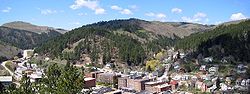 |
Deadwood Deadwood, South Dakota Deadwood is a city in South Dakota, United States, and the county seat of Lawrence County. It is named for the dead trees found in its gulch. The population was 1,270 according to a 2010 census... |
Lawrence Lawrence County, South Dakota As of the census of 2000, there were 21,802 people, 8,881 households, and 5,559 families residing in the county. The population density was 27 people per square mile . There were 10,427 housing units at an average density of 13 per square mile... |
|||
| Fort Pierre Chouteau Site Fort Pierre Chouteau Fort Pierre Chouteau Site is an archaeological site in Stanley County, South Dakota, near Fort Pierre, South Dakota. It was declared a National Historic Landmark in 1991.At the time of the designation in 1991, it was stated:... |
 |
Fort Pierre Fort Pierre, South Dakota Fort Pierre is a city in Stanley County, South Dakota, United States. It is part of the Pierre, South Dakota Micropolitan Statistical Area. The population was 2,078 at the 2010 census. It is the county seat of Stanley County. Lily Park, in Fort Pierre, is situated at the mouth of the Bad River. The... |
Stanley Stanley County, South Dakota As of the census of 2000, there were 2,772 people, 1,111 households, and 775 families residing in the county. The population density was 2 people per square mile . There were 1,277 housing units at an average density of 1 per square mile... |
http://tps.cr.nps.gov/nhl/detail.cfm?ResourceId=1670&ResourceType=Site | ||
| Fort Thompson Mounds Fort Thompson Mounds Fort Thompson Mounds is an archaeological site in Buffalo County, South Dakota, near Fort Thompson, South Dakota. It was declared a National Historic Landmark in 1964.At the time of the designation in 1964, it was stated:... |
 |
Fort Thompson Fort Thompson, South Dakota Fort Thompson is a census-designated place in Buffalo County, South Dakota, United States. The population was 1,282 at the 2010 census, making it the largest settlement on the Crow Creek Reservation.-Geography:... |
Buffalo | http://tps.cr.nps.gov/nhl/detail.cfm?ResourceId=533&ResourceType=District | ||
| Frawley Ranch Frawley Ranch Frawley Historic Ranch is an historic ranch in Lawrence County, South Dakota, near Spearfish, South Dakota. It was declared a National Historic Landmark in 1977.At the time of the designation in 1977, it was stated:... |
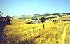 |
Spearfish Spearfish, South Dakota Spearfish is a city in Lawrence County, South Dakota,United States. The population was 10,494 at the 2010 census.- History :Prior to the Black Hills Gold Rush of 1876, the area was used by Native Americans who would spear fish in the creek... |
Lawrence Lawrence County, South Dakota As of the census of 2000, there were 21,802 people, 8,881 households, and 5,559 families residing in the county. The population density was 27 people per square mile . There were 10,427 housing units at an average density of 13 per square mile... |
http://tps.cr.nps.gov/nhl/detail.cfm?ResourceId=1489&ResourceType=District | ||
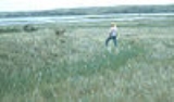
| Langdeau Site Langdeau Site Langdeau Site is an archaeological site in Lyman County, South Dakota, near Lower Brule, South Dakota. It was declared a National Historic Landmark in 1964.At the time of the designation in 1964, it was stated:... |
 |
Lower Brule Lower Brule, South Dakota Lower Brule is a census-designated place in Lyman County, South Dakota, United States. The population was 613 at the 2010 census. This community is located within the Lower Brule Indian Reservation.-Geography:... |
Lyman Lyman County, South Dakota As of the census of 2000, there were 3,895 people, 1,400 households, and 1,009 families residing in the county. The population density was 2 people per square mile . There were 1,636 housing units at an average density of 1 per square mile... |
http://tps.cr.nps.gov/nhl/detail.cfm?ResourceId=539&ResourceType=Site | ||
| Mitchell Site Mitchell Archaeological Site The Mitchell Site is an archaeological site in Davison County, South Dakota, near Mitchell, South Dakota. It was declared a National Historic Landmark in 1964.At the time of the designation in 1964, it was stated:... |
Mitchell Mitchell, South Dakota -Demographics:As of the census of 2000, there were 14,558 people, 6,121 households, and 3,599 families residing in the city. The population density was 1,475.7 people per square mile . There were 6,555 housing units at an average density of 664.4 per square mile... |
Davison Davison County, South Dakota As of the census of 2000, there were 18,741 people, 7,585 households, and 4,770 families residing in the county. The population density was 43 people per square mile . There were 8,093 housing units at an average density of 19 per square mile... |
http://tps.cr.nps.gov/nhl/detail.cfm?ResourceId=534&ResourceType=Site | |||
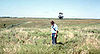
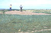
| Molstad Village Molstad Village Molstad Village is an archaeological site in Dewey County, South Dakota, near Mobridge, South Dakota. It was declared a National Historic Landmark in 1964.At the time of the designation in 1964, it was stated:... |
 |
Mobridge Mobridge, South Dakota Mobridge is a city in Walworth County, South Dakota, United States. The population was 3,465 at the 2010 census.-Geography:Mobridge is located at .... |
Dewey Dewey County, South Dakota As of the census of 2000, there were 5,972 people, 1,863 households, and 1,386 families residing in the county. The population density was 3 people per square mile . There were 2,133 housing units at an average density of 1 per square mile... |
A fortified Fortification Fortifications are military constructions and buildings designed for defence in warfare and military bases. Humans have constructed defensive works for many thousands of years, in a variety of increasingly complex designs... prehistoric Prehistory Prehistory is the span of time before recorded history. Prehistory can refer to the period of human existence before the availability of those written records with which recorded history begins. More broadly, it refers to all the time preceding human existence and the invention of writing... village Village A village is a clustered human settlement or community, larger than a hamlet with the population ranging from a few hundred to a few thousand , Though often located in rural areas, the term urban village is also applied to certain urban neighbourhoods, such as the West Village in Manhattan, New... of five circular house House A house is a building or structure that has the ability to be occupied for dwelling by human beings or other creatures. The term house includes many kinds of different dwellings ranging from rudimentary huts of nomadic tribes to free standing individual structures... rings enclosed by a ditch Ditch (fortification) A ditch in military engineering is an obstacle, designed to slow down or break up an attacking force, while a trench is intended to provide cover to the defenders... comprises this archaeological Archaeology Archaeology, or archeology , is the study of human society, primarily through the recovery and analysis of the material culture and environmental data that they have left behind, which includes artifacts, architecture, biofacts and cultural landscapes... site. It represents a transitional period as the Mandan, Hidatsa Hidatsa The Hidatsa are a Siouan people, a part of the Three Affiliated Tribes. The Hidatsa's autonym is Hiraacá. According to the tribal tradition, the word hiraacá derives from the word "willow"; however, the etymology is not transparent and the similarity to mirahací ‘willows’ inconclusive... , and Arikara Arikara Arikara are a group of Native Americans in North Dakota... peoples arose from the mixing of Central Plains and Middle Missouri cultural Culture Culture is a term that has many different inter-related meanings. For example, in 1952, Alfred Kroeber and Clyde Kluckhohn compiled a list of 164 definitions of "culture" in Culture: A Critical Review of Concepts and Definitions... traits. |
||
| Vanderbilt Archeo- logical Site Vanderbilt Archeological Site Vanderbilt Archeological Site is an archaeological site in Campbell County, South Dakota, near Pollock, South Dakota. It was declared a National Historic Landmark in 1997.At the time of the designation in 1997, it was stated:... |
Pollock Pollock, South Dakota Pollock is a town in Campbell County, South Dakota, United States. The population was 241 at the 2010 census.-Geography:Pollock is located at .... |
Campbell Campbell County, South Dakota As of the census of 2000, there were 1,782 people, 725 households, and 508 families residing in the county. The population density was 2 people per square mile . There were 962 housing units at an average density of 1 per square mile . The racial makeup of the county was 99.33% White, 0.34%... |
http://tps.cr.nps.gov/nhl/detail.cfm?ResourceId=2211&ResourceType=Site | |||
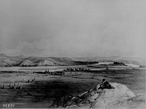
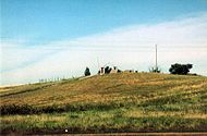
| Verendrye Site | 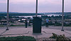 |
Fort Pierre Fort Pierre, South Dakota Fort Pierre is a city in Stanley County, South Dakota, United States. It is part of the Pierre, South Dakota Micropolitan Statistical Area. The population was 2,078 at the 2010 census. It is the county seat of Stanley County. Lily Park, in Fort Pierre, is situated at the mouth of the Bad River. The... |
Stanley Stanley County, South Dakota As of the census of 2000, there were 2,772 people, 1,111 households, and 775 families residing in the county. The population density was 2 people per square mile . There were 1,277 housing units at an average density of 1 per square mile... |
http://tps.cr.nps.gov/nhl/detail.cfm?ResourceId=1490&ResourceType=Site | ||
| Wounded Knee Wounded Knee Massacre The Wounded Knee Massacre happened on December 29, 1890, near Wounded Knee Creek on the Lakota Pine Ridge Indian Reservation in South Dakota, USA. On the day before, a detachment of the U.S. 7th Cavalry Regiment commanded by Major Samuel M... |
 |
Pine Ridge Indian Reservation Pine Ridge Indian Reservation The Pine Ridge Indian Reservation is an Oglala Sioux Native American reservation located in the U.S. state of South Dakota. Originally included within the territory of the Great Sioux Reservation, Pine Ridge was established in 1889 in the southwest corner of South Dakota on the Nebraska border... |
Shannon Shannon County, South Dakota As of the census of 2000, there were 12,466 people, 2,785 households, and 2,353 families residing in the county. The population density was 6 people per square mile . There were 3,123 housing units at an average density of 2 per square mile... |
http://tps.cr.nps.gov/nhl/detail.cfm?ResourceId=540&ResourceType=Site | ||
| Table notes: see below. | ||||||
Historic areas in the United States National Park System
National Historic Sites, National Historic Parks, National Memorials, and certain other areas listed in the National Park system are historic landmarks of national importance that are highly protected already, often before the inauguration of the NHL program in 1960, and are often not also named NHLs per se. Two additional South Dakota sites have national historical importance and have been designated as National Historic Site and as a National Memorial by the National Park System.| Monument name | Image | Established | Locality | County | Description | |
|---|---|---|---|---|---|---|
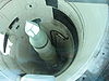
| Minuteman Missile National Historic Site Minuteman Missile National Historic Site Minuteman Missile National Historic Site was established in 1999 to illustrate the history and significance of the Cold War, the arms race, and intercontinental ballistic missile development. This National Historic Site preserves the last remaining Minuteman II ICBM system in the United States... |
 |
Jackson Jackson County, South Dakota As of the census of 2000, there were 2,930 people, 945 households, and 675 families residing in the county. The population density was 2 people per square mile . There were 1,173 housing units at an average density of 1 per square mile... and Pennington Pennington County, South Dakota As of the census of 2000, there were 88,565 people, 34,641 households, and 23,278 families residing in the county. The population density was 32 people per square mile . There were 37,249 housing units at an average density of 13 per square mile... |
||||
| Mount Rushmore National Memorial | 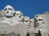 |
Black Hills Black Hills The Black Hills are a small, isolated mountain range rising from the Great Plains of North America in western South Dakota and extending into Wyoming, USA. Set off from the main body of the Rocky Mountains, the region is something of a geological anomaly—accurately described as an "island of... |
Pennington | |||