
List of Dartmoor tors and hills
Encyclopedia
This is a list of tors and hill
s on Dartmoor. Dartmoor
is a National Park
in South West England
.
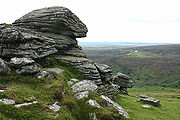
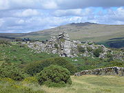
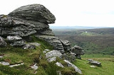
The total number of named tors and hills on the moor varies considerably depending on the source. Crossing refers to tors as "These granite masses, of which there are about 170 on Dartmoor". There are at least as many named Hills, Downs, Beacons etc. as well as Rocks used to refer to tors. It is not uncommon for a tor and a hill to share a name, as Tor refers to the granite outcrop (for example Nattor Down), equally, as can be seen in the list above, many names recur. Even the definition of Dartmoor varies between sources, particularly between modern sources and those that predate the national park.
For a more exhaustive list showing many minor tors which aren't named on the Ordnance Survey, follow this link http://www.legendarydartmoor.co.uk/tors_moor.htm
Hill
A hill is a landform that extends above the surrounding terrain. Hills often have a distinct summit, although in areas with scarp/dip topography a hill may refer to a particular section of flat terrain without a massive summit A hill is a landform that extends above the surrounding terrain. Hills...
s on Dartmoor. Dartmoor
Dartmoor
Dartmoor is an area of moorland in south Devon, England. Protected by National Park status, it covers .The granite upland dates from the Carboniferous period of geological history. The moorland is capped with many exposed granite hilltops known as tors, providing habitats for Dartmoor wildlife. The...
is a National Park
National park
A national park is a reserve of natural, semi-natural, or developed land that a sovereign state declares or owns. Although individual nations designate their own national parks differently A national park is a reserve of natural, semi-natural, or developed land that a sovereign state declares or...
in South West England
South West England
South West England is one of the regions of England defined by the Government of the United Kingdom for statistical and other purposes. It is the largest such region in area, covering and comprising Bristol, Gloucestershire, Somerset, Dorset, Wiltshire, Devon, Cornwall and the Isles of Scilly. ...
.
- Aish Tor
- Arch Tor
- Arms Tor
- Assycombe Hill
- Aylesborough Tor see Eylesbarrow
- Bag Tor
- Bagga Tor
- Beardown TorsBeardown TorsBeardown Tors is the 14th highest summit of Dartmoor. Despite its modest height at only 513m, it is one of the more interesting summits on Dartmoor.Beardown Tors is in Dartmoor, England.-References:OS OL20 Map...
- Bee Tor
- Bel Tor
- Bell Tor
- Bellever Tor
- Belstone Tor
- Bench Tor
- Birch Tor
- Black Dunghill
- Black Hill (Dartmoor). There are several Black Hills on Dartmoor, including:
- One near ManatonManatonThe village of Manaton is situated on the south-eastern side of Dartmoor National Park, Devon, England.The 15th century church, in a prominent spot to the north of the village green, is dedicated to St Winifred. Three of the six bells in its tower are medieval - markings on the oldest indicate a...
at . - One at
- One near Manaton
- Black Tor. There are 3 Black Tors on the moor:
- In the south of the moor, near Shipley Tor .
- In the north west of the moor, near High Willhays.
- In the west of the moor, near WalkhamptonWalkhamptonWalkhampton is a village and civil parish on the western side of Dartmoor in the county of Devon, England. The village lies on the Black Brook, a tributary of the River Walkham, about south-east of Tavistock, near the villages of Horrabridge, Yelverton and Dousland. Burrator Reservoir, constructed...
.
- Blackadon Tor
- Blackalder Tor
- Boulters Tor
- Bracken Tor
- Brat Tor, see Bray Tor
- Bray Tor
- Brent TorBrent TorBrent Tor is a tor on the western edge of Dartmoor, approximately five miles north of Tavistock, rising to 1100ft above sea level. The Tor is surmounted by the Church of St Michael, the parish church of the village of Brentor, which lies below the Tor.-Geology:Brent Tor is a unique example of an...
- Brimhill Tor
- BurratorBurratorBurrator is a civil parish in the English county of Devon. It is entirely within the boundaries of the Dartmoor National Park and was formed from the older parishes of Meavy, Sheepstor and Walkhampton....
- Butterdon HillButterdon HillButterdon Hill is on Dartmoor, in southwest England. The remains of a small stone circle and a stone row can be found on the summit. The name Butterdon is believed to derive an Old English word for "pasture".-References:...
- Buttern Hill
- Callisham Tor
- Calveslake Tor
- Chat Tor
- Chinkwell Tor
- Chub Tor
- Collard Tor
- Combeshead Tor
- Combestone Tor
- Conies Down Tor
- Coombe Tor
- Corndon Tor
- Cosdon Hill or Cosdon Beacon
- Cox Tor (Cocks' Tor).
- Cramber Tor
- Crane Hill
- Crockern TorCrockern TorCrockern Tor is a tor in Dartmoor National Park, Devon, England. Composed of two large outcrops of rock, it is 396 metres above sea level. The lower outcrop was the open-air meeting place of the Devonshire Stannary Parliament from the early 14th century until the first half of the 18th century...
- Crow Tor
- Cut Hill
- Devil's Tor
- Dinger Tor
- Doe Tor
- Down TorDown TorDown Tor is a tor on Dartmoor, England, at GR 581694, height , overlooking Burrator Reservoir.- References :...
- Lower Dunnagoat Tor
- Higher Dunnagoat Tor
- Easdon Tor
- East Mill Tor
- Eastern Tor
- Eastern White Barrow
- Eylesbarrow aka Aylesborough Tor
- Feather Tor
- Flat Tor
- Foggintor . Quarried out.
- Fox TorFox TorFox Tor is a relatively minor tor on Dartmoor in the United Kingdom. It is probably best known for the swampy land that lies beneath it, Fox Tor Mires. This is said to have been the inspiration for the fictional Grimpen Mire in the novel The Hound of the Baskervilles by Sir Arthur Conan Doyle...
There are two Fox Tors:- One Southeast of Princetown at . This is the one the name usually refers to.
- One near Mary TavyMary TavyMary Tavy is a village with a population of around 600, located four miles north of Tavistock in Devon in south-west England; it is named after the River Tavy. It used to be home to the world's largest copper mine Wheal Friendship, as well as a number of lead and tin mines. It borders Dartmoor...
at
- Fur Tor (or Vurretor)
- Ger Tor
- Giant's Hill
- Gidleigh Tor
- Grea Tor (not shown on all modern maps, though nearby Greator rocks is)
- Great Combe Tor
- Great Houndtor, see Hound Tor
- Great Kneeset
- Great Links TorGreat Links TorGreat Links Tor is a prominent tor on the north-western flank of Dartmoor, Devon, England. It is visible for a considerable distance on the approach to the moor from the west. It one of the highest points on Dartmoor, standing above sea level and is dominated by a monolithic outcropping of granite...
- Great Mis TorGreat Mis TorGreat Mis Tor is a hill with a rocky outcrop situated in Dartmoor. It has been called one of the grandest hills in Devon, and lies above the River Walkham, about 4 miles north-east of Princetown....
- Great Nodden
- Great Staple Tor
- Great Trowlesworthy Tor
- Green Hill
- Green Tor
- Gren Tor
- Gripper's Hill
- Gutter Tor
- Hameldown Tor
- Hangershell Rock
- Hangingstone Hill
- Hare Tor
- Hart Tor
- Hartland Tor
- Hartor Tors (also Hart Tor, Harter Tors) and
- Hawks Tor
- Haytor or Hay Tor (also Hey Tor)
- Heckwood Tor
- Heltor Rock
- Hen Tor
- High Tor
- Higher Tor There are 2 Higher Tors on the moor:
- One at (near BelstoneBelstoneBelstone is a village in Devon, England best known for the Nine Maidens stone circle. It lies within the West Devon local government district....
) - One at (near PoundsgatePoundsgatePoundsgate is a small village in Dartmoor, Devon, England, located on the road between Ashburton and Princetown.The postal area of "Poundsgate" is a wide geographical area. There are a few cottages clustered around a popular stopping point for travellers, the Tavistock Inn, which is thought to date...
)
- One at (near Belstone
- Higher White Tor
- High WillhaysHigh WillhaysHigh Willhays or, according to some authors, High Willes is the highest point on Dartmoor, Devon, at 621 metres above sea level, and the highest point in Great Britain south of the Brecon Beacons.-Toponymy:...
(or High Willes, High Willows, Highest Tor, Hight Will). - Hockinston Tor
- Hollow Tor . There are two Hollow Tors on the moor:
- One near Top Tor at
- One Near PrincetownPrincetownPrincetown is a town situated on Dartmoor in the English county of Devon.In 1785, Sir Thomas Tyrwhitt, Secretary to the Prince of Wales, leased a large area of moorland from the Duchy of Cornwall estate, hoping to convert it into good farmland. He encouraged people to live in the area and suggested...
at
- Holwell Tor
- Honeybag Tor
- Hookney Tor
- Hound TorHound TorHound Tor is a tor on Dartmoor, Devon, England and is a good example of a heavily weathered granite outcrop. It is easily accessible, situated within a few minutes from the B3387 between Bovey Tracey and Widecombe-in-the-Moor...
. There are two Hound Tors on Dartmoor- The more well known is near Widecombe-in-the-MoorWidecombe-in-the-MoorWidecombe-in-the-Moor is a small village located within the heart of the Dartmoor National Park in Devon, England. . The name is thought to derive from 'Withy-combe' which means Willow Valley....
at aka Great Hound Tor - The second and lesser known is at
- The more well known is near Widecombe-in-the-Moor
- Huccaby Tor
- Hucken Tor
- Hunt Tor
- Hunts Tor see Hunter's Tor, near Chagford
- Hunter's Tor
- Near ManatonManatonThe village of Manaton is situated on the south-eastern side of Dartmoor National Park, Devon, England.The 15th century church, in a prominent spot to the north of the village green, is dedicated to St Winifred. Three of the six bells in its tower are medieval - markings on the oldest indicate a...
at - Near ChagfordChagfordChagford is a small town and civil parish on the north-east edge of Dartmoor, in Devon, England, close to the River Teign. It is located off the A382, about 4 miles west of Moretonhampstead. The name Chagford is derived from the word chag, meaning gorse or broom, and the ford suffix indicates its...
at (Hunts Tor)
- Near Manaton
- Ingra Tor
- Ivy Tor
- Kennon Hill
- Kent's Tor
- Kes Tor aka Kestor Rock
- King Tor
- King's Tor
- Kitty Tor
- Lakehead Hill
- Langcombe Hill
- Laughter Tor (Lough Tor)
- Leather Tor (Lether Tor)
- Leedon Tor (Leeden Tor on the Ordnance Survey maps)
- Legis Tor
- Leigh Tor
- Lints Tor
- Littaford Tors
- Little Combe Tor
- Little Hound Tor
- Little Links Tor
- Little Mis Tor (Historically also called Wain Tor)
- Little Staple Tor
- Little Trowlesworthy Tor
- Longaford Tor
- Longtimber Tor
- Lower White Tor
- Luckey Tor
- Lydford Tor
- Lynch Tor
- Manga Hill
- Mel Tor
- Metheral Hill
- Merripit Hill
- Middle Staple Tor
- Middle Tor
- Nat Tor. There are two Nat Tors (or Nattor) on the moor:
- Near Burrator Reservoir at
- Near LydfordLydfordLydford, sometimes spelled Lidford, is a village, once an important town, in Devon situated north of Tavistock on the western fringe of Dartmoor in the West Devon district.-Description:The village has a population of 458....
at
- North Hessary TorNorth Hessary TorThe North Hessary Tor is a hill 517 metres high just above Dartmoor Prison, in Princetown within Dartmoor Forest civil parish, which is located in the borough of West Devon, Devon, England...
- Oke Tor
- Okement Hill (or Ockment)
- Penn Beacon
- Pew Tor
- Pil Tor
- Pupers Hill
- Raven's Tor. There are two.
- One at
- and another at
- Rippon Tor
- Rival Tor (Rippator, Rifle Tor)
- Rook Tor
- Roos Tor (Roose Tor, Rulestorre, Rolls Tor)
- Rough Tor
- Round Hill There are three hills known as Round Hill on the moor
- Row Tor There are two Row Tors on the moor.
- One at 3km south of Okehampton.
- Royal Hill
- Rundlestone Tor
- Ryder's HillRyder's HillAt 515 m, Ryder's Hill is one of the highest points on the southern part of Dartmoor, Devon, England. On its summit there are two standing stones and a low cairn, on top of which is a triangulation pillar....
- Saddle Tor
- Scarey Tor
- Scorhill Tor
- Shapley Tor
- Sharp Tor. There are several Sharp Tors, both Sharpitors may also be referred to as Sharp Tor in some cases
- One at near Dartmeet.
- Another at on Ugborough Moor.
- Another at .
- Another at .
- SharpitorSharpitorSharpitor is a megalithic site near Lustleigh in Dartmoor, Devon, England. The tor is surrounded by forest, overlooking the Bovey Valley. The remains consist of a degraded but still visible stone row....
. There are two Sharpitors on the moor:- At near Leather Tor.
- Near LustleighLustleighLustleigh is a small village nestled in the Wrey Valley, inside the Dartmoor National Park in Devon, England. It sits between the towns of Bovey Tracey and Moretonhampstead....
at
- Shavercombe Tor
- Sheeps Tor
- Shell Top (or Shiel Top, Shell Tor)
- Shelstone Tor
- Shilstone Tor
- Shipley Tor
- Sittaford Tor (or Siddaford Tor)
- Skir Hill
- Sourton Tors
- South Hessary Tor
- Snowdon
- Standon Hill
- Stannon Tor
- Staple Tor or Steeple Tor - see Little Staple Tor, Middle Staple tor and Great Staple Tor.
- Steeperton Tor
- Stenga Tor
- Stinger's Hill
- Stonetor Hill
- Swell Tor . Quarried out.
- Ter Hill
- Three Barrows
- Thornworthy Tor
- Top Tor
- Trowlesworthy Tor, see Great Trowlesworthy Tor
- Ugborough Beacon
- Vixen Tor
- Was Tor
- Water Hill
- Watern Tor (or Watern Borough)
- Western Beacon . The most southerly hill on Dartmoor.
- West Mill Tor
- White Tor . Also see Higher White Tor and Lower White Tor
- Whitehill Tor
- Whitehorse Hill
- Wild Tor
- Wind Tor
- Winter Tor
- Yar Tor
- Yes TorYes TorYes Tor is the second highest point on Dartmoor, Devon, South West England, at above sea level. Together with nearby High Willhays they are the only two peaks above south of the English Peak District National Park....
. There are actually two Yes Tors on the moor:- The name Yes Tor usually refers to the one near OkehamptonOkehamptonOkehampton is a town and civil parish in West Devon in the English county of Devon. It is situated at the northern edge of Dartmoor, and has an estimated population of 7,155.-History:...
at , which has also been known as Eastor and Highest Tor in the past (though High WillhaysHigh WillhaysHigh Willhays or, according to some authors, High Willes is the highest point on Dartmoor, Devon, at 621 metres above sea level, and the highest point in Great Britain south of the Brecon Beacons.-Toponymy:...
, approximately 1 kilometre south is actually 2 metres higher). - The second Yes Tor is on Walkhampton common
- The name Yes Tor usually refers to the one near Okehampton
The total number of named tors and hills on the moor varies considerably depending on the source. Crossing refers to tors as "These granite masses, of which there are about 170 on Dartmoor". There are at least as many named Hills, Downs, Beacons etc. as well as Rocks used to refer to tors. It is not uncommon for a tor and a hill to share a name, as Tor refers to the granite outcrop (for example Nattor Down), equally, as can be seen in the list above, many names recur. Even the definition of Dartmoor varies between sources, particularly between modern sources and those that predate the national park.
For a more exhaustive list showing many minor tors which aren't named on the Ordnance Survey, follow this link http://www.legendarydartmoor.co.uk/tors_moor.htm