

Linglestown, Pennsylvania
Encyclopedia
Census-designated place
A census-designated place is a concentration of population identified by the United States Census Bureau for statistical purposes. CDPs are delineated for each decennial census as the statistical counterparts of incorporated places such as cities, towns and villages...
(CDP) in Lower Paxton Township
Lower Paxton Township, Pennsylvania
Lower Paxton Township is a township in Dauphin County, Pennsylvania, United States. The township was incorporated in 1767 from Paxton Township...
, Dauphin County
Dauphin County, Pennsylvania
Dauphin County is a county in the U.S. state of Pennsylvania and is one of the three counties comprising the Harrisburg–Carlisle Metropolitan Statistical Area. As of 2010 census, the population was 268,100. The county includes the city of Harrisburg, which has served as the state capital...
, Pennsylvania
Pennsylvania
The Commonwealth of Pennsylvania is a U.S. state that is located in the Northeastern and Mid-Atlantic regions of the United States. The state borders Delaware and Maryland to the south, West Virginia to the southwest, Ohio to the west, New York and Ontario, Canada, to the north, and New Jersey to...
, United States
United States
The United States of America is a federal constitutional republic comprising fifty states and a federal district...
. It was founded and laid out in 1765 by Thomas Lingle.
The population was 6,414 at the 2000 census. It is part of the Harrisburg
Harrisburg, Pennsylvania
Harrisburg is the capital of Pennsylvania. As of the 2010 census, the city had a population of 49,528, making it the ninth largest city in Pennsylvania...
–Carlisle
Carlisle, Pennsylvania
Carlisle is a borough in and the county seat of Cumberland County, Pennsylvania, United States. The name is traditionally pronounced with emphasis on the second syllable. Carlisle is located within the Cumberland Valley, a highly productive agricultural region. As of the 2010 census, the borough...
Metropolitan Statistical Area
Harrisburg metropolitan area
The Harrisburg–Carlisle Metropolitan Statistical Area , as defined the United States Census Bureau, is an area consisting of three counties in Pennsylvania's Susquehanna Valley, anchored by the cities of Harrisburg and Carlisle...
.
History
Linglestown was founded in 1765 by Thomas Lingle and was named St. Thomas. Because of the founder's name, people referred to the town as "Lingle's Town", and was unofficially renamed "Linglestown" after his death in 1811. The existed within Lower Paxton Township, and gained village status within the township.Linglestown has its own committee, the Village of Linglestown committee, which was created to organize the town.
Geography
Linglestown is located at 40°20′13"N 76°47′27"W (40.336888, -76.790764).According to the United States Census Bureau
United States Census Bureau
The United States Census Bureau is the government agency that is responsible for the United States Census. It also gathers other national demographic and economic data...
, the CDP has a total area of 3.7 square miles (9.6 km²), all of it land (except a few streams and ponds).
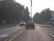
Highest elevation is about 1,650 ft (Blue Mountain) a short distance to the north. Route 39
Pennsylvania Route 39
Pennsylvania Route 39 is a long east–west state highway in Dauphin County, Pennsylvania, United States. It starts at North Front Street north of Harrisburg and ends at U.S. Route 322 and U.S. Route 422 near Hummelstown...
passes east-to-west through the village, is designated Linglestown Road, and connects Interstate 81
Interstate 81
Interstate 81 is an Interstate Highway in the eastern part of the United States. Its southern terminus is at Interstate 40 in Dandridge, Tennessee; its northern terminus is on Wellesley Island at the Canadian border, where the Thousand Islands Bridge connects it to Highway 401, the main freeway...
with Highway 22-322 to the west.
Demographics
As of the censusCensus
A census is the procedure of systematically acquiring and recording information about the members of a given population. It is a regularly occurring and official count of a particular population. The term is used mostly in connection with national population and housing censuses; other common...
of 2000, there were 6,414 people, 2,508 households, and 1,908 families residing in the CDP. The population density
Population density
Population density is a measurement of population per unit area or unit volume. It is frequently applied to living organisms, and particularly to humans...
was 1,713.1 people per square mile (662.2/km²). There were 2,587 housing units at an average density of 691.0/sq mi (267.1/km²). The racial makeup of the CDP was 95.28% White, 2.12% African American, 0.12% Native American, 1.64% Asian, 0.02% Pacific Islander, 0.12% from other races
Race (United States Census)
Race and ethnicity in the United States Census, as defined by the Federal Office of Management and Budget and the United States Census Bureau, are self-identification data items in which residents choose the race or races with which they most closely identify, and indicate whether or not they are...
, and 0.70% from two or more races. Hispanic or Latino of any race were 1.04% of the population.
There were 2,508 households out of which 32.6% had children under the age of 18 living with them, 63.6% were married couples
Marriage
Marriage is a social union or legal contract between people that creates kinship. It is an institution in which interpersonal relationships, usually intimate and sexual, are acknowledged in a variety of ways, depending on the culture or subculture in which it is found...
living together, 9.3% had a female householder with no husband present, and 23.9% were non-families. 20.4% of all households were made up of individuals and 7.4% had someone living alone who was 65 years of age or older. The average household size was 2.55 and the average family size was 2.95.
In the CDP the population was spread out with 23.0% under the age of 18, 6.0% from 18 to 24, 30.0% from 25 to 44, 27.9% from 45 to 64, and 13.1% who were 65 years of age or older. The median age was 40 years. For every 100 females there were 94.1 males. For every 100 females age 18 and over, there were 90.7 males.
The median income for a household in the CDP was $52,650, and the median income for a family was $59,398. Males had a median income of $41,536 versus $30,064 for females. The per capita income
Per capita income
Per capita income or income per person is a measure of mean income within an economic aggregate, such as a country or city. It is calculated by taking a measure of all sources of income in the aggregate and dividing it by the total population...
for the CDP was $24,347. About 1.9% of families and 2.2% of the population were below the poverty line, including 0.6% of those under age 18 and 1.2% of those age 65 or over.
Schools
The Linglestown Elementary School mascot is the Lion. Their colors are navy blue and gold. The school was built in 1955, and had extras built on in 1995.Linglestown Middle School was built in 1973 and presently has about 675 students. The mascot is a Ram and there colors are green and wight. Recreational and educational activities include basketball, lacrosse, soccer, track and field, field hockey, and cheer leading. Also, there are many groups such as the Linglestown Middle School band and chorus, as well as other themed clubs such as the History Classic Film Club and the Outdoor Sports Club.
Notable residents
- Maynard YingstMaynard YingstMaynard K. Yingst was an American racer and crew chief from Linglestown, Pennsylvania. He quit his sprint car racing career to become the crew chief for Bruce Larson's 1989 national championship Funny Car drag racing team. He was nicknamed "The Linglestown Leadfoot".-Racing career:Yingst was a...
, sprint car racer and drag racing national championship crew chief.
Koons
Koons Park is a popular park for kids to be during the summer. It features 3 basketball courts, 2 volleyball courts, 4 tennis courts, 6 baseball diamonds, a football field and 3 pavilions, a concession stand and a playground. In addition, Koons has restrooms and lots of paved parking area. It also has a pool which requires a membership to enter. It is a 33 acres (133,546.4 m²) park in the heart of Linglestown.During late May through early August, the park is home to Brightbill Basketball, a recreational basketball organization for ages 8–17. It ueses the 3 basketball courts 5 P.M. through 10 P.M. on Mondays through Thursdays during that season meaning a person cannot use the courts then during then.
During the summer, Koons features a 4 July fireworks display. This usually takes place on a weekend around the holiday. This attracts well over 2,000 people to the park. Parking is difficult and traffic afterward is as locals call it "a mess."
Schools
At Linglestown Middle and Linglestown Elemtary School, there is a track and field. Here, the school team practices in spring time. A non-student could of course use this. It has a track for running, an open field for many purposes, and even a discus field and cage as well as a shot put field and circle.At the elementary school right next to the middle school, there are two separate playgrounds for kids to play on after school hours. It ranges from toddlers' activities to older kids such as teens. There are also two blacktop areas.
See also
- Lower Paxton TownshipLower Paxton Township, PennsylvaniaLower Paxton Township is a township in Dauphin County, Pennsylvania, United States. The township was incorporated in 1767 from Paxton Township...
- Pennsylvania Route 39Pennsylvania Route 39Pennsylvania Route 39 is a long east–west state highway in Dauphin County, Pennsylvania, United States. It starts at North Front Street north of Harrisburg and ends at U.S. Route 322 and U.S. Route 422 near Hummelstown...
- Pennsylvania Route 894Pennsylvania Route 894Pennsylvania Route 894 was a Pennsylvania state route. It was established in 1928, and deleted in 1946 after being extended from its original terminus outside of Linglestown through Piketown in the mid 1930s.-Route description:...