
Lindsey, Ohio
Encyclopedia
Lindsey is a village in Sandusky County
, Ohio
, United States
. The population was 504 at the 2000 census. The National Arbor Day Foundation
has designated Lindsey as a Tree City USA
.
According to the United States Census Bureau
, the village has a total area of 1.5 square miles (3.9 km²), all of it land.
Lindsey lies between combined interstate highways I-80
and I-90
and US Route 20 on State Highway 590.
of 2000, there were 504 people, 199 households, and 148 families residing in the village. The population density
was 327.0 people per square mile (126.4/km²). There were 209 housing units at an average density of 135.6 per square mile (52.4/km²). The racial makeup of the village was 93.65% White, 0.20% African American, 0.20% Native American, 0.20% Asian, 4.96% from other races
, and 0.79% from two or more races. Hispanic or Latino of any race were 7.94% of the population.
There were 199 households out of which 34.2% had children under the age of 18 living with them, 63.8% were married couples
living together, 6.5% had a female householder with no husband present, and 25.6% were non-families. 23.6% of all households were made up of individuals and 14.1% had someone living alone who was 65 years of age or older. The average household size was 2.53 and the average family size was 3.01.
In the village the population was spread out with 25.2% under the age of 18, 6.9% from 18 to 24, 29.6% from 25 to 44, 24.2% from 45 to 64, and 14.1% who were 65 years of age or older. The median age was 38 years. For every 100 females there were 100.0 males. For every 100 females age 18 and over, there were 92.3 males.
The median income for a household in the village was $45,781, and the median income for a family was $53,889. Males had a median income of $33,125 versus $25,208 for females. The per capita income
for the village was $21,737. About 5.3% of families and 5.7% of the population were below the poverty line, including 5.4% of those under age 18 and 11.5% of those age 65 or over.
Sandusky County, Ohio
Sandusky County is a county in the U.S. state of Ohio. As of the 2010 census, the population was 60,944. Its county seat is Fremont and it is named for a native word meaning "water" ....
, Ohio
Ohio
Ohio is a Midwestern state in the United States. The 34th largest state by area in the U.S.,it is the 7th‑most populous with over 11.5 million residents, containing several major American cities and seven metropolitan areas with populations of 500,000 or more.The state's capital is Columbus...
, United States
United States
The United States of America is a federal constitutional republic comprising fifty states and a federal district...
. The population was 504 at the 2000 census. The National Arbor Day Foundation
National Arbor Day Foundation
The Arbor Day Foundation is the world's oldest and largest tree-planting organization. The foundation began September 3, 1971 with a mission "to inspire people to plant, nurture, and celebrate trees". The Foundation is supported by donations, selling trees and merchandise, and by corporate sponsors...
has designated Lindsey as a Tree City USA
Tree City USA
Tree City USA is a tree planting and tree care program sponsored by the National Arbor Day Foundation for cities and towns in the United States.- Requirements :...
.
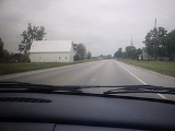
Geography
Lindsey is located at 41°25′10"N 83°13′15"W (41.419553, -83.220719).According to the United States Census Bureau
United States Census Bureau
The United States Census Bureau is the government agency that is responsible for the United States Census. It also gathers other national demographic and economic data...
, the village has a total area of 1.5 square miles (3.9 km²), all of it land.
Lindsey lies between combined interstate highways I-80
Interstate 80
Interstate 80 is the second-longest Interstate Highway in the United States, following Interstate 90. It is a transcontinental artery running from downtown San Francisco, California to Teaneck, New Jersey in the New York City Metropolitan Area...
and I-90
Interstate 90
Interstate 90 is the longest Interstate Highway in the United States at . It is the northernmost coast-to-coast interstate, and parallels US 20 for the most part. Its western terminus is in Seattle, at Edgar Martinez Drive S. near Safeco Field and CenturyLink Field, and its eastern terminus is in...
and US Route 20 on State Highway 590.
Demographics
As of the censusCensus
A census is the procedure of systematically acquiring and recording information about the members of a given population. It is a regularly occurring and official count of a particular population. The term is used mostly in connection with national population and housing censuses; other common...
of 2000, there were 504 people, 199 households, and 148 families residing in the village. The population density
Population density
Population density is a measurement of population per unit area or unit volume. It is frequently applied to living organisms, and particularly to humans...
was 327.0 people per square mile (126.4/km²). There were 209 housing units at an average density of 135.6 per square mile (52.4/km²). The racial makeup of the village was 93.65% White, 0.20% African American, 0.20% Native American, 0.20% Asian, 4.96% from other races
Race (United States Census)
Race and ethnicity in the United States Census, as defined by the Federal Office of Management and Budget and the United States Census Bureau, are self-identification data items in which residents choose the race or races with which they most closely identify, and indicate whether or not they are...
, and 0.79% from two or more races. Hispanic or Latino of any race were 7.94% of the population.
There were 199 households out of which 34.2% had children under the age of 18 living with them, 63.8% were married couples
Marriage
Marriage is a social union or legal contract between people that creates kinship. It is an institution in which interpersonal relationships, usually intimate and sexual, are acknowledged in a variety of ways, depending on the culture or subculture in which it is found...
living together, 6.5% had a female householder with no husband present, and 25.6% were non-families. 23.6% of all households were made up of individuals and 14.1% had someone living alone who was 65 years of age or older. The average household size was 2.53 and the average family size was 3.01.
In the village the population was spread out with 25.2% under the age of 18, 6.9% from 18 to 24, 29.6% from 25 to 44, 24.2% from 45 to 64, and 14.1% who were 65 years of age or older. The median age was 38 years. For every 100 females there were 100.0 males. For every 100 females age 18 and over, there were 92.3 males.
The median income for a household in the village was $45,781, and the median income for a family was $53,889. Males had a median income of $33,125 versus $25,208 for females. The per capita income
Per capita income
Per capita income or income per person is a measure of mean income within an economic aggregate, such as a country or city. It is calculated by taking a measure of all sources of income in the aggregate and dividing it by the total population...
for the village was $21,737. About 5.3% of families and 5.7% of the population were below the poverty line, including 5.4% of those under age 18 and 11.5% of those age 65 or over.