

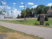
Lake Wobegon Trails
Encyclopedia
Rail trail
A rail trail is the conversion of a disused railway easement into a multi-use path, typically for walking, cycling and sometimes horse riding. The characteristics of former tracks—flat, long, frequently running through historical areas—are appealing for various development. The term sometimes also...
s in central Minnesota
Minnesota
Minnesota is a U.S. state located in the Midwestern United States. The twelfth largest state of the U.S., it is the twenty-first most populous, with 5.3 million residents. Minnesota was carved out of the eastern half of the Minnesota Territory and admitted to the Union as the thirty-second state...
, named after the fictional Lake Wobegon in Garrison Keillor's
Garrison Keillor
Gary Edward "Garrison" Keillor is an American author, storyteller, humorist, and radio personality. He is known as host of the Minnesota Public Radio show A Prairie Home Companion Gary Edward "Garrison" Keillor (born August 7, 1942) is an American author, storyteller, humorist, and radio...
"Prairie Home Companion
A Prairie Home Companion
A Prairie Home Companion is a live radio variety show created and hosted by Garrison Keillor. The show runs on Saturdays from 5 to 7 p.m. Central Time, and usually originates from the Fitzgerald Theater in Saint Paul, Minnesota, although it is frequently taken on the road...
". Each trail is marked with mileposts every 0.5 mile (0.80467 km), corresponding with the mile markers of the former railroad lines. Snowmobile use is allowed on the trail in winter, conditions permitting.
Main trail
The main trail is a 62 miles (99.8 km) trail along a former Burlington Northern RailroadBurlington Northern Railroad
The Burlington Northern Railroad was a United States-based railroad company formed from a merger of four major U.S. railroads. Burlington Northern operated between 1970 and 1996....
line, beginning near milepost 81 in St. Joseph
St. Joseph, Minnesota
As of the census of 2000, there were 4,681 people, 1,120 households, and 712 families residing in the city. The population density was 2,517.4 people per square mile . There were 1,147 housing units at an average density of 616.8 per square mile...
and ending near milepost 143 in Osakis
Osakis, Minnesota
As of the census of 2000, there were 1,567 people, 661 households, and 405 families residing in the city. The population density was 779.4 people per square mile . There were 760 housing units at an average density of 378.0 per square mile...
. This trail runs parallel to I-94
Interstate 94 in Minnesota
In the U.S. state of Minnesota, Interstate 94 runs east–west through the central portion of the state. The route connects the cities of Moorhead, Fergus Falls, Alexandria, St...
. The trail passes through the cities of Avon
Avon, Minnesota
Avon is a city in Stearns County, Minnesota, United States. The population was 1,396 at the 2010 census. It is part of the St. Cloud Metropolitan Statistical Area....
, Albany
Albany, Minnesota
As of the census of 2000, there were 1,796 people, 708 households, and 436 families residing in the city. The population density was 1,287.6 people per square mile . There were 732 housing units at an average density of 524.8 per square mile...
, Freeport
Freeport, Minnesota
Freeport is a city in Stearns County, Minnesota, United States. The population was 632 at the 2010 census. It is part of the St. Cloud Metropolitan Statistical Area.-Geography:Freeport is located in Oak Township, T125N R32W §3...
, Melrose
Melrose, Minnesota
Melrose is a city in Stearns County, Minnesota, United States. The population was 3,598 at the 2010 census. It is part of the St. Cloud Metropolitan Statistical Area.-Geography:...
, and West Union
West Union, Minnesota
West Union is a city in Todd County, Minnesota, United States. The population was 111 at the 2010 census.-Geography:According to the United States Census Bureau, the city has a total area of , all of it land....
. Beyond Osakis, the trail continues as the Central Lakes Trail
Central Lakes Trail
The Central Lakes State Trail is a paved recreational rail trail in central Minnesota, USA, running along a former Burlington Northern Railroad line. The trail is marked with mileposts every mile, corresponding with the mile markers of the former railroad line...
. These two trails form a continuous trail from St. Joseph to Fergus Falls
Fergus Falls, Minnesota
Fergus Falls is a city in and the county seat of Otter Tail County, Minnesota, United States. The population was 13,138 at the 2010 census.-Today:...
. The extension trail intersects near milepost 97 of the main trail in Albany.
Extension trail
The extension trail is a 13 miles (20.9 km) trail along a former Soo Line RailroadSoo Line Railroad
The Soo Line Railroad is the primary United States railroad subsidiary of the Canadian Pacific Railway , controlled through the Soo Line Corporation, and one of seven U.S. Class I railroads. Although it is named for the Minneapolis, St. Paul and Sault Ste...
line, beginning near milepost 131 in Albany
Albany, Minnesota
As of the census of 2000, there were 1,796 people, 708 households, and 436 families residing in the city. The population density was 1,287.6 people per square mile . There were 732 housing units at an average density of 524.8 per square mile...
passing through Albany, Krain and Holding Townships and ending 3 miles (4.8 km) northeast of Holdingford
Holdingford, Minnesota
Holdingford is a city in Stearns County, Minnesota, United States. The population was 708 at the 2010 census. It claims to be "The Gateway to Lake Wobegon", the fictional central Minnesota town created by Garrison Keillor.Holdingford is part of the St...
at approx. milepost 143.5, passing through Holdingford. This bicycle trail continues beyond milepost 143.5 as the Soo Line Trail, crossing the Mississippi River
Mississippi River
The Mississippi River is the largest river system in North America. Flowing entirely in the United States, this river rises in western Minnesota and meanders slowly southwards for to the Mississippi River Delta at the Gulf of Mexico. With its many tributaries, the Mississippi's watershed drains...
at the Blanchard Dam
Blanchard Dam
Blanchard Dam is a dam across the Mississippi River near the city of Royalton, Minnesota, United States. Blanchard is a hydroelectric station owned and operated by Minnesota Power. The dam sits slightly upriver from the former Soo Line rail bridge over the Mississippi...
, changing from asphalt to gravel at U.S. 10
U.S. Route 10 in Minnesota
U.S. Route 10 is a major divided highway for almost all of its length in the U.S. state of Minnesota. The route runs through the central portion of the state, following closely the alignment of the former Northern Pacific Railway and connects the cities of Moorhead, Detroit Lakes, Wadena, Little...
south of Little Falls
Little Falls, Minnesota
As of the census of 2000, there were 7,719 people , 3,197 households, and 1,899 families residing in the city. The population density was 1,232.5 people per square mile . There were 3,358 housing units at an average density of 536.2 per square mile...
, and extending to Onamia
Onamia, Minnesota
As of the census of 2000, there were 847 people, 318 households, and 171 families residing in the city. The population density was 938.3 people per square mile . There were 355 housing units at an average density of 393.3 per square mile...
. The Soo Line Trail traverses Morrison County
Morrison County, Minnesota
-Demographics:As of the census of 2000, there were 31,712 people, 11,816 households, and 8,460 families residing in the county. The population density was 28 people per square mile . There were 13,870 housing units at an average density of 12 per square mile...
and Mille Lacs County
Mille Lacs County, Minnesota
As of the census of 2000, there were 22,330 people, 8,638 households, and 6,003 families residing in the county. The population density was 39 people per square mile . There were 10,467 housing units at an average density of 18 per square mile...
.