
Kankakee Township, Jasper County, Indiana
Encyclopedia
Kankakee Township is one of thirteen townships
in Jasper County
, Indiana
, USA
. As of the 2000 census
, its population was 945.
Civil township
A civil township is a widely used unit of local government in the United States, subordinate to, and geographic divisions of, a county. Specific responsibilities and the degree of autonomy vary based on each state. Civil townships are distinct from survey townships, but in states that have both,...
in Jasper County
Jasper County, Indiana
As of the census of 2000, there were 30,043 people, 10,686 households, and 8,217 families residing in the county. The population density was 54 people per square mile . There were 11,236 housing units at an average density of 20 per square mile...
, Indiana
Indiana
Indiana is a US state, admitted to the United States as the 19th on December 11, 1816. It is located in the Midwestern United States and Great Lakes Region. With 6,483,802 residents, the state is ranked 15th in population and 16th in population density. Indiana is ranked 38th in land area and is...
, USA
United States
The United States of America is a federal constitutional republic comprising fifty states and a federal district...
. As of the 2000 census
United States Census, 2000
The Twenty-second United States Census, known as Census 2000 and conducted by the Census Bureau, determined the resident population of the United States on April 1, 2000, to be 281,421,906, an increase of 13.2% over the 248,709,873 persons enumerated during the 1990 Census...
, its population was 945.
Geography
Kankakee Township covers an area of 25.94 square miles (67.2 km²); of this, 0.57 square miles (1.5 km²) or 2.22 percent is water.Adjacent townships
- Pleasant Township, Porter CountyPleasant Township, Porter County, IndianaPleasant Township is one of twelve townships in Porter County, Indiana. As of the 2000 census, its population was 3,759.-Education:The township is served by the East Porter County School Corporation. Its high school is Kouts High School located in Kouts....
(north) - Dewey Township, LaPorte CountyDewey Township, LaPorte County, IndianaDewey Township is one of twenty-one townships in LaPorte County, Indiana. As of the 2000 census, its population was 970.-External links:* *...
(northeast) - Railroad Township, Starke CountyRailroad Township, Starke County, IndianaRailroad Township is one of nine townships in Starke County, Indiana, USA. As of the 2000 census, its population was 1,353.-Geography:According to the United States Census Bureau, Railroad Township covers an area of ; of this, is land and is water...
(east) - Cass Township, Pulaski CountyCass Township, Pulaski County, IndianaCass Township is one of twelve townships in Pulaski County, Indiana, USA. As of the 2000 census, its population was 1,013.-Geography:According to the United States Census Bureau, Cass Township covers an area of .-Unincorporated towns:* Clarks at...
(southeast) - Walker TownshipWalker Township, Jasper County, IndianaWalker Township is one of thirteen townships in Jasper County, Indiana, USA. As of the 2000 census, its population was 2,797.-Geography:Walker Township covers an area of ; of this, or 0.61 percent is water.-Unincorporated towns:* Asphaltum* Kniman...
(southwest) - Wheatfield TownshipWheatfield Township, Jasper County, IndianaWheatfield Township is one of thirteen townships in Jasper County, Indiana, USA. As of the 2000 census, its population was 3,622.-Geography:Wheatfield Township covers an area of...
(west)
Major highways
-
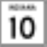
 Indiana State Road 10Indiana State Road 10State Road 10 is an east–west road in northwest Indiana. Its western terminus is at the Illinois state line west of Lake Village. Its eastern terminus is at State Road 19 south of Etna Green.-Route description:...
 -
 Indiana State Road 49Indiana State Road 49State Road 49 in the U.S. State of Indiana is a state highway in northwest Indiana. It runs from just north of Chesterton at the intersection with U.S. Route 12 south to a rural interchange 10 miles northeast of Rensselaer with State Road 14...