
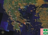
Ionia Odos
Encyclopedia
Greece
Greece , officially the Hellenic Republic , and historically Hellas or the Republic of Greece in English, is a country in southeastern Europe....
. The total length will be 196 km from Rio to Ioannina. It is part of the E55
European route E55
European route E 55 is a E-route. It passes through the following cities:Helsingborg … Helsingør – Copenhagen – Køge – Vordingborg – Nykøbing Falster – Gedser … Rostock – Berlin – Lübbenau – Dresden – Teplice – Prague – Tábor – Linz – Salzburg – Villach – Tarvisio – Udine – Palmanova – Mestre...
on its full length, along with the non-motorway part of Kakavia - Ioannina
Ioannina
Ioannina , often called Jannena within Greece, is the largest city of Epirus, north-western Greece, with a population of 70,203 . It lies at an elevation of approximately 500 meters above sea level, on the western shore of lake Pamvotis . It is located within the Ioannina municipality, and is the...
. The full length of the motorway will be completed by the end of 2013.
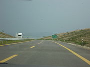
Construction
Construction began in 2001 on an interchange outside Missolongi near AitolikoAitoliko
Aitoliko is a town and a former municipality in Aetolia-Acarnania, West Greece, Greece. Since the 2011 local government reform it is part of the municipality Messolonghi, of which it is a municipal unit. It is located north of the Acheloos delta. The Greek National Road 5/E55 passes through the...
along Greek National Road 5
Greek National Road 5
Greek National Road 5 is a highway in Western Greece. It runs from 2 km south of Rio at GR-8/GR-9 , or at the beginning of the Patras By-Pass in the south up to the city centre of Ioannina. It is now connected with a new bridge, the Rio-Antirio bridge and for 5 km is a joint with GR-48...
with a paved section built up to near Angelokastro. Construction stopped shortly after, with rumors of funding problems with the builders.
In late 2006, Greece signed a €1.4 billion deal with a Greek-Spanish consortium consisting of construction firms GEK Group of Companies SA, Terna SA, Cintra SA (Cintra
Cintra
Cintra, S.A. is one of the largest private developers of transport infrastructure in the world. Its assets are fundamentally toll roads and car parks, in which it has a total investment of €16billion...
), and Actividades de Construcción y Servicios (Grupo ACS
Grupo ACS
Actividades de Construcción y Servicios, S.A. is a Spanish company dedicated to civil and engineering construction, all types services and telecommunications. It is one of the leading construction companies in the world, with projects in many countries around the world...
). The consortium, now operating under the name "Nea Odos", will build and operate the road, receiving toll fees for 30 years, while investing a combined €1.15 billion in the project. The rest of the funds will be provided by the European Union and the Greek government. Nea Odos is also responsible for the maintenance and upgrading of the PATHE motorway (A1) section from Metamorphosi I/C in Athens to Skarfeia I/C near Lamia, where it will also collect the toll fees. Construction, undertaken by the Euroionia Joint Venture (Terna SA, Dragados SA and Ferrovial
Ferrovial
Ferrovial, S.A. is a Spanish multinational company involved in the design, build, financing, operation and maintenance of transport, urban and services infrastructure. It is a publicly-traded company and is part of the IBEX 35 market value-weighted stock market index...
SA) finally started in 2008 with a completion date of 72 months. The bill was later ratified on March 28, 2007.
Construction began with repairs and completion of the existing section (Agrinio bypass), with construction toward Rigani and Kouvara. Construction has also started in a number of new sections: the Antirio to Kefalovryso section (where the tunnels of Makyneia and Kalydona are already under construction) and parts of the motorway bypassing Amfilohia. The final completion date will be around 2012. The previously completed section of the motorway was opened to traffic in 2009, running up until the current construction. The project has been marred by lack of vacant possession of land, necessary for construction, which leads to undue delays.
Interchanges
Below are the planned interchanges with their current status:| Interchange Name | Access to other places and attractions | Status |
|---|---|---|
| Rio Rio, Greece Rio is a town and a former municipality in Achaea, West Greece, Greece. Since the 2011 local government reform it is part of the municipality Patras, of which it is a municipal unit. The former municipality had a population of around 13,000.- Geography :... |
GR-8A Greek National Road 8A Greek National Road 8A is a toll road running from Kifissou avenue, in Athens up to the northeast of Patras. It is a highway from Kifissou avenue up to Corinth, for about 85 km and the rest is an undivided highway with just one lane per direction. The total length is 215 km, but for the... with Patras By-Pass |
GR-8A |
| Rio Rio, Greece Rio is a town and a former municipality in Achaea, West Greece, Greece. Since the 2011 local government reform it is part of the municipality Patras, of which it is a municipal unit. The former municipality had a population of around 13,000.- Geography :... |
- | - |
| Rio-Antirio bridge Rio-Antirio bridge The Rion-Antirion bridge , officially the Charilaos Trikoupis bridge after the statesman who first envisaged it, is the world's longest multi-span cable-stayed bridge... |
Complete | |
| Antirio Toll Station | Complete | |
| Antirrio Interchange | GR-48 Greek National Road 48 Greek National Road 48 is a highway in Western and Central Greece. It runs from 2 km south of Rio at GR-8/GR-9 , or at the beginning of the Patras By-Pass in the south up to near Levadia. It is now connected with a new bridge, the Rio-Antirio bridge and for 5 km is a joint with GR-5... with Nafpaktos, Itea Itea Itea may refer to:*Itea , a genus of plants that includes Itea virginica, the scientific name of Virginia Sweetspire.*places in Greece:**Itea, Evros, a village in the southeastern part of the Evros Prefecture... , Amfissa Amfissa Amfissa is a town and a former municipality in Phocis, Greece. Since the 2011 local government reform it is part of the municipality Delphi, of which it is the seat and a municipal unit. It is also the capital of the regional unit of Phocis... , Delphi Delphi Delphi is both an archaeological site and a modern town in Greece on the south-western spur of Mount Parnassus in the valley of Phocis.In Greek mythology, Delphi was the site of the Delphic oracle, the most important oracle in the classical Greek world, and a major site for the worship of the god... , Livadeia Livadeia Livadeia is a city in central Greece. It is the capital of the prefecture Boeotia. Livadeia is located 130 km NW of Athens, E of Nafpaktos, ESE of Amfissa and Desfina, SE of Lamia and west of Chalkida. Livadeia is linked with GR-48 and several kilometres west of GR-3. The area around Livadeia... |
Planned |
| Riza Interchange | - | Under Construction |
| Klokova Tunnel | Under Construction | |
| Klokova Interchange | - | Under Construction |
| Evinos River (Bridge) | Under Construction | |
| Evinochori Evinochori Evinochori is a Greek town located east of Messolongi in the southern part of Aetolia-Acarnania. Evinochori is in the municipality of Messolongi. Evinochori had a 2001 population of 1,683 for the village and 1,706 for the municipal district... Interchange |
- | Under Construction |
| Missolongi Interchange | - | Under Construction |
| Aitoliko Aitoliko Aitoliko is a town and a former municipality in Aetolia-Acarnania, West Greece, Greece. Since the 2011 local government reform it is part of the municipality Messolonghi, of which it is a municipal unit. It is located north of the Acheloos delta. The Greek National Road 5/E55 passes through the... Interchange |
Aitoliko, Astakos Astakos Astakos is a town and a former municipality in Aetolia-Acarnania, West Greece, Greece. Since the 2011 local government reform it is part of the municipality Xiromero, of which it is a municipal unit. It is located on the eastern shore of the Ionian Sea but small hills to the west of the town block... |
Partially open to traffic |
| Chalkio Interchange | GR-5, Trichonida area, Stamna | Partially open to traffic |
| Angelokastro Angelokastro Angelokastro is a village and a former municipality in Aetolia-Acarnania, West Greece, Greece. Since the 2011 local government reform it is part of the municipality Agrinio, of which it is a municipal unit.... Interchange |
Angelokastro, GR-5, Agrinio Agrinio Agrinion is the largest city and municipality of the Aetolia-Acarnania peripheral unit of Greece, with 96,321 inhabitants. It is the economical center of Aetolia-Acarnania, although its capital is the town of Mesolonghi. The settlement dates back to ancient times... |
Partially open to traffic |
| Rigani Interchange | GR-38 Greek National Road 38 Greek National Road 38 is a highway linking the cities of Agrinio, Karpenisi and Lamia. It is the only highway linking Agrinio and Larissa because GR-30 is narrow. The highway passes into the reservoir of the Acheloos river and into the Pindus ranges. It later passes through Karpenisi and into... /E952 - Agrinio Agrinio Agrinion is the largest city and municipality of the Aetolia-Acarnania peripheral unit of Greece, with 96,321 inhabitants. It is the economical center of Aetolia-Acarnania, although its capital is the town of Mesolonghi. The settlement dates back to ancient times... , Karpenissi, Lamia Lamia (city) Lamia is a city in central Greece. The city has a continuous history since antiquity, and is today the capital of the regional unit of Phthiotis and of the Central Greece region .-Name:... |
Partially open to traffic |
| Kouvara Interchange | GR-5, Agrinio, Kouvara | Partially open to traffic |
| Amvrakia Interchange | GR-5, Amvrakia, Future Interchange with A52 | Planned |
| Amfilochia Tunnel | Planned | |
| Amfilochia Amfilochia Amfilochia is a town and a municipality in the northwestern part of Aetolia-Acarnania in Greece, on the site of ancient Amfilochia. Under the Ottoman Empire, it was known as Karvassaras .... Interchange |
GR-42 Greek National Road 42 The Greek National Road 42 is a highway in the northern part of the Aitolia-Akarnania and the Lefkada prefectures that link with the center of Lefkada as well as the rest of the island and ends with the GR-5/E55 in Amfilochia via passing through the town of Vonitsa... , Amfilochia Amfilochia Amfilochia is a town and a municipality in the northwestern part of Aetolia-Acarnania in Greece, on the site of ancient Amfilochia. Under the Ottoman Empire, it was known as Karvassaras .... , Vonitsa Vonitsa Vonitsa is a town in the northwestern part of Aetolia-Acarnania in Greece, seat of the municipality of Aktio-Vonitsa. Population 4,081 . The town is situated in the bay overlooking the Ambracian Gulf and has a small forested peninsula, the peninsula and its narrow strait is in the northwest of... , Preveza Preveza Preveza is a town in the region of Epirus, northwestern Greece, located at the mouth of the Ambracian Gulf. It is the capital of the regional unit of Preveza, which is part of the region of Epirus. An immersed tunnel, completed in 2002 which runs between Preveza and Actium, connects the town... , Lefkada Lefkada Lefkada, or Leucas or Leucadia , is a Greek island in the Ionian Sea on the west coast of Greece, connected to the mainland by a long causeway and floating bridge. The principal town of the island and seat of the municipality is Lefkada . It is situated on the northern part of the island,... |
Planned |
| Menidi Interchange | - | Planned |
| South Arta Arta, Greece Arta is a city with a rich history in northwestern Greece, capital of the peripheral unit of Arta, which is part of Epirus region. The city was known in ancient times as Ambracia . Arta is famous for its old bridge located over the Arachthos River, situated west of downtown... or Arta South |
GR-30 Greek National Road 30 The Greek National Road 30 is a highway or route that links the cities of Volos, Karditsa, Trikala and Arta.-Information:... , Karditsa Karditsa Karditsa is a city in western Thessaly in mainland Greece. The city of Karditsa is the capital of Karditsa peripheral unit.Inhabitation is attested from 9000 BCE. Karditsa ls linked with GR-30, the road to Karpenisi, and the road to Palamas and Larissa... , Farsala Farsala Farsala , known in Antiquity as Φάρσαλος, Pharsalos or Pharsalus, is a city in southern Thessaly, in Greece. Farsala is located in the southern part of Larissa regional unit, and is one of its largest towns. The city is linked with GR-3, the old highway linking Larissa and Lamia and is also... , Volos Volos Volos is a coastal port city in Thessaly situated midway on the Greek mainland, about 326 km north of Athens and 215 km south of Thessaloniki... |
Planned |
| Arachthos Bridge Arachthos River The Arachthos is a river in eastern Epirus in Greece that flows from the Pindus mountains and begins in the area southeast of Metsovo in the Ioannina Prefecture near the Trikala Prefecture and flows by numerous village including Elliniko... |
Planned | |
| North Arta or Arta North - Arta Arta, Greece Arta is a city with a rich history in northwestern Greece, capital of the peripheral unit of Arta, which is part of Epirus region. The city was known in ancient times as Ambracia . Arta is famous for its old bridge located over the Arachthos River, situated west of downtown... |
GR-5 | Planned |
| Skamnia Tunnel | Planned | |
| Filippiada Filippiada Filippiada is a small town and a former municipality in the Preveza peripheral unit, Epirus, Greece. Since the 2011 local government reform it is part of the municipality Ziros, of which it is a municipal unit. Population 8,429 . Filippiada is divided into smaller regions entailing Old Filippiada,... /Preveza Preveza Preveza is a town in the region of Epirus, northwestern Greece, located at the mouth of the Ambracian Gulf. It is the capital of the regional unit of Preveza, which is part of the region of Epirus. An immersed tunnel, completed in 2002 which runs between Preveza and Actium, connects the town... |
GR-21 Greek National Road 21 Greek National Road 21 is a national highway of Greece. It connects Preveza with Greek National Road 5.... , Preveza Preveza Preveza is a town in the region of Epirus, northwestern Greece, located at the mouth of the Ambracian Gulf. It is the capital of the regional unit of Preveza, which is part of the region of Epirus. An immersed tunnel, completed in 2002 which runs between Preveza and Actium, connects the town... , Nikopoli, Parga Parga Parga, , is a town and municipality located in the northwestern part of the regional unit of Preveza in Epirus, northwestern Greece. The seat of the municipality is the village Kanallaki. Parga lies on the Ionian coast between the cities of Preveza and Igoumenitsa... |
Planned |
| Gorgomylos Interchange | - | Under Construction |
| Avgo Avgo Avgo , is an uninhabited Greek islet, in the Aegean Sea, close to the eastern coast of Crete. Administratively it lies within the Neapolis municipality of Lasithi Prefecture.-See also:*List of islands of Greece... Interchange |
- | Under Construction |
| Ioannina Ioannina Ioannina , often called Jannena within Greece, is the largest city of Epirus, north-western Greece, with a population of 70,203 . It lies at an elevation of approximately 500 meters above sea level, on the western shore of lake Pamvotis . It is located within the Ioannina municipality, and is the... South Interchange |
Egnatia Odos Egnatia Odos (modern road) Egnatia Odos is the Greek part of the European route. It is a motorway in Greece that extends from the western port of Igoumenitsa to the eastern Greek–Turkish border at Kipoi. It runs a total of... /E90 European route E90 European route E 90 is an A-Class West-East European route, extending from Lisbon in Portugal in the west to the Turkish-Iraqi border in the east.-Itinerary:... /E92 European route E92 European route E 92 is an A-Class European route, crossing the Greek peripheries of Epirus and Thessaly.E 92 routes through the following local capitals : Igoumenitsa, Ioannina, Trikala, Larisa, Volos.... , Igoumenitsa Igoumenitsa Igoumenitsa , is a coastal city in northwestern Greece. It is the capital of the regional unit Thesprotia. Its original ancient name used to be Titani.... , Parga Parga Parga, , is a town and municipality located in the northwestern part of the regional unit of Preveza in Epirus, northwestern Greece. The seat of the municipality is the village Kanallaki. Parga lies on the Ionian coast between the cities of Preveza and Igoumenitsa... and Kozani Kozani Kozani is a city in northern Greece, capital of Kozani regional unit and of West Macedonia region. It is located in the western part of Macedonia, in the northern part of the Aliakmonas river valley... , Thessaloniki Thessaloniki Thessaloniki , historically also known as Thessalonica, Salonika or Salonica, is the second-largest city in Greece and the capital of the region of Central Macedonia as well as the capital of the Decentralized Administration of Macedonia and Thrace... accesses with the GR-17 with Dodoni Dodoni Dodoni is a village and a municipality in the Ioannina regional unit, Epirus, Greece. The seat of the municipality is the village Agia Kyriaki... |
Under Construction/A2 A2 A2 is a letter-number combination.The terms A2, A02, A002, A², A.II or A-2 may refer to:-Media:Gaming :* A2 Racer, a 1997 Dutch racing computer game series... |
| Ioannina Ioannina Ioannina , often called Jannena within Greece, is the largest city of Epirus, north-western Greece, with a population of 70,203 . It lies at an elevation of approximately 500 meters above sea level, on the western shore of lake Pamvotis . It is located within the Ioannina municipality, and is the... North Interchange |
Ioannina Ioannina Ioannina , often called Jannena within Greece, is the largest city of Epirus, north-western Greece, with a population of 70,203 . It lies at an elevation of approximately 500 meters above sea level, on the western shore of lake Pamvotis . It is located within the Ioannina municipality, and is the... , Eleousa, Ioannina Airport, GR-5 and GR-20, Ioannina Bypass, GR-6 Greek National Road 6 Greek National Road 6 is a highway in north-central Greece. It begins at the port of Igoumenitsa and ends at Larissa. Part of the new road is run under the name Egnatia Odos from Igoumenitsa to east of the tunnel at Metsovo. It has junctions of GR-19GR-5/20/E55, GR-15, GR-30 and finally at... with Perama Perama, Ioannina Perama is a town and a former municipality in the Ioannina peripheral unit, Epirus, Greece. Since the 2011 local government reform it is part of the municipality Ioannina, of which it is a municipal unit. It lies about 4 km north of central Ioannina. The town's name means "passage" and it... , Igoumenitsa Igoumenitsa Igoumenitsa , is a coastal city in northwestern Greece. It is the capital of the regional unit Thesprotia. Its original ancient name used to be Titani.... and Metsovo Metsovo Metsovo is a town in Epirus on the mountains of Pindus in northern Greece, between Ioannina to the north and Meteora to the south. The largest centre of Vlach life in Greece, Metsovo is bypassed by GR-6 and also by Egnatia Odos Motorway.... (old road) |
Under Construction |
| Kalpaki Interchange | - | Planned |
| Ktismata Ktismata Ktismata is a village in the Ioannina Prefecture in Epirus, Greece next to the Greek - Albanian border at Kakavia. It is in the municipal unit of Delvinaki.-Location:... Interchange |
- | Planned |
| Kakavia border crossing | - | |
| Albania-Greece | - | |