
Interstate 94 in North Dakota
Encyclopedia
In the U.S. state
of North Dakota
, Interstate 94
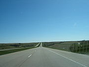
runs east–west through the central portion of the state.
at Beach
and immediately heads east, passing Dickinson
, Bismarck
and Jamestown
before entering Fargo
and finally exiting the state.
The route passes to the south of Theodore Roosevelt National Park
's southern unit. Access to the Northern unit is possible by taking US 85 north from Belfield
.
The route crosses from Mountain Time Zone
(UTC-7) into Central Time Zone
(UTC-6) at the Stark
/Morton County
line and vice versa.
The route has a 75 MPH posted speed limit between Montana State Line
and Mandan
near mile marker 152. A 60 MPH posted speed limit between Mandan
Near Mile marker 152 and Bismarck
mile marker 160. 75 MPH posted speed limit between Bismarck
mile marker 160 and West Fargo
near exit 346. 65 MPH posted speed limit between West Fargo
near exit 346 and West Fargo
mile marker 347. 55 MPH posted speed limit between West Fargo
mile marker 347 to the Minnesota State Line
.
U.S. state
A U.S. state is any one of the 50 federated states of the United States of America that share sovereignty with the federal government. Because of this shared sovereignty, an American is a citizen both of the federal entity and of his or her state of domicile. Four states use the official title of...
of North Dakota
North Dakota
North Dakota is a state located in the Midwestern region of the United States of America, along the Canadian border. The state is bordered by Canada to the north, Minnesota to the east, South Dakota to the south and Montana to the west. North Dakota is the 19th-largest state by area in the U.S....
, Interstate 94
Interstate 94
Interstate 94 is the northernmost east–west Interstate Highway, connecting the Great Lakes and Intermountain regions of the United States. I-94's western terminus is in Billings, Montana at a junction with Interstate 90; its eastern terminus is the U.S...
runs east–west through the central portion of the state.
Route description
The route enters from North DakotaNorth Dakota
North Dakota is a state located in the Midwestern region of the United States of America, along the Canadian border. The state is bordered by Canada to the north, Minnesota to the east, South Dakota to the south and Montana to the west. North Dakota is the 19th-largest state by area in the U.S....
at Beach
Beach, North Dakota
As of the 2000 Census, there were 1,116 people, 470 households, and 292 families residing in the city. The population density was . There were 570 housing units at an average density of . The racial makeup of the city was 98.66% White, 0.18% Native American, 0.18% Asian, 0.54% from other races, and...
and immediately heads east, passing Dickinson
Dickinson, North Dakota
As of the census of 2000, there were 16,010 people, 6,517 households, and 4,020 families residing in the city. The population density was 1,690.7 inhabitants per square mile . There were 7,033 housing units at an average density of 742.7 per square mile...
, Bismarck
Bismarck, North Dakota
Bismarck is the capital of the U.S. state of North Dakota and the county seat of Burleigh County. It is the second most populous city in North Dakota after Fargo. The city's population was 61,272 at the 2010 census, while its metropolitan population was 108,779...
and Jamestown
Jamestown, North Dakota
As of the census of 2000, there were 15,527 people, 6,505 households, and 3,798 families residing in the city. The population density was 1,246.7 per square mile . There were 6,970 housing units at an average density of 559.6 per square mile...
before entering Fargo
Fargo, North Dakota
Fargo is the largest city in the U.S. state of North Dakota and the county seat of Cass County. In 2010, its population was 105,549, and it had an estimated metropolitan population of 208,777...
and finally exiting the state.
The route passes to the south of Theodore Roosevelt National Park
Theodore Roosevelt National Park
Theodore Roosevelt National Park is a United States National Park comprising three geographically separated areas of badlands in western North Dakota. The park was named for U.S. President Theodore Roosevelt, in honor of his achievements in conservation as president and for the landscape's...
's southern unit. Access to the Northern unit is possible by taking US 85 north from Belfield
Belfield, North Dakota
As of the 2000 Census, there were 866 people, 355 households, and 235 families residing in the city. The population density was 799.8 people per square mile . There were 439 housing units at an average density of 405.4 per square mile...
.
The route crosses from Mountain Time Zone
Mountain Time Zone
The Mountain Time Zone of North America keeps time by subtracting seven hours from Coordinated Universal Time, also known as Greenwich Mean Time, during the shortest days of autumn and winter , and by subtracting six hours during daylight saving time in the spring, summer, and early autumn...
(UTC-7) into Central Time Zone
Central Time zone
In North America, the Central Time Zone refers to national time zones which observe standard time by subtracting six hours from UTC , and daylight saving, or summer time by subtracting five hours...
(UTC-6) at the Stark
Stark County, North Dakota
-Demographics:As of the census of 2000, there were 22,636 people, 8,932 households, and 5,877 families residing in the county. The population density was 17 people per square mile . There were 9,722 housing units at an average density of 7 per square mile...
/Morton County
Morton County, North Dakota
-Demographics:As of the census of 2000, there were 25,303 people, 9,889 households, and 6,932 families residing in the county. The population density was 13 people per square mile . There were 10,587 housing units at an average density of 6 per square mile...
line and vice versa.
The route has a 75 MPH posted speed limit between Montana State Line
Montana
Montana is a state in the Western United States. The western third of Montana contains numerous mountain ranges. Smaller, "island ranges" are found in the central third of the state, for a total of 77 named ranges of the Rocky Mountains. This geographical fact is reflected in the state's name,...
and Mandan
Mandan, North Dakota
As of the census of 2000, there were 16,718 people, 6,647 households, and 4,553 families residing in the city. The population density was 1,642.8 per square mile . There were 6,958 housing units at an average density of 683.7 per square mile...
near mile marker 152. A 60 MPH posted speed limit between Mandan
Mandan, North Dakota
As of the census of 2000, there were 16,718 people, 6,647 households, and 4,553 families residing in the city. The population density was 1,642.8 per square mile . There were 6,958 housing units at an average density of 683.7 per square mile...
Near Mile marker 152 and Bismarck
Bismarck, North Dakota
Bismarck is the capital of the U.S. state of North Dakota and the county seat of Burleigh County. It is the second most populous city in North Dakota after Fargo. The city's population was 61,272 at the 2010 census, while its metropolitan population was 108,779...
mile marker 160. 75 MPH posted speed limit between Bismarck
Bismarck, North Dakota
Bismarck is the capital of the U.S. state of North Dakota and the county seat of Burleigh County. It is the second most populous city in North Dakota after Fargo. The city's population was 61,272 at the 2010 census, while its metropolitan population was 108,779...
mile marker 160 and West Fargo
West Fargo, North Dakota
As of the census of 2000, there were 14,940 people, 5,771 households, and 4,091 families residing in the city, however the current population of West Fargo is estimated at over 26,000 residents. The population density was 2,049.2 per square mile . There were 5,968 housing units at an average...
near exit 346. 65 MPH posted speed limit between West Fargo
West Fargo, North Dakota
As of the census of 2000, there were 14,940 people, 5,771 households, and 4,091 families residing in the city, however the current population of West Fargo is estimated at over 26,000 residents. The population density was 2,049.2 per square mile . There were 5,968 housing units at an average...
near exit 346 and West Fargo
West Fargo, North Dakota
As of the census of 2000, there were 14,940 people, 5,771 households, and 4,091 families residing in the city, however the current population of West Fargo is estimated at over 26,000 residents. The population density was 2,049.2 per square mile . There were 5,968 housing units at an average...
mile marker 347. 55 MPH posted speed limit between West Fargo
West Fargo, North Dakota
As of the census of 2000, there were 14,940 people, 5,771 households, and 4,091 families residing in the city, however the current population of West Fargo is estimated at over 26,000 residents. The population density was 2,049.2 per square mile . There were 5,968 housing units at an average...
mile marker 347 to the Minnesota State Line
Minnesota
Minnesota is a U.S. state located in the Midwestern United States. The twelfth largest state of the U.S., it is the twenty-first most populous, with 5.3 million residents. Minnesota was carved out of the eastern half of the Minnesota Territory and admitted to the Union as the thirty-second state...
.
History
- Through the state, Interstate 94 follows the route once taken by U.S. Highway 10 west from FargoFargo, North DakotaFargo is the largest city in the U.S. state of North Dakota and the county seat of Cass County. In 2010, its population was 105,549, and it had an estimated metropolitan population of 208,777...
. This route was originally called "The Old Red Trail". Prairie Public TelevisionPrairie Public TelevisionPrairie Public Television is the Public Broadcasting Service member state network for the U.S. state of North Dakota. Along with its state radio network Prairie Public, the state network currently has nine digital stations covering all of North Dakota, plus portions of Minnesota, Montana, South...
in North Dakota produced a documentary about this road and the building of I-94 through the state.
Spur Routes
- I-194 - a short spur route into Bismarck (Bismarck Expressway). Unsigned
Exit list
| County | Location | Mile | # Exit number An exit number is a number assigned to a road junction, usually an exit from a freeway. It is usually marked on the same sign as the destinations of the exit, as well as a sign in the gore.... |
Destinations | Notes |
|---|---|---|---|---|---|
| Golden Valley Golden Valley County, North Dakota -Demographics:As of the census of 2000, there were 1,924 people, 761 households, and 506 families residing in the county. The population density was 1.92 people per square mile . There were 973 housing units at an average density of 0.97 per square mile... |
Beach Beach, North Dakota As of the 2000 Census, there were 1,116 people, 470 households, and 292 families residing in the city. The population density was . There were 570 housing units at an average density of . The racial makeup of the city was 98.66% White, 0.18% Native American, 0.18% Asian, 0.54% from other races, and... |
1.849 | 1 | Rest area just south of exit | |
| 7.368 | 7 | Home on the Range | |||
| 10.478 | 10 | Camel Hump Lake, Sentinel Butte Sentinel Butte, North Dakota As of the census of 2000, there were 62 people, 30 households, and 18 families residing in the city. The population density was 55.3 people per square mile . There were 44 housing units at an average density of 39.2 per square mile... |
|||
| 18.452 | 18 | Buffalo Gap | |||
| Billings Billings County, North Dakota -National protected areas:* Little Missouri National Grassland * Theodore Roosevelt National Park -Demographics:As of the census of 2000, there were 888 people, 366 households, and 255 families residing in the county. The population density was 0.79 people per square mile . There were 529 housing... |
23.001 | 23 | West River Road | Eastbound exit and westbound entrance | |
| 24.315 | 24 | ||||
| 27.243 | 27 | Westbound exit and eastbound entrance | |||
| 32.963 | 32 | Painted Canyon Visitor Center | |||
| 36.861 | 36 | Fryburg Fryburg, North Dakota Fryburg is an unincorporated community in Billings County, North Dakota. The Fryburg oil field is located here.... |
|||
| Stark Stark County, North Dakota -Demographics:As of the census of 2000, there were 22,636 people, 8,932 households, and 5,877 families residing in the county. The population density was 17 people per square mile . There were 9,722 housing units at an average density of 7 per square mile... |
Belfield Belfield, North Dakota As of the 2000 Census, there were 866 people, 355 households, and 235 families residing in the city. The population density was 799.8 people per square mile . There were 439 housing units at an average density of 405.4 per square mile... |
42.366 | 42 | To North Unit of Theodore Roosevelt National Park | Future junction with the Theodore Roosevelt Expressway Theodore Roosevelt Expressway The Theodore Roosevelt Expressway , is made up of several existing highways between Rapid City, South Dakota and the Port of Raymond between Saskatchewan and Montana. It is the northern third of the Ports to Plains Alliance. The corridor is approximately long with the majority of the highway two... |
| 51.476 | 51 | South Heart South Heart, North Dakota As of the census of 2000, there were 307 people, 108 households, and 81 families residing in the city. The population density was 327.7 people per square mile . There were 119 housing units at an average density of 127.0 per square mile... |
|||
| Dickinson Dickinson, North Dakota As of the census of 2000, there were 16,010 people, 6,517 households, and 4,020 families residing in the city. The population density was 1,690.7 inhabitants per square mile . There were 7,033 housing units at an average density of 742.7 per square mile... |
59.485 | 59 | To Dickinson State University Dickinson State University Dickinson State University is a four-year public university in Dickinson, North Dakota, United States, and is a part of the North Dakota University System... |
||
| 61.476 | 61 | ||||
| 64.204 | 64 | ||||
| A former rest area near Green River. Both entrance and exit ramps have been demolished http://maps.google.com/maps?q=bismarck,+north+dakota&oe=utf-8&client=firefox-a&ie=UTF8&split=0&gl=us&ei=zuWkSaKYLITFnQec4sSmBQ&ll=46.877414,-102.599216&spn=0.016926,0.04549&z=15&iwloc=addr | |||||
| 72.253 | 72 | Gladstone Gladstone, North Dakota As of the census of 2000, there were 248 people, 95 households, and 64 families residing in the city. The population density was 695.8 people per square mile . There were 106 housing units at an average density of 297.4 per square mile . The racial makeup of the city was 95.56% White, 1.21% Native... , Lefor Lefor, North Dakota Lefor is an unincorporated community in southern Stark County, North Dakota, United States. It lies southeast of the city of Dickinson, the county seat of Stark County. Its elevation is 2,592 feet . Lefor's post office closed November 2, 2002, but the town still has its own ZIP code of... |
Enchanted Highway Enchanted Highway The Enchanted Highway is a collection of the world's largest scrap metal sculptures constructed at intervals along a 32 mile stretch of highway in the southwestern part of the U.S. state of North Dakota. Artist Gary Greff conceived of, built it beginning in 1989, plans more sculptures, and... Exit |
||
| 78.901 | 78 | Taylor Taylor, North Dakota As of the census of 2000, there were 150 people, 65 households, and 44 families residing in the city. The population density was 301.5 people per square mile . There were 83 housing units at an average density of 166.8 per square mile... |
|||
| 84.885 | 84 | ||||
| 90.110 | 90 | (no name) | |||
| Morton Morton County, North Dakota -Demographics:As of the census of 2000, there were 25,303 people, 9,889 households, and 6,932 families residing in the county. The population density was 13 people per square mile . There were 10,587 housing units at an average density of 6 per square mile... |
97.188 | 97 | Hebron Hebron, North Dakota As of the census of 2000, there were 803 people, 357 households, and 228 families residing in the city. The population density was 539.2 people per square mile . There were 434 housing units at an average density of 291.4 per square mile... |
||
| 102.914 | 102 | Glen Ullin Glen Ullin, North Dakota As of the census of 2000, there were 865 people, 369 households, and 221 families residing in the city. The population density was 831.2 people per square mile . There were 405 housing units at an average density of 389.2 per square mile... , Hebron Hebron, North Dakota As of the census of 2000, there were 803 people, 357 households, and 228 families residing in the city. The population density was 539.2 people per square mile . There were 434 housing units at an average density of 291.4 per square mile... |
Half-cloverleaf exit | ||
| 108.354 | 108 | Glen Ullin Glen Ullin, North Dakota As of the census of 2000, there were 865 people, 369 households, and 221 families residing in the city. The population density was 831.2 people per square mile . There were 405 housing units at an average density of 389.2 per square mile... |
|||
| 110.367 | 110 | ||||
| 113.389 | 113 | (no name) | |||
| 117.197 | 117 | (no name) | |||
| 120.204 | 120 | (no name) | |||
| 123.200 | 123 | Almont Almont, North Dakota As of the census of 2000, there were 89 people, 43 households, and 22 families residing in the city. The population density was 33.8 people per square mile . There were 63 housing units at an average density of 23.9 per square mile... |
|||
| New Salem New Salem, North Dakota As of the census of 2000, there were 938 people, 411 households, and 246 families residing in the city. The population density was 649.0 people per square mile . There were 448 housing units at an average density of 310.0 per square mile... |
127.662 | 127 | |||
| 134.115 | 134 | Sweet Briar Lake, Judson | Scenic View just east of exit on westbound side. | ||
| 140.118 | 140 | Crown Butte Dam | |||
| 147.183 | 147 | ||||
| Mandan Mandan, North Dakota As of the census of 2000, there were 16,718 people, 6,647 households, and 4,553 families residing in the city. The population density was 1,642.8 per square mile . There were 6,958 housing units at an average density of 683.7 per square mile... |
152.329 | 152 | Sunset Drive – Mandan Mandan, North Dakota As of the census of 2000, there were 16,718 people, 6,647 households, and 4,553 families residing in the city. The population density was 1,642.8 per square mile . There were 6,958 housing units at an average density of 683.7 per square mile... |
Scenic View just west of exit on eastbound side. | |
| 153.988 | 153 | ||||
| 155.026 | 155 | Westbound exit and eastbound entrance | |||
| 156.069 | 156 | ||||
| Grant Marsh Bridge over the Missouri River Missouri River The Missouri River flows through the central United States, and is a tributary of the Mississippi River. It is the longest river in North America and drains the third largest area, though only the thirteenth largest by discharge. The Missouri's watershed encompasses most of the American Great... |
|||||
| Burleigh Burleigh County, North Dakota -National protected areas:*Canfield Lake National Wildlife Refuge*Florence Lake National Wildlife Refuge*Long Lake National Wildlife Refuge -Demographics:... |
Bismarck Bismarck, North Dakota Bismarck is the capital of the U.S. state of North Dakota and the county seat of Burleigh County. It is the second most populous city in North Dakota after Fargo. The city's population was 61,272 at the 2010 census, while its metropolitan population was 108,779... |
||||
| 157.344 | 157 | Divide Avenue | Modified Half-cloverleaf exit | ||
| 159.419 | 159 | West end of US 83 overlap, North Dakota State Capitol | |||
| 161.439 | 161 | Bismarck Expressway (I-94 Bus. west) – Lincoln Lincoln, North Dakota As of the census of 2000, there were 1,730 people, 527 households, and 452 families residing in the city. The population density was 1,700.3 people per square mile . There were 541 housing units at an average density of 531.7 per square mile... |
|||
| 170.519 | 170 | Menoken Menoken, North Dakota Menoken is a census-designated place in southwestern Burleigh County, North Dakota, United States. An unincorporated community, it was designated as part of the U.S. Census Bureau's Participant Statistical Areas Program on June 10, 2010... |
|||
| 176.501 | 176 | McKenzie McKenzie, North Dakota McKenzie is an unincorporated community in Burleigh County, North Dakota, United States. It lies about 20 miles east of Bismarck along I-94/US 83. The community was named after early North Dakota politician Alexander McKenzie. McKenzie's ZIP code is 58572.... |
|||
| 182.488 | 182 | East end of US 83 overlap | |||
| 190.110 | 190 | Driscoll Driscoll, North Dakota Driscoll is a census-designated place in southeastern Burleigh County, North Dakota, United States. An unincorporated community, it was designated as part of the U.S. Census Bureau's Participant Statistical Areas Program on June 10, 2010... |
|||
| Kidder Kidder County, North Dakota -National protected areas:*Hutchinson Lake National Wildlife Refuge*Lake George National Wildlife Refuge*Long Lake National Wildlife Refuge *Slade National Wildlife Refuge-Demographics:... |
195.090 | 195 | (no name) | ||
| Steele Steele, North Dakota As of the census of 2000, there were 761 people, 336 households, and 191 families residing in the city. The population density was 1,338.5 people per square mile . There were 367 housing units at an average density of 645.5 per square mile... |
200.760 | 200 | West end of ND 3 overlap | ||
| 205.071 | 205 | Robinson Robinson, North Dakota As of the census of 2000, there were 71 people, 40 households, and 21 families residing in the city. The population density was 432.2 people per square mile . There were 56 housing units at an average density of 340.9 per square mile... |
|||
| Dawson Dawson, North Dakota As of the census of 2000, there were 75 people, 38 households, and 16 families residing in the city. The population density was 186.9 people per square mile . There were 52 housing units at an average density of 129.6 per square mile... |
208.702 | 208 | East end of ND 3 overlap | ||
| Tappen Tappen, North Dakota As of the census of 2000, there were 210 people, 88 households, and 54 families residing in the city. The population density was 167.7 people per square mile . There were 100 housing units at an average density of 79.9 per square mile . The racial makeup of the city was 99.52% White and 0.48%... |
214.126 | 214 | Tappen Tappen, North Dakota As of the census of 2000, there were 210 people, 88 households, and 54 families residing in the city. The population density was 167.7 people per square mile . There were 100 housing units at an average density of 79.9 per square mile . The racial makeup of the city was 99.52% White and 0.48%... |
||
| 217.145 | 217 | Pettibone Pettibone, North Dakota As of the census of 2000, there were 88 people, 42 households, and 24 families residing in the city. The population density was 501.8 people per square mile . There were 60 housing units at an average density of 342.2 per square mile... |
|||
| 221.733 | 221 | Crystal Springs | |||
| Stutsman Stutsman County, North Dakota -National protected areas:*Arrowwood National Wildlife Refuge *Chase Lake National Wildlife Refuge*Halfway Lake National Wildlife Refuge-Demographics:... |
228.321 | 228 | |||
| 230.288 | 230 | Medina Medina, North Dakota As of the census of 2000, there were 335 people, 165 households, and 99 families residing in the city. The population density was 331.3 people per square mile . There were 209 housing units at an average density of 206.7 per square mile . The racial makeup of the city was 99.40% White, and 0.60%... , Woodworth Woodworth, North Dakota As of the census of 2000, there were 80 people, 37 households, and 24 families residing in the city. The population density was 368.4 people per square mile . There were 56 housing units at an average density of 257.9 per square mile... |
|||
| 233.343 | 233 | (no name) | |||
| Cleveland Cleveland, North Dakota As of the census of 2000, there were 112 people, 52 households, and 34 families residing in the city. The population density was 617.5 people per square mile . There were 59 housing units at an average density of 325.3 per square mile... |
238.793 | 238 | Cleveland Cleveland, North Dakota As of the census of 2000, there were 112 people, 52 households, and 34 families residing in the city. The population density was 617.5 people per square mile . There were 59 housing units at an average density of 325.3 per square mile... , Gackle Gackle, North Dakota As of the census of 2000, there were 335 people, 163 households, and 93 families residing in the city. The population density was 617.3 people per square mile . There were 212 housing units at an average density of 390.6 per square mile . The racial makeup of the city was 99.40% White, and 0.60%... |
||
| 242.672 | 242 | Windsor | |||
| 245.191 | 245 | (no name) | |||
| 248.991 | 248 | (no name) | |||
| 251.686 | 251 | Eldridge | |||
| 256.224 | 256 | West end of US 52 Truck/US 281 Truck overlap | |||
| Jamestown Jamestown, North Dakota As of the census of 2000, there were 15,527 people, 6,505 households, and 3,798 families residing in the city. The population density was 1,246.7 per square mile . There were 6,970 housing units at an average density of 559.6 per square mile... |
257.002 | 257 | 17th Street S.W. | Eastbound exit and westbound entrance | |
| 258.055 | 258 | East end of US 52/US 281 Truck Bypass overlap; west end of US 52 overlap | |||
| 260.125 | 260 | (14th Street S.E.) | |||
| 262.361 | 262 | Jamestown Regional Airport Jamestown Regional Airport Jamestown Regional Airport is a public airport located two miles northeast of the central business district of Jamestown, a city in Stutsman County, North Dakota, USA. The airport covers and has two runways. It is mostly used for general aviation but is also served by one commercial airline,... , Bloom |
|||
| 269.355 | 269 | Spiritwood Spiritwood, North Dakota Spiritwood is a census-designated place in eastern Stutsman County, North Dakota, United States. An unincorporated community, it was designated as part of the U.S. Census Bureau's Participant Statistical Areas Program on March 31, 2010... |
|||
| Barnes Barnes County, North Dakota -National protected areas:*Hobart Lake National Wildlife Refuge*Stoney Slough National Wildlife Refuge*Tomahawk National Wildlife Refuge-Demographics:... |
272.369 | 272 | (no name) | ||
| 276.385 | 276 | Eckelson Eckelson, North Dakota Eckelson is an unincorporated community in Barnes County, North Dakota, United States. Eckelson is west of Sanborn and north of Interstate 94, which has an exit serving Eckelson.... , Marion Marion, North Dakota As of the census of 2000, there were 146 people, 71 households, and 40 families residing in the city. The population density was 174.4 people per square mile . There were 86 housing units at an average density of 102.8 per square mile... |
|||
| 281.640 | 281 | Sanborn Sanborn, North Dakota As of the census of 2000, there were 194 people, 74 households, and 54 families residing in the city. The population density was 357.0 people per square mile . There were 80 housing units at an average density of 147.2 per square mile... |
|||
| 283.139 | 283 | West end of ND 1 overlap | |||
| 288.636 | 288 | East end of ND 1 overlap | |||
| Valley City Valley City, North Dakota As of the census of 2000, there were 6,826 people, 2,996 households, and 1,668 families residing in the city. The population density was 2,062.5 per square mile . There were 3,250 housing units at an average density of 982.0 per square mile... |
290.803 | 290 | |||
| 292.072 | 292 | Valley City Valley City, North Dakota As of the census of 2000, there were 6,826 people, 2,996 households, and 1,668 families residing in the city. The population density was 2,062.5 per square mile . There were 3,250 housing units at an average density of 982.0 per square mile... , Kathryn Kathryn, North Dakota As of the census of 2000, there were 63 people, 29 households, and 18 families residing in the city. The population density was 106.1 people per square mile . There were 43 housing units at an average density of 72.4 per square mile... |
|||
| 294.283 | 294 | ||||
| 296.741 | 296 | Peak Peak, North Dakota Peak is an unincorporated community in Barnes County, North Dakota, United States.... |
|||
| 298.746 | 298 | Cuba Cuba, North Dakota Cuba is an unincorporated community in Barnes County, North Dakota, United States.... |
|||
| Oriska Oriska, North Dakota As of the census of 2000, there were 128 people, 47 households, and 31 families residing in the city. The population density was 463.4 people per square mile . There were 57 housing units at an average density of 206.3 per square mile . The racial makeup of the city was 98.44% White, and 1.56% from... |
302.712 | 302 | |||
| Tower City Tower City, North Dakota As of the census of 2000, there were 252 people, 107 households, and 75 families residing in the city. The population density was 121.2 people per square mile . There were 113 housing units at an average density of 54.3 per square mile... |
307.679 | 307 | Tower City Tower City, North Dakota As of the census of 2000, there were 252 people, 107 households, and 75 families residing in the city. The population density was 121.2 people per square mile . There were 113 housing units at an average density of 54.3 per square mile... |
||
| Cass Cass County, North Dakota -Demographics:As of the census of 2000, there were 123,138 people, 51,315 households, and 29,814 families residing in the county. The population density was 70 people per square mile . There were 53,790 housing units at an average density of 30 per square mile... |
310.456 | 310 | (no name) | ||
| 314.863 | 314 | ||||
| 317.846 | 317 | Ayr Ayr, North Dakota As of the census of 2000, there were 23 people, 11 households, and 7 families residing in the city. The population density was 279.5 people per square mile . There were 13 housing units at an average density of 158.0 per square mile... |
|||
| 320.837 | 320 | Embden | |||
| 322.827 | 322 | Absaraka Absaraka, North Dakota Absaraka is an unincorporated community in central Cass County, North Dakota, United States. It lies northwest of the city of Fargo, the county seat of Cass County. Its elevation is 1,070 feet , and it is located at .... |
|||
| 324.821 | 324 | Wheatland Wheatland, North Dakota Wheatland is a census-designated place in Cass County, North Dakota in the United States. The population was 68 at the 2010 census.-Geography:Wheatland is located at .... , Chaffee Chaffee, North Dakota -History:The post office of Chaffee, was established on April 21 in 1894. The site was renamed to honor Eben Chaffee, who had promoted the site. In 1966, the post office was closed.... |
|||
| 328.710 | 328 | Lynchburg | |||
| Casselton Casselton, North Dakota As of the census of 2000, there were 1,855 people, 702 households, and 509 families residing in the city. The population density was 1,315.5 people per square mile . There were 738 housing units at an average density of 523.4 per square mile... |
331.226 | 331 | |||
| Mapleton Mapleton, North Dakota As of the census of 2000, there were 606 people, 191 households, and 160 families residing in the city. The population density was 151.4 people per square mile . There were 193 housing units at an average density of 48.2 per square mile . The racial makeup of the city was 98.18% White, 0.17%... |
338.737 | 338 | Mapleton Mapleton, North Dakota As of the census of 2000, there were 606 people, 191 households, and 160 families residing in the city. The population density was 151.4 people per square mile . There were 193 housing units at an average density of 48.2 per square mile . The racial makeup of the city was 98.18% White, 0.17%... |
||
| 340.717 | 340 | Kindred Kindred, North Dakota As of the census of 2000, there were 614 people, 248 households, and 167 families residing in the city. The population density was 615.3 people per square mile . There were 267 housing units at an average density of 267.6 per square mile... |
|||
| 342.721 | 342 | (no name) | |||
| West Fargo West Fargo, North Dakota As of the census of 2000, there were 14,940 people, 5,771 households, and 4,091 families residing in the city, however the current population of West Fargo is estimated at over 26,000 residents. The population density was 2,049.2 per square mile . There were 5,968 housing units at an average... |
343.803 | 343 | |||
| 346.442 | 346 | West Fargo West Fargo, North Dakota As of the census of 2000, there were 14,940 people, 5,771 households, and 4,091 families residing in the city, however the current population of West Fargo is estimated at over 26,000 residents. The population density was 2,049.2 per square mile . There were 5,968 housing units at an average... , Horace Horace, North Dakota As of the census of 2000, there were 915 people, 300 households, and 248 families residing in the city. The population density was 408.7 people per square mile . There were 311 housing units at an average density of 138.9 per square mile... |
Signed as exits 346A (south) and 346B (north) westbound | ||
| 347.786 | 347 | Veterans Boulevard (South) 9th Street E. (North) | Signed as 9th Street E. North of I-94 and Veterans Boulevard South of I-94 | ||
| Fargo Fargo, North Dakota Fargo is the largest city in the U.S. state of North Dakota and the county seat of Cass County. In 2010, its population was 105,549, and it had an estimated metropolitan population of 208,777... |
348.481 | 348 | 45th Street | ||
| 349.584 | 349 | – Grand Forks Grand Forks, North Dakota Grand Forks is the third-largest city in the U.S. state of North Dakota and the county seat of Grand Forks County. According to the 2010 census, the city's population was 52,838, while that of the city and surrounding metropolitan area was 98,461... , Sioux Falls Sioux Falls, South Dakota Sioux Falls is the largest city in the U.S. state of South Dakota. Sioux Falls is the county seat of Minnehaha County, and also extends into Lincoln County to the south... |
Signed as exits 349A (south) and 349B (north) | ||
| 350.586 | 350 | 25th Street | |||
| 351.590 | 351 | University Drive | |||
Lane configurations
- 2 lanes in each direction through most of the state, 3 lanes in each direction in the FargoFargo, North DakotaFargo is the largest city in the U.S. state of North Dakota and the county seat of Cass County. In 2010, its population was 105,549, and it had an estimated metropolitan population of 208,777...
area from 45th Street exit to the Red River (Minnesota state line). There are also three lanes in each direction in the Bismarck/Mandan area from Exit 155 to Exit 156.