
Indiana State Road 17
Encyclopedia
State Road 17 is a north–south road in Northern Indiana
. Its southern terminus is at State Road 25
in Logansport
. Its northern terminus is at U.S. Route 30
in Plymouth
.
. Where SR 17 turns west, with SR 114 heading east. After SR 114, SR 17 has five 90 degrees curves, thens SR 17 heads due north. SR 17 heads north until Kewanna
. North of Kewanna SR 17 heads north toward Culver
. After Culver SR 17 heads north and then east toward Plymouth. SR 17 enters Plymouth on the southwest side of town and heads toward downtown. North of downtown Plymouth SR 17 heads north towards its northern terminus at US 30.
to the Ohio
State Line, east of Butler
, this route is the same as U.S. Route 6
takes today. At this time the route that SR 17 takes today was unsigned.
Northern Indiana
Northern Indiana is the region of Indiana including 26 counties bordering parts of Illinois, Michigan, and Ohio. The area is generally sub-classified into other regions. The northwest is economically and culturally intertwined with Chicago, and is considered part of the Chicago metropolitan area...
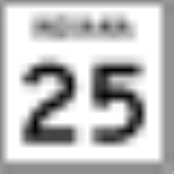
. Its southern terminus is at State Road 25
Indiana State Road 25
State Road 25 is a highway in the U. S. state of Indiana. Although it is designated a north–south road, in practice it travels generally northeast from its southern terminus at State Road 32 to its northern terminus at State Road 15 in Warsaw.- Waynetown to Lafayette :SR 25 heads north...
in Logansport
Logansport, Indiana
Logansport is a city in and the county seat of Cass County, Indiana, United States. The population was 18,396 at the 2010 census. Logansport is located in northern Indiana, at the junction of the Wabash and Eel rivers, northeast of Lafayette.-History:...
. Its northern terminus is at U.S. Route 30
U.S. Route 30
U.S. Route 30 is an east–west main route of the system of United States Numbered Highways, with the highway traveling across the northern tier of the country. It is the third longest U.S. route, after U.S. Route 20 and U.S. Route 6. The western end of the highway is at Astoria, Oregon; the...
in Plymouth
Plymouth, Indiana
-Demographics:As of the census of 2000, there were 9,840 people, 3,838 households, and 2,406 families residing in the city. The population density was 1,414.0 people per square mile . There were 4,100 housing units at an average density of 589.2 per square mile...
.
Route description
SR 17 southern terminus is in Logansport at eastbound SR 25 (East Market Street). One block north SR 17 meets the westbound SR 25 (East Broadway). After SR 25, SR 17 heads north-northwest out of Logansport. After Logansport SR 17 heads due north toward a T-intersection with State Road 114Indiana State Road 114
State Road 114 in the U.S. State of Indiana consists of three discontinuous east–west routes, between the Illinois border and U.S. Route 421, State Road 17 and State Road 25, and State Road 14 and U.S. Route 24.- Western section :...
. Where SR 17 turns west, with SR 114 heading east. After SR 114, SR 17 has five 90 degrees curves, thens SR 17 heads due north. SR 17 heads north until Kewanna
Kewanna, Indiana
Kewanna is a town in Union Township, Fulton County, Indiana, United States. The population was 613 at the 2010 census.-Geography:Kewanna is located at ....
. North of Kewanna SR 17 heads north toward Culver
Culver, Indiana
Culver is a town in Marshall County, Indiana, United States. Culver is part of Union Township that also includes the communities of Burr Oak, Hibbard, Maxinkuckee and Rutland. The population was 1,353 at the 2010 census...
. After Culver SR 17 heads north and then east toward Plymouth. SR 17 enters Plymouth on the southwest side of town and heads toward downtown. North of downtown Plymouth SR 17 heads north towards its northern terminus at US 30.
History
Between 1917 and 1926, SR 17 was a route from LigonierLigonier, Indiana
Ligonier is a city in Perry Township, Noble County, Indiana, United States. The population was 4,405 at the 2010 census.-Geography:Ligonier is located at ....
to the Ohio
Ohio
Ohio is a Midwestern state in the United States. The 34th largest state by area in the U.S.,it is the 7th‑most populous with over 11.5 million residents, containing several major American cities and seven metropolitan areas with populations of 500,000 or more.The state's capital is Columbus...
State Line, east of Butler
Butler, Indiana
Butler is a city in DeKalb County, Indiana, United States. The population was 2,684 at the 2010 census.-Geography:Butler is located at .According to the United States Census Bureau, the city has a total area of , all of it land.-Demographics:...
, this route is the same as U.S. Route 6
U.S. Route 6 in Indiana
U.S. Route 6 is a part of the United States Numbered Highway that runs from California to Provincetown, Massachusetts. In Indiana, it is a mostly rural, two-lane route that travels in the northern part of the state. However, some four-lane stretches may be found in Lake and Porter counties. For...
takes today. At this time the route that SR 17 takes today was unsigned.