

Hornsby Heights, New South Wales
Encyclopedia
Hornsby Heights is a suburb of northern Sydney
, in the state of New South Wales
, Australia
. Hornsby Heights is located 27 kilometres north-west of the Sydney central business district
, in the local government area of Hornsby Shire
and is part of the North Shore
region.
Hornsby Heights lies to the north of Hornsby
. The suburb's northern boundary and western boundary are defined by Berowra Creek
, as far south as Galston Road. South of Galston Road, the western boundary, falls generally west of Berowra Creek. Walls Gully forms the eastern boundary. The southern boundary of Hornsby Heights is north of the Hookhams Corner
locality. The following localities are in Hornsby Heights: Black Ash, Outlook, Galston Gorge
, Montview, Somerville, Rofe Park
.
-turned-Constable
Samuel Henry Horne, who took part in the apprehension of bushranger
s Dalton and MacNamara on June 22, 1830. In return he was granted land which he named Hornsby Place.
.
Parks within Hornsby Heights are Rofe Park and Montview Oval. Rofe Park is located on Galston Road and has a leash-free dog area. Crosslands Reserve, a camping and picnic
area is at the northern end of Hornsby Heights. Hornsby Heights also contains small parks such as Ulolo, off Galston Road. Many of these can be found around various quiet streets.
The Galston Gorge to Crosslands section of the Great North Walk
runs along the western boundary of Hornsby Heights.
. The bus runs in a loop from Hornsby railway station. The loop takes in Galston Road, Somerville Road and the area around Montview Oval (Montview Parade and McKay Road). On a weekday the buses run between the approximate hours of 6am and 9pm. A reduced service operates on weekends and public holidays.
Hornsby North Public School sits on the boundary between Hornsby and Hornsby Heights.
Hornsby Heights lies within the Ku-ring-gai Chase Catholic parish.
Hornsby Heights Baptist Church is at 110A Galston Road, next to the shopping centre.
1st Hornsby Heights Scout Group
St Lukes Railway Modellers Club
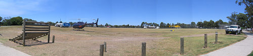
control centre for the Hornsby – Ku-ring-gai region is located at 143 Galston Road in Hornsby Heights.
Sydney
Sydney is the most populous city in Australia and the state capital of New South Wales. Sydney is located on Australia's south-east coast of the Tasman Sea. As of June 2010, the greater metropolitan area had an approximate population of 4.6 million people...
, in the state of New South Wales
New South Wales
New South Wales is a state of :Australia, located in the east of the country. It is bordered by Queensland, Victoria and South Australia to the north, south and west respectively. To the east, the state is bordered by the Tasman Sea, which forms part of the Pacific Ocean. New South Wales...
, Australia
Australia
Australia , officially the Commonwealth of Australia, is a country in the Southern Hemisphere comprising the mainland of the Australian continent, the island of Tasmania, and numerous smaller islands in the Indian and Pacific Oceans. It is the world's sixth-largest country by total area...
. Hornsby Heights is located 27 kilometres north-west of the Sydney central business district
Sydney central business district
The Sydney central business district is the main commercial centre of Sydney, New South Wales, Australia. It extends southwards for about 3 kilometres from Sydney Cove, the point of first European settlement. Its north–south axis runs from Circular Quay in the north to Central railway station in...
, in the local government area of Hornsby Shire
Hornsby Shire
Hornsby Shire is a Local Government Area in the Northern region of Sydney, Australia. The Shire stretches from the suburb of Eastwood in the south to the Hawkesbury River town of Wisemans Ferry, some to the north...
and is part of the North Shore
North Shore (Sydney)
The North Shore is an informal term used to describe the primarily residential area of northern metropolitan Sydney, in the state of New South Wales, Australia. The term usually refers to the suburbs located on the north shore of Sydney Harbour between Middle Harbour and the Lane Cove River, up to...
region.
Hornsby Heights lies to the north of Hornsby
Hornsby, New South Wales
* Highest Maximum Temperature: 42 °C* Lowest Maximum Temperature: 4.9 °C* Warmest Month: January* Coolest Month: July* Highest Precipitation: February* Lowest Precipitation: July-Notable residents:...
. The suburb's northern boundary and western boundary are defined by Berowra Creek
Berowra Creek
Berowra Creek is a tributary of the Hawkesbury River, situated to the north of the city of Sydney in the Australian state of New South Wales....
, as far south as Galston Road. South of Galston Road, the western boundary, falls generally west of Berowra Creek. Walls Gully forms the eastern boundary. The southern boundary of Hornsby Heights is north of the Hookhams Corner
Hookhams Corner, New South Wales
Hookham's Corner is the junction between the Pacific Highway, Carrington Rd, Galston Road and Old Berowra Road, Hornsby, .It is also the name of a Locality encompassing the area....
locality. The following localities are in Hornsby Heights: Black Ash, Outlook, Galston Gorge
Galston Gorge
Galston Gorge is part of the picturesque Berowra Valley Regional Park in Sydney, Australia and separates Galston from Hornsby Heights. It contains a narrow stretch of road with a one-way wooden bridge across Tunks Creek, a tributary of Berowra Creek. Here traffic must wait for cars already on the...
, Montview, Somerville, Rofe Park
Rofe Park
Rofe Park is a bushland reserve in New South Wales, Australia. It has a heritage listing of .This district park is located on Galston Road in Hornsby Heights...
.
History
The name Hornsby is derived from ConvictConvict
A convict is "a person found guilty of a crime and sentenced by a court" or "a person serving a sentence in prison", sometimes referred to in slang as simply a "con". Convicts are often called prisoners or inmates. Persons convicted and sentenced to non-custodial sentences often are not termed...
-turned-Constable
Constable
A constable is a person holding a particular office, most commonly in law enforcement. The office of constable can vary significantly in different jurisdictions.-Etymology:...
Samuel Henry Horne, who took part in the apprehension of bushranger
Bushranger
Bushrangers, or bush rangers, originally referred to runaway convicts in the early years of the British settlement of Australia who had the survival skills necessary to use the Australian bush as a refuge to hide from the authorities...
s Dalton and MacNamara on June 22, 1830. In return he was granted land which he named Hornsby Place.
Parks
Hornsby Heights is dominated by parks. The suburb is encircled by the Berowra Valley Regional ParkBerowra Valley Regional Park
The Berowra Valley Regional Park is in the Hornsby Shire in Sydney, Australia. Notable features include the Thornleigh Zig Zag Railway, an historic quarry and a bridge spanning Tunks Creek at Galston Gorge...
.
Parks within Hornsby Heights are Rofe Park and Montview Oval. Rofe Park is located on Galston Road and has a leash-free dog area. Crosslands Reserve, a camping and picnic
area is at the northern end of Hornsby Heights. Hornsby Heights also contains small parks such as Ulolo, off Galston Road. Many of these can be found around various quiet streets.
The Galston Gorge to Crosslands section of the Great North Walk
Great North Walk
The Great North Walk is a walking track which runs from Sydney to Newcastle in New South Wales, Australia. The main track, in length, runs between the Obelisk in Macquarie Place in Sydney to Queens Wharf Tower in Bicentennial Park in Newcastle and is well sign-posted. There are many "side tracks"...
runs along the western boundary of Hornsby Heights.
Buses
Hornsby Heights is serviced by bus route number 596, operated by ShorelinkShorelink
Shorelink is a commuter bus company serving suburbs on the upper North Shore of Sydney, Australia. On 3 September 2001, the company was acquired by French public transport giant Transdev from the John A Gilbert group, forming a partnership with Transfield Services Limited in 2009...
. The bus runs in a loop from Hornsby railway station. The loop takes in Galston Road, Somerville Road and the area around Montview Oval (Montview Parade and McKay Road). On a weekday the buses run between the approximate hours of 6am and 9pm. A reduced service operates on weekends and public holidays.
Cycling
A cycling track along the length of Galston Road, starting at Hookhams Corner and ending at the Gorge, is mandatory for cyclists over 13 years old who are not travelling with an adult.Schools
Schools in Hornsby Heights include Hornsby Heights Public School and Hornsby North Public School.Hornsby North Public School sits on the boundary between Hornsby and Hornsby Heights.
Churches
Saint Lukes Anglican Church is located at 155 Galston Road.Hornsby Heights lies within the Ku-ring-gai Chase Catholic parish.
Hornsby Heights Baptist Church is at 110A Galston Road, next to the shopping centre.
Clubs
Hornsby Heights Sports Club1st Hornsby Heights Scout Group
St Lukes Railway Modellers Club
Community groups
The NSW Rural Fire Service'sNew South Wales Rural Fire Service
The New South Wales Rural Fire Service is a volunteer-based firefighting agency and statutory body of the NSW Government. The NSW RFS is responsible for the general administration of rural fire management affairs including administration of the Rural Fire Fighting Fund, co-ordination with local...
control centre for the Hornsby – Ku-ring-gai region is located at 143 Galston Road in Hornsby Heights.