
.gif)
Highway 638 (Ontario)
Encyclopedia
Ontario
Ontario is a province of Canada, located in east-central Canada. It is Canada's most populous province and second largest in total area. It is home to the nation's most populous city, Toronto, and the nation's capital, Ottawa....
. The highway measures 52.1 kilometres (32.4 mi) in length, extending from Echo Bay eastward through the communities of Sylvan Valley, Leeburn and Ophir, where it turns southward and runs south through Rydal Bank
Plummer Additional, Ontario
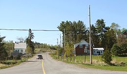
Population trend:* Population in 2006: 625* Population in 2001: 671* Population in 1996: 693* Population in 1991: 596-Transportation:The township is served by Ontario Highway 17 which traverses the south in an east-west orientation, and Ontario Highway 638, which travels the middle of the township...
, Bruce Station, and finally to its southeastern terminus, also at Highway 17, in the town of Bruce Mines
Bruce Mines, Ontario
Bruce Mines is a town in the Canadian province of Ontario, located on the north shore of Lake Huron in the Algoma District along Highway 17. The town of Bruce Mines has a population of 584 residents. The current mayor of Bruce Mines is Gordon Post.- History :...
.
Highway 17B
From 2007 to 2009, the highway extended for an additional 15.6 kilometres westerly from Echo Bay, to another junction with Highway 17 in Sault Ste. MarieSault Ste. Marie, Ontario
Sault Ste. Marie is a city on the St. Marys River in Algoma District, Ontario, Canada. It is the third largest city in Northern Ontario, after Sudbury and Thunder Bay, with a population of 74,948. The community was founded as a French religious mission: Sault either means "jump" or "rapids" in...
. The extended route from Echo Bay to Sault Ste. Marie was formerly an alignment of Highway 17, the route of the Trans-Canada Highway
Trans-Canada Highway
The Trans-Canada Highway is a federal-provincial highway system that joins the ten provinces of Canada. It is, along with the Trans-Siberian Highway and Australia's Highway 1, one of the world's longest national highways, with the main route spanning 8,030 km...
through the region, and was redesignated as part of Highway 638 when Highway 17 was rerouted along a four-lane expressway
Limited-access road
A limited-access road known by various terms worldwide, including limited-access highway, dual-carriageway and expressway, is a highway or arterial road for high-speed traffic which has many or most characteristics of a controlled-access highway , including limited or no access to adjacent...
alignment which opened on October 31, 2007.
However, the Garden River First Nation
Garden River First Nation
Garden River First Nation, also known as Ketegaunseebee , is an Ojibwa band located at Garden River 14 near Sault Ste. Marie....
, citing a 1909 agreement with the province whereby ownership of the highway reverts to the band after realignment, refused to accept the highway being badged as anything other than Highway 17B
Highway 17B (Ontario)
Highway 17B was formerly the highway designation for five business routes of Highway 17, the main route of the Trans-Canada Highway through the Canadian province of Ontario...
. The provincial Ministry of Transportation, has decommissioned most B-suffixed highways in Ontario, but the band posted unofficial "Highway 17B" signs at the eastern and western limits of the reserve.
The municipal councils of Sault Ste. Marie
Sault Ste. Marie, Ontario
Sault Ste. Marie is a city on the St. Marys River in Algoma District, Ontario, Canada. It is the third largest city in Northern Ontario, after Sudbury and Thunder Bay, with a population of 74,948. The community was founded as a French religious mission: Sault either means "jump" or "rapids" in...
and Macdonald, Meredith and Aberdeen Additional
Macdonald, Meredith and Aberdeen Additional, Ontario
Population trend:* Population in 2006: 1550* Population in 2001: 1452* Population in 1996: 1521* Population in 1991: 1548-External links:*...
, which border Garden River on either side and are also located on the route of the disputed roadway, both passed municipal resolutions in 2007 supporting Garden River's position and calling on the province to designate the road as Highway 17B.
As of February 2009, the segment is officially designated as 17B, and the route of Highway 638 once again ends at its original pre-2007 terminus in Echo Bay. However, exit signs along the Highway 17 bypass route do not identify the road with a 17B shield, but only as Bar River Road.
Future
The safety of the current at-grade intersection at Highway 17 has been called into question by local residents. In February 2011, the Ministry of Transportation announced that this crossing will be upgraded to a full interchangeInterchange (road)
In the field of road transport, an interchange is a road junction that typically uses grade separation, and one or more ramps, to permit traffic on at least one highway to pass through the junction without directly crossing any other traffic stream. It differs from a standard intersection, at which...
.