
.gif)
Highway 28 (Ontario)
Encyclopedia
King's Highway 28, commonly referred to as Highway 28, is a provincially maintained highway in the Canadian
province of Ontario
. The route travels in a southwest–northeast from Highway 7
east of Peterborough
, to Highway 41 in Denbigh.
have since flattened the route for easier travel. Passing east of Lakefield, the straight path of the route is interrupted by the Otonabee River
; it curves northeast and intersects Peterborough County Road 29 (Queen Street) and Road 6 while travelling south of the river. At Young's Point
, the southern tip of Stony Lake
, the highway crosses the river and serves cottage
s along the western shore of the lake. Approximately 1 kilometre (0.621372736649807 mi) south of Burleigh Falls, the route descends a hill and enters the Canadian Shield
; south of this point, the terrain is underlain by limestone
and covered by deciduous forests, whereas north of it the terrain is dominated by exposed granite bedrock
and coniferous forests.
 Within Burleigh Falls, Highway 28 encounters the eastern terminus of the former Highway 36
. From there it continues northeast through the rugged shield to Highway 118, at which point it has curved fully to the east. The highway passes through Bancroft
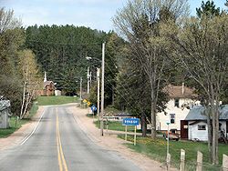
, where it encounters Highway 62. East of Bancroft, there is relatively little human inhabitation, with the exception of a select group of communities located on or nearby the highway. At the community of Denbigh, Highway 28 ends at a junction with Highway 41.
(Walton Street) in Port Hope
to Highway 7 (George Street North) in downtown Peterborough.
The route received the 12A numbering during the summer of 1925.
 During the mid-1930s, Highway 28 was extended as far north as Apsley. This was accomplished by assuming existing Peterborough County roads along the Otonabee River as far as Burleigh Falls, via Lakefield. North of there, the department assumed the Burleigh Falls Road. Highway 28 was extended from Peterborough to Burleigh Falls on April 4, 1934.
The Burleigh Falls Road was assumed to Apsley on August 11, 1937.
During the 1936 fiscal year, preparations were made for the upcoming merger of the Department of Northern Development and Department of Highway, which occurred on April 1, 1937. The town of Bancroft was chosen as the location of the first operations centre for the new Central District of the department. Consequently, it was decided to extend Highway 28 to the town along the remainder of the Burleigh Falls Road.
In early 1956, Highway 500 was established between Kinmount and Hermon following the Monck Road.
In 1963, a new road was constructed between McArthur Mills and Denbigh through the Madawaska Highlands, and opened as an extension of Highway 500 on July 1.
During the early 1980s, Highway 500 was renumbered as an extension of Highway 28. This took place between 1980 and 1982.
During the 1997 and 1998 mass downloading of highways, the southern 63 kilometres (39.1 mi) of Highway 28 were transferred to the counties of Peterborough and Northumberland
, the town of Port Hope and Lakefield and the city of Peterborough. The section from Highway 115 north to Lakefield was decommissioned on April 1, 1997.
On January 1, 1998, the southernmost section, between Highway 2 and Highway 115, was transferred.
In 2003, the entirety of Highway 134 was redesignated as part of Highway 28, extending the southern terminus to Highway 7 east of Peterborough.
Canada
Canada is a North American country consisting of ten provinces and three territories. Located in the northern part of the continent, it extends from the Atlantic Ocean in the east to the Pacific Ocean in the west, and northward into the Arctic Ocean...
province of Ontario
Ontario
Ontario is a province of Canada, located in east-central Canada. It is Canada's most populous province and second largest in total area. It is home to the nation's most populous city, Toronto, and the nation's capital, Ottawa....
. The route travels in a southwest–northeast from Highway 7
Ontario Highway 7
King's Highway 7, commonly referred to as Highway 7 and historically as the Northern Highway, is a provincially maintained highway in the Canadian province of Ontario...
east of Peterborough
Peterborough, Ontario
Peterborough is a city on the Otonabee River in southern Ontario, Canada, 125 kilometres northeast of Toronto. The population of the City of Peterborough was 74,898 as of the 2006 census, while the census metropolitan area has a population of 121,428 as of a 2009 estimate. It presently ranks...
, to Highway 41 in Denbigh.
Route description
Highway 28 begins at an intersection with Highway 7 approximately 7 kilometres (4.3 mi) east of Peterborough. The road that carries Highway 28 continues south as Peterborough County Road 34 (Heritage Line). Proceeding north, Highway 28 crosses the Peterborough Drumlin Field, an area dominated by undulating terrain oriented in a southwest–northeast direction. Despite this, the highway progresses due north without regard for the terrain; numerous cuts and fillsCut and fill
In earthmoving, cut and fill is the process of constructing a railway, road or canal whereby the amount of material from cuts roughly matches the amount of fill needed to make nearby embankments, so minimizing the amount of construction labor...
have since flattened the route for easier travel. Passing east of Lakefield, the straight path of the route is interrupted by the Otonabee River
Otonabee River
The Otonabee River is a river that runs from Katchewanooka Lake near Lakefield, into the east side of Peterborough, Ontario , through Little Lake and down 30 km into the northwestern side of Rice Lake...
; it curves northeast and intersects Peterborough County Road 29 (Queen Street) and Road 6 while travelling south of the river. At Young's Point
Young's Point, Ontario
Young's Point is a small village in Ontario, Canada, established in 1825. It is about 25 km north of Peterborough.Young's Point gets its name from the founders of the village. The Young family settled the area and build the dam and a grist mill here...
, the southern tip of Stony Lake
Stony Lake (Ontario)
Stoney Lake is a lake in Ontario, Canada. There are three interconnected lakes . Stoney Lake forms the eastern end of the Kawartha lakes region...
, the highway crosses the river and serves cottage
Cottage
__toc__In modern usage, a cottage is usually a modest, often cozy dwelling, typically in a rural or semi-rural location. However there are cottage-style dwellings in cities, and in places such as Canada the term exists with no connotations of size at all...
s along the western shore of the lake. Approximately 1 kilometre (0.621372736649807 mi) south of Burleigh Falls, the route descends a hill and enters the Canadian Shield
Canadian Shield
The Canadian Shield, also called the Laurentian Plateau, or Bouclier Canadien , is a vast geological shield covered by a thin layer of soil that forms the nucleus of the North American or Laurentia craton. It is an area mostly composed of igneous rock which relates to its long volcanic history...
; south of this point, the terrain is underlain by limestone
Limestone
Limestone is a sedimentary rock composed largely of the minerals calcite and aragonite, which are different crystal forms of calcium carbonate . Many limestones are composed from skeletal fragments of marine organisms such as coral or foraminifera....
and covered by deciduous forests, whereas north of it the terrain is dominated by exposed granite bedrock
Bedrock
In stratigraphy, bedrock is the native consolidated rock underlying the surface of a terrestrial planet, usually the Earth. Above the bedrock is usually an area of broken and weathered unconsolidated rock in the basal subsoil...
and coniferous forests.
Ontario Highway 36
King's Highway 36, commonly referred to as Highway 36, was a provincially maintained highway in the Canadian province of Ontario. The highway connected Highway 7 and Highway 35 in Lindsay with Highway 28 in Burleigh Falls, providing access to recreational cottages along the northern shore...
. From there it continues northeast through the rugged shield to Highway 118, at which point it has curved fully to the east. The highway passes through Bancroft
Bancroft, Ontario
Bancroft is a town located on the York River in Hastings County in the Canadian province of Ontario.- History :In 1853 the first pioneer family settled in the area, and over the next 15 years the settlement grew quickly, as another 88 families followed...
, where it encounters Highway 62. East of Bancroft, there is relatively little human inhabitation, with the exception of a select group of communities located on or nearby the highway. At the community of Denbigh, Highway 28 ends at a junction with Highway 41.
History
Highway 28 was assigned in 1928, when the entirety of Highway 12A was renumbered. Highway 12A was one of the original provincial highways assumed in 1919 and 1920. The Port Hope – Peterborough Road was assumed by the Department of Highways on August 11, 1920, extending from Highway 2Ontario Highway 2
King's Highway 2, usually referred to simply as Highway 2 is a provincially maintained highway in Ontario. Once the primary east–west route across the southern end of the province, Highway 2 became mostly redundant in the 1960s following the completion of Highway 401, which more or less...
(Walton Street) in Port Hope
Port Hope, Ontario
Port Hope is a municipality in Southern Ontario, Canada, about east of Toronto and about west of Kingston. It is located at the mouth of the Ganaraska River on the north shore of Lake Ontario, in the west end of Northumberland County...
to Highway 7 (George Street North) in downtown Peterborough.
The route received the 12A numbering during the summer of 1925.
The Burleigh Falls Road was assumed to Apsley on August 11, 1937.
During the 1936 fiscal year, preparations were made for the upcoming merger of the Department of Northern Development and Department of Highway, which occurred on April 1, 1937. The town of Bancroft was chosen as the location of the first operations centre for the new Central District of the department. Consequently, it was decided to extend Highway 28 to the town along the remainder of the Burleigh Falls Road.
In early 1956, Highway 500 was established between Kinmount and Hermon following the Monck Road.
In 1963, a new road was constructed between McArthur Mills and Denbigh through the Madawaska Highlands, and opened as an extension of Highway 500 on July 1.
During the early 1980s, Highway 500 was renumbered as an extension of Highway 28. This took place between 1980 and 1982.
During the 1997 and 1998 mass downloading of highways, the southern 63 kilometres (39.1 mi) of Highway 28 were transferred to the counties of Peterborough and Northumberland
Northumberland County, Ontario
Northumberland County is situated on the north shore of Lake Ontario, in central Ontario, Canada. It is located east of Durham County , west of Hastings, southeast of Kawartha Lakes and south of Peterborough County. The county seat is Cobourg...
, the town of Port Hope and Lakefield and the city of Peterborough. The section from Highway 115 north to Lakefield was decommissioned on April 1, 1997.
On January 1, 1998, the southernmost section, between Highway 2 and Highway 115, was transferred.
In 2003, the entirety of Highway 134 was redesignated as part of Highway 28, extending the southern terminus to Highway 7 east of Peterborough.