
.gif)
Highway 156 (Wisconsin)
Encyclopedia
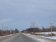
State Trunk Highway 156 (often called Highway 156, STH 156 or WIS 156) is a 26.72 miles (43 km) state highway in the U.S. state
of Wisconsin
. The highway runs east–west through northeast Wisconsin, passing through Waupaca
and Shawano
counties. Highway 156 runs from Wisconsin Highway 22 in Clintonville
east to Wisconsin Highway 29 at the Brown County line northwest of Green Bay
. The highway is maintained by the Wisconsin Department of Transportation
.
 Highway 156 begins at an intersection with Highway 22 in Clintonville. The route leaves Clintonville and runs through eastern Waupaca County before crossing into Shawano County. Highway 156 meets Highway 187 in southwest Shawano County. The highway runs through southern Shawano County and passes through the community of Navarino
before meeting Highway 47 near Briarton
. Highway 156 continues eastward through Briarton and meets Highway 55 in Rose Lawn
before terminating at Highway 29 at the Brown County line.
in Clintonville to Nichols
via Leeman
. In 1954, the western terminus of the highway was moved north to its present location, and the highway ran westward until becoming concurrent
with Highway 187 at their present junction. In the mid-1980s, Highway 156 was realigned to its current route; the former route remained Highway 187 on the concurrency and became Highway 168 from Leeman to Nichols.
U.S. state
A U.S. state is any one of the 50 federated states of the United States of America that share sovereignty with the federal government. Because of this shared sovereignty, an American is a citizen both of the federal entity and of his or her state of domicile. Four states use the official title of...
of Wisconsin
Wisconsin
Wisconsin is a U.S. state located in the north-central United States and is part of the Midwest. It is bordered by Minnesota to the west, Iowa to the southwest, Illinois to the south, Lake Michigan to the east, Michigan to the northeast, and Lake Superior to the north. Wisconsin's capital is...
. The highway runs east–west through northeast Wisconsin, passing through Waupaca
Waupaca County, Wisconsin
-Demographics: As of the census of 2000, there were 51,731 people, 19,863 households, and 13,884 families residing in the county. The population density was . There were 22,508 housing units at an average density of...
and Shawano
Shawano County, Wisconsin
Shawano County is a county located in the U.S. state of Wisconsin. As of 2000, the population was 40,664. Its county seat is Shawano.-History:...
counties. Highway 156 runs from Wisconsin Highway 22 in Clintonville
Clintonville, Wisconsin
Clintonville is a city in Waupaca County, Wisconsin, United States. The population was 4,736 at the 2000 census.- Geography :Clintonville is located at 44°37'27" North, 88°45'29" West ....
east to Wisconsin Highway 29 at the Brown County line northwest of Green Bay
Green Bay, Wisconsin
Green Bay is a city in and the county seat of Brown County in the U.S. state of Wisconsin, located at the head of Green Bay, a sub-basin of Lake Michigan, at the mouth of the Fox River. It has an elevation of above sea level and is located north of Milwaukee. As of the 2010 United States Census,...
. The highway is maintained by the Wisconsin Department of Transportation
Wisconsin Department of Transportation
The Wisconsin Department of Transportation, abbreviated as WisDOT, is a governmental agency of the U.S. state of Wisconsin responsible for planning, building and maintaining the state's highways...
.
Route description
Navarino (community), Wisconsin
Navarino is an unincorporated census-designated place located in the town of Navarino, Shawano County, Wisconsin, United States. Navarino is located on Wisconsin Highway 156 north-northwest of Nichols. As of the 2010 census, its population is 177....
before meeting Highway 47 near Briarton
Briarton, Wisconsin
Briarton is an unincorporated community in Shawano County, Wisconsin, United States, in the Town of Lessor, west of Green Bay. It appears on the Nichols U.S. Geological Survey map. Briarton is a small community that began as a Belgian settlement. Today, there is little economic activity in the...
. Highway 156 continues eastward through Briarton and meets Highway 55 in Rose Lawn
Rose Lawn, Wisconsin
Rose Lawn is an unincorporated community located in the town of Maple Grove, Shawano County, Wisconsin, United States. Rose Lawn is located at the intersection of Wisconsin Highway 55 and Wisconsin Highway 156 north of Seymour....
before terminating at Highway 29 at the Brown County line.
History
The original route of Highway 156 ran from the intersection of Wisconsin Highway 22 and U.S. Route 45U.S. Route 45
U.S. Route 45 is a north–south United States highway. US 45 is a border-to-border route, from Lake Superior to the Gulf of Mexico. A sign at the highway's northern terminus notes the total distance as ....
in Clintonville to Nichols
Nichols, Wisconsin
Nichols is a village in Outagamie County, Wisconsin, United States. The population was 273 at the 2010 census.-Geography:Nichols is located at ....
via Leeman
Leeman, Wisconsin
Leeman is a small unincorporated community located in the Town of Maine in northwestern Outagamie County, Wisconsin, United States. It is two miles west of Nichols and one mile south of Shawano County. The Wolf River runs through the community...
. In 1954, the western terminus of the highway was moved north to its present location, and the highway ran westward until becoming concurrent
Concurrency (road)
A concurrency, overlap, or coincidence in a road network is an instance of one physical road bearing two or more different highway, motorway, or other route numbers...
with Highway 187 at their present junction. In the mid-1980s, Highway 156 was realigned to its current route; the former route remained Highway 187 on the concurrency and became Highway 168 from Leeman to Nichols.