
Harrison Township, Clay County, Indiana
Encyclopedia
Harrison Township is one of eleven townships
in Clay County, Indiana
. As of the 2000 census
, its population was 2,366.
(This list is based on USGS data and may include former settlements.)
Township (United States)
A township in the United States is a small geographic area. Townships range in size from 6 to 54 square miles , with being the norm.The term is used in three ways....
in Clay County, Indiana
Clay County, Indiana
Clay County is a county located in the U.S. state of Indiana. As of 2010, the population was 26,890. The county seat is Brazil. Clay County is included in the Terre Haute, Indiana, Metropolitan Statistical Area.- History :Clay County was formed in 1825...
. As of the 2000 census
United States Census, 2000
The Twenty-second United States Census, known as Census 2000 and conducted by the Census Bureau, determined the resident population of the United States on April 1, 2000, to be 281,421,906, an increase of 13.2% over the 248,709,873 persons enumerated during the 1990 Census...
, its population was 2,366.
Geography
Harrison Township covers an area of 62.7 square miles (162.4 km²); 0.44 square miles (1.1 km²) (0.7 percent) of this is water.Unincorporated towns
- Barrick CornerBarrick Corner, IndianaBarrick Corner is an unincorporated community in Harrison Township, Clay County, Indiana. It is part of the Terre Haute Metropolitan Statistical Area....
- Eel River
- New BrunswickNew Brunswick, IndianaNew Brunswick is an unincorporated town in Harrison Township, Boone County, Indiana....
- Old HillOld Hill, IndianaOld Hill is an unincorporated community in northern Lewis Township, Clay County, Indiana. It is right near the intersection of Lewis Township with Harrison and Perry Townships. Old Hill is part of the Terre Haute Metropolitan Statistical Area....
(This list is based on USGS data and may include former settlements.)
Adjacent townships
- Sugar Ridge TownshipSugar Ridge Township, Clay County, IndianaSugar Ridge Township is one of eleven townships in Clay County, Indiana. As of the 2000 census, its population was 999.-Geography:Sugar Ridge Township covers an area of ; of this is water...
(north) - Washington TownshipWashington Township, Clay County, IndianaWashington Township is one of eleven townships in Clay County, Indiana. As of the 2000 census, its population was 802.-Unincorporated towns:* Bowling Green* Hoffman Crossing* Six Points...
(northeast) - Marion Township, Owen CountyMarion Township, Owen County, IndianaMarion Township is one of thirteen townships in Owen County, Indiana, USA. As of the 2000 census, its population was 1,004.-Geography:According to the United States Census Bureau, Marion Township covers an area of ; of this, is land and is water.-Unincorporated towns:* Denmark at * Hickory...
(east) - Jefferson Township, Owen CountyJefferson Township, Owen County, IndianaJefferson Township is one of thirteen townships in Owen County, Indiana, USA. As of the 2000 census, its population was 1,078.-Geography:According to the United States Census Bureau, Jefferson Township covers an area of ; of this, is land and is water.-Unincorporated towns:* Arney at * Coal...
(southeast) - Smith Township, Greene CountySmith Township, Greene County, IndianaSmith Township is one of fifteen townships in Greene County, Indiana, USA. As of the 2000 census, its population was 344.-Geography:Smith Township covers an area of ; of this, or 0.12 percent is water...
(south) - Lewis TownshipLewis Township, Clay County, IndianaLewis Township is one of eleven townships in Clay County, Indiana. As of the 2000 census, its population was 1,510.-Geography:Lewis Township covers an area of ; of this is water...
(southwest) - Perry TownshipPerry Township, Clay County, IndianaPerry Township is one of eleven townships in Clay County, Indiana. As of the 2000 census, its population was 960.-Geography:Perry Township covers an area of ; of this is water.-Unincorporated towns:* Art* Cory* Hickory Island...
(northwest)
Major highways
-
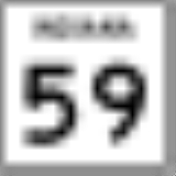
 Indiana State Road 59Indiana State Road 59State Road 59 is a north–south road in Central Indiana that covers a distance of about through five counties.-Route description:State Road 59 begins at State Road 58 and heads north towards Sandborn. In Sandborn SR 59 has intersection with State Road 67...
 -
 Indiana State Road 157Indiana State Road 157State Road 157 in the U.S. State of Indiana is a north–south route in Clay, Greene and Owen counties that covers a distance of about .-Route description:...
 -
 Indiana State Road 246Indiana State Road 246State Road 246 is an east–west road in the southwest portion of the U.S. state of Indiana.-Route description:State Road 246 begins in the small town of Prairie Creek at State Road 63. Going east, it crosses U.S. Route 41 just north of Farmersburg...