
Harlow, North Dakota
Encyclopedia
Harlow is an unincorporated community in Benson County
, North Dakota
, United States
. It is located in Butte Valley Township
along North Dakota Highway 30
. Harlow is assigned Zip code
58346, which it shares with neighboring Leeds
.
. The post office was established in 1914 and was later assigned the zipcode 58340. The post office closed in 1984. The town's population was estimated as high as 100 during its development, but it never incorporated as a city. Alternative suggestions for the origin of the town's name are either after an official with the railroad or after the Harlow House in Plymouth, Massachusetts
.
The original homesteader was Louis Larsen Ulvestead in 1896. Local resident Ole Ronning (1905-2005), lived on the homestead until moving to Devils Lake
in 2000. Ole and his wife, Alma, were known for publishing a comprehensive history of Harlow and the surrounding township in the 1960s.
between the cities of York
and Maddock
.
. As an unincorporated community, the United States Census Bureau
does not track total population numbers for Harlow. However, according to census block
data, Harlow includes blocks 1275, 1276, and 1282 through 1287 within census tract
9565, block group 1. These blocks had a combined population of 21 during the 2000 Census
.
Benson County, North Dakota
-Major highways:* U.S. Highway 2* U.S. Highway 281* North Dakota Highway 19* North Dakota Highway 20* North Dakota Highway 57-National protected areas:*Pleasant Lake National Wildlife Refuge*Silver Lake National Wildlife Refuge...
, North Dakota
North Dakota
North Dakota is a state located in the Midwestern region of the United States of America, along the Canadian border. The state is bordered by Canada to the north, Minnesota to the east, South Dakota to the south and Montana to the west. North Dakota is the 19th-largest state by area in the U.S....
, United States
United States
The United States of America is a federal constitutional republic comprising fifty states and a federal district...
. It is located in Butte Valley Township
Butte Valley Township, Benson County, North Dakota
Butte Valley Township is a civil township in Benson County, North Dakota, USA. As of the 2000 census, its population was 87.-References:...
along North Dakota Highway 30
North Dakota Highway 30
-External links:* by Chris Geelhart...
. Harlow is assigned Zip code
ZIP Code
ZIP codes are a system of postal codes used by the United States Postal Service since 1963. The term ZIP, an acronym for Zone Improvement Plan, is properly written in capital letters and was chosen to suggest that the mail travels more efficiently, and therefore more quickly, when senders use the...
58346, which it shares with neighboring Leeds
Leeds, North Dakota
As of the census of 2000, there were 464 people, 212 households, and 129 families residing in the city. The population density was 1,018.8 people per square mile . There were 282 housing units at an average density of 619.2 per square mile...
.
History
Harlow was established in 1912 along the Soo Line RailroadSoo Line Railroad
The Soo Line Railroad is the primary United States railroad subsidiary of the Canadian Pacific Railway , controlled through the Soo Line Corporation, and one of seven U.S. Class I railroads. Although it is named for the Minneapolis, St. Paul and Sault Ste...
. The post office was established in 1914 and was later assigned the zipcode 58340. The post office closed in 1984. The town's population was estimated as high as 100 during its development, but it never incorporated as a city. Alternative suggestions for the origin of the town's name are either after an official with the railroad or after the Harlow House in Plymouth, Massachusetts
Massachusetts
The Commonwealth of Massachusetts is a state in the New England region of the northeastern United States of America. It is bordered by Rhode Island and Connecticut to the south, New York to the west, and Vermont and New Hampshire to the north; at its east lies the Atlantic Ocean. As of the 2010...
.
The original homesteader was Louis Larsen Ulvestead in 1896. Local resident Ole Ronning (1905-2005), lived on the homestead until moving to Devils Lake
Devils Lake, North Dakota
As of the 2000 Census, there were 7,222 people, 3,127 households, and 1,773 families residing in the city. The population density was . There were 3,508 housing units at an average density of . The racial makeup of the city was 89.23% White, 0.22% African American, 7.84% Native American, 0.28%...
in 2000. Ole and his wife, Alma, were known for publishing a comprehensive history of Harlow and the surrounding township in the 1960s.
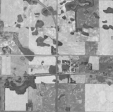
Geography
Harlow is located at 48°9′49"N 99°31′8"W (48.1636145, -99.5190232). The community lies along North Dakota Highway 30North Dakota Highway 30
-External links:* by Chris Geelhart...
between the cities of York
York, North Dakota
As of the census of 2000, there were 26 people, 11 households, and 7 families residing in the city. The population density was 114.1 people per square mile . There were 32 housing units at an average density of 140.4 per square mile...
and Maddock
Maddock, North Dakota
As of the census of 2000, there were 498 people, 238 households, and 127 families residing in the city. The population density was 564.7 people per square mile . There were 276 housing units at an average density of 313.0 per square mile . The racial makeup of the city was 99.60% White, 0.20%...
.
Demographics
Butte Valley Township, in which Harlow is located, showed a population of 87 as of the 2000 CensusUnited States Census, 2000
The Twenty-second United States Census, known as Census 2000 and conducted by the Census Bureau, determined the resident population of the United States on April 1, 2000, to be 281,421,906, an increase of 13.2% over the 248,709,873 persons enumerated during the 1990 Census...
. As an unincorporated community, the United States Census Bureau
United States Census Bureau
The United States Census Bureau is the government agency that is responsible for the United States Census. It also gathers other national demographic and economic data...
does not track total population numbers for Harlow. However, according to census block
Census block
A census block is the smallest geographic unit used by the United States Census Bureau for tabulation of 100-percent data . Several blocks make up block groups, which again make up census tracts. There are on average about 39 blocks per block group, but there are variations...
data, Harlow includes blocks 1275, 1276, and 1282 through 1287 within census tract
Census tract
A census tract, census area, or census district is a geographic region defined for the purpose of taking a census. Usually these coincide with the limits of cities, towns or other administrative areas and several tracts commonly exist within a county...
9565, block group 1. These blocks had a combined population of 21 during the 2000 Census
United States Census, 2000
The Twenty-second United States Census, known as Census 2000 and conducted by the Census Bureau, determined the resident population of the United States on April 1, 2000, to be 281,421,906, an increase of 13.2% over the 248,709,873 persons enumerated during the 1990 Census...
.
Notable natives
- Byron KnutsonByron KnutsonByron Knutson is a North Dakota Democratic-NPL Party politician who served as the North Dakota Insurance Commissioner from 1977 to 1980 and as the North Dakota Labor Commissioner from 1987 to 1990...
, member of the North Dakota House of RepresentativesNorth Dakota House of RepresentativesThe North Dakota House of Representatives is the lower house of the North Dakota Legislative Assembly and is larger than the North Dakota Senate....
(1959-1962); North Dakota Insurance CommissionerNorth Dakota Insurance CommissionerThe North Dakota Insurance Commissioner regulates the insurance industry in North Dakota, licenses insurance professionals in the state, educates consumers about different types of insurance, and handles consumer complaints...
(1977-1980); North Dakota Labor CommissionerNorth Dakota Labor CommissionerIn the U.S. state of North Dakota, the Commissioner of Labor, commonly referred to as Labor Commissioner, is an appointed official who heads the North Dakota Department of Labor...
(1987-1990)