

Géoportail
Encyclopedia
Web mapping
Web mapping is the process of designing, implementing, generating and delivering maps on the World Wide Web and its product. While web mapping primarily deals with technological issues, web cartography additionally studies theoretic aspects: the use of web maps, the evaluation and optimization of...
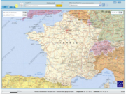
service of the French government whose aim is to publicise geographical data about the whole French territory. This service, developed by two public agencies (the IGN and the BRGM), was officially inaugurated on June 23, 2006 by president Jacques Chirac
Jacques Chirac
Jacques René Chirac is a French politician who served as President of France from 1995 to 2007. He previously served as Prime Minister of France from 1974 to 1976 and from 1986 to 1988 , and as Mayor of Paris from 1977 to 1995.After completing his studies of the DEA's degree at the...
. The newly launched website, which only offered 2D maps, was largely reported because it went quickly down after undergoing large underestimated traffic.
Though the French service has sometimes been described as a competitor or rival to Google Maps
Google Maps
Google Maps is a web mapping service application and technology provided by Google, free , that powers many map-based services, including the Google Maps website, Google Ride Finder, Google Transit, and maps embedded on third-party websites via the Google Maps API...
’s, it is different from Google
Google
Google Inc. is an American multinational public corporation invested in Internet search, cloud computing, and advertising technologies. Google hosts and develops a number of Internet-based services and products, and generates profit primarily from advertising through its AdWords program...
's mapping service (launched one year before in February 2005), since they are designed in a different fashion, have different objectives (Geoportail is only available in French language
French language
French is a Romance language spoken as a first language in France, the Romandy region in Switzerland, Wallonia and Brussels in Belgium, Monaco, the regions of Quebec and Acadia in Canada, and by various communities elsewhere. Second-language speakers of French are distributed throughout many parts...
) and offer different geographical data. While Geoportail covers the whole French territory in the same resolution, Google Maps cover the whole world with higher resolution on places of interest. As a consequence, apart from the main towns, the maps of France proposed by Geoportail are higher quality than those offered by Google.
Since its inception in June 2006, the French service has progressively improved (better resolution, new data like cadastre
Cadastre
A cadastre , using a cadastral survey or cadastral map, is a comprehensive register of the metes-and-bounds real property of a country...
s for certain departments) and undergone two significant updates: a new version in May 2007 and a 3D version in August 2007. This last version is actually provided through a client software named TerraExplorer, a virtual globe
Virtual globe
A virtual globe is a 3D software model or representation of the Earth or another world. A virtual globe provides the user with the ability to freely move around in the virtual environment by changing the viewing angle and position. Compared to a conventional globe, virtual globes have the...
developed by SkylineGlobe. As of February 2008, this software is only available for Microsoft Windows
Microsoft Windows
Microsoft Windows is a series of operating systems produced by Microsoft.Microsoft introduced an operating environment named Windows on November 20, 1985 as an add-on to MS-DOS in response to the growing interest in graphical user interfaces . Microsoft Windows came to dominate the world's personal...
but is expected to be released in early 2008 for Mac OS
Mac OS
Mac OS is a series of graphical user interface-based operating systems developed by Apple Inc. for their Macintosh line of computer systems. The Macintosh user experience is credited with popularizing the graphical user interface...
and Linux
Linux
Linux is a Unix-like computer operating system assembled under the model of free and open source software development and distribution. The defining component of any Linux system is the Linux kernel, an operating system kernel first released October 5, 1991 by Linus Torvalds...
. As with the 2D version, this virtual globe is quite different from Google's similar product Google Earth
Google Earth
Google Earth is a virtual globe, map and geographical information program that was originally called EarthViewer 3D, and was created by Keyhole, Inc, a Central Intelligence Agency funded company acquired by Google in 2004 . It maps the Earth by the superimposition of images obtained from satellite...
because only the French territory can be observed at high resolution.
Origin of the project
The project originated for two main purposes:- INSPIRE (Infrastructure for spatial information in Europe) European directive and ADELE French programme aim at the development of on-line administrative information;
- the success of other online projects like Google MapsGoogle MapsGoogle Maps is a web mapping service application and technology provided by Google, free , that powers many map-based services, including the Google Maps website, Google Ride Finder, Google Transit, and maps embedded on third-party websites via the Google Maps API...
, in which navigation in maps and satellite views is possible.
Partners
The DGME (French General Directorate for State Modernisation) is in charge of the project, with implementation managed by two state entities:- IGNInstitut géographique national (France)This article is about the French Institut Géographique National; for the similar Belgian institution also called Institut Géographique National see Nationaal Geografisch Instituut - Institut Géographique National...
developed the visualisation interface, with the background of its own data (maps and photos), - French Office of Geological and Mineral Research BRGM developed the catalog and search system.
Each administration or partner will provide the data they are responsible for. For example, the Sports Ministry could provide data on activities and links to the corresponding websites.
Project
The project was launched during summer 2005 in the IGN. The goal for the opening of the Géoportail was set as summer 2007.On January 6, 2006, in Metz
Metz
Metz is a city in the northeast of France located at the confluence of the Moselle and the Seille rivers.Metz is the capital of the Lorraine region and prefecture of the Moselle department. Located near the tripoint along the junction of France, Germany, and Luxembourg, Metz forms a central place...
, the former President of the French Republic
President of the French Republic
The President of the French Republic colloquially referred to in English as the President of France, is France's elected Head of State....
, Jacques Chirac
Jacques Chirac
Jacques René Chirac is a French politician who served as President of France from 1995 to 2007. He previously served as Prime Minister of France from 1974 to 1976 and from 1986 to 1988 , and as Mayor of Paris from 1977 to 1995.After completing his studies of the DEA's degree at the...
, expressed the wish to open the Géoportail during the year.
In early March 2006, the IGN launched an advertising campaign about the Géoportail.
Launch problems
On June 23, 2006, the site was launched by Jacques Chirac and other ministers.In this first release, users could browse in 2D over:
- the orthophotoOrthophotoAn orthophoto, orthophotograph or orthoimage is an aerial photograph geometrically corrected such that the scale is uniform: the photo has the same lack of distortion as a map...
(corrected aerial photographs) of France, including a great part of French overseas departments and territories, with an image resolutionImage resolutionImage resolution is an umbrella term that describes the detail an image holds. The term applies to raster digital images, film images, and other types of images. Higher resolution means more image detail....
of 50 cm; - the IGN maps, at a scale adapted for the chosen zoom (up to 1:25000 with a zoom of 1/3000).
After the site was first launched, connection requests were 5 times greater than expected by the project team, which lead to a crash of the servers. A message was posted apologizing for this problem while a solution was found.
On July 1, access to the site was restored.
Evolution
- During August 2006, the maximum zoom was set to 1/1500.
- In summer 2007, a 3D3D computer graphics3D computer graphics are graphics that use a three-dimensional representation of geometric data that is stored in the computer for the purposes of performing calculations and rendering 2D images...
interface was made available.
Links
- Le Géoportail
- Press release of the IGN
- Geoportail plugin for NASA World Wind adds 3D navigation to geoportail.fr imagery