
Gwinear-Gwithian
Encyclopedia
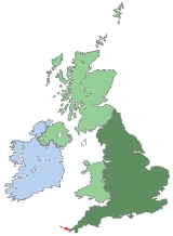
Gwinear–Gwithian is a coastal civil parish in west Cornwall
, United Kingdom
. It includes the villages of Connor Downs
, Gwinear
, Gwithian
, Reawla
and Rosewarne. The parish is situated approximately two miles (3 km) east of Hayle
two miles (3 km) west of Camborne
.
For the purposes of local government Gwinear–Gwithian has a parish council and elects councillors every four years. The principal local authority is Cornwall Council. The population of the parish was 3032 in the 2001 census
.
Cornwall
Cornwall is a unitary authority and ceremonial county of England, within the United Kingdom. It is bordered to the north and west by the Celtic Sea, to the south by the English Channel, and to the east by the county of Devon, over the River Tamar. Cornwall has a population of , and covers an area of...
, United Kingdom
United Kingdom
The United Kingdom of Great Britain and Northern IrelandIn the United Kingdom and Dependencies, other languages have been officially recognised as legitimate autochthonous languages under the European Charter for Regional or Minority Languages...
. It includes the villages of Connor Downs
Connor Downs
Connor Downs is a village in west Cornwall, United Kingdom. It is situated approximately two miles east of Hayle.The village straddles the old course of the A30 road but has now been bypassed. Facilities include a school , a petrol station and a fish-and-chip shop....
, Gwinear
Gwinear, Cornwall
Gwinear is a village in west Cornwall, United Kingdom. It is situated approximately two miles east of Hayle and overlooks the Angarrack valley....
, Gwithian
Gwithian
beach2Gwithian is a coastal village in west Cornwall, United Kingdom. It is situated three miles northeast of Hayle and four miles east of St Ives, Cornwall across St Ives Bay....
, Reawla
Reawla
Reawla is a large hamlet in Penwith district in Cornwall. It is believed the family name "Rule" came from here....
and Rosewarne. The parish is situated approximately two miles (3 km) east of Hayle
Hayle
Hayle is a small town, civil parish and cargo port in west Cornwall, United Kingdom. It is situated at the mouth of the Hayle River and is approximately seven miles northeast of Penzance...
two miles (3 km) west of Camborne
Camborne
Camborne is a town and civil parish in west Cornwall, England, United Kingdom. It is at the western edge of a conurbation comprising Camborne, Pool and Redruth....
.
For the purposes of local government Gwinear–Gwithian has a parish council and elects councillors every four years. The principal local authority is Cornwall Council. The population of the parish was 3032 in the 2001 census
Census
A census is the procedure of systematically acquiring and recording information about the members of a given population. It is a regularly occurring and official count of a particular population. The term is used mostly in connection with national population and housing censuses; other common...
.