
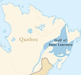
Gulf of Saint Lawrence
Overview
Estuary
An estuary is a partly enclosed coastal body of water with one or more rivers or streams flowing into it, and with a free connection to the open sea....
, is the outlet of North America's Great Lakes
Great Lakes
The Great Lakes are a collection of freshwater lakes located in northeastern North America, on the Canada – United States border. Consisting of Lakes Superior, Michigan, Huron, Erie, and Ontario, they form the largest group of freshwater lakes on Earth by total surface, coming in second by volume...
via the Saint Lawrence River
Saint Lawrence River
The Saint Lawrence is a large river flowing approximately from southwest to northeast in the middle latitudes of North America, connecting the Great Lakes with the Atlantic Ocean. It is the primary drainage conveyor of the Great Lakes Basin...
into the Atlantic Ocean
Atlantic Ocean
The Atlantic Ocean is the second-largest of the world's oceanic divisions. With a total area of about , it covers approximately 20% of the Earth's surface and about 26% of its water surface area...
. It is a semi–enclosed sea, covering an area of about 236000 km² (91,120.1 sq mi) and containing 35000 km³ (7,698,923,690,468,070 imp gal) of water.
The gulf is bounded on the north by the Labrador Peninsula
Labrador Peninsula
The Labrador Peninsula is a large peninsula in eastern Canada. It is bounded by the Hudson Bay to the west, the Hudson Strait to the north, the Labrador Sea to the east, and the Gulf of Saint Lawrence to the south-east...
, to the east by Newfoundland, to the south by the Nova Scotia peninsula
Nova Scotia peninsula
The Nova Scotia peninsula is a peninsula on the Atlantic coast of North America.-Location:The Nova Scotia peninsula is part of the province of Nova Scotia, Canada and is connected to the neighbouring province of New Brunswick through the Isthmus of Chignecto...
and Cape Breton Island
Cape Breton Island
Cape Breton Island is an island on the Atlantic coast of North America. It likely corresponds to the word Breton, the French demonym for Brittany....
, and to the west by the Gaspé
Gaspé Peninsula
The Gaspésie , or Gaspé Peninsula or the Gaspé, is a peninsula along the south shore of the Saint Lawrence River in Quebec, Canada, extending into the Gulf of Saint Lawrence...
and New Brunswick
New Brunswick
New Brunswick is one of Canada's three Maritime provinces and is the only province in the federation that is constitutionally bilingual . The provincial capital is Fredericton and Saint John is the most populous city. Greater Moncton is the largest Census Metropolitan Area...
.
Discussions