

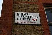
Great Titchfield Street
Encyclopedia
West End of London
The West End of London is an area of central London, containing many of the city's major tourist attractions, shops, businesses, government buildings, and entertainment . Use of the term began in the early 19th century to describe fashionable areas to the west of Charing Cross...
of London
London
London is the capital city of :England and the :United Kingdom, the largest metropolitan area in the United Kingdom, and the largest urban zone in the European Union by most measures. Located on the River Thames, London has been a major settlement for two millennia, its history going back to its...
. It runs north from Oxford Street
Oxford Street
Oxford Street is a major thoroughfare in the City of Westminster in the West End of London, United Kingdom. It is Europe's busiest shopping street, as well as its most dense, and currently has approximately 300 shops. The street was formerly part of the London-Oxford road which began at Newgate,...
to Greenwell Street, just short of the busy A501 Marylebone Road
Marylebone Road
Marylebone Road is an important thoroughfare in central London, within the City of Westminster. It runs east-west from the Euston Road at Regent's Park to the A40 Westway at Paddington...
and Euston Road
Euston Road
Euston Road is an important thoroughfare in central London, England, and forms part of the A501. It is part of the New Road from Paddington to Islington, and was opened as part of the New Road in 1756...
. It lies within the informally designated London area of Fitzrovia
Fitzrovia
Fitzrovia is a neighbourhood in central London, near London's West End lying partly in the London Borough of Camden and partly in the City of Westminster ; and situated between Marylebone and Bloomsbury and north of Soho. It is characterised by its mixed-use of residential, business, retail,...
. In administrative terms it is in the City of Westminster
City of Westminster
The City of Westminster is a London borough occupying much of the central area of London, England, including most of the West End. It is located to the west of and adjoining the ancient City of London, directly to the east of the Royal Borough of Kensington and Chelsea, and its southern boundary...
. It lies within their designated East Marylebone Conservation Area in the Metropolitan Borough of St Marylebone
Metropolitan Borough of St Marylebone
The Metropolitan Borough of St Marylebone was a Metropolitan borough of the County of London from 1900 to 1965. It was based directly on the previously existing civil parish of St Marylebone, which was incorporated into the Metropolitan Board of Works area in 1855, retaining a parish vestry, and...
.
Like the better known Portland Place
Portland Place
Portland Place is a street in the Marylebone district of central London, England.-History and topography:The street was laid out by the brothers Robert and James Adam for the Duke of Portland in the late 18th century and originally ran north from the gardens of a detached mansion called Foley House...
and Great Portland Street
Great Portland Street
Great Portland Street is a street in the West End of London. Linking Oxford Street with Albany Street and the busy A501 Marylebone Road and Euston Road, the road forms the boundary between Fitzrovia to the east and Marylebone to the west...
which run parallel with it to the west, Great Titchfield Street was developed by the Dukes of Portland, who owned most of the eastern half of Marylebone in the 18th and 19th centuries.
It appears half complete on the John Rocque
John Rocque
John Rocque was a surveyor and cartographer.Rocque was born no later than 1709, since that was the year he moved to England with his parents, who were French Huguenot émigrés...
map of 1746. At that time it only ran from Oxford Street to Riding House Street. In 1757 the New Road, now Marylebone Road, was laid out to provide a route around built-up London. This encouraged residential development in the area, with a regular grid of streets centred on Great Titchfield Street and Great Portland Street. Great Titchfield Street appears in its current complete form on the Richard Horwood
Richard Horwood
Richard Horwood was a surveyor and cartographer. In 1795 he published a Plan of the Cities of London and Westminster the Borough of Southwark and Parts adjoining Shewing every House, at a scale of 26 inches to the mile. At the time this was the largest map ever printed in Britain.Horwood also...
map of 1793 (Guildhall Archives).
By the mid-19th century it was described as being in an area of "dirty shops and dingy private dwellings...where children never washed" (quote from Pevsner and Cherry, 1991, London 3: North West). However, in February 1900, F.S.Webster, rector of the All Souls Church, Langham Place
All Souls Church, Langham Place
All Souls Church is an Anglican Evangelical church in central London, situated in Marylebone at the north end of Regent Street on Langham Place, just south of BBC Broadcasting House. As well as the core church membership, many hundreds of visitors come to All Souls, bringing the average number of...
described how "the locality east of Great Titchfield Street is rapidly changing. The old dwelling houses are being pulled down and large blocks containing small residential flats and business premises are being built in their place whose flats...are too expensive for working people" (quote from B Hanson, 1993, The Golden City Essays).
The garment industry, historically important in the East Marylebone and Soho areas, continues to have a presence in Great Titchfield Street. In recent years many have been displaced by the arrival of media organisations, television production and post-production companies and a number of highly specialised boutiques including Wise Buddah and Maverick Media. The radio & television stations of the Canadian Broadcasting Corporation
Canadian Broadcasting Corporation
The Canadian Broadcasting Corporation, commonly known as CBC and officially as CBC/Radio-Canada, is a Canadian crown corporation that serves as the national public radio and television broadcaster...
have their UK Office & Administration headquarters at 43-51 Great Titchfield Street.
Like Charlotte Street
Charlotte Street
Charlotte Street is a well-known street in Fitzrovia, central London, England. The southern half of the street has many restaurants and cafes, and a lively nightlife during the evening; while the northern part of the street is more mixed in character and includes the large office building of the...
, its near neighbour to the east, Great Titchfield Street is also home to a diverse range of specialist restaurants including Scandinavian Kitchen
Scandinavian Kitchen
Scandinavian Kitchen is London’s first Scandinavian delicatessen and grocery store. It is located at 61 Great Titchfield Street. Their menu is based on the smorgasbord and the Danish smorrebrod and draws on the Scandinavian tradition of uncomplicated food served on rye bread...
(Norwegian, Swedish and Danish), HT Harris (Italian Delicatessen), Efes (Turkish), Sergios (Italian Cafe), Shikara (North Indian) and the currently closed CVO Firevault (modern European).
It was designated a Conservation Area in 1982 (City of Westminster, Conservation Audit No.33: East Marylebone).
External links
- John Rocque's Map of Westminster and Southwark (First edition) 1746 — note that you can zoom in on the map by clicking on it.
- Historical maps of the area — from the Portman Estate, including Richard Horwood's maps.