

Greaser Petroglyph Site
Encyclopedia
The Greaser Petroglyph Site is located on land owned by the Bureau of Land Management
in eastern Lake County
, Oregon
. The designs were scraped into a basalt
boulder by Native Americans
perhaps 12,000 years ago. No one knows the meaning of the designs. Because of its unique archaeological and cultural significance, the Greaser petroglyph site was listed on the National Register of Historic Places
in 1974.
, 12,000 to 10,000 years ago. At that time, pluvial lakes filled many of the high desert
basins. Little is known about the people who occupied the land at that time, except that they camped and hunted near the lakes. The earliest petroglyphs in southeastern Oregon may be as much as 12,000 years old.
No one knows when the Greaser petroglyphs were carved or who carved them. They were probably created during either Clovis Period or the Stemmed Point Period that followed, placing the likely period of the Greaser rock carvings sometime between 12,000 and 7,500 years ago.
In 1840, when the first white men came through southern Oregon, the Fort Bidwell Band
and the Harney Valley Band of the Northern Paiute tribe lived in the southeastern part of Oregon around Greaser Canyon. However, given the age of the carvings, it is possible that the Northern Paiute people had nothing to do with their creation.
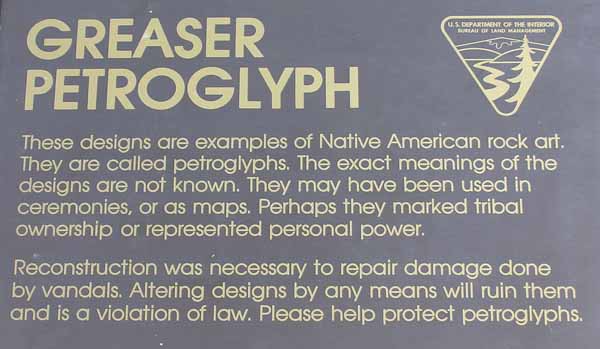
The meanings of the Greaser petroglyphs are not known. They may have been used in religious ceremonies or marked tribal ownership of territory. The designs may have been map directions or simply art created to tell a personal story. No one knows.
The Greaser petroglyphs were vandalized at least once. However, Bureau of Land Management archaeologists were able to repair the damage. Today, a sign warn visitors that altering the petroglyph designs in any way is a violation of Federal law and can ruin the works.
. The site is in the Warner Valley near Greaser Canyon, five miles east of the unincorporated community of Adel
. The petroglyphs are carved on a southwest-facing basalt boulder, approximately one-half mile north of Oregon Route 140. The protected area around the petroglyphs covers nine acres of open range land owned by the Bureau of Land Management.
Bureau of Land Management
The Bureau of Land Management is an agency within the United States Department of the Interior which administers America's public lands, totaling approximately , or one-eighth of the landmass of the country. The BLM also manages of subsurface mineral estate underlying federal, state and private...
in eastern Lake County
Lake County, Oregon
Lake County is a county in the high desert south central region of the U.S. state of Oregon, so named for the many lakes found within its boundaries, including Lake Abert, Hart Lake Reservoir, and Goose Lake. While Lake is among Oregon's largest counties, it is sparsely populated with 7,895...
, Oregon
Oregon
Oregon is a state in the Pacific Northwest region of the United States. It is located on the Pacific coast, with Washington to the north, California to the south, Nevada on the southeast and Idaho to the east. The Columbia and Snake rivers delineate much of Oregon's northern and eastern...
. The designs were scraped into a basalt
Basalt
Basalt is a common extrusive volcanic rock. It is usually grey to black and fine-grained due to rapid cooling of lava at the surface of a planet. It may be porphyritic containing larger crystals in a fine matrix, or vesicular, or frothy scoria. Unweathered basalt is black or grey...
boulder by Native Americans
Native Americans in the United States
Native Americans in the United States are the indigenous peoples in North America within the boundaries of the present-day continental United States, parts of Alaska, and the island state of Hawaii. They are composed of numerous, distinct tribes, states, and ethnic groups, many of which survive as...
perhaps 12,000 years ago. No one knows the meaning of the designs. Because of its unique archaeological and cultural significance, the Greaser petroglyph site was listed on the National Register of Historic Places
National Register of Historic Places
The National Register of Historic Places is the United States government's official list of districts, sites, buildings, structures, and objects deemed worthy of preservation...
in 1974.
Prehistoric art
Native Americans have lived in southeastern Oregon since the Clovis PeriodClovis culture
The Clovis culture is a prehistoric Paleo-Indian culture that first appears 11,500 RCYBP , at the end of the last glacial period, characterized by the manufacture of "Clovis points" and distinctive bone and ivory tools...
, 12,000 to 10,000 years ago. At that time, pluvial lakes filled many of the high desert
High Desert (Oregon)
The Oregon High Desert is a region of the U.S. state of Oregon, located east of the Cascade Range and south of the Blue Mountains, in the central and eastern parts of the state. Divided into a southern region and a northern region, the desert covers most of five Oregon counties and averages above...
basins. Little is known about the people who occupied the land at that time, except that they camped and hunted near the lakes. The earliest petroglyphs in southeastern Oregon may be as much as 12,000 years old.
No one knows when the Greaser petroglyphs were carved or who carved them. They were probably created during either Clovis Period or the Stemmed Point Period that followed, placing the likely period of the Greaser rock carvings sometime between 12,000 and 7,500 years ago.
In 1840, when the first white men came through southern Oregon, the Fort Bidwell Band
Fort Bidwell Indian Community of the Fort Bidwell Reservation of California
The Fort Bidwell Indian Community of the Fort Bidwell Reservation of California is a federally recognized tribe of Northern Paiute Indians in Modoc County in the northwest corner of California.-Reservation:...
and the Harney Valley Band of the Northern Paiute tribe lived in the southeastern part of Oregon around Greaser Canyon. However, given the age of the carvings, it is possible that the Northern Paiute people had nothing to do with their creation.
The meanings of the Greaser petroglyphs are not known. They may have been used in religious ceremonies or marked tribal ownership of territory. The designs may have been map directions or simply art created to tell a personal story. No one knows.
Protection
Because prehistoric petroglyph sites have great archeological value and are often associated with Native American cultural practices, they are identified for protection when located on Federal lands. A majority of the Government owned petroglyph sites have been officially designated as Areas of Critical Environmental Concern. This ensures maximum protection and careful preservation of these valuable cultural resources. There are also some sites of unique importance to the study of prehistory or of particularly cultural significance that have been listed on the National Register of Historic Places. Because of its cultural significance and unique archaeological value, the Greaser Petroglyph Site was listed on the National Register of Historic Places on 20 November 1974.The Greaser petroglyphs were vandalized at least once. However, Bureau of Land Management archaeologists were able to repair the damage. Today, a sign warn visitors that altering the petroglyph designs in any way is a violation of Federal law and can ruin the works.
Location
The Greaser petroglyphs are located 28 miles east of Lakeview, OregonLakeview, Oregon
Lakeview is a city in Lake County, Oregon, United States. The population was 2,294 at the 2010 census. It is the county seat of Lake County. Although it is an incorporated city, the municipal government refers to the community as "The Town of Lakeview", and bills itself as "Tallest Town in Oregon"...
. The site is in the Warner Valley near Greaser Canyon, five miles east of the unincorporated community of Adel
Adel, Oregon
Adel is an unincorporated community in southeastern Lake County, Oregon, United States. It consists largely of a cafe and gas station, amid a community of loosely scattered ranches...
. The petroglyphs are carved on a southwest-facing basalt boulder, approximately one-half mile north of Oregon Route 140. The protected area around the petroglyphs covers nine acres of open range land owned by the Bureau of Land Management.