
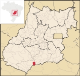
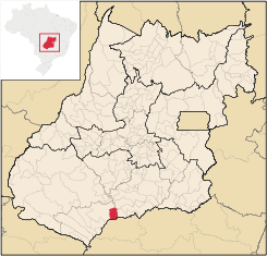
Gouvelândia
Encyclopedia
| Gouvelândia | |
|---|---|
| State | Goiás Goiás Goiás is a state of Brazil, located in the central part of the country. The name Goiás comes from the name of an indigenous community... |
| Coordinates: | 18°26′33"S 50°07′18"W |
| Area: | 830.77 km² |
| Population: | 4,507 (IBGE 2007) |
| Elevation: | 395m above sea level |
| Postcode (CEP): | 75865-000 |
| Became a city: | 1989 |
| Mayor: | José do Nascimento Januário (2005) |
| IBGE statistical Microregion: | Quirinópolis Microregion Quirinópolis Microregion The Quirinópolis Microregion is a region in south Goiás state, Brazil. It includes 8 municipalities with a population of 95,094 and a total area of 16,117.60 km². The population density was 5.89 km²... |
| Distance to Goiânia Goiânia -Climate:The city has a tropical wet and dry climate with an average temperature of . There's a wet season, from October to April, and a dry one, from May to September. Annual rainfall is around 1,520 mm.... : |
330 km. |
| Website: | none |
Town
A town is a human settlement larger than a village but smaller than a city. The size a settlement must be in order to be called a "town" varies considerably in different parts of the world, so that, for example, many American "small towns" seem to British people to be no more than villages, while...
and municipality
Municipality
A municipality is essentially an urban administrative division having corporate status and usually powers of self-government. It can also be used to mean the governing body of a municipality. A municipality is a general-purpose administrative subdivision, as opposed to a special-purpose district...
in south Goiás
Goiás
Goiás is a state of Brazil, located in the central part of the country. The name Goiás comes from the name of an indigenous community...
state, Brazil
Brazil
Brazil , officially the Federative Republic of Brazil , is the largest country in South America. It is the world's fifth largest country, both by geographical area and by population with over 192 million people...
. Gouvelândia is a large producer of sesame and peanuts.
Location
Gouvelândia is located in the Quirinópolis MicroregionQuirinópolis Microregion
The Quirinópolis Microregion is a region in south Goiás state, Brazil. It includes 8 municipalities with a population of 95,094 and a total area of 16,117.60 km². The population density was 5.89 km²...
, 35 kilometers west of the most important city, Quirinópolis
Quirinópolis
Quirinópolis is a small city and municipality in south Goiás state, Brazil. It is a large producer of cattle and agricultural products.-Location:...
. The Rio dos Bois, a tributary of the Paranaíba
Paranaíba River
The Paranaíba River is a Brazilian river whose source lies in the state of Minas Gerais in the Mata da Corda mountains, municipality of Rio Paranaíba, at an altitude of 1,148 meters; on the other face of this mountain chain are the sources of the Abaeté river, tributary of the São Francisco River...
crosses the region. The southern boundary is with the São Simão artificial lake and the border with the state of Minas Gerais
Minas Gerais
Minas Gerais is one of the 26 states of Brazil, of which it is the second most populous, the third richest, and the fourth largest in area. Minas Gerais is the Brazilian state with the largest number of Presidents of Brazil, the current one, Dilma Rousseff, being one of them. The capital is the...
.
The distance to state capital, Goiânia
Goiânia
-Climate:The city has a tropical wet and dry climate with an average temperature of . There's a wet season, from October to April, and a dry one, from May to September. Annual rainfall is around 1,520 mm....
, is 299 km. Highway connections from Goiânia
Goiânia
-Climate:The city has a tropical wet and dry climate with an average temperature of . There's a wet season, from October to April, and a dry one, from May to September. Annual rainfall is around 1,520 mm....
are by GO-040 / Aragoiânia
Aragoiânia
Aragoiânia is a small town and municipality in central Goiás state, Brazil. The population was 7,243 in a total area of 219.5 km²....
/ Cromínia
Cromínia
Cromínia is a small town and municipality in south Goiás state, Brazil. It is famous for its chrome mines.-Geographical Information:Cromínia is located in the Meia Ponte Microregion, which includes the cities in the Meia Ponte River basin...
/ GO-215 / Pontalina
Pontalina
Pontalina is a small city and municipality in south-central Goiás state, Brazil.GeographyPontalina is 125 kilometers from the state capital, Goiânia. It is connected by highways BR-153 and GO-19...
/ GO-040 / Aloândia
Aloândia
Aloândia is a small town and municipality in south Goiás state, Brazil. The population was 2,065 in 2007 and the municipal area was 102.1 km², one of the smallest in the state of Goiás.-Geographical Information:...
/ Bom Jesus de Goiás
Bom Jesus de Goiás
Bom Jesus de Goiás is a town and municipality in south Goiás state, Brazil. It is a large producer of soybeans.-Geographical Information:The distance to the state capital, Goiânia, is 223 km and it is linked by highways BR-452 and GO-040...
/ BR-452 / Itumbiara
Itumbiara
Itumbiara is a small city and municipality in the extreme south of the state of Goiás, Brazil. The population was 100,000 in a total area of 2,461,3 km²...
/ GO-206 / BR-483 / Cachoeira Dourada
Cachoeira Dourada
Cachoeira Dourada is a small town and municipality in south-central Goiás state, Brazil. The population was 7,567 in a total area of 521.1 km².-Geographical Information:...
/ Inaciolândia
Inaciolândia
Inaciolândia is a small town and municipality in south Goiás state, Brazil. The population was 5,650 inhabitants in a total area of 688.3 km². Inaciolândia is a large producer of cotton and soybeans.-Geographical Information:...
. See Sepin for all the distances.
Neighboring municipalities are:
- north: CastelândiaCastelândiaright|250pxCastelândia is a small town and municipality in southwest Goiás state, Brazil. It is a large producer of sugar cane and soybeans.-Location:...
- south: Santa VitóriaSanta Vitória, Minas GeraisSanta Vitória is a municipality in the west of the Brazilian state of Minas Gerais. , the population was 18,157. It became a municipality in 1948....
, Minas Gerais - east: InaciolândiaInaciolândiaInaciolândia is a small town and municipality in south Goiás state, Brazil. The population was 5,650 inhabitants in a total area of 688.3 km². Inaciolândia is a large producer of cotton and soybeans.-Geographical Information:...
- west: QuirinópolisQuirinópolisQuirinópolis is a small city and municipality in south Goiás state, Brazil. It is a large producer of cattle and agricultural products.-Location:...
Demographics
- Population density in 2007: 5.43 inhab/km²
- Population growth rate 1996/2007: 0.98.%
- Total population in 2007: 4,507
- Total population in 1980: 4,136
- Urban population in 2007: 3,466
- Rural population in 2007: 1,041
- Population change: the population has increased about 350 inhabitants since 1980.
The economy
The main economic activities were cattle raising and agriculture. Agricultural production was based on cattle raising (73,000 in 2006), cotton, peanuts, sesame seeds, corn , and soybeans.Economic Data (2007)
- Industrial establishments: 5
- Financial Institutions in 2007: Banco do Brasil S.A.
- Retail establishments in 2007: 1,282
- Automobiles: 258 (2007)
Main agricultural products in ha.(2006)
- cotton: 146
- sugarcane: 5,000
- corn: 2,500
- sesame: 1,500 (largest producer in the state)
- soybeans: 4,000
Farm Data (2006)in ha.
- Number of farms: 115
- Total area: 885,613
- Area of permanent crops: not available
- Area of perennial crops: 129,010
- Area of natural pasture: 657,315
- Persons dependent on farming: 310
- Farms with tractors: 44
- Number of tractors: 84 IBGE
Health and education
There were 04 schools with 1,640 students (2006). There were no hospitals.- Literacy rate: 84.0%
- Infant mortality rate: 24.07 in 1,000 live births
- Ranking on the Municipal Human Development IndexHuman Development IndexThe Human Development Index is a composite statistic used to rank countries by level of "human development" and separate "very high human development", "high human development", "medium human development", and "low human development" countries...
: 0.754 - State ranking: 114 (out of 242 municipalities in 2000)
- National ranking: 2,228 (out of 5,507 municipalities in 2000) For the complete list see Frigoletto
Gouvelândia first became a district of Quirinópolis
Quirinópolis
Quirinópolis is a small city and municipality in south Goiás state, Brazil. It is a large producer of cattle and agricultural products.-Location:...
in 1963, gaining municipal status in 1983.