
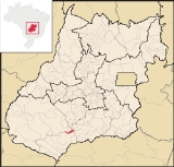
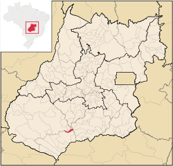
Castelândia
Encyclopedia
| Castelândia | |
|---|---|
| State | Goiás Goiás Goiás is a state of Brazil, located in the central part of the country. The name Goiás comes from the name of an indigenous community... |
| Coordinates: | 18°04′57"S 50°12′49"W |
| Area: | 298.4 km² |
| Population: | 3,530(IBGE 2007) |
| Elevation: | 443m |
| Postcode (CEP): | 75925-000 |
| IBGE statistical microregion: | 018 Sudoeste de Goiás |
| Became a city: | 1993 |
| Mayor: | Octávio Antônio Dias Júnior |
| Distance to Goiânia Goiânia -Climate:The city has a tropical wet and dry climate with an average temperature of . There's a wet season, from October to April, and a dry one, from May to September. Annual rainfall is around 1,520 mm.... : |
301 km. |
| Website: | n/a |
Town
A town is a human settlement larger than a village but smaller than a city. The size a settlement must be in order to be called a "town" varies considerably in different parts of the world, so that, for example, many American "small towns" seem to British people to be no more than villages, while...
and municipality
Municipality
A municipality is essentially an urban administrative division having corporate status and usually powers of self-government. It can also be used to mean the governing body of a municipality. A municipality is a general-purpose administrative subdivision, as opposed to a special-purpose district...
in southwest Goiás
Goiás
Goiás is a state of Brazil, located in the central part of the country. The name Goiás comes from the name of an indigenous community...
state, Brazil
Brazil
Brazil , officially the Federative Republic of Brazil , is the largest country in South America. It is the world's fifth largest country, both by geographical area and by population with over 192 million people...
. It is a large producer of sugar cane and soybeans.
Location
Castelândia is located in the southwest of the state, west of the Rio dos Bois, a major tributary of the ParanaíbaParanaíba River
The Paranaíba River is a Brazilian river whose source lies in the state of Minas Gerais in the Mata da Corda mountains, municipality of Rio Paranaíba, at an altitude of 1,148 meters; on the other face of this mountain chain are the sources of the Abaeté river, tributary of the São Francisco River...
. It is 54 kilometers northeast of the regional center, Quirinópolis
Quirinópolis
Quirinópolis is a small city and municipality in south Goiás state, Brazil. It is a large producer of cattle and agricultural products.-Location:...
and 95 kilometers southwest of Rio Verde
Rio Verde, Goiás
Rio Verde is a city and municipality in the Brazilian state of Goiás. It is a fast-growing center and is the largest producer of grains in the state.-Location:...
. The distance to the state capital, Goiânia
Goiânia
-Climate:The city has a tropical wet and dry climate with an average temperature of . There's a wet season, from October to April, and a dry one, from May to September. Annual rainfall is around 1,520 mm....
, is 282 km. Highway connections are made by GO-040 / Aragoiânia
Aragoiânia
Aragoiânia is a small town and municipality in central Goiás state, Brazil. The population was 7,243 in a total area of 219.5 km²....
/ Cromínia
Cromínia
Cromínia is a small town and municipality in south Goiás state, Brazil. It is famous for its chrome mines.-Geographical Information:Cromínia is located in the Meia Ponte Microregion, which includes the cities in the Meia Ponte River basin...
/ Pontalina
Pontalina
Pontalina is a small city and municipality in south-central Goiás state, Brazil.GeographyPontalina is 125 kilometers from the state capital, Goiânia. It is connected by highways BR-153 and GO-19...
/ Bom Jesus de Goiás
Bom Jesus de Goiás
Bom Jesus de Goiás is a town and municipality in south Goiás state, Brazil. It is a large producer of soybeans.-Geographical Information:The distance to the state capital, Goiânia, is 223 km and it is linked by highways BR-452 and GO-040...
/ BR-452 / GO-319 / Aloândia
Aloândia
Aloândia is a small town and municipality in south Goiás state, Brazil. The population was 2,065 in 2007 and the municipal area was 102.1 km², one of the smallest in the state of Goiás.-Geographical Information:...
. Sepin. Neighboring municipalities are Rio Verde
Rio Verde, Goiás
Rio Verde is a city and municipality in the Brazilian state of Goiás. It is a fast-growing center and is the largest producer of grains in the state.-Location:...
, Maurilândia
Maurilândia
thumb|right|250px|Coordinates: Maurilândia is a small town and municipality in southwest Goiás state, Brazil. It is a large producer of sugarcane.-Location:...
, and Bom Jesus de Goiás
Bom Jesus de Goiás
Bom Jesus de Goiás is a town and municipality in south Goiás state, Brazil. It is a large producer of soybeans.-Geographical Information:The distance to the state capital, Goiânia, is 223 km and it is linked by highways BR-452 and GO-040...
.
Demographics
- Population density in 2007: 11.87 inhab/km²
- Population growth rate 1996/2007: -0.31.%
- Total population in 2007: 3,530
- Total population in 1996: 3,653
- Urban population in 2007: 3,205
- Rural population in 2007: 325
The economy
The economy is based on cattle raising (22,000 head in 2006), poultry production, and growing of sugar cane, corn, and soybeans. There was 01 financial institution in 2007—BRADESCO S.AMotor vehicles
- Automobiles: 187
- Pickup trucks: 38
- Number of inhabitants per motor vehicle: 15.6
Main agricultural products in ha.(2006)
- rice: 600
- sugarcane: 2,600
- corn: 3,000
- soybeans: 6,000
Farm Data (2006)in ha.
- Number of farms: 119
- Total area: 23,793
- Area of permanent crops: n/a
- Area of perennial crops: 18,246
- Area of natural pasture: 4,212
- Persons dependent on farming: 351
Health and education
In 2006 there was 01 hospital with 15 beds. There were no institutions of higher education.- The infant mortality rate was 20.02 in 2000.
- The literacy rate was 80.0 in 2000.
- MHDI: 0.732
- State ranking: 137 (out of 242 municipalities)
- National ranking: 2,379 (out of 5,507 municipalities)
History
- Castelândia was created as a district belonging to the municipality of Rio VerdeRio Verde, GoiásRio Verde is a city and municipality in the Brazilian state of Goiás. It is a fast-growing center and is the largest producer of grains in the state.-Location:...
in 1963. In 1993 it was dismembered from Rio Verde to become its own municipality.
See also
- List of municipalities in Goiás
- Microregions of Goiás