
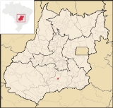
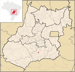
Aloândia
Encyclopedia
| Aloândia | |
|---|---|
| State | Goiás Goiás Goiás is a state of Brazil, located in the central part of the country. The name Goiás comes from the name of an indigenous community... |
| Coordinates; | 17°43′42"S 49°28′14"W |
| Area: | 102.1 km² |
| Population: | 2,065 (IBGE 2007) |
| Elevation: | 672 m above sea level |
| Postcode (CEP): | 75615-000 |
| Became a city: | 1953 |
| Mayor: | Cássio Vieira Sampaio |
| Distance to Goiânia Goiânia -Climate:The city has a tropical wet and dry climate with an average temperature of . There's a wet season, from October to April, and a dry one, from May to September. Annual rainfall is around 1,520 mm.... : |
132 km. |
| IBGE statistical microregion: | Meia Ponte Microregion Meia Ponte Microregion The Meia Ponte Microregion is a statistical region of Goiás state, Brazil created by the IBGE . It is located south of the state capital, Goiânia, and includes 21 cities with a total population of 338,147 inhabitants . The total area is 21,229.00 km² and the population density is 14.39 inhab/km²... |
| Website: | none |
Town
A town is a human settlement larger than a village but smaller than a city. The size a settlement must be in order to be called a "town" varies considerably in different parts of the world, so that, for example, many American "small towns" seem to British people to be no more than villages, while...
and municipality
Municipality
A municipality is essentially an urban administrative division having corporate status and usually powers of self-government. It can also be used to mean the governing body of a municipality. A municipality is a general-purpose administrative subdivision, as opposed to a special-purpose district...
in south Goiás
Goiás
Goiás is a state of Brazil, located in the central part of the country. The name Goiás comes from the name of an indigenous community...
state, Brazil
Brazil
Brazil , officially the Federative Republic of Brazil , is the largest country in South America. It is the world's fifth largest country, both by geographical area and by population with over 192 million people...
. The population was 2,065 in 2007 and the municipal area was 102.1 km², one of the smallest in the state of Goiás
Goiás
Goiás is a state of Brazil, located in the central part of the country. The name Goiás comes from the name of an indigenous community...
.
Geographical Information
Aloândia is located in the Meia Ponte MicroregionMeia Ponte Microregion
The Meia Ponte Microregion is a statistical region of Goiás state, Brazil created by the IBGE . It is located south of the state capital, Goiânia, and includes 21 cities with a total population of 338,147 inhabitants . The total area is 21,229.00 km² and the population density is 14.39 inhab/km²...
, 35 kilometers south of Pontalina
Pontalina
Pontalina is a small city and municipality in south-central Goiás state, Brazil.GeographyPontalina is 125 kilometers from the state capital, Goiânia. It is connected by highways BR-153 and GO-19...
and 35 kilometers west of the important BR-135 highway, which connects São Paulo
São Paulo
São Paulo is the largest city in Brazil, the largest city in the southern hemisphere and South America, and the world's seventh largest city by population. The metropolis is anchor to the São Paulo metropolitan area, ranked as the second-most populous metropolitan area in the Americas and among...
with Belém
Belém
Belém is a Brazilian city, the capital and largest city of state of Pará, in the country's north region. It is the entrance gate to the Amazon with a busy port, airport and bus/coach station...
.
The distance to the state capital, Goiânia
Goiânia
-Climate:The city has a tropical wet and dry climate with an average temperature of . There's a wet season, from October to April, and a dry one, from May to September. Annual rainfall is around 1,520 mm....
, is 132 km. Highway connections are made by BR-153 / Aparecida de Goiânia
Aparecida de Goiânia
Aparecida de Goiânia is a city and municipality in central Goiás, Brazil. It is the second largest city in the state and a bustling industrial center.-Location:...
/ Professor Jamil
Professor Jamil
Professor Jamil is a small town and municipality in south-central Goiás state, Brazil. The population was 3,298 in a total area of 347.4 km²...
/ Pontalina
Pontalina
Pontalina is a small city and municipality in south-central Goiás state, Brazil.GeographyPontalina is 125 kilometers from the state capital, Goiânia. It is connected by highways BR-153 and GO-19...
/ GO-217 / GO -040. See Sepin
Neighboring municipalities:
- north and west: PontalinaPontalinaPontalina is a small city and municipality in south-central Goiás state, Brazil.GeographyPontalina is 125 kilometers from the state capital, Goiânia. It is connected by highways BR-153 and GO-19...
- south: JoviâniaJoviâniaJoviânia is small town and municipality in south-central Goiás state, Brazil. The population was 6,731 in a total area of 454.9 km² .-Location:...
- east: MorrinhosMorrinhosMorrinhos may refer to one of the following cities in Brazil:* Morrinhos, Ceará, a city in the state of Ceará* Morrinhos, Goiás, a city in the state of Goiás* Morrinhos, Rio Grande do Sul, a city in the state of Rio Grande do Sul...
History
Construction of the first houses of the settlement called São João, after a ranch nearby, began in 1941. The name was later changed to "Itambé", meaning waterfall, from the waterfalls coming down from the nearby hills. In 1948 it was elevated to district in the municipality of PontalinaPontalina
Pontalina is a small city and municipality in south-central Goiás state, Brazil.GeographyPontalina is 125 kilometers from the state capital, Goiânia. It is connected by highways BR-153 and GO-19...
with a new name, "Aloândia", meaning "praise to the light". In 1953 it became a municipality.
Demographic and Political Data
- Population density: 20.21 inhab/km² (2007)
- Population growth rate: 1996/2007 0.19.%
- Population in 2007: 2,065
- Population in 1980: 2.233
- Urban population: 1,761 (2007)
- Rural population: 304
- City government: mayor(Cássio Vieira Sampaio), vice-mayor (Cleusa Edir Lopes Vieira), and 09 council members
The economy
The economy is based on cattle raising, services, government organs (city government, health centers, and schools), and agriculture. the main agricultural products were bananas, hearts of palm, rice, corn, and soybeans.- There were 22 retail commerce establishments in 2007
- There was one financial institution in the town in 2007: Bradesco S.A.
- There were 16,355 head of cattle. (2006)
In 2003 most workers were employed in public administration, defense, and social security.
Agricultural data 2006
- Farms: 182
- Total area: 5,236 ha.
- Area of permanent crops: 23 ha.
- Area of perennial crops: 766 ha.
- Area of natural pasture: 3,336 ha.
- Area of woodland and forests: 888 ha.
- Persons dependent on farming: 390
- Farms with tractors: 33
- Number of tractors: 49 IBGE
Health and education
In 2007 there was one health clinic and 1 small hospital with 16 beds. There were 479 students in 02 primary schools.The United Nations Human Development Index
Human Development Index
The Human Development Index is a composite statistic used to rank countries by level of "human development" and separate "very high human development", "high human development", "medium human development", and "low human development" countries...
(2000) ranked Aloândia 93 out of 242 municipalities in the state of Goiás
Goiás
Goiás is a state of Brazil, located in the central part of the country. The name Goiás comes from the name of an indigenous community...
with a score of 0.744 and 2,052 out of 5,507 municipalities in Brazil
Brazil
Brazil , officially the Federative Republic of Brazil , is the largest country in South America. It is the world's fifth largest country, both by geographical area and by population with over 192 million people...
. For the complete list see Frigoletto.