

Glen Cove Road
Encyclopedia
Nassau County, New York
Nassau County is a suburban county on Long Island, east of New York City in the U.S. state of New York, within the New York Metropolitan Area. As of the 2010 census, the population was 1,339,532...
on Long Island
Long Island
Long Island is an island located in the southeast part of the U.S. state of New York, just east of Manhattan. Stretching northeast into the Atlantic Ocean, Long Island contains four counties, two of which are boroughs of New York City , and two of which are mainly suburban...
, New York
New York
New York is a state in the Northeastern region of the United States. It is the nation's third most populous state. New York is bordered by New Jersey and Pennsylvania to the south, and by Connecticut, Massachusetts and Vermont to the east...
, and the main road leading to the communities on the east shore of Hempstead Harbor
Hempstead Harbor
Hempstead Harbor, New York is a bay in Long Island Sound, between the towns of Oyster Bay on the east and North Hempstead on the west, in Nassau County, Long Island, New York. It is sometimes called Roslyn Harbor....
. The portion south of the North Hempstead
Town of North Hempstead, New York
North Hempstead is one of three towns in Nassau County, New York, USA. As of the 2010 census, the town population was 226,322.The Town of North Hempstead occupies the northwest part of the county. Its Supervisor is Jon Kaiman, a Democrat.-History:...
/Oyster Bay
Town of Oyster Bay, New York
Oyster Bay, New York can refer to:* Oyster Bay , New York* Oyster Bay , New York* Oyster Bay , New York, also Oyster Bay Harbor, an inlet on the north shore of Long Island, New York...
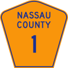
town line is the unsigned Nassau County Route 1, while the portion north of the town line until its intersection with Route 107 is designated as New York State Route 900B, an unsigned reference route.
Route description
The alignment of Glen Cove Road starts at Peninsula Boulevard in downtown HempsteadHempstead (village), New York
Hempstead is a village located in the town of Hempstead, Nassau County, New York, United States. The population was 53,891 at the 2010 census.Hofstra University is located on the border between Hempstead and Uniondale.-Foundation:...
, but is known as Clinton Road until its intersection with Old Country Road
Old Country Road
Old Country Road is a major east–west thoroughfare through central Nassau County and extending into western Suffolk County on Long Island, New York. It serves many of the major shopping centers in central Nassau County including Roosevelt Field Mall...
in Carle Place
Carle Place, New York
Carle Place is a hamlet in Nassau County, New York, United States. As of 2010 the CDP population was 4,981...
. It curves from when it intersects with NY 25 to I-495
Interstate 495 (New York)
Interstate 495 is an auxiliary Interstate Highway on Long Island in New York in the United States. The route extends for from the western portal of the Queens-Midtown Tunnel in the New York City borough of Manhattan to County Route 58 in Riverhead, Suffolk County...
to steer clear of the Meadowbrook Parkway and the Northern Parkway
Northern State Parkway
The Northern State Parkway is a long limited-access state parkway on Long Island in the U.S. state of New York. The western terminus is at the Queens-Nassau County line, where the parkway continues westward into New York City as the Grand Central Parkway...
. Within Old Westbury
Old Westbury, New York
Old Westbury is a village in Nassau County, New York on the North Shore of Long Island. As of the 2010 United States Census, the village population was 4,671....
the road is concurrently signed as Guinea Woods Road.
Soon after its intersection with NY 25A in Greenvale
Greenvale, New York
Greenvale is a hamlet in Nassau County, New York on the North Shore of Long Island. As of the United States 2010 Census, the CDP population was 1,094. It is part of both the Roslyn and North Shore School Districts....
, it widens to a divided highway and assumes the NY 900B designation, although the reference markers
Reference marker (New York)
In New York, a reference marker is a small green sign mounted approximately every one-tenth mile on highways maintained by the New York State Department of Transportation. This was initiated in response to the Highway Safety Act of 1966 enacted by Congress, in an effort to monitor traffic and...
refer to it as NY 904. At its intersection with NY 107 the alignment assumes that route's number and name. After another 1.4 miles (2.3 km) the divided highway alignment and the NY 107 designation forks to the left as Pratt Boulevard while Cedar Swamp Road forks to the right as a surface street. The road eventually ends at its intersection with Brewster Street near downtown Glen Cove
Glen Cove, New York
Glen Cove is a city in Nassau County, New York on the North Shore of Long Island. As of the United States 2010 Census, the city population was 26,964....
.
History
Glen Cove Road was once (as of 1959) part of an extended County Route 1 which reached as far south as Point LookoutPoint Lookout, New York
Point Lookout is a hamlet located in the town Hempstead in Nassau County, New York. The population was 1,219 at the 2010 census.-Geography:...
and as far north as Centre Island
Centre Island, New York
The Village of Centre Island is a village located within the town of Oyster Bay in Nassau County, New York, United States. Its population was 410 as of the 2010 census....
. The current state designation for the route only includes the Clinton Road and Glen Cove Road alignment south of the North Hempstead
Town of North Hempstead, New York
North Hempstead is one of three towns in Nassau County, New York, USA. As of the 2010 census, the town population was 226,322.The Town of North Hempstead occupies the northwest part of the county. Its Supervisor is Jon Kaiman, a Democrat.-History:...
/Oyster Bay
Town of Oyster Bay, New York
Oyster Bay, New York can refer to:* Oyster Bay , New York* Oyster Bay , New York* Oyster Bay , New York, also Oyster Bay Harbor, an inlet on the north shore of Long Island, New York...
town line, after which it becomes NY 900B and later New York State Route 107. Route 900B had originally been NY 904 prior to the creation of the modern reference route system. The county route signage was removed in the mid-1970s because the county did not want to pay to replace the signs to conform to new federal standards.
The northernmost segment of NY 107, known as the Glen Cove Arterial Highway, clearly had limited-access aspirations. In the mid-1960s, this segment was constructed as a bypass of Glen Street, likely as the approach for one of two proposed bridges to Rye, New York
Rye (city), New York
Rye is a city in Westchester County, New York, United States. It is separate from the town of Rye, which is larger than the city. Rye city, formerly the village of Rye, was part of the town until 1942, when it received its charter as a city, the most recent to be issued in New York...
across the Long Island Sound
Long Island Sound
Long Island Sound is an estuary of the Atlantic Ocean, located in the United States between Connecticut to the north and Long Island, New York to the south. The mouth of the Connecticut River at Old Saybrook, Connecticut, empties into the sound. On its western end the sound is bounded by the Bronx...
.
Major intersections
- Note: The mileages below only cover the portion actually signed as Glen Cove Road.