
Georgia State Route 46
Encyclopedia
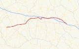
State Route 46 is a west–east state route located in the east-central part of the U.S. state
of Georgia
. The route travels from U.S. Route 23/State Route 87 in Eastman
east to State Route 67 northwest of Pembroke
. The route mostly runs in close proximity to Interstate 16 and serves mostly to local traffic.
, Laurens
, and Wheeler
counties before crossing the Oconee River
into Treutlen County
and entering the county seat of Soperton
. State Route 46 departs Soperton to the east, and continues east to its junction with U.S. Route 1
/State Route 4 north of Oak Park
. In Oak Park, State Route 46 becomes cosigned
with U.S. Route 1/State Route 4 for a short distance north. Shortly after meeting Interstate 16
at exit 90, State Route 46 departs U.S. Route 1, and continues east, closely paralleling Interstate 16. After passing through Metter
, the route enters Bulloch County
, where it meets its eastern terminus at State Route 67 northwest of Pembroke.
It has an Average Annual Daily Traffic of less than 5,000 over the entire route with the exception of a short segment east of Metter.
U.S. state
A U.S. state is any one of the 50 federated states of the United States of America that share sovereignty with the federal government. Because of this shared sovereignty, an American is a citizen both of the federal entity and of his or her state of domicile. Four states use the official title of...
of Georgia
Georgia (U.S. state)
Georgia is a state located in the southeastern United States. It was established in 1732, the last of the original Thirteen Colonies. The state is named after King George II of Great Britain. Georgia was the fourth state to ratify the United States Constitution, on January 2, 1788...
. The route travels from U.S. Route 23/State Route 87 in Eastman
Eastman, Georgia
Eastman is a city in Dodge County, Georgia, United States. The population was 13,541 at the 2000 census. The city is the county seat of Dodge County...
east to State Route 67 northwest of Pembroke
Pembroke, Georgia
Pembroke is a small city in Bryan County, Georgia, United States. The population was 2,379 at the 2000 census. The city is the county seat of Bryan County.Pembroke is part of the Savannah Metropolitan Statistical Area.-History:...
. The route mostly runs in close proximity to Interstate 16 and serves mostly to local traffic.
Route description
From its western terminus at U.S. Route 23/State Route 87 in downtown Eastman, State Route 46 travels east through rural parts of DodgeDodge County, Georgia
Dodge County is a county located in the U.S. state of Georgia. As of 2000, the population was 19,171. The 2007 Census Estimate shows a population of 20,042. The county seat is Eastman. Dodge County lies in the Historic South region of Georgia, an area that has architectural wonders and shows the...
, Laurens
Laurens County, Georgia
Laurens County is a county located in the U.S. state of Georgia. It was created on December 10, 1807. As of 2000, the population was 44,874. The 2007 Census Estimate shows a population of 47,520...
, and Wheeler
Wheeler County, Georgia
Wheeler County is a county located in the U.S. state of Georgia. As of 2000, the population was 6,179. The 2007 Census Estimate shows a population of 6,830. The county seat is Alamo.-History:Wheeler County is named after Confederate General Joseph Wheeler...
counties before crossing the Oconee River
Oconee River
The Oconee River is a river which has its origin in Hall County, Georgia, and terminates where it joins the Ocmulgee River to form the Altamaha River near Lumber City at the borders of Montgomery County, Wheeler County, and Jeff Davis County. South of Athens, two forks, known as the North Oconee...
into Treutlen County
Treutlen County, Georgia
Treutlen County is a county located in the U.S. state of Georgia. As of 2000, the population was 6,854. The 2007 Census Estimate shows a population of 6,938. The county seat is Soperton...
and entering the county seat of Soperton
Soperton, Georgia
Soperton is a city in Treutlen County, Georgia, United States. The population was 2,824 at the 2000 census. The city is the county seat of Treutlen County.-Geography:Soperton is located at ....
. State Route 46 departs Soperton to the east, and continues east to its junction with U.S. Route 1
U.S. Route 1
U.S. Route 1 is a major north–south U.S. Highway that serves the East Coast of the United States. It runs 2,377 miles from Fort Kent, Maine at the Canadian border south to Key West, Florida. U.S. 1 generally parallels Interstate 95, though it is significantly farther west between...
/State Route 4 north of Oak Park
Oak Park, Georgia
Oak Park is a town in Emanuel County, Georgia, United States. The population was 366 at the 2000 census.-Geography:Oak Park is located at ....
. In Oak Park, State Route 46 becomes cosigned
Concurrency (road)
A concurrency, overlap, or coincidence in a road network is an instance of one physical road bearing two or more different highway, motorway, or other route numbers...
with U.S. Route 1/State Route 4 for a short distance north. Shortly after meeting Interstate 16
Interstate 16
Interstate 16 , also known as Jim Gillis Historic Savannah Parkway or State Route 404 , is an intrastate Interstate Highway located entirely within the state of Georgia, United States...
at exit 90, State Route 46 departs U.S. Route 1, and continues east, closely paralleling Interstate 16. After passing through Metter
Metter, Georgia
Metter is a city in Candler County, Georgia, United States. The population was 3,879 at the 2000 census. The city is the county seat of Candler County.- Geography :Metter is located at ....
, the route enters Bulloch County
Bulloch County, Georgia
Bulloch County is a county located in the U.S. state of Georgia. It was created on February 8, 1796. Bulloch County has undergone rapid growth in recent years. As of 2000, the population was 55,983. The 2009 Census Estimate showed a population of 69,213. The county seat is Statesboro.In...
, where it meets its eastern terminus at State Route 67 northwest of Pembroke.
It has an Average Annual Daily Traffic of less than 5,000 over the entire route with the exception of a short segment east of Metter.