
Erineos
Encyclopedia
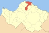
Erineos is a former municipality
in Achaea
, West Greece, Greece
. Since the 2011 local government reform it is part of the municipality Aigialeia
, of which it is a municipal unit. Its seat of administration was in the village of Kamares
. It is connected by the old road of GR-8
linking Patras and Corinth along with Aigio while the superhighway is to the north. Kamares is also linked with the road linking to Seliana
, the only road linking through the Panachaicus. It is located about 10 km W of Aigio, about 40 km NW of Pteri, about 30 km E of Patras from the old road and about 36 km from the superhighwway via the Longos interchange to the east which its nearest interchange and is also accessed to Longos Beach. The municipality is the second northernmost municipality in the entire peninsula of the Peloponnese
, right after Rio.
mountain range. The Salmenikos river flows into the municipality.
. By the sea had a naby between Athens
and the Peloponnese around 412 BC. In Kamares, it has artifacts dating back to the Roman times
in which one of them derives its name to the present town. In Salmeniko, it had a castle, the Orias Castle. In present-day Lampiri, it had a lake in the ancient times named Rhypae or Erineos. The origin of the name of Lampiri comes from the Frankish leader of the area Gerard de Lambri.
The municipality was founded in 1994 and included the former communes of Kamares, Neos Erineos and Ziria. In 1998 under the Capodistrian Constitution added Arravonitsa, Damakini and Salmeniko.
The mountains to the northwest suffered a catastrophic forest fire in 1994 which saw hundreds of hectares englufed in flames. It took about five years to regreen the affected area.
Communities and Municipalities of Greece
For the new municipalities of Greece see the Kallikratis ProgrammeThe municipalities and communities of Greece are one of several levels of government within the organizational structure of that country. Thirteen regions called peripheries form the largest unit of government beneath the State. ...
in Achaea
Achaea
Achaea is one of the regional units of Greece. It is part of the region of West Greece. It is situated in the northwestern part of the Peloponnese peninsula. The capital is Patras. The population exceeds 300,000 since 2001.-Geography:...
, West Greece, Greece
Greece
Greece , officially the Hellenic Republic , and historically Hellas or the Republic of Greece in English, is a country in southeastern Europe....
. Since the 2011 local government reform it is part of the municipality Aigialeia
Aigialeia
Aigialeia is a municipality and a former province of the Achaea peripheral unit, Greece. The seat of the municipality is the town Aigio. The main towns are Aigio, Akrata and Diakopto. The mountains dominate the central, the southern and the western part, farmlands dominate the northern part...
, of which it is a municipal unit. Its seat of administration was in the village of Kamares
Kamares, Achaea
Kamares is a village in the east-northeastern part of Achaea, Greece. Kamares was an independent commune until 1994 when it became part of the municipality of Erineos. Kamares served as the seat of the former municipality of Erineos. The village is connected by the old road of GR-8 linking...
. It is connected by the old road of GR-8
Greek National Road 8
The National Road 8 in Greece is a single carriageway with at-grade intersections in the Attica and Peloponnese regions. It links the cities of Patras, Corinth and Athens. Until the 1960s when the National Road 8A, a toll road, replaced it as a major route, it was the only road linking Athens and...
linking Patras and Corinth along with Aigio while the superhighway is to the north. Kamares is also linked with the road linking to Seliana
Seliana
Seliana also known as Phelloe is a Greek village located in north Peloponnese and more specifically in the east part of the prefecture of Achaea...
, the only road linking through the Panachaicus. It is located about 10 km W of Aigio, about 40 km NW of Pteri, about 30 km E of Patras from the old road and about 36 km from the superhighwway via the Longos interchange to the east which its nearest interchange and is also accessed to Longos Beach. The municipality is the second northernmost municipality in the entire peninsula of the Peloponnese
Peloponnese
The Peloponnese, Peloponnesos or Peloponnesus , is a large peninsula , located in a region of southern Greece, forming the part of the country south of the Gulf of Corinth...
, right after Rio.
Subdivisions
The municipal unit Erineos is subdivided into the following communities (constituent villages in brackets):- ArravonitsaArravonitsaArravonitsa is a Greek village located west of Aigio in Achaea. The GR-9 highway is to the east. Arravonitsa had a 2001 population of 198 for the village and 263 for the municipal district.-Village Settlements:*Agioi Theodoroi...
(Arravonitsa, Synania) - Damakini (Damakini, Vounopyrgos)
- KamaresKamares, AchaeaKamares is a village in the east-northeastern part of Achaea, Greece. Kamares was an independent commune until 1994 when it became part of the municipality of Erineos. Kamares served as the seat of the former municipality of Erineos. The village is connected by the old road of GR-8 linking...
(Kamares, Bouka, Pefka) - Neos Erineos
- Salmeniko (Ano Salmeniko, Kato Salmeniko, Voteni, Neo Salmeniko)
- Ziria (Ziria, Ano Ziria, Kyani Akti, LampiriLampiri, AchaeaLampiri is a Greek village located southeast of Patras. Lampiri had a population of 246 in 2001. Lampiri is part of the municipal unit of Erineos. Lampiri is connected with the old GR-8 and is connected with the new GR-8A/E65 8 km southeast by Longos...
, Rodini, Sarkounas)
Historical population
| Year | Population |
|---|---|
| 1991 | 3,683 |
| 2001 | 3,768 |
Geography
The municipality are made up of farmlands which includes groves and some forest to the east and the northern part, the rest of the area are mountainous and are forested in the eastern and the central parts, the rest of the area are made up of grasslands and the western half is part of the PanachaikoPanachaiko
The Panachaikon or Panachaiko , also known as Vodias in medieval times and until the early 20th century, is a mountain range that spans about 20 km in length from north to south , and 15 to 20 km from east to west...
mountain range. The Salmenikos river flows into the municipality.
History
The area had a Ryhpae land and the ancient city of Rhypae which was one of the cities of the Achaean LeagueAchaean League
The Achaean League was a Hellenistic era confederation of Greek city states on the northern and central Peloponnese, which existed between 280 BC and 146 BC...
. By the sea had a naby between Athens
Athens
Athens , is the capital and largest city of Greece. Athens dominates the Attica region and is one of the world's oldest cities, as its recorded history spans around 3,400 years. Classical Athens was a powerful city-state...
and the Peloponnese around 412 BC. In Kamares, it has artifacts dating back to the Roman times
Roman Empire
The Roman Empire was the post-Republican period of the ancient Roman civilization, characterised by an autocratic form of government and large territorial holdings in Europe and around the Mediterranean....
in which one of them derives its name to the present town. In Salmeniko, it had a castle, the Orias Castle. In present-day Lampiri, it had a lake in the ancient times named Rhypae or Erineos. The origin of the name of Lampiri comes from the Frankish leader of the area Gerard de Lambri.
The municipality was founded in 1994 and included the former communes of Kamares, Neos Erineos and Ziria. In 1998 under the Capodistrian Constitution added Arravonitsa, Damakini and Salmeniko.
The mountains to the northwest suffered a catastrophic forest fire in 1994 which saw hundreds of hectares englufed in flames. It took about five years to regreen the affected area.