

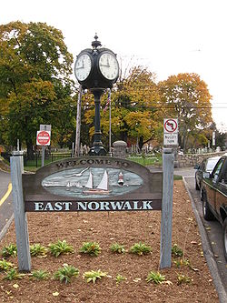
East Norwalk
Encyclopedia
Neighbourhood
A neighbourhood or neighborhood is a geographically localised community within a larger city, town or suburb. Neighbourhoods are often social communities with considerable face-to-face interaction among members. "Researchers have not agreed on an exact definition...
located in Norwalk, Connecticut
Norwalk, Connecticut
Norwalk is a city in Fairfield County, Connecticut, United States. According to the 2010 U.S. Census, the population of the city is 85,603, making Norwalk sixth in population in Connecticut, and third in Fairfield County...
.
The neighborhood is a culturally diverse, mostly middle-class section of the city, inhabited by many different ethnicities such as Greeks, Italians, Hispanics, African Americans, and long time "Connecticut Yankee
Yankee
The term Yankee has several interrelated and often pejorative meanings, usually referring to people originating in the northeastern United States, or still more narrowly New England, where application of the term is largely restricted to descendants of the English settlers of the region.The...
" residents. Many long-time residents are beginning to move out due to gentrification
Gentrification
Gentrification and urban gentrification refer to the changes that result when wealthier people acquire or rent property in low income and working class communities. Urban gentrification is associated with movement. Consequent to gentrification, the average income increases and average family size...
and are being replaced by wealthier residents.
Boundaries
The boundaries of the neighborhood are Interstate 95Interstate 95 in Connecticut
Interstate 95, the main north–south Interstate Highway on the East Coast of the United States, runs in a general east–west compass direction for 111.57 miles in Connecticut from the Rhode Island state line to the New York State line. I-95 Southbound from East Lyme to the New York State...
to the north, the Westport
Westport, Connecticut
-Neighborhoods:* Saugatuck – around the Westport railroad station near the southwestern corner of the town – a built-up area with some restaurants, stores and offices....
town limits to the east, the Norwalk River
Norwalk River
The Norwalk River is a river in southwestern Connecticut, approximately long. The word "Norwalk" comes from the Algonquian word "noyank" meaning "point of land".-Description:...
to the west, and Long Island Sound
Long Island Sound
Long Island Sound is an estuary of the Atlantic Ocean, located in the United States between Connecticut to the north and Long Island, New York to the south. The mouth of the Connecticut River at Old Saybrook, Connecticut, empties into the sound. On its western end the sound is bounded by the Bronx...
to the south.
Neighborhood Association
Laurel Lindstrom, the president of the Eastern Norwalk Neighborhood Association (ENNA), has been elected as a city representative for East Norwalk, has been a resident of Norwalk for 15 years and made the United States her home a quarter century ago. The ENNA has members from within traditional East Norwalk that comprises the third taxing district and also has members all the way up to the Post Road. The ENNA extended its boundaries "from the sea to the green" to allow these residents that do not have their own neighborhood association to participate in neighborhood forums and activities organized by the ENNA. Norwalk's historic town green is maintained by Central NorwalkCentral Norwalk
The Central or Midtown section of Norwalk, Connecticut is an urbanized area in roughly the geographic center of the city, north of the South Norwalk neighborhood and the Connecticut Turnpike. Wall Street, West Avenue and Belden Avenue are the main thoroughfares...
's first taxing district and is north of I-95.
History
Roger Ludlow
Roger Ludlow was one of the founders of the Colony of Connecticut. He was born in March 1590 in Dinton, Wiltshire, England. Roger was the second son of Sir Thomas Ludlow of Maiden Bradley, Wiltshire and Jane Pyle, sister of Sir Gabriel Pyle...
in 1640. Historical markers in the neighborhood include the Roger Ludlow Monument, and the Founder's Stone Monument of 1649. The 31 first settlers listed are:
George Abbitt, Robert Beacham, Stephen Beckwith, John Bowton, Matthew Campfield, Nathaniel Eli, Thomas Fitch, John Griggorie, Samuel Hales, Thomas Hales, Walter Haite, Nathaniel Haies, Rev. Thomas Hanford, Richard Homes, Ralph Keiler, Daniel Kellogge, Thomas Lupton, Matthew Marvin, Sen, Matthew Marvin, Jr, Isacke More, Jonathan Marsh, Widow Morgan, Richard Olmsted, Nathaniel Richards, John Ruskoe, Matthias Sention, Sen, Matthias Sention, Jr., Matthew Sention, Thomas Seamer, Richard Webb, Walter Keiler. Other local tributes to Ludlow include the Ludlow Manor street, the former Roger Ludlow school (which is now an apartment building), and the Ludlow shopping center just south of the train station.
British forces under General William Tryon
William Tryon
William Tryon was a British soldier and colonial administrator who served as governor of the Province of North Carolina and the Province of New York .-Early life and career:...
arrived on July 10, 1779 at Calf Pasture Beach
Calf Pasture Beach
Calf Pasture Beach is an historically significant park and beach in East Norwalk, Connecticut along Long Island Sound.The area of the park lands is approximately ....
and almost completely destroyed Norwalk by fire; only six houses were spared. A portion of the Thomas Fitch (governor) house was left standing and in the 1950s it was moved to the Mill Hill Historic Park
Mill Hill Historic Park
Mill Hill Historic Park in Norwalk, Connecticut is a living history museum composed of three buildings: the circa 1740 Governor Thomas Fitch IV "law office", the circa 1826 Downtown District Schoolhouse, and the 1835 Norwalk Town Hall; as well as a historic cemetery...
to make way for the construction of the Connecticut turnpike
Connecticut Turnpike
The Connecticut Turnpike, known now as the Governor John Davis Lodge Turnpike, is a freeway in Connecticut that runs from Greenwich to Killingly. It is signed as Interstate 95 from the New York state line at Greenwich to East Lyme, and then as Interstate 395 from East Lyme to Plainfield...
(I-95).
In 1913, East Norwalk combined with the Town of Norwalk, the City (formerly Borough) of Norwalk, and the city of South Norwalk into the present day City of Norwalk. East Norwalk became the new city's third taxing district.
Local institutions
One prominent local institution in the neighborhood is Overton's, a 60-year-old "landmark food stand" that closes down in the colder months. The owner also owns the neighboring Harbor Lights waterfront restaurant and the East Side cafe. The food stand was founded by Willis Overton in 1948 and sold to the Gavrielidis family in 2000 because the Gavrielidises were the only potential buyers who promised not to tear it down, according to Willis' son, Neil.Marvin Elementary School is located on Calf Pasture Beach Road.
Gibbs College
Gibbs College
Katharine Gibbs College was a private for-profit institution of higher learning based in the United States of America, founded by Katharine Gibbs....
was located on Norden Place. The Dooney & Bourke
Dooney & Bourke
Dooney & Bourke is a company specializing in fashion accessories, such as handbags, iPod cases, luggage, bracelets, watches, and briefcases, as well as a limited clothing line, which includes sweaters, shoes, jackets, and scarves. While most products are made for women, there are some products,...
headquarters are on Regent Street just off of Strawberry Hill Avenue.
Parks
The neighborhood is the location of Calf Pasture BeachCalf Pasture Beach
Calf Pasture Beach is an historically significant park and beach in East Norwalk, Connecticut along Long Island Sound.The area of the park lands is approximately ....
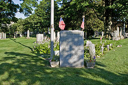
, Shady Beach, Veterans Memorial Park, Ludlow Park, Taylor Farm, Liberty Square, and the East Norwalk Historical Cemetery (burial location of Thomas Fitch).
Veterans Memorial Park
Veterans Memorial Park, often called "Veterans Park" (there is no apostrophe in the name) is a large open space on a peninsula which sticks out into Norwalk Harbor south of Fort Point Street and Seaview Avenue just to the east of South Norwalk. It contains baseball fields (last refurbished in the 1980s), a boat launch and a large open field. The Norwalk Oyster Festival is held on the site each year.The park sits on a former dump but has never been environmentally tested, and no one knows what chemicals or substances have been leaching or oozing out of the park. Dumping continued until the 1960s. In nearby Stamford, Connecticut
Stamford, Connecticut
Stamford is a city in Fairfield County, Connecticut, United States. According to the 2010 census, the population of the city is 122,643, making it the fourth largest city in the state and the eighth largest city in New England...
a similar dump, which operated until the 1970s, was also closed and turned into a park (Koskiuszko Park), but when contaminated soil was discovered in 2002, the park was closed and not opened again until the spring of 2007 after more than $1 million was spent on remediation work. Unlike the Stamford dump, Veterans Park was created before the state Department of Environmental Protection had a permitting process for old dumps, so DEP jurisdiction is unclear.
Culture & Fairs
East Norwalk is home to the annual Norwalk Oyster Festival, located in Veterans Memorial Park, the annual 4th of JulyIndependence Day (United States)
Independence Day, commonly known as the Fourth of July, is a federal holiday in the United States commemorating the adoption of the Declaration of Independence on July 4, 1776, declaring independence from the Kingdom of Great Britain...
fireworks display at Calf Pasture Beach, and the Memorial Day
Memorial Day
Memorial Day is a United States federal holiday observed on the last Monday of May. Formerly known as Decoration Day, it originated after the American Civil War to commemorate the fallen Union soldiers of the Civil War...
parade, which begins in Veterans Park.
Transportation
East Norwalk is located immediately south of Exit 16 of the Connecticut TurnpikeConnecticut Turnpike
The Connecticut Turnpike, known now as the Governor John Davis Lodge Turnpike, is a freeway in Connecticut that runs from Greenwich to Killingly. It is signed as Interstate 95 from the New York state line at Greenwich to East Lyme, and then as Interstate 395 from East Lyme to Plainfield...
. The neighborhood is served by the East Norwalk Metro North station
East Norwalk (Metro-North station)
The East Norwalk Metro-North Railroad station is one of three New Haven Line stations serving the residents of Norwalk, Connecticut. It is located in the neighborhood of East Norwalk, from which it derives its name....
and the Norwalk Wheels Bus
Norwalk Transit District
The Norwalk Transit District is the primary provider of public transportation services in Norwalk, Connecticut and surrounding communities. The district's fixed-route bus transit system, known as WHEELS, is the primary service of the system linking Norwalk and its immediate suburbs as well as...
Line #8.
External links
- Eastern Norwalk Neighborhood Association
- East Norwalk Improvement Association (website for the East Norwalk Library)
- Marvin Elementary School
- Shorehaven Golf Club
- Third Taxing District website for the municipally owned electric utility company that provides power to East Norwalk
- Norwalk Veteran's Memorial Committee organize the Memorial Day Parade that starts in Veterans Park