
Duntroon, New Zealand
Encyclopedia
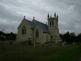
Duntroon is a small farming town in the Waitaki District
of New Zealand
's South Island
. Although traditionally considered a North Otago
town, it is presently officially located within the farthest southern reaches of Canterbury
. Just north of the town is the Waitaki River
that forms the traditional border between the two regions, although the official border has now been moved south to put most of Waitaki District within Canterbury, including Duntroon. To the east of the village is the Maerewhenua River
. Near the village are the Earthquakes, a limestone
cliff
formation.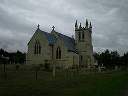 The 2001 census
recorded Duntroon as having a population of 120, consisting of 69 females and 51 males, an increase of 3 people or 2.6% since the 1996 census. By the 2006 census the population had declined to 114. The town was named by Scottish
settler and farmer Robert Campbell. Economic activity has been mainly agricultural for much of the town's history, focusing primarily on sheep farming and the growth of crops
such as wheat
and barley
.
Duntroon is home to the Vanished World Heritage Centre, dedicated to showcasing the geology of the Waitaki region and preserving fossil
s of extinct species that have been found in the region. These include two species of the penguin
genus
Archaeospheniscus
, Lowe's penguin
and Lopdell's penguin
. The town is also located near two sites of centuries-old Māori rock drawings.
railway that ultimately became the Kurow Branch
, and was one of the few towns to be served by a railway station for the entire life of the line (most others were closed earlier than the line itself). In 1875, the railway from the junction with the Main South Line
at Pukeuri
was opened to Duntroon, but due to bridging difficulties, the line actually terminated outside Duntroon on the east side of the Maerewhenua River. In 1878, construction began on another line from Duntroon to Kurow
; on 2 July 1881, the Maerewhenua River was finally bridged and Duntroon proper was linked to the national railway network
; on 7 November 1881, the line beyond Duntroon opened and the town lost its status as terminus. The railway served the town for over a century, closing in mid-1983, and the old railway station now serves as a community crafts centre. Near the station building, an old water tank
for steam locomotive
s still stands in good condition.
Duntroon will be on the route of the Alps to Ocean Cycle Trail
, to be constructed in the following years after approval in 2010.
Waitaki District
The Waitaki district, in the Canterbury and Otago regions of New Zealand, straddles the traditional border between the two regions, the Waitaki River. It has a land area of 7,151.94 km² , divided 59.28% to Canterbury Region and 40.72% to Otago Region. It is the only district on the South...
of New Zealand
New Zealand
New Zealand is an island country in the south-western Pacific Ocean comprising two main landmasses and numerous smaller islands. The country is situated some east of Australia across the Tasman Sea, and roughly south of the Pacific island nations of New Caledonia, Fiji, and Tonga...
's South Island
South Island
The South Island is the larger of the two major islands of New Zealand, the other being the more populous North Island. It is bordered to the north by Cook Strait, to the west by the Tasman Sea, to the south and east by the Pacific Ocean...
. Although traditionally considered a North Otago
North Otago
The district of North Otago in New Zealand covers the area of Otago between Shag Point and the Waitaki River, and extends inland to the west as far as the village of Omarama . The large east-coast town of Oamaru serves as North Otago's main centre...
town, it is presently officially located within the farthest southern reaches of Canterbury
Canterbury, New Zealand
The New Zealand region of Canterbury is mainly composed of the Canterbury Plains and the surrounding mountains. Its main city, Christchurch, hosts the main office of the Christchurch City Council, the Canterbury Regional Council - called Environment Canterbury - and the University of Canterbury.-...
. Just north of the town is the Waitaki River
Waitaki River
The Waitaki River is a large river in the South Island of New Zealand, some 110 km long. It is the major river of the Mackenzie Basin.It is a braided river which flows through Lake Benmore, Lake Aviemore and Lake Waitaki. These are ultimately fed by three large glacial lakes, Pukaki, Tekapo,...
that forms the traditional border between the two regions, although the official border has now been moved south to put most of Waitaki District within Canterbury, including Duntroon. To the east of the village is the Maerewhenua River
Maerewhenua River
The Maerewhenua River, also known as the Marewhenua River, is a small river in the Otago region of New Zealand's South Island. It is located in North Otago and acts as a tributary of the Waitaki River, which forms the border between Otago and Canterbury....
. Near the village are the Earthquakes, a limestone
Limestone
Limestone is a sedimentary rock composed largely of the minerals calcite and aragonite, which are different crystal forms of calcium carbonate . Many limestones are composed from skeletal fragments of marine organisms such as coral or foraminifera....
cliff
Cliff
In geography and geology, a cliff is a significant vertical, or near vertical, rock exposure. Cliffs are formed as erosion landforms due to the processes of erosion and weathering that produce them. Cliffs are common on coasts, in mountainous areas, escarpments and along rivers. Cliffs are usually...
formation.
Census
A census is the procedure of systematically acquiring and recording information about the members of a given population. It is a regularly occurring and official count of a particular population. The term is used mostly in connection with national population and housing censuses; other common...
recorded Duntroon as having a population of 120, consisting of 69 females and 51 males, an increase of 3 people or 2.6% since the 1996 census. By the 2006 census the population had declined to 114. The town was named by Scottish
Scotland
Scotland is a country that is part of the United Kingdom. Occupying the northern third of the island of Great Britain, it shares a border with England to the south and is bounded by the North Sea to the east, the Atlantic Ocean to the north and west, and the North Channel and Irish Sea to the...
settler and farmer Robert Campbell. Economic activity has been mainly agricultural for much of the town's history, focusing primarily on sheep farming and the growth of crops
Crop (agriculture)
A crop is a non-animal species or variety that is grown to be harvested as food, livestock fodder, fuel or for any other economic purpose. Major world crops include maize , wheat, rice, soybeans, hay, potatoes and cotton. While the term "crop" most commonly refers to plants, it can also include...
such as wheat
Wheat
Wheat is a cereal grain, originally from the Levant region of the Near East, but now cultivated worldwide. In 2007 world production of wheat was 607 million tons, making it the third most-produced cereal after maize and rice...
and barley
Barley
Barley is a major cereal grain, a member of the grass family. It serves as a major animal fodder, as a base malt for beer and certain distilled beverages, and as a component of various health foods...
.
Duntroon is home to the Vanished World Heritage Centre, dedicated to showcasing the geology of the Waitaki region and preserving fossil
Fossil
Fossils are the preserved remains or traces of animals , plants, and other organisms from the remote past...
s of extinct species that have been found in the region. These include two species of the penguin
Penguin
Penguins are a group of aquatic, flightless birds living almost exclusively in the southern hemisphere, especially in Antarctica. Highly adapted for life in the water, penguins have countershaded dark and white plumage, and their wings have become flippers...
genus
Genus
In biology, a genus is a low-level taxonomic rank used in the biological classification of living and fossil organisms, which is an example of definition by genus and differentia...
Archaeospheniscus
Archaeospheniscus
Archaeospheniscus is an extinct genus of large penguins. It currently contains three species, known from somewhat fragmentary remains. A...
, Lowe's penguin
Archaeospheniscus lowei
Lowe's Penguin is the type species of the extinct penguin genus Archaeospheniscus. It stood approximately 85-115 cm high, between a modern King Penguin and an Emperor Penguin in size...
and Lopdell's penguin
Archaeospheniscus lopdelli
Lopdell's Penguin was the largest species of the extinct penguin genus Archaeospheniscus, standing about 90-120 cm high, or somewhat less than the extant Emperor Penguin. It is only known from bones of a single individual which was found in the Late Oligocene Kokoamu Greensand Formation at...
. The town is also located near two sites of centuries-old Māori rock drawings.
Transport
Duntroon was once the terminus of the branch lineBranch line
A branch line is a secondary railway line which branches off a more important through route, usually a main line. A very short branch line may be called a spur line...
railway that ultimately became the Kurow Branch
Kurow Branch
The Kurow Branch was a branch line railway that formed part of New Zealand's national rail network...
, and was one of the few towns to be served by a railway station for the entire life of the line (most others were closed earlier than the line itself). In 1875, the railway from the junction with the Main South Line
Main South Line
The Main South Line, sometimes referred to as part of the South Island Main Trunk Railway, is a railroad line that runs north and south from Lyttelton in New Zealand through Christchurch and along the east coast of the South Island to Invercargill via Dunedin...
at Pukeuri
Pukeuri
Pukeuri is a settlement to the north of Oamaru in the North Otago region of New Zealand's South Island. It is located near the coast in the Waitaki District that straddles the border of Otago and Canterbury...
was opened to Duntroon, but due to bridging difficulties, the line actually terminated outside Duntroon on the east side of the Maerewhenua River. In 1878, construction began on another line from Duntroon to Kurow
Kurow
Kurow is a town in the Waitaki Valley in the South Island of New Zealand, 55 kilometres inland from OamaruThe name of the town is an Anglicised form of the name of the nearby mountain Te Kohurau....
; on 2 July 1881, the Maerewhenua River was finally bridged and Duntroon proper was linked to the national railway network
Rail transport in New Zealand
Rail transport in New Zealand consists of a network of gauge railway lines in both the North and South Islands. Rail services are focused primarily on freight, particularly bulk freight, with limited passenger services on some lines...
; on 7 November 1881, the line beyond Duntroon opened and the town lost its status as terminus. The railway served the town for over a century, closing in mid-1983, and the old railway station now serves as a community crafts centre. Near the station building, an old water tank
Water tank
A Water tank is a container for storing water. The need for a water tank is as old as civilized man, providing storage of water for drinking water, irrigation agriculture, fire suppression, agricultural farming, both for plants and livestock, chemical manufacturing, food preparation as well as many...
for steam locomotive
Steam locomotive
A steam locomotive is a railway locomotive that produces its power through a steam engine. These locomotives are fueled by burning some combustible material, usually coal, wood or oil, to produce steam in a boiler, which drives the steam engine...
s still stands in good condition.
Duntroon will be on the route of the Alps to Ocean Cycle Trail
Alps to Ocean Cycle Trail
The Alps to Ocean Cycle Trail is a cycle trail funded as one of the projects of the New Zealand Cycle Trail system in Otago and Canterbury, New Zealand...
, to be constructed in the following years after approval in 2010.