
Devil's Bit
Encyclopedia
The Devil's Bit is a mountain
in North Tipperary
, Ireland
which is 478m (1570 feet) above sea level at its highest elevation. It lies to the north-west of the town of Templemore
. The mountain is usually ascended via the village of Barnane
. There is a car park at the base near the village.
took a bite out of it. There is a small gap in the mountain between one outcrop of rock (known as the Rock) and another small plateau. The bite the devil allegedly took made this gap. The legend suggests that the devil broke his teeth taking this bite and the Rock of Cashel
fell from his mouth to where it now stands.
The Book of Dimma was supposedly discovered in a cave on the mountain in 1789. It is an illuminated manuscript copy of the four Gospels and was written in the monastery of St. Cronan in Roscrea some time during the 6th century. According to legend, Cronan ordered his scribe Dimma to produce the manuscript before sunset on that day. He then used miraculous powers to ensure that the sun did not set for forty days, and Dimma spent all of this period completing the manuscript without feeling the need to eat or sleep. The manuscript disappeared following the dissolution of the monasteries in the 16th century. There is some debate about whether or not the manuscript was actually found on the Devil's Bit amid claims that it could not have survived without damage in an outdoor environment for over two centuries. The Book of Dimma is currently housed in the library of Trinity College Dublin .
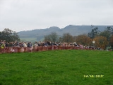
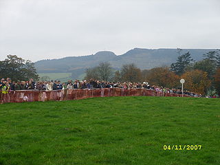
The mountain was the scene of a mass anti-tithe meeting on July 25th 1832. The meeting was part of a wider campaign of resistance to the payment of tithes (one-tenth of the value of arable produce) to the Church of Ireland by the majority Catholic population. According to press reports of the time, over 50,000 people attended, many coming from as far away as Co. Galway, although the attendance would have been larger had there not been confusion about whether or not the meeting was cancelled . Although local folklore states that Daniel O' Connell attended the meeting, it is almost certain that he was not present as he was attending parliamentary debates in Westminster at the time. A semi-fictional account of the meeting was given by Samuel Lover in Legends and Stories of Ireland (1834), where he refers to a mock 'burial' of the tithes by local peasantry.
The tower on the approach to the summit is known as Carden's Folly
. The Cardens were an Anglo-Irish aristocratic family who arrived in Ireland during the seventeenth century. They purchased estates in Templemore and Barnane and became the principal landlords in the area in subsequent centuries. The most notable Carden was undoubtedly John Rutter Carden (1811-1866), better known as 'Woodcock', so-called by irate tenants because he was as difficult to shoot as the bird of that name. As well as constructing the folly, he built a magnificent family home on the lower slopes of the mountain. Although the house was demolished in the early 20th century, the ruins of the walled garden can still be seen. In 1854, 'Woodcock' made a notorious attempt to kidnap a lady, Ms. Eleanor Arbuthnot, with whom he had become obsessed. A detailed history of the Carden family has been published by a descendent, Arthur Eustace Carden.
A cross was erected on the Rock in 1953-1954 in celebration of the Marian Year dedicated by the Roman Catholic Church. A committee was formed and planning of the work began in early 1953 and construction began in September of that year. The Cross was officially blessed by the Archbishop of Cashel and Emly, Most Rev. Dr. Jeremiah Kinane, on Sunday, August 22nd 1954. The cross stands 45 feet high and has a span of 25 feet. The base of 340 tons is 5 feet squared and 10 feet deep. Work was carried out by Duggan Bros. contractors of Templemore and the total cost was approximately IR£2,000. The cross is presently illuminated at night. Holy Mass is celebrated at the base of the Rock each year on Rock Sunday. A statue of the Virgin Mary was erected in 1988 on the eastern side of the Rock.
A 1980 article in the journal Nature
described the finding on the mountain of the earliest record of a fossil flora containing Cooksonia
-type sporangia
.
The Devil's Bit offers expansive views of the surrounding countryside. When the cross was erected, it was said that nine counties can be viewed from the summit - Tipperary itself, Clare
, Cork
, Galway
, Kilkenny
, Laois
, Limerick
, Offaly
, and Waterford
. There is doubt as to whether any part of County Cork is actually visible. One can see the Knockmealdown
and Comeragh Mountains
in Waterford, along with the Galtees, and, to the north-west, Lough Derg and the River Shannon
.
The triangulation station which marks the highest point of the mountain is on the 'Long Rock' which lies to the east of the Gap. The Long Rock can be climbed if one passes through the Gap and follows the pathway to the right.
There is a military firing range on the western slopes of the mountain.
.
Mountain
Image:Himalaya_annotated.jpg|thumb|right|The Himalayan mountain range with Mount Everestrect 58 14 160 49 Chomo Lonzorect 200 28 335 52 Makalurect 378 24 566 45 Mount Everestrect 188 581 920 656 Tibetan Plateaurect 250 406 340 427 Rong River...
in North Tipperary
North Tipperary
North Tipperary is a county in Ireland. It is part of the Mid-West Region and is also located in the province of Munster. It is named after the town of Tipperary and consists of 48% of the land area of the traditional county of Tipperary. The county was established in 1898 and has had a county...
, Ireland
Republic of Ireland
Ireland , described as the Republic of Ireland , is a sovereign state in Europe occupying approximately five-sixths of the island of the same name. Its capital is Dublin. Ireland, which had a population of 4.58 million in 2011, is a constitutional republic governed as a parliamentary democracy,...
which is 478m (1570 feet) above sea level at its highest elevation. It lies to the north-west of the town of Templemore
Templemore
Templemore is a town in North Tipperary, Ireland. It is a civil parish in the historical barony of Eliogarty. It is part of the Roman Catholic parish of Templemore, Clonmore and Killea....
. The mountain is usually ascended via the village of Barnane
Barnane
Barnane is a townsland in North Tipperary in Ireland. It is in the civil parish of Barnane-Ely in the barony of Ikerrin. It is also part of the Roman Catholic Ecclesiastical parish of Drom and Inch. Although Barnane itself has not claimed allegiance, religious or otherwise, to either.-Location:It...
. There is a car park at the base near the village.
History
According to local legend, the mountain got its name because the devilDevil
The Devil is believed in many religions and cultures to be a powerful, supernatural entity that is the personification of evil and the enemy of God and humankind. The nature of the role varies greatly...
took a bite out of it. There is a small gap in the mountain between one outcrop of rock (known as the Rock) and another small plateau. The bite the devil allegedly took made this gap. The legend suggests that the devil broke his teeth taking this bite and the Rock of Cashel
Rock of Cashel
The Rock of Cashel , also known as Cashel of the Kings and St. Patrick's Rock, is a historic site in Ireland's province of Munster, located at Cashel, South Tipperary.-History:...
fell from his mouth to where it now stands.
The Book of Dimma was supposedly discovered in a cave on the mountain in 1789. It is an illuminated manuscript copy of the four Gospels and was written in the monastery of St. Cronan in Roscrea some time during the 6th century. According to legend, Cronan ordered his scribe Dimma to produce the manuscript before sunset on that day. He then used miraculous powers to ensure that the sun did not set for forty days, and Dimma spent all of this period completing the manuscript without feeling the need to eat or sleep. The manuscript disappeared following the dissolution of the monasteries in the 16th century. There is some debate about whether or not the manuscript was actually found on the Devil's Bit amid claims that it could not have survived without damage in an outdoor environment for over two centuries. The Book of Dimma is currently housed in the library of Trinity College Dublin .
The mountain was the scene of a mass anti-tithe meeting on July 25th 1832. The meeting was part of a wider campaign of resistance to the payment of tithes (one-tenth of the value of arable produce) to the Church of Ireland by the majority Catholic population. According to press reports of the time, over 50,000 people attended, many coming from as far away as Co. Galway, although the attendance would have been larger had there not been confusion about whether or not the meeting was cancelled . Although local folklore states that Daniel O' Connell attended the meeting, it is almost certain that he was not present as he was attending parliamentary debates in Westminster at the time. A semi-fictional account of the meeting was given by Samuel Lover in Legends and Stories of Ireland (1834), where he refers to a mock 'burial' of the tithes by local peasantry.
The tower on the approach to the summit is known as Carden's Folly
Folly
In architecture, a folly is a building constructed primarily for decoration, but either suggesting by its appearance some other purpose, or merely so extravagant that it transcends the normal range of garden ornaments or other class of building to which it belongs...
. The Cardens were an Anglo-Irish aristocratic family who arrived in Ireland during the seventeenth century. They purchased estates in Templemore and Barnane and became the principal landlords in the area in subsequent centuries. The most notable Carden was undoubtedly John Rutter Carden (1811-1866), better known as 'Woodcock', so-called by irate tenants because he was as difficult to shoot as the bird of that name. As well as constructing the folly, he built a magnificent family home on the lower slopes of the mountain. Although the house was demolished in the early 20th century, the ruins of the walled garden can still be seen. In 1854, 'Woodcock' made a notorious attempt to kidnap a lady, Ms. Eleanor Arbuthnot, with whom he had become obsessed. A detailed history of the Carden family has been published by a descendent, Arthur Eustace Carden.
A cross was erected on the Rock in 1953-1954 in celebration of the Marian Year dedicated by the Roman Catholic Church. A committee was formed and planning of the work began in early 1953 and construction began in September of that year. The Cross was officially blessed by the Archbishop of Cashel and Emly, Most Rev. Dr. Jeremiah Kinane, on Sunday, August 22nd 1954. The cross stands 45 feet high and has a span of 25 feet. The base of 340 tons is 5 feet squared and 10 feet deep. Work was carried out by Duggan Bros. contractors of Templemore and the total cost was approximately IR£2,000. The cross is presently illuminated at night. Holy Mass is celebrated at the base of the Rock each year on Rock Sunday. A statue of the Virgin Mary was erected in 1988 on the eastern side of the Rock.
A 1980 article in the journal Nature
Nature (journal)
Nature, first published on 4 November 1869, is ranked the world's most cited interdisciplinary scientific journal by the Science Edition of the 2010 Journal Citation Reports...
described the finding on the mountain of the earliest record of a fossil flora containing Cooksonia
Cooksonia
Cooksonia is an extinct grouping of primitive land plants. The earliest Cooksonia date from the middle of the Silurian ; the group continues to be an important component of the flora until the Early Devonian, a total time span of...
-type sporangia
Sporangium
A sporangium is an enclosure in which spores are formed. It can be composed of a single cell or can be multicellular. All plants, fungi, and many other lineages form sporangia at some point in their life cycle...
.
Topography
The southwestern extremity of the Slieve Bloom range just touches Tipperary at Roscrea. The valley in which Roscrea stands separates this end of Slieve Bloom from the Devil's Bit range, which begins immediately south of the town and runs southwest. This mountain has a singular gap in its contour (very conspicuous from the railway), from which it was formerly called Barnane-Ely, i.e., the gapped mountain of Ely (the old territory in which it was situated), which is still the name of the parish. The other chief summits are Kilduff Mountain (1,462 feet), Borrisnoe (1,471 feet), and Benduff (1,399 feet), all near Devil's Bit in a line to the northwest; and 4 miles southwest of Devil's Bit, Knockanora (1,429 feet) and Latteragh (1,257 feet).The Devil's Bit offers expansive views of the surrounding countryside. When the cross was erected, it was said that nine counties can be viewed from the summit - Tipperary itself, Clare
County Clare
-History:There was a Neolithic civilisation in the Clare area — the name of the peoples is unknown, but the Prehistoric peoples left evidence behind in the form of ancient dolmen; single-chamber megalithic tombs, usually consisting of three or more upright stones...
, Cork
County Cork
County Cork is a county in Ireland. It is located in the South-West Region and is also part of the province of Munster. It is named after the city of Cork . Cork County Council is the local authority for the county...
, Galway
County Galway
County Galway is a county in Ireland. It is located in the West Region and is also part of the province of Connacht. It is named after the city of Galway. Galway County Council is the local authority for the county. There are several strongly Irish-speaking areas in the west of the county...
, Kilkenny
County Kilkenny
County Kilkenny is a county in Ireland. It is part of the South-East Region and is also located in the province of Leinster. It is named after the city of Kilkenny. The territory of the county was the core part of the ancient Irish Kingdom of Osraige which in turn was the core of the Diocese of...
, Laois
County Laois
County Laois is a county in Ireland. It is part of the Midlands Region and is also located in the province of Leinster. It was formerly known as Queen's County until the establishment of the Irish Free State in 1922. The county's name was formerly spelt as Laoighis and Leix. Laois County Council...
, Limerick
County Limerick
It is thought that humans had established themselves in the Lough Gur area of the county as early as 3000 BC, while megalithic remains found at Duntryleague date back further to 3500 BC...
, Offaly
County Offaly
County Offaly is a county in Ireland. It is part of the Midlands Region and is also located in the province of Leinster. It is named after the ancient Kingdom of Uí Failghe and was formerly known as King's County until the establishment of the Irish Free State in 1922. Offaly County Council is...
, and Waterford
County Waterford
*Abbeyside, Affane, Aglish, Annestown, An Rinn, Ardmore*Ballinacourty, Ballinameela, Ballinamult, Ballinroad, Ballybeg, Ballybricken, Ballyduff Lower, Ballyduff Upper, Ballydurn, Ballygunner, Ballylaneen, Ballymacarbry, Ballymacart, Ballynaneashagh, Ballysaggart, Ballytruckle, Bilberry, Bunmahon,...
. There is doubt as to whether any part of County Cork is actually visible. One can see the Knockmealdown
Knockmealdown Mountains
The Knockmealdown Mountains are a mountain range located on the border of counties South Tipperary and Waterford in Ireland, running east and west between the two counties. The highest peak of the range is Knockmealdown, situated in County Waterford...
and Comeragh Mountains
Comeragh Mountains
The Comeragh Mountains are a glaciated mountain range situated in the south east of Ireland in County Waterford. They are located between the town of Clonmel on the County Tipperary border and the villages of Kilrossanty and Kilmacthomas in County Waterford.The twelve mountains which form the...
in Waterford, along with the Galtees, and, to the north-west, Lough Derg and the River Shannon
River Shannon
The River Shannon is the longest river in Ireland at . It divides the west of Ireland from the east and south . County Clare, being west of the Shannon but part of the province of Munster, is the major exception...
.
The triangulation station which marks the highest point of the mountain is on the 'Long Rock' which lies to the east of the Gap. The Long Rock can be climbed if one passes through the Gap and follows the pathway to the right.
There is a military firing range on the western slopes of the mountain.
See also
This article is about an Irish mountain. For the plant of the same name, see Succisa pratensisSuccisa
Succisa is a genus of flowering plants in the Dipsacaceae family.Species include the Devil's bit scabious, Succisa pratensis....
.