
Davao River
Encyclopedia
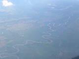
The Davao River catchment
is the third largest river catchment on the Southern Philippines
Island of Mindanao
. It drains an area of over 1700 km² with a river length of 160 km. Most of the area is uplands. Average flows within the river near to the mouth are estimated at 70-80 cubic meters per second. The climate type is relatively uniform throughout the year with evenly distributed rainfall and temperature
s and humidity (rainfall = 2600mm, Actual Evap 1028mm). The area rarely experiences typhoons.
Intermediate Upland:
Hills and Mountains:
and landcover within the basin is highly diverse. Ranging from lowland urban, agricultural, wetland and mangrove
to natural riparian, plantations, upland agriculture and mountainous forest including primary forest. The area is classified by DENR as 77.5% forestlands and 22.5% alienable and disposable land. This is not a true land uses (or land cover) classification. Detailed land use is not available. Information is available from several sources including the Comprehensive Land Use Plan of the City, however this data is as yet theoretical and does not represent the realities or suitability of land at the barangay (lowest tier of local government) level. However the City Planning Office is collecting and digitizing data for land use maps.
The main drinking water
sources for Davao City are in the neighboring Talomo watershed. These sources are under pressure and the Davao River Basin is likely to be required for water abstraction in the near future.
The Environmental Management Bureau samples 8 sites from the confluence of the Tamugan river downsteam to the mouth of the river. From the Tamugan River confluence with the Davao River down stream to DDF Subdivision, Mandug the water is classified as Class A – Public Water Supply Class II. Downstream of this point to the sea is classified as Class B or recreational water class I. Analyses for dissolved oxygen over the past 4 years has indicated no significant change in quality. The current monitoring of water quality is insufficient to monitor and evaluate pollution levels and trends in the river.
Drainage basin
A drainage basin is an extent or an area of land where surface water from rain and melting snow or ice converges to a single point, usually the exit of the basin, where the waters join another waterbody, such as a river, lake, reservoir, estuary, wetland, sea, or ocean...
is the third largest river catchment on the Southern Philippines
Philippines
The Philippines , officially known as the Republic of the Philippines , is a country in Southeast Asia in the western Pacific Ocean. To its north across the Luzon Strait lies Taiwan. West across the South China Sea sits Vietnam...
Island of Mindanao
Mindanao
Mindanao is the second largest and easternmost island in the Philippines. It is also the name of one of the three island groups in the country, which consists of the island of Mindanao and smaller surrounding islands. The other two are Luzon and the Visayas. The island of Mindanao is called The...
. It drains an area of over 1700 km² with a river length of 160 km. Most of the area is uplands. Average flows within the river near to the mouth are estimated at 70-80 cubic meters per second. The climate type is relatively uniform throughout the year with evenly distributed rainfall and temperature
Temperature
Temperature is a physical property of matter that quantitatively expresses the common notions of hot and cold. Objects of low temperature are cold, while various degrees of higher temperatures are referred to as warm or hot...
s and humidity (rainfall = 2600mm, Actual Evap 1028mm). The area rarely experiences typhoons.
Stats
- River Length: 150 km
- Maximum Elevation: 1875m
- Rainfall Average: Mean annual rainfall is 1800mm. Rainfall is evenly distributed throughout the year.
Topography/Soil Type
Plains and Valley: Parent Material:- San Maguel Silty Clay Loam: AlluviumAlluviumAlluvium is loose, unconsolidated soil or sediments, eroded, deposited, and reshaped by water in some form in a non-marine setting. Alluvium is typically made up of a variety of materials, including fine particles of silt and clay and larger particles of sand and gravel...
of igneous - Matina Clay Loam : Alluvium from limestoneLimestoneLimestone is a sedimentary rock composed largely of the minerals calcite and aragonite, which are different crystal forms of calcium carbonate . Many limestones are composed from skeletal fragments of marine organisms such as coral or foraminifera....
, shaleShaleShale is a fine-grained, clastic sedimentary rock composed of mud that is a mix of flakes of clay minerals and tiny fragments of other minerals, especially quartz and calcite. The ratio of clay to other minerals is variable. Shale is characterized by breaks along thin laminae or parallel layering...
and sandstoneSandstoneSandstone is a sedimentary rock composed mainly of sand-sized minerals or rock grains.Most sandstone is composed of quartz and/or feldspar because these are the most common minerals in the Earth's crust. Like sand, sandstone may be any colour, but the most common colours are tan, brown, yellow,...
s
Intermediate Upland:
- Tugbok Clay: Igneous rockIgneous rockIgneous rock is one of the three main rock types, the others being sedimentary and metamorphic rock. Igneous rock is formed through the cooling and solidification of magma or lava...
AndesiteAndesiteAndesite is an extrusive igneous, volcanic rock, of intermediate composition, with aphanitic to porphyritic texture. In a general sense, it is the intermediate type between basalt and dacite. The mineral assemblage is typically dominated by plagioclase plus pyroxene and/or hornblende. Magnetite,...
s - Faraon Clay: Soft CorallineCorallineCoralline means "resembling coral" and may refer to:* Coralline algae, whose fronds are covered with calcareous deposits.* Coralline rock, formed by the death of layers of coralline algae.* Sclerosponges, sometimes called "coralline sponges"....
limestone - Cabantain Clay: Soft shales with mix of weathered gravels and pebbles
Hills and Mountains:
- Camansa sandy clay loam: Shale and sandstone with weathered gravel and sand
- Mountain Soils: undifferentiated : Various igneous and metamorphic rockMetamorphic rockMetamorphic rock is the transformation of an existing rock type, the protolith, in a process called metamorphism, which means "change in form". The protolith is subjected to heat and pressure causing profound physical and/or chemical change...
Demographic properties
- DRW Population: ~ 800,000
- Average per capita income: 144,039 per family per annum (2000 National average)
- Industrial and agricultural Gross Domestic Product: 64.1 Billion Peso for Region XI
- Population Below Poverty Line: 45% in rural areas ; 27% in urban areas (for southern Mindanao)
- Water Poverty Index parameters: Medium (WPI 56-61.9).
Land uses
The landformLandform
A landform or physical feature in the earth sciences and geology sub-fields, comprises a geomorphological unit, and is largely defined by its surface form and location in the landscape, as part of the terrain, and as such, is typically an element of topography...
and landcover within the basin is highly diverse. Ranging from lowland urban, agricultural, wetland and mangrove
Mangrove
Mangroves are various kinds of trees up to medium height and shrubs that grow in saline coastal sediment habitats in the tropics and subtropics – mainly between latitudes N and S...
to natural riparian, plantations, upland agriculture and mountainous forest including primary forest. The area is classified by DENR as 77.5% forestlands and 22.5% alienable and disposable land. This is not a true land uses (or land cover) classification. Detailed land use is not available. Information is available from several sources including the Comprehensive Land Use Plan of the City, however this data is as yet theoretical and does not represent the realities or suitability of land at the barangay (lowest tier of local government) level. However the City Planning Office is collecting and digitizing data for land use maps.
Water resources and uses in the basin
River discharge measurements taken from 1984 to 1990 indicated an average river flow of approximately 78 cubic meters per second for the period.The main drinking water
Drinking water
Drinking water or potable water is water pure enough to be consumed or used with low risk of immediate or long term harm. In most developed countries, the water supplied to households, commerce and industry is all of drinking water standard, even though only a very small proportion is actually...
sources for Davao City are in the neighboring Talomo watershed. These sources are under pressure and the Davao River Basin is likely to be required for water abstraction in the near future.
The Environmental Management Bureau samples 8 sites from the confluence of the Tamugan river downsteam to the mouth of the river. From the Tamugan River confluence with the Davao River down stream to DDF Subdivision, Mandug the water is classified as Class A – Public Water Supply Class II. Downstream of this point to the sea is classified as Class B or recreational water class I. Analyses for dissolved oxygen over the past 4 years has indicated no significant change in quality. The current monitoring of water quality is insufficient to monitor and evaluate pollution levels and trends in the river.