

Damascus, Ohio
Encyclopedia
Census-designated place
A census-designated place is a concentration of population identified by the United States Census Bureau for statistical purposes. CDPs are delineated for each decennial census as the statistical counterparts of incorporated places such as cities, towns and villages...
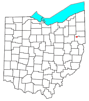
(CDP) in southwestern Goshen Township
Goshen Township, Mahoning County, Ohio
Goshen Township is one of the fourteen townships of Mahoning County, Ohio, United States. The 2000 census found 3,281 people in the township.-Geography:Located in the southwestern part of the county, it borders the following townships:...
in Mahoning County and northwestern Butler Township
Butler Township, Columbiana County, Ohio
Butler Township is one of the eighteen townships of Columbiana County, Ohio, United States. The 2000 census found 3,444 people in the township.-Geography:Located in the northwestern part of the county, it borders the following townships:...
in Columbiana County
Columbiana County, Ohio
Columbiana County is a county located in the U.S. state of Ohio. As of 2010, the population was 107,841. It is named for Christopher Columbus and the county seat is Lisbon....
in the U.S. state
U.S. state
A U.S. state is any one of the 50 federated states of the United States of America that share sovereignty with the federal government. Because of this shared sovereignty, an American is a citizen both of the federal entity and of his or her state of domicile. Four states use the official title of...
of Ohio
Ohio
Ohio is a Midwestern state in the United States. The 34th largest state by area in the U.S.,it is the 7th‑most populous with over 11.5 million residents, containing several major American cities and seven metropolitan areas with populations of 500,000 or more.The state's capital is Columbus...
. Although it is unincorporated, it has a post office
Post office
A post office is a facility forming part of a postal system for the posting, receipt, sorting, handling, transmission or delivery of mail.Post offices offer mail-related services such as post office boxes, postage and packaging supplies...
, with the ZIP code
ZIP Code
ZIP codes are a system of postal codes used by the United States Postal Service since 1963. The term ZIP, an acronym for Zone Improvement Plan, is properly written in capital letters and was chosen to suggest that the mail travels more efficiently, and therefore more quickly, when senders use the...
of 44619. Its elevation is 1,211 feet (369 m), and it is located at 40°54′7"N 80°57′18"W (40.9020031, -80.9550891). The community lies at the intersection of U.S. Route 62
U.S. Route 62
U.S. Route 62 runs from the US-Mexico border at El Paso, Texas to Niagara Falls, New York, near the United States-Canada border. It is the only east-west US Route that connects Mexico and Canada.Parts of U.S...
and State Routes 173
Ohio State Route 173
State Route 173 is located in northeastern Ohio, and runs east–west from State Route 44, about north of Louisville, Ohio to State Route 14 and State Route 9 in downtown Salem, Ohio. It primarily passes through Stark and Columbiana counties, though it also straddles the county line between...
and 534
Ohio State Route 534
State Route 534 is a north–south state highway in the northeastern portion of the U.S. state of Ohio. The southern terminus of SR 534 is at its junction with the duplex of U.S. Route 62 and SR 173 nearly west of Salem...
.
The Mahoning County portion of Damascus is part of the Youngstown
Youngstown, Ohio
Youngstown is a city in the U.S. state of Ohio and the county seat of Mahoning County; it also extends into Trumbull County. The municipality is situated on the Mahoning River, approximately southeast of Cleveland and northwest of Pittsburgh, Pennsylvania...
–Warren
Warren, Ohio
As of the census of 2000, there were 46,832 people, 19,288 households and 12,035 families residing in the city. The population density was 2,912.4 people per square mile . There were 21,279 housing units at an average density of 1,322.9 per square mile...
–Boardman
Boardman, Ohio
Boardman is a census-designated place in Boardman Township, Mahoning County, Ohio, United States, just south of Youngstown. Boardman is considered to be a moderately affluent community and is one of two major retail hubs in the greater Youngstown area...
, OH-PA
Pennsylvania
The Commonwealth of Pennsylvania is a U.S. state that is located in the Northeastern and Mid-Atlantic regions of the United States. The state borders Delaware and Maryland to the south, West Virginia to the southwest, Ohio to the west, New York and Ontario, Canada, to the north, and New Jersey to...
Metropolitan Statistical Area
Youngstown-Warren-Boardman, OH-PA Metropolitan Area
The Youngstown Metropolitan Area is a metropolitan area centered on the American city of Youngstown, Ohio. According to the US Census Bureau, the metropolitan area includes Mahoning and Trumbull counties in Ohio and Mercer county in Pennsylvania...
, while the Columbiana County portion is part of the East Liverpool
East Liverpool, Ohio
As of the census of 2000, there were 13,089 people, 5,261 households, and 3,424 families residing in the city. The population density was 3,010.3 people per square mile . There were 5,743 housing units at an average density of 1,320.8 per square mile...
–Salem
Salem, Ohio
Salem is a city in northern Columbiana County and extreme southern Mahoning County, Ohio, United States. At the 2000 census, the city's population was 12,197....
Micropolitan Statistical Area.