
Coryell County, Texas
Encyclopedia
Coryell County is a county located on the Edwards Plateau
in the U.S. state
of Texas
. In 2000, its population
was 74,978. The county seat
is Gatesville
. Coryell County forms part of the Killeen
–Temple
–Fort Hood Metropolitan Statistical Area
. It is named for James Coryell, a frontier
sman, and Texas Ranger
who was killed by Native Americans while protecting settlers.
, Lipan Apache, Kiowa
and Comanche
were among other tribes who migrated through the area.
When the General Colonization Law
went into effect in 1824, and the 1825 State Colonization Law of Coahuila y Tejas
, Robert Leftwich obtained a grant to settle 800 families in Texas. This grant went through legal challenges, and later became known as the Robertson's Colony
grant, named after Sterling C. Robertson
. The grant encompassed all or part of thirty present-day Texas counties Settlers began moving into the area only after Fort Gates
was established at Gatesville
. The state legislature established the county in 1854 and named it after exlorer James Coryell.
, the county has a total area of 1057 square miles (2,737.6 km²), of which 1052 square miles (2,724.7 km²) is land and 5 square miles (12.9 km²) (0.47%) is water.
of 2000, there were 74,978 people, 19,950 households, and 15,780 families residing in the county. The population density
was 71 people per square mile (28/km²). There were 21,776 housing units at an average density of 21 per square mile (8/km²). The racial makeup of the county was 65.28% White
, 21.80% Black
or African American
, 0.88% Native American
, 1.75% Asian
, 0.49% Pacific Islander
, 6.26% from other races
, and 3.54% from two or more races. 12.57% of the population were Hispanic
or Latino
of any race.
There were 19,950 households out of which 47.70% had children under the age of 18 living with them, 64.80% were married couples
living together, 11.00% had a female householder with no husband present, and 20.90% were non-families. 16.90% of all households were made up of individuals and 5.50% had someone living alone who was 65 years of age or older. The average household size was 2.91 and the average family size was 3.27.
In the county, the population was spread out with 26.20% under the age of 18, 17.90% from 18 to 24, 36.30% from 25 to 44, 13.80% from 45 to 64, and 5.70% who were 65 years of age or older. The median age was 28 years. For every 100 females there were 105.30 males. For every 100 females age 18 and over, there were 106.20 males.
The median income for a household in the county was $35,999, and the median income for a family was $38,307. Males had a median income of $24,236 versus $21,186 for females. The per capita income
for the county was $14,410. About 7.80% of families and 9.50% of the population were below the poverty line, including 12.30% of those under age 18 and 9.00% of those age 65 or over.
general correctional facilities for women, which include five prisons and three state jails, Five of the units, including four prisons and one state jail, are in the City of Gatesville
.
The Christina Crain Unit
prison (formerly Gatesville Unit),
the Hilltop Unit
prison,
the Dr. Lane Murray Unit
prison,
and the Linda Woodman Unit state jail are co-located amongst one another. In addition the Mountain View Unit
, a prison with the State of Texas female death row, is in Gatesville. One male prison, the Alfred D. Hughes Unit
, is in Gatesville.
Mountain View opened in July 1975, Crain opened in August 1980, Hilltop opened in November 1981, Hughes opened in January 1990. Murray opened in November 1995, and Woodman opened in June 1997. In 1995, of the counties in Texas, Coryell had the third highest number of state prisons and jails, after Walker
and Brazoria
.
Edwards Plateau
The Edwards Plateau is a region of west-central Texas which is bounded by the Balcones Fault to the south and east, the Llano Uplift and the Llano Estacado to the north, and the Pecos River and Chihuahuan Desert to the west. San Angelo, Austin, San Antonio and Del Rio roughly outline the area...
in the U.S. state
U.S. state
A U.S. state is any one of the 50 federated states of the United States of America that share sovereignty with the federal government. Because of this shared sovereignty, an American is a citizen both of the federal entity and of his or her state of domicile. Four states use the official title of...
of Texas
Texas
Texas is the second largest U.S. state by both area and population, and the largest state by area in the contiguous United States.The name, based on the Caddo word "Tejas" meaning "friends" or "allies", was applied by the Spanish to the Caddo themselves and to the region of their settlement in...
. In 2000, its population
Population
A population is all the organisms that both belong to the same group or species and live in the same geographical area. The area that is used to define a sexual population is such that inter-breeding is possible between any pair within the area and more probable than cross-breeding with individuals...
was 74,978. The county seat
County seat
A county seat is an administrative center, or seat of government, for a county or civil parish. The term is primarily used in the United States....
is Gatesville
Gatesville, Texas
Gatesville is a city in and the county seat of Coryell County in Central Texas, United States of America. The population was 15,591 at the 2000 census...
. Coryell County forms part of the Killeen
Killeen, Texas
Killeen is a city in Bell County, Texas, The United States. The population was 86,911 at the 2000 census. As of 2009, Killeen had 119,510 people. In 2010 Killeen's population shot to 127,921...
–Temple
Temple, Texas
Temple is a city in Bell County, Texas, United States. Located near the county seat of Belton, Temple lies in the region referred to as Central Texas. Located off Interstate 35, Temple is 65 miles north of Austin and 34 miles south of Waco. In the 2010 Census, Temple's population was 66,102, an...
–Fort Hood Metropolitan Statistical Area
Killeen-Temple-Fort Hood metropolitan area
The Killeen-Temple-Fort Hood Metropolitan Statistical Area is a metropolitan area in Central Texas that covers three counties - Bell, Coryell, and Lampasas...
. It is named for James Coryell, a frontier
Frontier
A frontier is a political and geographical term referring to areas near or beyond a boundary. 'Frontier' was absorbed into English from French in the 15th century, with the meaning "borderland"--the region of a country that fronts on another country .The use of "frontier" to mean "a region at the...
sman, and Texas Ranger
Texas Ranger Division
The Texas Ranger Division, commonly called the Texas Rangers, is a law enforcement agency with statewide jurisdiction in Texas, and is based in Austin, Texas...
who was killed by Native Americans while protecting settlers.
History
The habitation history of Coryell County dates to its indigenous peoples as far back as 4500 b.c. The TonkawaTonkawa
The Tickanwa•tic Tribe , better known as the Tonkawa , are a Native American people indigenous to present-day Oklahoma and Texas. They once spoke the now-extinct Tonkawa language believed to have been a language isolate not related to any other indigenous tongues...
, Lipan Apache, Kiowa
Kiowa
The Kiowa are a nation of American Indians and indigenous people of the Great Plains. They migrated from the northern plains to the southern plains in the late 17th century. In 1867, the Kiowa moved to a reservation in southwestern Oklahoma...
and Comanche
Comanche
The Comanche are a Native American ethnic group whose historic range consisted of present-day eastern New Mexico, southern Colorado, northeastern Arizona, southern Kansas, all of Oklahoma, and most of northwest Texas. Historically, the Comanches were hunter-gatherers, with a typical Plains Indian...
were among other tribes who migrated through the area.
When the General Colonization Law
General Colonization Law
The Colonization Law of August 18, 1824 was a Mexican statute allowing foreigners to immigrate to the country.-Background:Under Spanish rule, New Spain was populated almost solely with native peoples or Spanish settlers. Foreign immigration was forbidden for much of the country...
went into effect in 1824, and the 1825 State Colonization Law of Coahuila y Tejas
Coahuila y Tejas
Coahuila y Tejas was one of the constituent states of the newly established United Mexican States under its 1824 Constitution.It had two capitals: first Saltillo, and then Monclova...
, Robert Leftwich obtained a grant to settle 800 families in Texas. This grant went through legal challenges, and later became known as the Robertson's Colony
Robertson's Colony
Robertson's Colony was an empresario colonization effort during the Mexican Texas period. It is named after Sterling C. Robertson, but had previously been known by other names...
grant, named after Sterling C. Robertson
Sterling C. Robertson
Sterling Clack Robertson was an empresario from Tennessee, during Mexican Texas. He introduced 600 families into Robertson's Colony. Robertson was also an elected delegate to the Washington-on-the-Brazos convention, signing both the Texas Declaration of Independence and the Constitution of the...
. The grant encompassed all or part of thirty present-day Texas counties Settlers began moving into the area only after Fort Gates
Fort Gates
Fort Gates, was a United States Army fort established on October 26, 1849 as Camp Gates by Captain William R. Montgomery. The fort was located on the north bank of the Leon River about five miles east of the site of present Gatesville, Texas...
was established at Gatesville
Gatesville, Texas
Gatesville is a city in and the county seat of Coryell County in Central Texas, United States of America. The population was 15,591 at the 2000 census...
. The state legislature established the county in 1854 and named it after exlorer James Coryell.
Geography
According to the U.S. Census BureauUnited States Census Bureau
The United States Census Bureau is the government agency that is responsible for the United States Census. It also gathers other national demographic and economic data...
, the county has a total area of 1057 square miles (2,737.6 km²), of which 1052 square miles (2,724.7 km²) is land and 5 square miles (12.9 km²) (0.47%) is water.
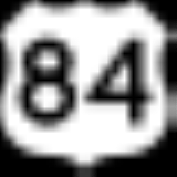
Major highways
 U.S. Highway 84
 U.S. Highway 190
 State Highway 36State Highway 36 (Texas)State Highway 36 runs from Abilene to Freeport. It was designated as The 36th Division Memorial Highway between Cameron and Sealy by the Texas Legislature in 1985.-History:...
Adjacent counties
- Bosque CountyBosque County, TexasBosque County is a county located on the Edwards Plateau in the U.S. state of Texas. As of 2000, the population is 17,204. Its county seat is Meridian. Clifton, however, is the largest city and the cultural/financial center of the county. Bosque is named for the Bosque River, which runs through...
(north) - McLennan CountyMcLennan County, TexasMcLennan County is a county located on the Edwards Plateau in Central Texas. In 2000, its population was 213,517; in 2008 the U.S. Census Bureau estimated its population to be 230,213. Its seat is Waco. The county is named for Neil McLennan, an early settler....
(northeast) - Bell CountyBell County, TexasBell County is a county located in the U.S. state of Texas. Bell County was founded in 1850. It is part of the Killeen–Temple–Fort Hood Metropolitan Statistical Area. In 2000, the county's population was 237,974; in 2010 the U.S. Census Bureau reported that its population had reached...
(southeast) - Lampasas CountyLampasas County, TexasLampasas County is a county located on the Edwards Plateau in the U.S. state of Texas. In 2000, its population was 17,762. Its seat is Lampasas. The county is named for the Lampasas River....
(southwest) - Hamilton County (northwest)
Demographics
As of the censusCensus
A census is the procedure of systematically acquiring and recording information about the members of a given population. It is a regularly occurring and official count of a particular population. The term is used mostly in connection with national population and housing censuses; other common...
of 2000, there were 74,978 people, 19,950 households, and 15,780 families residing in the county. The population density
Population density
Population density is a measurement of population per unit area or unit volume. It is frequently applied to living organisms, and particularly to humans...
was 71 people per square mile (28/km²). There were 21,776 housing units at an average density of 21 per square mile (8/km²). The racial makeup of the county was 65.28% White
Race (United States Census)
Race and ethnicity in the United States Census, as defined by the Federal Office of Management and Budget and the United States Census Bureau, are self-identification data items in which residents choose the race or races with which they most closely identify, and indicate whether or not they are...
, 21.80% Black
Race (United States Census)
Race and ethnicity in the United States Census, as defined by the Federal Office of Management and Budget and the United States Census Bureau, are self-identification data items in which residents choose the race or races with which they most closely identify, and indicate whether or not they are...
or African American
Race (United States Census)
Race and ethnicity in the United States Census, as defined by the Federal Office of Management and Budget and the United States Census Bureau, are self-identification data items in which residents choose the race or races with which they most closely identify, and indicate whether or not they are...
, 0.88% Native American
Race (United States Census)
Race and ethnicity in the United States Census, as defined by the Federal Office of Management and Budget and the United States Census Bureau, are self-identification data items in which residents choose the race or races with which they most closely identify, and indicate whether or not they are...
, 1.75% Asian
Race (United States Census)
Race and ethnicity in the United States Census, as defined by the Federal Office of Management and Budget and the United States Census Bureau, are self-identification data items in which residents choose the race or races with which they most closely identify, and indicate whether or not they are...
, 0.49% Pacific Islander
Race (United States Census)
Race and ethnicity in the United States Census, as defined by the Federal Office of Management and Budget and the United States Census Bureau, are self-identification data items in which residents choose the race or races with which they most closely identify, and indicate whether or not they are...
, 6.26% from other races
Race (United States Census)
Race and ethnicity in the United States Census, as defined by the Federal Office of Management and Budget and the United States Census Bureau, are self-identification data items in which residents choose the race or races with which they most closely identify, and indicate whether or not they are...
, and 3.54% from two or more races. 12.57% of the population were Hispanic
Race (United States Census)
Race and ethnicity in the United States Census, as defined by the Federal Office of Management and Budget and the United States Census Bureau, are self-identification data items in which residents choose the race or races with which they most closely identify, and indicate whether or not they are...
or Latino
Race (United States Census)
Race and ethnicity in the United States Census, as defined by the Federal Office of Management and Budget and the United States Census Bureau, are self-identification data items in which residents choose the race or races with which they most closely identify, and indicate whether or not they are...
of any race.
There were 19,950 households out of which 47.70% had children under the age of 18 living with them, 64.80% were married couples
Marriage
Marriage is a social union or legal contract between people that creates kinship. It is an institution in which interpersonal relationships, usually intimate and sexual, are acknowledged in a variety of ways, depending on the culture or subculture in which it is found...
living together, 11.00% had a female householder with no husband present, and 20.90% were non-families. 16.90% of all households were made up of individuals and 5.50% had someone living alone who was 65 years of age or older. The average household size was 2.91 and the average family size was 3.27.
In the county, the population was spread out with 26.20% under the age of 18, 17.90% from 18 to 24, 36.30% from 25 to 44, 13.80% from 45 to 64, and 5.70% who were 65 years of age or older. The median age was 28 years. For every 100 females there were 105.30 males. For every 100 females age 18 and over, there were 106.20 males.
The median income for a household in the county was $35,999, and the median income for a family was $38,307. Males had a median income of $24,236 versus $21,186 for females. The per capita income
Per capita income
Per capita income or income per person is a measure of mean income within an economic aggregate, such as a country or city. It is calculated by taking a measure of all sources of income in the aggregate and dividing it by the total population...
for the county was $14,410. About 7.80% of families and 9.50% of the population were below the poverty line, including 12.30% of those under age 18 and 9.00% of those age 65 or over.
Cities and towns
- Copperas CoveCopperas Cove, TexasCopperas Cove is a city located in central Texas at the southern corner of Coryell County, with city limits extending into neighboring Bell and Lampasas Counties. Founded in 1879 as a small ranching and farming community, today the city is the largest in Coryell County, with more than 30,000...
- EvantEvant, TexasEvant is a town in Coryell and Hamilton Counties in Central Texas. The population was 393 at the 2000 census. The Coryell County portion of Evant is part of the Killeen–Temple–Fort Hood Metropolitan Statistical Area.- History :...
- FlatFlat, TexasFlat is a small unincorporated community in Coryell County, Texas, United States. It is part of the Killeen–Temple–Fort Hood Metropolitan Statistical Area.- History :...
(unincorporated) - Fort Hood
- GatesvilleGatesville, TexasGatesville is a city in and the county seat of Coryell County in Central Texas, United States of America. The population was 15,591 at the 2000 census...
- JonesboroJonesboro, TexasJonesboro is an unincorporated town in Coryell and Hamilton Counties in Central Texas. The Coryell County portion of the community is part of the Killeen–Temple–Fort Hood Metropolitan Statistical Area....
(unincorporated) - MoundMound, TexasMound is an unincorporated community in Coryell County, Texas, United States. Its elevation is 692 feet . Although Mound is unincorporated, it has a post office, with the ZIP code of 76558....
(unincorporated) - OglesbyOglesby, TexasOglesby is a city in Coryell County, Texas, United States. The population was 458 at the 2000 census. It is part of the Killeen–Temple–Fort Hood Metropolitan Statistical Area.-Geography:Oglesby is located at ....
- PurmelaPurmela, TexasPurmela is an unincorporated community in Coryell County, Texas, United States. The community is part of the Killeen–Temple–Fort Hood Metropolitan Statistical Area. Although it is unincorporated, Purmela has a post office, with the ZIP code of 76566....
(unincorporated) - South MountainSouth Mountain, TexasSouth Mountain is a town in Coryell County, Texas, United States. The population was 412 at the 2000 census. It is part of the Killeen–Temple–Fort Hood Metropolitan Statistical Area.-Geography:...
- The GroveThe Grove, TexasThe Grove is an unincorporated community in Coryell County, Texas, United States. It is located some sixteen miles southeast of Gatesville, Texas in the eastern portion of the county.The Grove is located on Texas State Highway 36....
(unincorporated) - TurnersvilleTurnersville, TexasTurnersville is a town located in Coryell County, Texas approximately west of Waco, Texas and approximately north-northeast of Gatesville, Texas. The town sits approximately two miles southwest of the intersection of FM217 and FM182 at 31° 30' 00"N, 097° 37' 30"W The Middle Bosque River flows...
(unincorporated)
Government and infrastructure
Of the eight Texas Department of Criminal JusticeTexas Department of Criminal Justice
The Texas Department of Criminal Justice is a department of the government of the state of Texas. The TDCJ is responsible for statewide criminal justice for adult offenders, including managing offenders in state prisons, state jails and private correctional facilities, funding and certain...
general correctional facilities for women, which include five prisons and three state jails, Five of the units, including four prisons and one state jail, are in the City of Gatesville
Gatesville, Texas
Gatesville is a city in and the county seat of Coryell County in Central Texas, United States of America. The population was 15,591 at the 2000 census...
.
The Christina Crain Unit
Christina Crain Unit
The Christina Melton Crain Unit is a Texas Department of Criminal Justice prison for females in Gatesville, Texas. The prison is along Texas State Highway 36, north of central Gatesville. The unit, with about of space, is co-located with the Hilltop Unit, the Dr. Lane Murray Unit, and the Linda...
prison (formerly Gatesville Unit),
the Hilltop Unit
Hilltop Unit
The Hilltop Unit is a Texas Department of Criminal Justice prison for women located in Gatesville, Texas. It is located on Business Texas State Highway 36, north of Downtown Gatesville. Hilltop sites on an approximately plot of land and is co-located with the Crain, Murray, and Woodman units...
prison,
the Dr. Lane Murray Unit
Dr. Lane Murray Unit
Dr. Lane Murray Unit is a women's prison of the Texas Department of Criminal Justice located in Gatesville, Texas. The prison is located on Texas State Highway 36, between Farm to Market Road 215 and Farm to Market Road 929...
prison,
and the Linda Woodman Unit state jail are co-located amongst one another. In addition the Mountain View Unit
Mountain View Unit
Mountain View Unit is a Texas Department of Criminal Justice prison housing female offenders in Gatesville, Texas. The unit, with about of land, is located north of central Gatesville on Farm to Market Road 215. The prison is located in a 45 minute driving distance from Waco...
, a prison with the State of Texas female death row, is in Gatesville. One male prison, the Alfred D. Hughes Unit
Alfred D. Hughes Unit
Alfred D. Hughes Unit is a prison for men of the Texas Department of Criminal Justice located in Gatesville, Texas.The facility is located along Farm to Market Road 929, north of Texas Loop 36.-History:...
, is in Gatesville.
Mountain View opened in July 1975, Crain opened in August 1980, Hilltop opened in November 1981, Hughes opened in January 1990. Murray opened in November 1995, and Woodman opened in June 1997. In 1995, of the counties in Texas, Coryell had the third highest number of state prisons and jails, after Walker
Walker County, Texas
Walker County is a county located in the U.S. state of Texas. In 2010, its population was 67,861. Its county seat is Huntsville.Initially, Walker County was named for Robert J. Walker, a legislator from Mississippi who introduced into the United States Congress the resolution to annex Texas...
and Brazoria
Brazoria County, Texas
Brazoria County[p] is a county in the U.S. state of Texas, located on the Gulf Coast within the Houston–Sugar Land–Baytown metropolitan area. Regionally, parts of the county are within the extreme southern-most fringe of the regions locally known as Southeast Texas. Brazoria County is among a...
.
See also
- National Register of Historic Places listings in Coryell County, Texas
External links
- Texas State Directory, County officials
- Coryell County in Handbook of Texas Online at the University of TexasUniversity of Texas at AustinThe University of Texas at Austin is a state research university located in Austin, Texas, USA, and is the flagship institution of the The University of Texas System. Founded in 1883, its campus is located approximately from the Texas State Capitol in Austin...
- Read James Coryell's entry in the Biographical Encyclopedia of Texas hosted by the Portal to Texas History.