
Corumbá de Goiás
Encyclopedia
| Corumbá de Goiás | |
|---|---|
| State | Goiás Goiás Goiás is a state of Brazil, located in the central part of the country. The name Goiás comes from the name of an indigenous community... |
| Geographical coordinates: | 15°55′27"S 48°48′31"W |
| Area: | 1,062.4 km² |
| Population: | 9,190 (IBGE 2007) |
| Urban and Rural Population: | 5,448 / 3,742 |
| Population density: | 8.65 inhab/km² (2007) |
| Elevation: | 950 m above sea level |
| Postcode (CEP): | 72960-000 |
| IBGE statistical microregion: | Entorno de Brasília |
| Became a city: | 1875 |
| Mayor: | Emílio de Paiva Jacinto |
| Distance to Goiânia Goiânia -Climate:The city has a tropical wet and dry climate with an average temperature of . There's a wet season, from October to April, and a dry one, from May to September. Annual rainfall is around 1,520 mm.... : |
110 km. |
| Website: | |
Municipality
A municipality is essentially an urban administrative division having corporate status and usually powers of self-government. It can also be used to mean the governing body of a municipality. A municipality is a general-purpose administrative subdivision, as opposed to a special-purpose district...
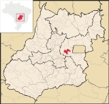
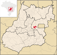
in central Goiás
Goiás
Goiás is a state of Brazil, located in the central part of the country. The name Goiás comes from the name of an indigenous community...
state, Brazil
Brazil
Brazil , officially the Federative Republic of Brazil , is the largest country in South America. It is the world's fifth largest country, both by geographical area and by population with over 192 million people...
. It is one of the oldest cities in the state and still preserves vestiges of its colonial heritage. The Areias River
Areias River (Goiás)
The Areias River is a river of Goiás state in central Brazil. Part of the Paraná River watershed, its source is located near the Serra dos Pirineus, and flows into the Corumbá River.Its approximate length is sixty miles...
passes through the municipality.
Location and Geography
Located in the micro-region of Entorno de Brasília, the town belongs to the area of influence of the Geoeconomical Region of BrasíliaBrasília
Brasília is the capital city of Brazil. The name is commonly spelled Brasilia in English. The city and its District are located in the Central-West region of the country, along a plateau known as Planalto Central. It has a population of about 2,557,000 as of the 2008 IBGE estimate, making it the...
and is linked by highways BR-070 and BR-414. Important distances are: 110 km to Goiânia
Goiânia
-Climate:The city has a tropical wet and dry climate with an average temperature of . There's a wet season, from October to April, and a dry one, from May to September. Annual rainfall is around 1,520 mm....
, 45 km to Anápolis
Anápolis
Anápolis is the third largest city in the State of Goiás in Brazil. It lies in the center of a rich agricultural region and has become a leader in food processing and pharmaceutical plants.-Location and population:...
and 130 km to Brasília. Corumbá is bounded by the following municipalities: Pirenópolis
Pirenópolis
Pirenópolis is a town located in the Brazilian state of Goiás. It is well known for its waterfalls and colonial architecture, and a popular festival involving mounted horses called Festa do Divino Espírito Santo which takes place 45 days after Easter....
, Cocalzinho de Goiás
Cocalzinho de Goiás
Cocalzinho de Goiás is a small town and municipality in central Goiás state, Brazil.-Location and Geography:Cocalzinho, as it is known by the inhabitants, is located in the micro-region of Entorno de Brasília, on highway BR-414, almost at the junction with highway BR-070...
, Santo Antônio do Descoberto
Santo Antônio do Descoberto
Santo Antônio do Descoberto is a small city and municipality in central Goiás state, Brazil. It is a suburb of Brasília that was a sleepy country hamlet until the population exploded in the 1970s due to the construction of the national capital...
, Alexânia
Alexânia
Alexânia is a small town and municipality in central Goiás state, Brazil. Alexânia is known for its alleged extraterrestrial sightings in the late sixties and early seventies. The Areias River passes through the municipality.-Location:...
and Abadiânia
Abadiânia
Abadiânia is a small town and municipality in the state of Goiás, Brazil. It is home to a famous Brazilian medium and "psychic surgeon" — João de Deus.-Location:Abadiânia is part of the Entorno de Brasília statistical micro-region...
.
Due to variations in elevation, temperatures are quite varied. The average is around 26°C; The rains obey a tropical pattern and are at their strongest in the period of October to March.
Nature is the tourist attraction of the town. The region is full of waterfalls, caverns, and rivers. The Salto de Corumbá is known throughout the region and attracts many tourists from Brasília and Goiânia. The Corumbá River
Corumbá River
The Corumbá River is the most important river in the Central Plateau region of Brazil. Its source is in the Montes de Pireneus, near Pirenópolis, state of Goiás, near the boundary with the Federal District and its length ifs 567 km. It receives the waters of the Descoberto and São Bartolomeu,...
crosses the town and has beaches and rapids.
The town is one of the oldest in the state and still preserves part of the houses from past centuries, with special notice given to the Igreja Matriz de Nossa Senhora da Penha de França. Corumbá, like neighboring Pirenópolis
Pirenópolis
Pirenópolis is a town located in the Brazilian state of Goiás. It is well known for its waterfalls and colonial architecture, and a popular festival involving mounted horses called Festa do Divino Espírito Santo which takes place 45 days after Easter....
, receives a great number of tourists for the Festival of the Cavalhadas, which are mock battles between Moors and Christians.
History
The settlement of Corumbá de Goiás began in 1731 when miners looked for gold at the confluence of the Corumbá River and the Bagagem River. In 1734 a chapel was built honoring Nossa Senhora da Penha da França. In 1840 the town was already a parish with its first priest Manoel Inocêncio da Costa Campos. In 1849 it was raised to the status of "vila" (like a municipality today) only to lose this status in 1863, becoming a district of Meia Ponte, which is today called PirenópolisPirenópolis
Pirenópolis is a town located in the Brazilian state of Goiás. It is well known for its waterfalls and colonial architecture, and a popular festival involving mounted horses called Festa do Divino Espírito Santo which takes place 45 days after Easter....
. The Vila de Corumbá became a city in 1902 changing its name to Corumbá de Goiás because of the confusion with the more important Corumbá
Corumbá
Corumbá is a municipality in the Brazilian state of Mato Grosso do Sul, 425 km northwest of Campo Grande, the state's capital. It has a population of approximately 96,000 inhabitants, and its economy is based mainly on agriculture, animal husbandry, mineral extraction, and tourism, being the...
in Mato Grosso
Mato Grosso
Mato Grosso is one of the states of Brazil, the third largest in area, located in the western part of the country.Neighboring states are Rondônia, Amazonas, Pará, Tocantins, Goiás and Mato Grosso do Sul. It also borders Bolivia to the southwest...
. Corumbá de Goiás had grown to 20,212 inhabitants in 1980 with 17,765 living in the rural area. Between 1991 and 1996 the population dropped 15% with the rural population being reduced to 4,109 inhabitants. The population continued to diminish gradually until stabilizing after 2000.
Economy
The economy is poorly developed due to the isolation of the town and is based on rural agricultural production and touristic activities. There is some cattle raising (59,000 head in 2006) both for beef and for milk. In 2007 there were two financial institutions. There was one dairy: S. Teixeira Produtos Alimentícios Ltda. (22/05/2006).Agricultural data 2006
- Farms: 841
- Total area: 55,844 ha.
- Area of permanent crops: 263 ha.
- Area of perennial crops: 3,895 ha.
- Area of natural pasture: 40,296 ha.
- Area of woodland and forests: 9,952 ha.
- Persons dependent on farming: 2,100
- Number of tractors: 158
- Cattle herd: 59,000
- Main crop: corn with 1,300 planted hectares producing 5,200 tons
Health and education
- Schools: 22 with 2,413 students (2006)
- Hospitals: 02 with 29 beds (2007)
- Literacy rate (2000): 82%
- Infant mortality rate (2000): 24.45
- MHDI (2000): 0.716
- State ranking: 182 (out of 242 municipalities in 2000)
- National ranking: 2,701 (out of 5,507 municipalities in 2000)