
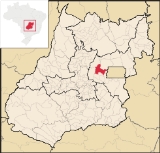
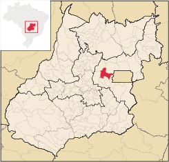
Cocalzinho de Goiás
Encyclopedia
| Cocalzinho de Goiás | |
|---|---|
| State | Goiás Goiás Goiás is a state of Brazil, located in the central part of the country. The name Goiás comes from the name of an indigenous community... |
| Geographical coordinates: | 15°47′40"S 48°36′34"W |
| Area: | 1,787.9 km² |
| Population: | 14,762 (IBGE 2007) |
| Population density: | 8.26 (2007) |
| Urban / Rural Population: | 6,096 / 8,666 (2007) |
| Elevation: | 1l52 m above sea level |
| Postcode (CEP): | 72975-000 |
| IBGE statistical microregion: | Entorno de Brasília |
| Became a city: | 1993 |
| Mayor: | Salomão Costa Araújo |
| Distance to Goiânia Goiânia -Climate:The city has a tropical wet and dry climate with an average temperature of . There's a wet season, from October to April, and a dry one, from May to September. Annual rainfall is around 1,520 mm.... : |
203 km. |
| Website: | none |
Municipality
A municipality is essentially an urban administrative division having corporate status and usually powers of self-government. It can also be used to mean the governing body of a municipality. A municipality is a general-purpose administrative subdivision, as opposed to a special-purpose district...
in central Goiás
Goiás
Goiás is a state of Brazil, located in the central part of the country. The name Goiás comes from the name of an indigenous community...
state, Brazil
Brazil
Brazil , officially the Federative Republic of Brazil , is the largest country in South America. It is the world's fifth largest country, both by geographical area and by population with over 192 million people...
.
Location and Geography
Cocalzinho, as it is known by the inhabitants, is located in the micro-region of Entorno de Brasília, on highway BR-414, almost at the junction with highway BR-070. It is 132 kilometers from the state capital, GoiâniaGoiânia
-Climate:The city has a tropical wet and dry climate with an average temperature of . There's a wet season, from October to April, and a dry one, from May to September. Annual rainfall is around 1,520 mm....
and is 127 km from the national capital, Brasilia
Brasília
Brasília is the capital city of Brazil. The name is commonly spelled Brasilia in English. The city and its District are located in the Central-West region of the country, along a plateau known as Planalto Central. It has a population of about 2,557,000 as of the 2008 IBGE estimate, making it the...
.
Municipal boundaries are with:
- North: Padre BernardoPadre BernardoPadre Bernardo is a small city and municipality north of the Federal District of Brazil in Goiás state, Brazil.-Location:Padre Bernardo is located 42 km. north of the boundary with the Federal District...
and Vila PropícioVila PropícioVila Propício is a small town and municipality in central Goiás state, Brazil. It is a large producer of sugarcane.-Location:Vila Propício is located in the Entorno de Brasília micro-region and has boundaries with the following municipalities:... - South: Corumbá de GoiásCorumbá de GoiásCorumbá de Goiás is a small town and municipality in central Goiás state, Brazil. It is one of the oldest cities in the state and still preserves vestiges of its colonial heritage...
- East: Santo Antônio do DescobertoSanto Antônio do DescobertoSanto Antônio do Descoberto is a small city and municipality in central Goiás state, Brazil. It is a suburb of Brasília that was a sleepy country hamlet until the population exploded in the 1970s due to the construction of the national capital...
and Águas Lindas de GoiásÁguas Lindas de GoiásÁguas Lindas de Goiás is a city and municipality located in central Goiás, Brazil. It is the fifth largest city in the state and one of the fastest growing cities in Brazil.-Location:... - West: PirenópolisPirenópolisPirenópolis is a town located in the Brazilian state of Goiás. It is well known for its waterfalls and colonial architecture, and a popular festival involving mounted horses called Festa do Divino Espírito Santo which takes place 45 days after Easter....
The elevation varies between 800 and 1,200 meters. Geographical relief is very irregular since the region is crossed by the Continental Divider of Waters, which separates the river basins of the Amazon and the Plata. Therefore there are numerous springs that grow until they form the major rivers of South America. For this reason it is called the Berço das Águas (the Cradle of Waters).
Major rivers are: Rio Verde, Oliveira Costa, Jacaré, Piqui, Taquaral, Corumbá, and Areias. There are many waterfalls and swimming spots. Nearby in neighboring Corumbá de Goiás there is a cavern called Gruta dos Ecos, with one of the largest subterranean lakes in South America. The municipality also contains Pico dos Pireneus, the highest point in the region, with an elevation of 1,385 meters.
History
Cocalzinho began in 1960 with the arrival of a cement plant, Companhia de Cimento Portland Itaú, which closed down in 1996 putting five thousand families out of work. Since then the local population has either left for better opportunities or continued working in agriculture. Today the economy is based on agriculture, cattle raising, dairy industries and rock quarries. The area is rich in sand and decorative rock.The name "Cocalzinho" comes from a stream called Cocá or Cocal, which has its source near the seat of the municipality.
When highway BR-414 is paved up to Niquelândia, Cocalzinho will benefit from tourism since there will be a tourist route from the Serra da Mesa lake to the Chapada dos Veadeiros national park.
Economy
The main economic activities were cattle raising (76,000 head in 2006, poultry raising, and agriculture (cotton, corn, and soybeans).Agricultural data 2006
- Farms: 603
- Total area: 75,013 ha.
- Area of permanent crops: 442 ha.
- Area of perennial crops: 7,883 ha.
- Area of natural pasture: 54,373 ha.
- Area of woodland and forests: 29,307 ha.
- Persons dependent on farming: 1,475
- Number of tractors: 172
- Cattle herd: 76,000
- Main crop: soybeans producing 16,200 tons on 6,000 hectares
Health and education
- Schools: 16
- Higher education: none in 2007
- Literacy rate (2000): 82.3%
- Infant mortality rate (2000): 23.61
- Hospitals: 01 with 21 beds (2007)
- HDI-M (2000): 0.703
- State ranking: 207 (out of 242 municipalities in 2000)
- National ranking: 2935 (out of 5507 in 2000 municipalities)
Sources of Data
See also
- List of municipalities in Goiás
- Microregions of Goiás