
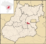
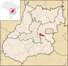
Abadiânia
Encyclopedia
| Abadiânia | |
|---|---|
| State | Goiás Goiás Goiás is a state of Brazil, located in the central part of the country. The name Goiás comes from the name of an indigenous community... |
| Geographical coordinates: | 16°06′S 48°48′W |
| Area: | 1,047 km² |
| Population: | 12,736 (IBGE 2005) |
| Elevation: | 1,052 m above sea level |
| Postal code (CEP): | 72940-000 |
| Became a city: | 1953 |
| Statistical Microregion: | Entorno de Brasília |
| Distance to Goiânia Goiânia -Climate:The city has a tropical wet and dry climate with an average temperature of . There's a wet season, from October to April, and a dry one, from May to September. Annual rainfall is around 1,520 mm.... : |
88 km. |
| Website: | www.eabadiania.com.br |
Goiás
Goiás is a state of Brazil, located in the central part of the country. The name Goiás comes from the name of an indigenous community...
, Brazil
Brazil
Brazil , officially the Federative Republic of Brazil , is the largest country in South America. It is the world's fifth largest country, both by geographical area and by population with over 192 million people...
. It is home to a famous Brazilian medium and "psychic surgeon" — João de Deus
João de Deus (medium)
João Teixeira de Faria , known also as João de Deus , is a self-described medium and "psychic surgeon" from Brazil. He is based in Abadiânia, a small town in the state of Goiás, southwest of Brasília.-Early life:...
.
Location
Abadiânia is part of the Entorno de Brasília statistical micro-region. Neighboring municipalities are:- North: PirenópolisPirenópolisPirenópolis is a town located in the Brazilian state of Goiás. It is well known for its waterfalls and colonial architecture, and a popular festival involving mounted horses called Festa do Divino Espírito Santo which takes place 45 days after Easter....
, Corumbá de GoiásCorumbá de GoiásCorumbá de Goiás is a small town and municipality in central Goiás state, Brazil. It is one of the oldest cities in the state and still preserves vestiges of its colonial heritage...
, and AlexâniaAlexâniaAlexânia is a small town and municipality in central Goiás state, Brazil. Alexânia is known for its alleged extraterrestrial sightings in the late sixties and early seventies. The Areias River passes through the municipality.-Location:... - South: SilvâniaSilvâniaSilvânia is a small city and municipality in southcentral Goiás state, Brazil.-Location and highway connections:Silvânia is located 77 kilometers from the state capital of Goiânia, 180 km...
- East: AnápolisAnápolisAnápolis is the third largest city in the State of Goiás in Brazil. It lies in the center of a rich agricultural region and has become a leader in food processing and pharmaceutical plants.-Location and population:...
- West: AlexâniaAlexâniaAlexânia is a small town and municipality in central Goiás state, Brazil. Alexânia is known for its alleged extraterrestrial sightings in the late sixties and early seventies. The Areias River passes through the municipality.-Location:...
The distance to the state capital, Goiânia
Goiânia
-Climate:The city has a tropical wet and dry climate with an average temperature of . There's a wet season, from October to April, and a dry one, from May to September. Annual rainfall is around 1,520 mm....
, is 88 km. Highway connections with Goiânia
Goiânia
-Climate:The city has a tropical wet and dry climate with an average temperature of . There's a wet season, from October to April, and a dry one, from May to September. Annual rainfall is around 1,520 mm....
are made by BR-153 / Anápolis
Anápolis
Anápolis is the third largest city in the State of Goiás in Brazil. It lies in the center of a rich agricultural region and has become a leader in food processing and pharmaceutical plants.-Location and population:...
/ BR-060.
It is known as the City of Spiritual Cures because of the presence of psychic healer, João de Deus
João de Deus (medium)
João Teixeira de Faria , known also as João de Deus , is a self-described medium and "psychic surgeon" from Brazil. He is based in Abadiânia, a small town in the state of Goiás, southwest of Brasília.-Early life:...
, who attracts many national and international tourists seeking cures for their maladies.
Located between Brasília
Brasília
Brasília is the capital city of Brazil. The name is commonly spelled Brasilia in English. The city and its District are located in the Central-West region of the country, along a plateau known as Planalto Central. It has a population of about 2,557,000 as of the 2008 IBGE estimate, making it the...
and Goiânia
Goiânia
-Climate:The city has a tropical wet and dry climate with an average temperature of . There's a wet season, from October to April, and a dry one, from May to September. Annual rainfall is around 1,520 mm....
on the Brasília - São Paulo highway (BR 153), it has always been a stopping-off point for travellers between the two cities.
Website: eabadiania.com.br
Economy
There is modest agricultural production—corn, rice and soybeans—as well as cattle raising. There were two dairies JERIVÁ - Comércio, Indústria e Agropecuária Ltda. and Laticínios Vale do Capivari. (22/05/2006). There was also a meat packing plant Luiz Carlos Pavão e Outros (22/05/2006). There was one financial institution in the town in 2004: Banco Itaú S.A.Agricultural data 2006
- Farms: 1,150
- Total area: 85,292 ha.
- Area of permanent crops: 5,901 ha.
- Area of perennial crops: 5,703 ha.
- Area of pasture: 51,990 ha.
- Area of woodland and forests: 17,255 ha.
- Cattle herd: 41,665
The main tourist attractions are two waterfalls—Cachoeira do Ribeirão Curralinho and Cachoeira Pedregulho—the Corumbá River
Corumbá River
The Corumbá River is the most important river in the Central Plateau region of Brazil. Its source is in the Montes de Pireneus, near Pirenópolis, state of Goiás, near the boundary with the Federal District and its length ifs 567 km. It receives the waters of the Descoberto and São Bartolomeu,...
and the religious festivals.
History
Despite being a municipality since 1953 Abadiânia was only installed in its present site in the 1960s. The population was not happy with conditions of access and little by little they began to build their houses along the highway 18 kilometers away, where the present-day town is located.Health and education
- Infant mortality rate: 22.36 in 1,000 live births (2000)
- Literacy rate: 84.1 (2000)
- Hospitals: none (February 2007)
- Schools: 18 with 3,369 students (2006)
On the Human Development Index
Human Development Index
The Human Development Index is a composite statistic used to rank countries by level of "human development" and separate "very high human development", "high human development", "medium human development", and "low human development" countries...
of 2000 Abadiânia had a score of 0.723, which gave it a state ranking of 165 (out of 242 municipalities)
and a national ranking of 2,569 (out of 5,507 municipalities).