

Cornelius Pass Road
Encyclopedia
Cornelius Pass Road is an arterial road
over Cornelius Pass in the Tualatin Mountains
west of Portland
, Oregon
, USA. Running north–south, the road stretches between U.S. Route 30
on the north and Oregon Route 8 on the south. The road passes through Washington
and Multnomah
counties, crossing the Tualatin Mountains at Cornelius Pass at the 577 feet (175.9 m) elevation.
in the 1800s. The interchange with the Sunset Highway was rebuilt and widened in 1989, and the road widened to five lanes from the freeway to Cornell Road the following year. In 1996, the road was extended southward when 216th and 219th avenues were renamed and became the southern section of the road. At that time the intersection with Baseline Road was re-aligned. The intersection with U.S. 26 was revised in 2005 with new on and off ramps extending from Cornelius Pass to the east where a railroad overpass had previously been located. In 2008, the entire Multnomah County section was changed to a no passing zone on the winding road over the Tualatin Mountains
. A one-mile section from Lois to Wilkins streets is scheduled to close for eight months in 2010 in order to widen the road in that area to five lanes as well as add bike lanes and sidewalks.
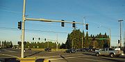 Cornelius Pass is one of only two main north–south connecting roads in Hillsboro. The former country road handles 11,000 drivers each day and is an arterial route from the Tualatin Valley
between Hillsboro to the Columbia River
north of Portland. A mountainous road at points, 1,500 of the 11,000 vehicles each day are tractor-trailers on the road designed to handle up to 10,000 vehicles per day. A portion of the road, from US 26 to Cornell, is part of the National Highway System
.
Arterial road
An arterial road, or arterial thoroughfare, is a high-capacity urban road. The primary function of an arterial road is to deliver traffic from collector roads to freeways, and between urban centres at the highest level of service possible. As such, many arteries are limited-access roads, or feature...
over Cornelius Pass in the Tualatin Mountains
Tualatin Mountains
The Tualatin Mountains are a range of hills on the western border of Multnomah County, Oregon, United States...
west of Portland
Portland, Oregon
Portland is a city located in the Pacific Northwest, near the confluence of the Willamette and Columbia rivers in the U.S. state of Oregon. As of the 2010 Census, it had a population of 583,776, making it the 29th most populous city in the United States...
, Oregon
Oregon
Oregon is a state in the Pacific Northwest region of the United States. It is located on the Pacific coast, with Washington to the north, California to the south, Nevada on the southeast and Idaho to the east. The Columbia and Snake rivers delineate much of Oregon's northern and eastern...
, USA. Running north–south, the road stretches between U.S. Route 30
U.S. Route 30
U.S. Route 30 is an east–west main route of the system of United States Numbered Highways, with the highway traveling across the northern tier of the country. It is the third longest U.S. route, after U.S. Route 20 and U.S. Route 6. The western end of the highway is at Astoria, Oregon; the...
on the north and Oregon Route 8 on the south. The road passes through Washington
Washington County, Oregon
- Major highways :* Interstate 5* Interstate 205* U.S. Route 26* Oregon Route 6* Oregon Route 8* Oregon Route 10* Oregon Route 47* Oregon Route 99W* Oregon Route 210* Oregon Route 217* Oregon Route 219-Demographics:...
and Multnomah
Multnomah County, Oregon
Multnomah County is one of 36 counties in the U.S. state of Oregon. Though smallest in area, it is the most populous as its county seat, Portland, is the state's largest city...
counties, crossing the Tualatin Mountains at Cornelius Pass at the 577 feet (175.9 m) elevation.
History
The road was built by Thomas R. CorneliusThomas R. Cornelius
Thomas R. Cornelius was a prominent American politician and soldier in the early history of Oregon. A native of Missouri, he moved to the Oregon Country with his family as a young man where he fought in the Cayuse War and Yakima Indian War against the Native Americans...
in the 1800s. The interchange with the Sunset Highway was rebuilt and widened in 1989, and the road widened to five lanes from the freeway to Cornell Road the following year. In 1996, the road was extended southward when 216th and 219th avenues were renamed and became the southern section of the road. At that time the intersection with Baseline Road was re-aligned. The intersection with U.S. 26 was revised in 2005 with new on and off ramps extending from Cornelius Pass to the east where a railroad overpass had previously been located. In 2008, the entire Multnomah County section was changed to a no passing zone on the winding road over the Tualatin Mountains
Tualatin Mountains
The Tualatin Mountains are a range of hills on the western border of Multnomah County, Oregon, United States...
. A one-mile section from Lois to Wilkins streets is scheduled to close for eight months in 2010 in order to widen the road in that area to five lanes as well as add bike lanes and sidewalks.
Details
Tualatin Valley
The Tualatin Valley is a farming and suburban region southwest of Portland, Oregon in the United States. The valley is formed by the meandering Tualatin River, a tributary of the Willamette River at the northwest corner of the Willamette Valley, east of the Northern Oregon Coast Range...
between Hillsboro to the Columbia River
Columbia River
The Columbia River is the largest river in the Pacific Northwest region of North America. The river rises in the Rocky Mountains of British Columbia, Canada, flows northwest and then south into the U.S. state of Washington, then turns west to form most of the border between Washington and the state...
north of Portland. A mountainous road at points, 1,500 of the 11,000 vehicles each day are tractor-trailers on the road designed to handle up to 10,000 vehicles per day. A portion of the road, from US 26 to Cornell, is part of the National Highway System
National Highway System (United States)
The National Highway System is a network of strategic highways within the United States, including the Interstate Highway System and other roads serving major airports, ports, rail or truck terminals, railway stations, pipeline terminals and other strategic transport facilities.Individual states...
.
Major intersections
| County | Location | Destinations | Notes |
|---|---|---|---|
| Multnomah Multnomah County, Oregon Multnomah County is one of 36 counties in the U.S. state of Oregon. Though smallest in area, it is the most populous as its county seat, Portland, is the state's largest city... |
Near Portland Portland, Oregon Portland is a city located in the Pacific Northwest, near the confluence of the Willamette and Columbia rivers in the U.S. state of Oregon. As of the 2010 Census, it had a population of 583,776, making it the 29th most populous city in the United States... (45.651668°N 122.851524°W) |
||
| Washington Washington County, Oregon - Major highways :* Interstate 5* Interstate 205* U.S. Route 26* Oregon Route 6* Oregon Route 8* Oregon Route 10* Oregon Route 47* Oregon Route 99W* Oregon Route 210* Oregon Route 217* Oregon Route 219-Demographics:... |
Hillsboro Hillsboro, Oregon Hillsboro is the fifth-largest city in the U.S. state of Oregon and is the county seat of Washington County. Lying in the Tualatin Valley on the west side of the Portland metropolitan area, the city is home to many high-technology companies, such as Intel, that compose what has become known as the... (45.554388°N 122.90079°W) |
Interchange | |
| Hillsboro Hillsboro, Oregon Hillsboro is the fifth-largest city in the U.S. state of Oregon and is the county seat of Washington County. Lying in the Tualatin Valley on the west side of the Portland metropolitan area, the city is home to many high-technology companies, such as Intel, that compose what has become known as the... (45.53966°N 122.900104°W) |
Cornell Road | ||
| Hillsboro Hillsboro, Oregon Hillsboro is the fifth-largest city in the U.S. state of Oregon and is the county seat of Washington County. Lying in the Tualatin Valley on the west side of the Portland metropolitan area, the city is home to many high-technology companies, such as Intel, that compose what has become known as the... (45.515308°N 122.901048°W) |
Baseline Road | ||
| Reedville Reedville, Oregon Reedville is an unincorporated community in Washington County, Oregon, United States between Hillsboro and Aloha. Oregon Route 8 runs through the area. Cornelius Pass Road is another main arterial... (45.497548°N 122.902164°W) |