
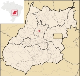
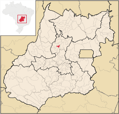
Ceres, Goiás
Encyclopedia
| Ceres | |
|---|---|
| State | Goiás Goiás Goiás is a state of Brazil, located in the central part of the country. The name Goiás comes from the name of an indigenous community... |
| Area: | 456.6 km² |
| Population: | 18,637 (IBGE 2007) |
| Urban population: | 17,732 (IBGE 2007) |
| Population Density: | 87.29 (IBGE 2007) |
| Population growth rate: | -1.48% 1996/2007 |
| Elevation: | 571 m above sea level |
| Postcode (CEP): | 76300-000 |
| Became a city: | 1953 |
| Mayor: | Edmário de Castro Barbosa |
| Distance to Goiânia Goiânia -Climate:The city has a tropical wet and dry climate with an average temperature of . There's a wet season, from October to April, and a dry one, from May to September. Annual rainfall is around 1,520 mm.... : |
187 km. |
| IBGE statistical microregion: | Ceres Microregion Ceres Microregion The Ceres Microregion is located in north-central Goiás state, Brazil. It includes 22 cities with a total population of 215,820 inhabitants . The total area is 13,224.40 km² and the population density is 16.32 inhab/km². The most important cities are Ceres and Goianésia.The most populous... |
| Website: | Prefeitura Municipal de Ceres |
City
A city is a relatively large and permanent settlement. Although there is no agreement on how a city is distinguished from a town within general English language meanings, many cities have a particular administrative, legal, or historical status based on local law.For example, in the U.S...
and municipality
Municipality
A municipality is essentially an urban administrative division having corporate status and usually powers of self-government. It can also be used to mean the governing body of a municipality. A municipality is a general-purpose administrative subdivision, as opposed to a special-purpose district...
in central Goiás
Goiás
Goiás is a state of Brazil, located in the central part of the country. The name Goiás comes from the name of an indigenous community...
state, Brazil
Brazil
Brazil , officially the Federative Republic of Brazil , is the largest country in South America. It is the world's fifth largest country, both by geographical area and by population with over 192 million people...
. It was the first agricultural colony built in the state of Goiás.
Geography
Ceres is 187 km. from the state capital, Goiânia. Municipal boundaries are with ItapaciItapaci
Itapaci is a small town and municipality in northern Goiás state, Brazil. The population was 16,003 in 2007 . The total area of the municipality was 956.1 km² .-Geography:...
, Nova Glória
Nova Glória
Nova Glória is a small town and municipality in north-central Goiás state, Brazil. It is a large producer of sugarcane.-Location:Nova Glória is in the Ceres Microregion and is north of Goiânia, just east of the important BR-153 highway. It is 21 kilometers north of the important commercial...
, São Patrício
São Patrício
São Patrício is a small town and municipality in the northwestern portion of the Brazilian state of Goiás.-Location:São Patrício is located 42 km. west of Ceres. Highway connections from Goiânia: GO-070 / Goianira / Inhumas / GO-154 / Itaguaru / Uruana / Carmo do Rio Verde / GO-460...
, Carmo do Rio Verde
Carmo do Rio Verde
Carmo do Rio Verde is a small town and municipality in central Goiás state, Brazil. The population was 8,897 in a total area of 457.5 km². Carmo do Rio Verde is a major producer of sugar cane for production of alcohol.-Location:...
, Rialma
Rialma
Rialma is a small city and municipality in north-central Goiás state, Brazil.-Location and Geography:Rialma is located across the Rio das Almas from Ceres on the important interstate highway BR-153, which links Anápolis to Belém. It was created as part of the urban area of Ceres, which was also...
and Rubiataba
Rubiataba
Rubiataba is a small city and municipality in northeastern Goiás state, Brazil.-Location and Geography:Rubiataba is located in the north of the state, south of the source of the Crixás River. It is 235 kilometres to the state capital of Goiânia. Other distances are:*Nova América: 21 km. to the...
. Highway links are made by GO-080 / Nerópolis
Nerópolis
Nerópolis is a small city and municipality in central Goiás state, Brazil.-Location:The municipality is part of the metropolitan region of Goiânia, which is 42 kilometers to the west. It is nationally known as the city of garlic and sweets...
/ Petrolina de Goiás
Petrolina de Goiás
Petrolina de Goiás is a small town and municipality in central Goiás state, Brazil.-Location:Petrolina de Goiás is located 81 km. almost due north of Goiânia, the state capital. It is 23 km. southwest of São Francisco de Goiás, 23 km. northwest of Ouro Verde de Goiás, 21 km....
/ BR-153 / Jaraguá / Rianápolis
Rianápolis
Rianápolis is a small town and municipality in northeastern Goiás state, Brazil.-Location:It is located almost directly north of the state capital and is on the important BR-153 highway, which links Belem to São Paulo. The regional center of Ceres is located 19 km. to the northwest. Highway...
/ Rialma
Rialma
Rialma is a small city and municipality in north-central Goiás state, Brazil.-Location and Geography:Rialma is located across the Rio das Almas from Ceres on the important interstate highway BR-153, which links Anápolis to Belém. It was created as part of the urban area of Ceres, which was also...
. See Sepin
The city is located in the fertile São Patrício valley and is rich in water courses. The Rio das Almas is the main river in the region and separates Ceres from its neighbor, Rialma
Rialma
Rialma is a small city and municipality in north-central Goiás state, Brazil.-Location and Geography:Rialma is located across the Rio das Almas from Ceres on the important interstate highway BR-153, which links Anápolis to Belém. It was created as part of the urban area of Ceres, which was also...
. The Rio das Almas flows north to join the Maranhão, a tributary of the Tocantins. The average annual temperature is 26 °C and the annual rainfall is approximately 1,800 mm3.
Temperatures
→ Winter temperatures: low: 12°C/high: 32°C;→ Spring temperatures: low: 19°C/high: 36°C;
→ Summer temperatures: low: 21°C/high: 29°C;
→ Autumn temperatures: low: 15°C/high: 29°C.
Demographic and political data
The population dropped dramatically from 1980 to 2007 (31,400 to 18,600) and now appears to be stabilizing. Most of the population lives in the urban area of Ceres while the rural area has been losing population at a rapid pace.Economy
Agriculture used to be the mainstay of the local economy and the city once had about 70 thousand inhabitants. In recent years Ceres has been transformed from an agricultural town into a service center. The town is noted for its health and education. There are small industries specializing in furniture, wooden carts, wheat flour, sawed wood, bricks, coffee toasting, cereals, and milk products. In 2007 there were 4 banks.In 2006 there were 273 farms with a total area of 17,627 hectares, of which 4,700 hectares were cropland. There were 24,000 head of cattle in 2006. The main crops in planted area were rice, corn, sugarcane, and tomatoes. See IBGE
Health and Education Data
There were 8 hospitals with 302 beds in 2007 and 23 public health walk-in clinics. The literacy rate in 2000 was 89.4%. There were 23 schools with 7,084 students in 2006. There were three campuses of institutes of higher education: Faculdade de Filosofia do Vale do São Patrício. - UEG - Faculdade de Ciências Agrárias do Vale do São Patrício - Faculdades Integradas da Associação Educativa Evangélica (extension)- MHDI (2000): 0.782
- State ranking: 28 (out of 242 municipalities in 2000)
- National ranking: 1,019 (out of 5,507 municipalities)For the complete list see frigoletto.com.br
History
Ceres began in 1941 when the Getulio Vargas government created an agricultural colony called Colônia Agrícola Nacional de Goiás – CANG established on the banks of the left bank of the Rio Almas. Lots of between 26 to 32 hectares were distributed along with seeds and tools, while free medical and dental care was promised to the new settlers. Each area had to preserve 25% of the land in forest. A house was given to each settler. The head of this project was an engineer Bernardo Sayão, one of the pioneers of modern Goiás. The city of Ceres has is origin in this colony, which at the time attracted migrants from all over the country, attracted by the offers of free land in a fertile valley. In 1947 there were already 10,000 inhabitants. In 1943 Ceres was a district in the municipality of GoiásGoiás, Goiás
Goiás is a small city and municipality in the state of Goiás in Brazil. The population was 24,072 in a total area of 3,108 km² . It is the former capital of the state and preserves much of its colonial heritage...
, separating in 1953 to become a municipality.