
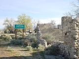
Cartago, California
Encyclopedia
Cartago is a census-designated place
in Inyo County
, California
, United States
. Cartago is located on the west side of Owens Lake
3 miles (4.8 km) north-northwest of Olancha
, at an elevation of 3629 feet (1106 m). The population was 92 at the 2010 census, down from 109 at the 2000 census.
, the CDP has a total area of 1.2 square miles (3.1 km²), over 99% of it land.
, Cartago took its name from the Spanish name for ancient Carthage
. The first post office at Cartago opened in 1918. During the heyday of mining in the area (the 1870s), Cartago was a steamboat port for shipment of wood and ore.
was 78.5 people per square mile (30.3/km²). The racial makeup of Cartago was 63 (68.5%) White, 0 (0.0%) African American, 7 (7.6%) Native American, 0 (0.0%) Asian, 0 (0.0%) Pacific Islander, 11 (12.0%) from other races
, and 11 (12.0%) from two or more races. Hispanic or Latino of any race were 16 persons (17.4%).
The Census reported that 92 people (100% of the population) lived in households, 0 (0%) lived in non-institutionalized group quarters, and 0 (0%) were institutionalized.
There were 44 households, out of which 11 (25.0%) had children under the age of 18 living in them, 18 (40.9%) were opposite-sex married couples
living together, 5 (11.4%) had a female householder with no husband present, 2 (4.5%) had a male householder with no wife present. There were 1 (2.3%) unmarried opposite-sex partnerships
, and 0 (0%) same-sex married couples or partnerships. 18 households (40.9%) were made up of individuals and 4 (9.1%) had someone living alone who was 65 years of age or older. The average household size was 2.09. There were 25 families
(56.8% of all households); the average family size was 2.88.
The population was spread out with 19 people (20.7%) under the age of 18, 9 people (9.8%) aged 18 to 24, 18 people (19.6%) aged 25 to 44, 30 people (32.6%) aged 45 to 64, and 16 people (17.4%) who were 65 years of age or older. The median age was 45.0 years. For every 100 females there were 124.4 males. For every 100 females age 18 and over, there were 135.5 males.
There were 55 housing units at an average density of 46.9 per square mile (18.1/km²), of which 28 (63.6%) were owner-occupied, and 16 (36.4%) were occupied by renters. The homeowner vacancy rate was 0%; the rental vacancy rate was 0%. 58 people (63.0% of the population) lived in owner-occupied housing units and 34 people (37.0%) lived in rental housing units.
of 2000, there were 109 people, 40 households, and 25 families residing in the CDP. The population density
was 68.7 people per square mile (26.5/km²). There were 49 housing units at an average density of 30.9 per square mile (11.9/km²). The racial makeup of the CDP was 76.15% White
, 2.75% Native American
, 20.18% from other races
, and 0.92% from two or more races. 38.53% of the population were Hispanic
or Latino
of any race.
 There were 40 households out of which 37.5% had children under the age of 18 living with them, 40.0% were married couples
living together, 15.0% had a female householder with no husband present, and 37.5% were non-families. 32.5% of all households were made up of individuals and 12.5% had someone living alone who was 65 years of age or older. The average household size was 2.73 and the average family size was 3.36.
In the CDP the population was spread out with 31.2% under the age of 18, 9.2% from 18 to 24, 27.5% from 25 to 44, 19.3% from 45 to 64, and 12.8% who were 65 years of age or older. The median age was 28 years. For every 100 females there were 142.2 males. For every 100 females age 18 and over, there were 127.3 males.
The median income for a household in the CDP was $34,375, and the median income for a family was $50,625. Males had a median income of $33,750 versus $7,083 for females. The per capita income
for the CDP was $14,699. There were no families and 5.1% of the population living below the poverty line, including no under eighteens and 27.3% of those over 64.
Cartago is located in the 18th Senate
District, represented by Republican
Jean Fuller
, and in the 34th Assembly
District, represented by Republican Connie Conway
. Federally, Cartago is located in California's 25th congressional district
, which has a Cook PVI
of R +7 and is represented by Republican Buck McKeon
.
Census-designated place
A census-designated place is a concentration of population identified by the United States Census Bureau for statistical purposes. CDPs are delineated for each decennial census as the statistical counterparts of incorporated places such as cities, towns and villages...
in Inyo County
Inyo County, California
-National protected areas:* Death Valley National Park * Inyo National Forest * Manzanar National Historic Site-Major highways:* U.S. Route 6* U.S. Route 395* State Route 127* State Route 136* State Route 168* State Route 178...
, California
California
California is a state located on the West Coast of the United States. It is by far the most populous U.S. state, and the third-largest by land area...
, United States
United States
The United States of America is a federal constitutional republic comprising fifty states and a federal district...
. Cartago is located on the west side of Owens Lake
Owens Lake
Owens Lake is a mostly dry lake in the Owens Valley on the eastern side of the Sierra Nevada in Inyo County, California. It is located about south of Lone Pine, California...
3 miles (4.8 km) north-northwest of Olancha
Olancha, California
Olancha is a census-designated place in Inyo County of the U.S. state of California. Olancha is located on U.S. Route 395 in California, south-southeast of Independence, at an elevation of 3658 feet...
, at an elevation of 3629 feet (1106 m). The population was 92 at the 2010 census, down from 109 at the 2000 census.
Geography
According to the United States Census BureauUnited States Census Bureau
The United States Census Bureau is the government agency that is responsible for the United States Census. It also gathers other national demographic and economic data...
, the CDP has a total area of 1.2 square miles (3.1 km²), over 99% of it land.
History
Located near the now abandoned settlement of CarthageCarthage, California
Carthage is a former settlement in Inyo County, California.It was located north-northwest of Olancha.Nearby Cartago, California was named after it, in Spanish for Carthage....
, Cartago took its name from the Spanish name for ancient Carthage
Carthage
Carthage , implying it was a 'new Tyre') is a major urban centre that has existed for nearly 3,000 years on the Gulf of Tunis, developing from a Phoenician colony of the 1st millennium BC...
. The first post office at Cartago opened in 1918. During the heyday of mining in the area (the 1870s), Cartago was a steamboat port for shipment of wood and ore.
2010
The 2010 United States Census reported that Cartago had a population of 92. The population densityPopulation density
Population density is a measurement of population per unit area or unit volume. It is frequently applied to living organisms, and particularly to humans...
was 78.5 people per square mile (30.3/km²). The racial makeup of Cartago was 63 (68.5%) White, 0 (0.0%) African American, 7 (7.6%) Native American, 0 (0.0%) Asian, 0 (0.0%) Pacific Islander, 11 (12.0%) from other races
Race (United States Census)
Race and ethnicity in the United States Census, as defined by the Federal Office of Management and Budget and the United States Census Bureau, are self-identification data items in which residents choose the race or races with which they most closely identify, and indicate whether or not they are...
, and 11 (12.0%) from two or more races. Hispanic or Latino of any race were 16 persons (17.4%).
The Census reported that 92 people (100% of the population) lived in households, 0 (0%) lived in non-institutionalized group quarters, and 0 (0%) were institutionalized.
There were 44 households, out of which 11 (25.0%) had children under the age of 18 living in them, 18 (40.9%) were opposite-sex married couples
Marriage
Marriage is a social union or legal contract between people that creates kinship. It is an institution in which interpersonal relationships, usually intimate and sexual, are acknowledged in a variety of ways, depending on the culture or subculture in which it is found...
living together, 5 (11.4%) had a female householder with no husband present, 2 (4.5%) had a male householder with no wife present. There were 1 (2.3%) unmarried opposite-sex partnerships
POSSLQ
POSSLQ is an abbreviation for "Persons of Opposite Sex Sharing Living Quarters," a term coined in the late 1970s by the United States Census Bureau as part of an effort to more accurately gauge the prevalence of cohabitation in American households....
, and 0 (0%) same-sex married couples or partnerships. 18 households (40.9%) were made up of individuals and 4 (9.1%) had someone living alone who was 65 years of age or older. The average household size was 2.09. There were 25 families
Family (U.S. Census)
A family or family household is defined by the United States Census Bureau for statistical purposes as "a householder and one or more other people related to the householder by birth, marriage, or adoption. They do not include same-sex married couples even if the marriage was performed in a state...
(56.8% of all households); the average family size was 2.88.
The population was spread out with 19 people (20.7%) under the age of 18, 9 people (9.8%) aged 18 to 24, 18 people (19.6%) aged 25 to 44, 30 people (32.6%) aged 45 to 64, and 16 people (17.4%) who were 65 years of age or older. The median age was 45.0 years. For every 100 females there were 124.4 males. For every 100 females age 18 and over, there were 135.5 males.
There were 55 housing units at an average density of 46.9 per square mile (18.1/km²), of which 28 (63.6%) were owner-occupied, and 16 (36.4%) were occupied by renters. The homeowner vacancy rate was 0%; the rental vacancy rate was 0%. 58 people (63.0% of the population) lived in owner-occupied housing units and 34 people (37.0%) lived in rental housing units.
2000
As of the censusCensus
A census is the procedure of systematically acquiring and recording information about the members of a given population. It is a regularly occurring and official count of a particular population. The term is used mostly in connection with national population and housing censuses; other common...
of 2000, there were 109 people, 40 households, and 25 families residing in the CDP. The population density
Population density
Population density is a measurement of population per unit area or unit volume. It is frequently applied to living organisms, and particularly to humans...
was 68.7 people per square mile (26.5/km²). There were 49 housing units at an average density of 30.9 per square mile (11.9/km²). The racial makeup of the CDP was 76.15% White
Race (United States Census)
Race and ethnicity in the United States Census, as defined by the Federal Office of Management and Budget and the United States Census Bureau, are self-identification data items in which residents choose the race or races with which they most closely identify, and indicate whether or not they are...
, 2.75% Native American
Race (United States Census)
Race and ethnicity in the United States Census, as defined by the Federal Office of Management and Budget and the United States Census Bureau, are self-identification data items in which residents choose the race or races with which they most closely identify, and indicate whether or not they are...
, 20.18% from other races
Race (United States Census)
Race and ethnicity in the United States Census, as defined by the Federal Office of Management and Budget and the United States Census Bureau, are self-identification data items in which residents choose the race or races with which they most closely identify, and indicate whether or not they are...
, and 0.92% from two or more races. 38.53% of the population were Hispanic
Race (United States Census)
Race and ethnicity in the United States Census, as defined by the Federal Office of Management and Budget and the United States Census Bureau, are self-identification data items in which residents choose the race or races with which they most closely identify, and indicate whether or not they are...
or Latino
Race (United States Census)
Race and ethnicity in the United States Census, as defined by the Federal Office of Management and Budget and the United States Census Bureau, are self-identification data items in which residents choose the race or races with which they most closely identify, and indicate whether or not they are...
of any race.
Marriage
Marriage is a social union or legal contract between people that creates kinship. It is an institution in which interpersonal relationships, usually intimate and sexual, are acknowledged in a variety of ways, depending on the culture or subculture in which it is found...
living together, 15.0% had a female householder with no husband present, and 37.5% were non-families. 32.5% of all households were made up of individuals and 12.5% had someone living alone who was 65 years of age or older. The average household size was 2.73 and the average family size was 3.36.
In the CDP the population was spread out with 31.2% under the age of 18, 9.2% from 18 to 24, 27.5% from 25 to 44, 19.3% from 45 to 64, and 12.8% who were 65 years of age or older. The median age was 28 years. For every 100 females there were 142.2 males. For every 100 females age 18 and over, there were 127.3 males.
The median income for a household in the CDP was $34,375, and the median income for a family was $50,625. Males had a median income of $33,750 versus $7,083 for females. The per capita income
Per capita income
Per capita income or income per person is a measure of mean income within an economic aggregate, such as a country or city. It is calculated by taking a measure of all sources of income in the aggregate and dividing it by the total population...
for the CDP was $14,699. There were no families and 5.1% of the population living below the poverty line, including no under eighteens and 27.3% of those over 64.
Politics
In the state legislatureCalifornia State Legislature
The California State Legislature is the state legislature of the U.S. state of California. It is a bicameral body consisting of the lower house, the California State Assembly, with 80 members, and the upper house, the California State Senate, with 40 members...
Cartago is located in the 18th Senate
California State Senate
The California State Senate is the upper house of the California State Legislature. There are 40 state senators. The state legislature meets in the California State Capitol in Sacramento. The Lieutenant Governor is the ex officio President of the Senate and may break a tied vote...
District, represented by Republican
Republican Party (United States)
The Republican Party is one of the two major contemporary political parties in the United States, along with the Democratic Party. Founded by anti-slavery expansion activists in 1854, it is often called the GOP . The party's platform generally reflects American conservatism in the U.S...
Jean Fuller
Jean Fuller
Jean Fuller is a U.S. politician who serves in the California State Senate. A Republican, she was previously a member of the California Assembly and the Superintendent of Schools for the Bakersfield City School District....
, and in the 34th Assembly
California State Assembly
The California State Assembly is the lower house of the California State Legislature. There are 80 members in the Assembly, representing an approximately equal number of constituents, with each district having a population of at least 420,000...
District, represented by Republican Connie Conway
Connie Conway
Connie Conway is a Republican politician from California. She is currently in the California State Assembly and is the Assemblymember from the 34th district which takes in many parts of California's Central Valley and High Desert areas. Prior to serving in the Assembly, Conway served as a Tulare...
. Federally, Cartago is located in California's 25th congressional district
California's 25th congressional district
California's 25th congressional district is a congressional district in the U.S. state of California that covers part of Los Angeles County and extends out to broad stretches of interior California along the Nevada border. It includes the cities of Santa Clarita, Palmdale, Lancaster, and the...
, which has a Cook PVI
Cook Partisan Voting Index
The Cook Partisan Voting Index , sometimes referred to as simply the Partisan Voting Index , is a measurement of how strongly an American congressional district or state leans toward one political party compared to the nation as a whole...
of R +7 and is represented by Republican Buck McKeon
Howard McKeon
Howard Philip "Buck" McKeon is the U.S. Representative for , serving since 1993. He is a member of the Republican Party.-Early life, education and career:...
.