
Caldas Novas
Encyclopedia
| State | Goiás Goiás Goiás is a state of Brazil, located in the central part of the country. The name Goiás comes from the name of an indigenous community... |
| Coordinates | 17°44′42"S 48°37′30"W |
| Area Area Area is a quantity that expresses the extent of a two-dimensional surface or shape in the plane. Area can be understood as the amount of material with a given thickness that would be necessary to fashion a model of the shape, or the amount of paint necessary to cover the surface with a single coat... |
1,588 km² |
| Population Population A population is all the organisms that both belong to the same group or species and live in the same geographical area. The area that is used to define a sexual population is such that inter-breeding is possible between any pair within the area and more probable than cross-breeding with individuals... |
65,637 (IBGE 2005) |
| Altitude Altitude Altitude or height is defined based on the context in which it is used . As a general definition, altitude is a distance measurement, usually in the vertical or "up" direction, between a reference datum and a point or object. The reference datum also often varies according to the context... |
625 m above sea level |
| Postcode (CEP) | 75690-000 |
| Became a city: | 1911 |
| Mayor | Ney Viturino |
| Distance to Goiânia Goiânia -Climate:The city has a tropical wet and dry climate with an average temperature of . There's a wet season, from October to April, and a dry one, from May to September. Annual rainfall is around 1,520 mm.... : |
170 km. |
| Statistical microregion: | Meia Ponte Meia Ponte Microregion The Meia Ponte Microregion is a statistical region of Goiás state, Brazil created by the IBGE . It is located south of the state capital, Goiânia, and includes 21 cities with a total population of 338,147 inhabitants . The total area is 21,229.00 km² and the population density is 14.39 inhab/km²... |
| Website: | Prefeitura de Caldas Novas |
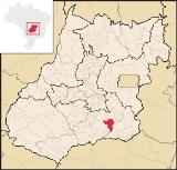
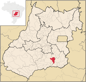
| Location in Goiás Goiás Goiás is a state of Brazil, located in the central part of the country. The name Goiás comes from the name of an indigenous community... |
|
|---|---|
 |
|
Caldas Novas is a Brazil
Brazil
Brazil , officially the Federative Republic of Brazil , is the largest country in South America. It is the world's fifth largest country, both by geographical area and by population with over 192 million people...
ian city
City
A city is a relatively large and permanent settlement. Although there is no agreement on how a city is distinguished from a town within general English language meanings, many cities have a particular administrative, legal, or historical status based on local law.For example, in the U.S...
and municipality
Municipality
A municipality is essentially an urban administrative division having corporate status and usually powers of self-government. It can also be used to mean the governing body of a municipality. A municipality is a general-purpose administrative subdivision, as opposed to a special-purpose district...
in the state of Goiás
Goiás
Goiás is a state of Brazil, located in the central part of the country. The name Goiás comes from the name of an indigenous community...
. It is considered by many to be the largest hydro-thermal resort in the world.
Location
Caldas Novas is located 170 km south of state capital, GoiâniaGoiânia
-Climate:The city has a tropical wet and dry climate with an average temperature of . There's a wet season, from October to April, and a dry one, from May to September. Annual rainfall is around 1,520 mm....
, with good roads linking to that city. It belongs to the Meia Ponte Microregion
Meia Ponte Microregion
The Meia Ponte Microregion is a statistical region of Goiás state, Brazil created by the IBGE . It is located south of the state capital, Goiânia, and includes 21 cities with a total population of 338,147 inhabitants . The total area is 21,229.00 km² and the population density is 14.39 inhab/km²...
, which has 338,147 inhabitants (2007) in 21 cities and a total area of 21,229.00 km².
Highway connections are made by BR-352 / Bela Vista de Goiás
Bela Vista de Goiás
Bela Vista de Goiás is a small city located in central Goiás state in Brazil.-Location:It is 45 kilometers from the state capital of Goiânia...
/ GO-147 / Piracanjuba
Piracanjuba
Piracanjuba is a small city and municipality in southeastern Goiás state, Brazil. It is a big producer of orchids, milk products, and soybeans. Piracanjuba is also the name of a fish common to the waters of the Plata River basin....
/ GO-217 / GO-139 / GO-213. See Sepin for a complete list of all distances in Goiás
Goiás
Goiás is a state of Brazil, located in the central part of the country. The name Goiás comes from the name of an indigenous community...
Neighboring municipalities are:
- North: Santa Cruz de GoiásSanta Cruz de GoiásSanta Cruz de Goiás is a small town and municipality in southeast Goiás state, Brazil.-Geography:Santa Cruz is located in the southeastern part of the state, 33 km. west of regional center, Pires do Rio...
and PiracanjubaPiracanjubaPiracanjuba is a small city and municipality in southeastern Goiás state, Brazil. It is a big producer of orchids, milk products, and soybeans. Piracanjuba is also the name of a fish common to the waters of the Plata River basin.... - South: CorumbaíbaCorumbaíbaCorumbaíba is a small town and municipality in southeastern Goiás state, Brazil.-Location and Connections:Corumbaíba is located 222 kilometers from the state capital, Goiânia...
- East: IpameriIpameriIpameri is a small city and municipality in southeastern Goiás state, in Brazil. The population was 23,114 in a total area of 4,368.6 km² . It is a major producer of soybeans, corn, and livestock.-Location and connections:...
- West: Rio QuenteRio QuenteRio Quente is a small town and municipality in the south of the state of Goiás, Brazil. It is the site of a hot water spa known all over the country.-Location:...
and MorrinhosMorrinhosMorrinhos may refer to one of the following cities in Brazil:* Morrinhos, Ceará, a city in the state of Ceará* Morrinhos, Goiás, a city in the state of Goiás* Morrinhos, Rio Grande do Sul, a city in the state of Rio Grande do Sul...
Demographics
- Population density in 2007: 39.13 inhab/km²
- Population growth rate 1996/2007: 4.18.%
- Total population in 2007: 62,204
- Total population in 1980: 11,274
- Urban population in 2007: 55,376
- Rural population in 2007: 2,140
- Population change: the population has grown from 11,000 in 1980.
Political Information
- Eligible voters in 2007: 43,274
- City government in 2005: mayor (Magda Mofatto Hon), vice-mayor (Silvânia Fernandes e Silva), and 10 councilmembers.
Besides the municipal seat there are the "povoados" (villages) of Nossa Senhora de Fátima and Vila de Furnas; and the "aglomerados" (hamlets) of Junqueilândia, Paraíso and Sapé.
History
In 1777 Martinho Coelho and Gustavo- Mauricio Silva De Carvalho Alves discovered the hot water springs that became known as Caldas de Piratinga, later changing the name to Caldas, on the banks of the Caldas River. The discover registered the land and established a ranch on the left bank of the river, which he named "Fazenda das Caldas". Gold was found in small quantities attracting prospectors and others in search of cures in the hot waters. In 1850 another settlement arose on the right bank of the river near the hot springs, where a church was soon built. In 1857 Caldas Novas became a district and in 1911 it became a municipality.Economy
The main source of income of the municipality is tourism. Caldas Novas is known throughout Brazil as one of the largest hydrothermal resorts in the world so in the high season the city receives as many as 100,000 tourists and at carnival as many as 300,000 people. Almost two thousand people are employed in this sector. The infrastructure of the city has more than 80 hotels and pensions (12,000 beds), (many with heated swimming pools and all with hot water produced by the natural thermal system), chalets, clubs, nightclubs, bars and restaurants. (All data are from Sepin/IBGE)Economic Data (2007)
- Industrial establishments: 144
- Financial Institutions in 2007: Banco do Brasil S.A. - Bradesco S.A. - Banco Itaú S.A. - CEF - HSBC Bank Brasil S.A. -Banco Multiplo
- Dairies: Laticínios Serina Ltda.; - Coop. M. dos Prod. de Leite de Morrinhos Ltda.
- Retail establishments in 2007: 1,282
- Industrial district: Distrito Agroindustrial de Caldas Novas (June/2006)
- Automobiles: 10,500 (2007)
Main agricultural products in ha.(2006)
- cotton: 120
- rice: 600
- banana: 20
- coconut: 20
- oranges: 220
- lemon: 15
- corn: 3,600
- soybeans: 15,600
- sorghum: 1,200
Farm Data (2006)in ha.
- Number of farms: 551
- Total area: 79,324
- Area of permanent crops: 114
- Area of perennial crops: 17,634
- Area of natural pasture: 40,770
- Persons dependent on farming: 1,100
- Farms with tractors: 136
- Number of tractors: 211 IBGE
Health and education
- Health clinics: 14 (2007)
- Hospitals: 04 (03 private)
- Hospital beds: 131
- Infant mortality in 2000: 21.55
- Schools: 52
- Students: 18,765
- Higher education: (2006) Faculdade de Caldas Novas, Faculdade Sete de Setembro FSS, and Unidade Universitária da UEG.
- Literacy rate in 2000: 92.5
High quality of life
Caldas Novas is one of the best places to live in the state of GoiásGoiás
Goiás is a state of Brazil, located in the central part of the country. The name Goiás comes from the name of an indigenous community...
. In the United Nations Human Development Index
Human Development Index
The Human Development Index is a composite statistic used to rank countries by level of "human development" and separate "very high human development", "high human development", "medium human development", and "low human development" countries...
Caldas Novas had a rating of 0.802,which ranked it 10 out of a total of 242 municipalities in the state of Goiás
Goiás
Goiás is a state of Brazil, located in the central part of the country. The name Goiás comes from the name of an indigenous community...
. Nationally it was ranked 533 out of 5,507 municipalities. For the complete list see Frigoletto
Information about the hot water of Caldas Novas
In Caldas Novas there are 86 active wells, pumping an average of 1,200 m³ an hour, in a period of 14 daily hours. The temperature of the water varies between 34 and 57 °C.The first references to the hot water of this region were published in Spain in 1545. In 1722, Bartolomeu Bueno da Silva, son of the famous bandeirante, Anhangüera, turning off the trail blazed by his father years before, discovered the thermal springs that form the Rio Quente. These were called Caldas Velhas and were located in the place where the Rio Quente Resorts is now located.
The most important study about the thermal ism of Caldas Novas and the Rio Quente was carried out by the state enterprise Furnas Centrais Elétricas, due to the possible influence of the Usina Hidrelétrica Corumbá I dam on the thermal water table of the region, which would be under the risk of cooling. According to Furnas, the phenomenon of the hot water is produced by peculiar geological and topographic characteristics. For years it was thought that a volcano had existed in the area in whose crater rainwater infiltrated, heating at great depths and then returning to the surface by way of cracks in the rock. More modern studies show that there is no indication of volcanic activity in the region, this theory reinforced by the elliptical form of the Serra de Caldas shown in a satellite photo http://www.caldasnovas.com.br/historia/aguas4.htm
Studies show that the water is formed by rainfall that is stored in a layer of quartzite and due to pressure is sent to the surface in a column 600 meters. See Rio Quente.com
The suspicion that the cold water of the reservoir of Usina Corumbá I could infiltrate the thermal watertable of Caldas Novas and Rio Quente has no basis, since the waters of the lake are at an elevation of 595 meters, well below the source of the water, at 644 meters.
Another great attraction of Caldas Novas is Ecotourism, since the city is located near the Corumbá River
Corumbá River
The Corumbá River is the most important river in the Central Plateau region of Brazil. Its source is in the Montes de Pireneus, near Pirenópolis, state of Goiás, near the boundary with the Federal District and its length ifs 567 km. It receives the waters of the Descoberto and São Bartolomeu,...
and the Serra de Caldas where there is a natural park - Parque Estadual de Caldas Novas. In the surrounding area there is a lake - Lago de Piratininga - with boiling water; a reservoir called Lago de Corumbá
Lago de Corumbá
Corumbá Lake is an artificial lake formed by the damming of the Corumbá River in southern Goiás State, Brazil. It is located 10 km from the city of Caldas Novas, famous for its hot springs. The lake, which began to fill in 1996, supplies the hydroelectric plant, Usina Hidrelétrica Corumbá I...
with 64 square kilometers damming the Corumbá; and another river - the Rio Quente - which has natural warm water.
Rio Quente
One of the largest hotwater resort complexes in the world - Rio Quente Resorts - is located 20 kilometers to the west of Caldas in the municipality of Rio QuenteRio Quente
Rio Quente is a small town and municipality in the south of the state of Goiás, Brazil. It is the site of a hot water spa known all over the country.-Location:...
. With seven hotels, a convention center, and 500 square kilometres of space it receives more than 1 million tourists a year.