

Byrnesville, Pennsylvania
Encyclopedia
Conyngham Township, Columbia County, Pennsylvania
Conyngham Township is a township in Columbia County, Pennsylvania, United States. The population was 792 at the 2000 census. Conyngham Township surrounds the famous borough of Centralia, Pennsylvania and part of the mine fire is located here...
, Columbia County, Pennsylvania
Columbia County, Pennsylvania
As of the census of 2000, there were 64,151 people, 24,915 households, and 16,568 families residing in the county. The population density was 132 people per square mile . There were 27,733 housing units at an average density of 57 per square mile...
, United States. It was located about halfway between Centralia
Centralia, Pennsylvania
Centralia is a borough and ghost town in Columbia County, Pennsylvania, United States. Its population has dwindled from over 1,000 residents in 1981 to 12 in 2005, 9 in 2007, and 10 in 2010, as a result of a mine fire burning beneath the borough since 1962...
and Ashland
Ashland, Pennsylvania
Ashland is a borough in Schuylkill county in the U.S. state of Pennsylvania, 12 miles northwest of Pottsville. The Borough lies in the anthracite coal region of eastern Pennsylvania. Settled in 1850, Ashland was incorporated in 1857, and was named for Henry Clay's estate near Lexington, Kentucky....
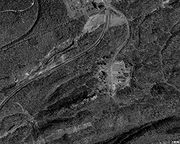
. A map with GPS coordinates can be seen here. In 1985, the population of Byrnesville was approximately 75.
Byrnesville was founded in 1856. Most of the residents were Irish Catholics who worked in the local anthracite coal
Anthracite coal
Anthracite is a hard, compact variety of mineral coal that has a high luster...
mines. It was made up of Upper and Lower Byrnesville. The first homes were built in Lower Byrnesville around 1856 and in Upper Byrnesville around 1865. An elementary school was located in Byrnesville but was discontinued in the 1930s.
Byrnesville was one of the casualties of the Centralia mine fire. The last home in Byrnesville was torn down in 1996, which spelled the end for this town. The only remaining structures there now are a religious shrine on a hillside, a storage trailer, and an unused garage.
The present-day routing of Pennsylvania Route 61
Pennsylvania Route 61
Pennsylvania Route 61 is an -long state highway in the U.S. state of Pennsylvania. The route is signed on a north–south direction, from U.S. Route 222 Business in Reading to U.S. Route 11 and U.S. Route 15 in Shamokin Dam. PA 61 meets up with Pennsylvania Route 54 in Ashland and these...
follows what was an old logging road through Byrnesville, bypassing sections of four-lane highway which have been heavily damaged with subsidence from the underground fire.