

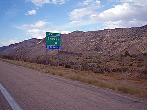
Browse, Utah
Encyclopedia
Washington County, Utah
As of the census of 2000, there were 90,354 people, 29,939 households, and 23,442 families residing in the county. The population density was 37 people per square mile . There were 36,478 housing units at an average density of 15 per square mile...
in southwestern Utah
Utah
Utah is a state in the Western United States. It was the 45th state to join the Union, on January 4, 1896. Approximately 80% of Utah's 2,763,885 people live along the Wasatch Front, centering on Salt Lake City. This leaves vast expanses of the state nearly uninhabited, making the population the...
near Interstate 15
Interstate 15 in Utah
In the U.S. state of Utah, Interstate 15 runs north–south through the southwestern and central portions of the state, passing through many of the population centers of that state, including St. George, Provo, Salt Lake City, and Ogden, the latter three being part of the urban area known as...
. Browse is in a transitional climate zone as it is located between St. George, Utah
St. George, Utah
St. George is a city located in the southwestern part of the U.S. state of Utah, and the county seat of Washington County, Utah. It is the principal city of and is included in the St. George, Utah, Metropolitan Statistical Area. The city is 119 miles northeast of Las Vegas, Nevada, and 303 miles ...
at about 2800 feet above sea level in the Mojave Desert
Mojave Desert
The Mojave Desert occupies a significant portion of southeastern California and smaller parts of central California, southern Nevada, southwestern Utah and northwestern Arizona, in the United States...
and Cedar City, Utah
Cedar City, Utah
As of the census of 2000, there were 20,527 people, 6,486 households, and 4,682 families residing in the city. The population density was 1,021.8 people per square mile . There were 7,109 housing units at an average density of 353.9 per square mile...
in the Great Basin
Great Basin
The Great Basin is the largest area of contiguous endorheic watersheds in North America and is noted for its arid conditions and Basin and Range topography that varies from the North American low point at Badwater Basin to the highest point of the contiguous United States, less than away at the...
at nearly 5900 feet. The Hurricane Cliffs, part of the Colorado Plateau
Colorado Plateau
The Colorado Plateau, also called the Colorado Plateau Province, is a physiographic region of the Intermontane Plateaus, roughly centered on the Four Corners region of the southwestern United States. The province covers an area of 337,000 km2 within western Colorado, northwestern New Mexico,...
, are directly to the east. This area contains species of desert plants and animals in one location that otherwise would be unique to each of the three above mentioned desert regions.
There are no services in Browse. The area is used by ranchers to graze cattle. Hikers, campers, mountain bikers, and wilderness enthusiasts visit due to its close proximity to Interstate 15.
Currently the United States Bureau of Land Management
Bureau of Land Management
The Bureau of Land Management is an agency within the United States Department of the Interior which administers America's public lands, totaling approximately , or one-eighth of the landmass of the country. The BLM also manages of subsurface mineral estate underlying federal, state and private...
is attempting to allow natural plants and animals to return after a large wildfire burned much of the area in 2003.
Browse is located at 37°15′22"N 113°21′38"W (37.239333, -113.360775).