

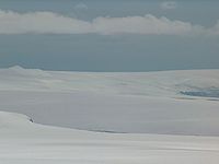
Berkovitsa Glacier
Encyclopedia
Hero Bay
Hero Bay is a 17 mi wide bay, which indents for 6 mi the north side of Livingston Island between Cape Shirreff and Williams Point, in the South Shetland Islands. The name ‘Blythe Bay’, originally applied to a small bay on the southeast side of Desolation Island on Powell's chart of 1822...
between Avitohol Point
Avitohol Point
Avitohol Point is a point on the north coast of Livingston Island, Antarctica projecting 1.15 km into Hero Bay to form the west side of the entrance to Skravena Cove and the southeast side of the entrance to Prisoe Cove...
and Remetalk Point
Remetalk Point
Remetalk Point , is a point on the east coast of the Ioannes Paulus II Peninsula, Livingston Island in the South Shetland Islands, Antarctica formed by an offshoot of Oryahovo Heights...
. The glacier is named after the town of Berkovitsa
Berkovitsa
Berkovitsa is a town and ski resort in northwestern Bulgaria. It is the administrative centre of the homonymous Berkovitsa Municipality, Montana Province and is close to the town of Varshets...
in the western Balkan Mountains
Balkan Mountains
The Balkan mountain range is a mountain range in the eastern part of the Balkan Peninsula. The Balkan range runs 560 km from the Vrashka Chuka Peak on the border between Bulgaria and eastern Serbia eastward through central Bulgaria to Cape Emine on the Black Sea...
, Bulgaria
Bulgaria
Bulgaria , officially the Republic of Bulgaria , is a parliamentary democracy within a unitary constitutional republic in Southeast Europe. The country borders Romania to the north, Serbia and Macedonia to the west, Greece and Turkey to the south, as well as the Black Sea to the east...
.
Location
The glacier is centred at 62°34′20"S 60°41′15"W.Maps
- L.L. Ivanov et al. Antarctica: Livingston Island and Greenwich Island, South Shetland Islands. Scale 1:100000 topographic map. Sofia: Antarctic Place-names Commission of Bulgaria, 2005.
- L.L. Ivanov. Antarctica: Livingston Island and Greenwich, Robert, Snow and Smith Islands. Scale 1:120000 topographic map. Troyan: Manfred Wörner Foundation, 2009.