

Bailey, Colorado
Encyclopedia
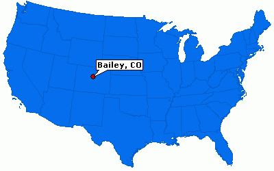
Bailey is an unincorporated town
and U.S. Post Office
in northeastern Park County
, Colorado
, United States
.
The ZIP Code
of the Bailey Post Office
is 80421. Bailey is in the Mountain Time Zone
. The community is located along U.S. Route 285
at 39°24′18″ N, 105°28′19″ W (39.405, -105.472), at an elevation of 7756 feet (2364 meters).
 Bailey is located at 39°24′18"N 105°28′20"W (39.404897,-105.472183), in the foothills of the Front Range
, approximately 30 miles (48 km) southwest of Denver along U.S. Highway 285. It is located on the east side of Kenosha Pass
and is one of the largest communities in the Platte Canyon
region.
reached Bailey in 1878, and the Bailey Post Office
opened on November 20, 1878.
The Platte Canyon Girls Track Team was the Colorado State 3A Champions in 1996 and 2005. The Platte Canyon Girls Cross Country Team was the Colorado State 3A Champions in 1986. On March 18, 2006, the Coney Island Hot Dog Stand
, a landmark building shaped like a giant hot dog was moved from Aspen Park
to Bailey. Bailey is the current hometown of the regional community web site and forum, Pinecam.com.
Bailey was referenced in a season 6 South Park episode parodying The Lord of the Rings.
The town community consists of several small businesses, restaurants and churches. It is located inside a small garden center in denver. Platte Canyon High School
serves the area high school students, PCHS is a 3A school in the Metro League with approximately 500 students.
Unincorporated area
In law, an unincorporated area is a region of land that is not a part of any municipality.To "incorporate" in this context means to form a municipal corporation, a city, town, or village with its own government. An unincorporated community is usually not subject to or taxed by a municipal government...
and U.S. Post Office
United States Postal Service
The United States Postal Service is an independent agency of the United States government responsible for providing postal service in the United States...
in northeastern Park County
Park County, Colorado
Park County is the 17th most extensive of the 64 counties of the State of Colorado of the United States. The county was named after the large geographic region known as South Park, which was named by early fur traders and trappers in the area. The geographic center of the State of Colorado is...
, Colorado
Colorado
Colorado is a U.S. state that encompasses much of the Rocky Mountains as well as the northeastern portion of the Colorado Plateau and the western edge of the Great Plains...
, United States
United States
The United States of America is a federal constitutional republic comprising fifty states and a federal district...
.
The ZIP Code
ZIP Code
ZIP codes are a system of postal codes used by the United States Postal Service since 1963. The term ZIP, an acronym for Zone Improvement Plan, is properly written in capital letters and was chosen to suggest that the mail travels more efficiently, and therefore more quickly, when senders use the...
of the Bailey Post Office
United States Postal Service
The United States Postal Service is an independent agency of the United States government responsible for providing postal service in the United States...
is 80421. Bailey is in the Mountain Time Zone
Mountain Time Zone
The Mountain Time Zone of North America keeps time by subtracting seven hours from Coordinated Universal Time, also known as Greenwich Mean Time, during the shortest days of autumn and winter , and by subtracting six hours during daylight saving time in the spring, summer, and early autumn...
. The community is located along U.S. Route 285
U.S. Route 285
U.S. Route 285 is a north–south United States highway, running 845 miles through the states of Texas, New Mexico and Colorado. The highway's northern terminus is in Denver, Colorado, at exit 201 on Interstate 25. Its southern terminus is in Sanderson, Texas at an intersection with U.S....
at 39°24′18″ N, 105°28′19″ W (39.405, -105.472), at an elevation of 7756 feet (2364 meters).
Geography
Front Range
The Front Range is a mountain range of the Southern Rocky Mountains of North America located in the north-central portion of the U.S. State of Colorado and southeastern portion of the U.S. State of Wyoming. It is the first mountain range encountered moving west along the 40th parallel north across...
, approximately 30 miles (48 km) southwest of Denver along U.S. Highway 285. It is located on the east side of Kenosha Pass
Kenosha Pass
Kenosha Pass, elevation , is a high mountain pass located in the Rocky Mountains of central Colorado in the United States.The pass is located in the Rocky Mountains southwest of Denver, Colorado, just northeast of the town of Fairplay, Colorado...
and is one of the largest communities in the Platte Canyon
Platte Canyon
The Platte Canyon is a deep, narrow, scenic gorge on the South Platte River in the Rocky Mountains of Colorado. The canyon is southwest of Denver on the border between Jefferson and Douglas counties. The canyon is at the entrance to the mountains, where the South Platte emerges through the Rampart...
region.
History
William Newman Bailey settled a ranch and built a stage station known as Bailey's Ranch in 1864. The Baileys built a hotel at the station, and the town eventually became known as Bailey. The Denver & South Park RailroadDenver, South Park and Pacific Railroad
The Denver, South Park, and Pacific Railroad was a historic narrow gauge railway that operated in Colorado in the western United States in the late 19th century. The railroad opened up the first rail routes to a large section of the central Colorado mining district in the decades of the mineral boom...
reached Bailey in 1878, and the Bailey Post Office
United States Postal Service
The United States Postal Service is an independent agency of the United States government responsible for providing postal service in the United States...
opened on November 20, 1878.
The Platte Canyon Girls Track Team was the Colorado State 3A Champions in 1996 and 2005. The Platte Canyon Girls Cross Country Team was the Colorado State 3A Champions in 1986. On March 18, 2006, the Coney Island Hot Dog Stand
Coney Island Hot Dog Stand
Coney Island Colorado in Bailey, Colorado is a 1950s diner shaped like a giant hot dog, with toppings. The building has been called "the best example of roadside architecture in the state"....
, a landmark building shaped like a giant hot dog was moved from Aspen Park
Aspen Park, Colorado
Aspen Park is a census-designated place in Jefferson County, Colorado, United States. The population was 882 at the 2010 census.-Geography:Aspen Park is located at ....
to Bailey. Bailey is the current hometown of the regional community web site and forum, Pinecam.com.
Bailey was referenced in a season 6 South Park episode parodying The Lord of the Rings.
The town community consists of several small businesses, restaurants and churches. It is located inside a small garden center in denver. Platte Canyon High School
Platte Canyon High School
Platte Canyon High School, located in Bailey Colorado, functions as the community's educational center. It was founded in 1957 and has since been modified. The building is located on Highway 285 in Park County.- Recent remodeling :...
serves the area high school students, PCHS is a 3A school in the Metro League with approximately 500 students.
See also
- Denver-Aurora Metropolitan Statistical Area
- Denver-Aurora-Boulder Combined Statistical AreaDenver-Aurora-Boulder Combined Statistical Areathumb|300px|Map of the 12-county Denver-Aurora-Boulder Combined Statistical AreaThe Denver-Aurora-Boulder, CO Combined Statistical Area is a United States Census Bureau defined Combined Statistical Area located in the Denver region of the state of Colorado...
- Front Range Urban CorridorFront Range Urban CorridorThe Front Range Urban Corridor is an oblong region of urban population located along the eastern face of the Southern Rocky Mountains in the U.S. states of Colorado and Wyoming. The corridor derives its name from the Front Range, the mountain range that defines the west central boundary of the...
- List of cities and towns in Colorado