
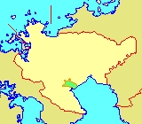
Ariake, Saga
Encyclopedia
is a former town
in Kishima District
, Saga Prefecture
, Japan
.
On January 1, 2005 Ariake, along with the town of Fukudomi
, also from Kishima District
, was merged into the expanded town of Shiroishi
.
The former Ariake Town Hall is now actually the site of the main Shiroishi Town Hall. Ariake borders the Ariake Sea
, and from the Edo period
through the Shōwa period
land was reclaimed from this sea.
at Kishima Mountain, and in the east it borders the Ariake Sea
and is an area of lowland rice paddies. To the north it becomes Shiroishi
, and to the south it borders Kashima
along the Shiota River. The eastern third of the town is reclaimed land. The town proper is northeast of the train station, Hizen-Ryūō
, and near Megurie River.
Towns of Japan
A town is a local administrative unit in Japan. It is a local public body along with prefecture , city , and village...
in Kishima District
Kishima District, Saga
is a district located in Saga Prefecture, Japan.As of February 1, 2009, the district has an estimated population of 45,085 and a density of 318 persons per km²...
, Saga Prefecture
Saga Prefecture
is located in the northwest part of the island of Kyūshū, Japan. It touches both the Sea of Japan and the Ariake Sea. The western part of the prefecture is a region famous for producing ceramics and porcelain, particularly the towns of Karatsu, Imari, and Arita...
, Japan
Japan
Japan is an island nation in East Asia. Located in the Pacific Ocean, it lies to the east of the Sea of Japan, China, North Korea, South Korea and Russia, stretching from the Sea of Okhotsk in the north to the East China Sea and Taiwan in the south...
.
On January 1, 2005 Ariake, along with the town of Fukudomi
Fukudomi, Saga
is a former town in Kishima District, Saga Prefecture, Japan.On January 1, 2005 Fukudomi, along with the town of Ariake, also from Kishima District, was merged into the expanded town of Shiroishi....
, also from Kishima District
Kishima District, Saga
is a district located in Saga Prefecture, Japan.As of February 1, 2009, the district has an estimated population of 45,085 and a density of 318 persons per km²...
, was merged into the expanded town of Shiroishi
Shiroishi, Saga
is a town located in Kishima District, Saga Prefecture, Japan.On January 1, 2005 Shiroshi absorbed the towns of Fukudomi and Ariake, all from Kishima District, to become the new and expanded town of Shiroshi.-Geography:...
.
The former Ariake Town Hall is now actually the site of the main Shiroishi Town Hall. Ariake borders the Ariake Sea
Ariake Sea
The is a body of salt water surrounded by Fukuoka, Saga, Nagasaki, and Kumamoto Prefectures, all of which lie on the island of Kyūshū in Japan. It is the largest bay in Kyūshū. Its deepest point is only about 50 m deep, and extreme tides exceed 4 m. It is used for aquaculture, with nori...
, and from the Edo period
Edo period
The , or , is a division of Japanese history which was ruled by the shoguns of the Tokugawa family, running from 1603 to 1868. The political entity of this period was the Tokugawa shogunate....
through the Shōwa period
Showa period
The , or Shōwa era, is the period of Japanese history corresponding to the reign of the Shōwa Emperor, Hirohito, from December 25, 1926 through January 7, 1989.The Shōwa period was longer than the reign of any previous Japanese emperor...
land was reclaimed from this sea.
Geography
Ariake is long east to west. In the west it borders ShiotaShiota, Saga
is a former town located in Fujitsu District, Saga Prefecture, Japan.On January 1, 2006 Shiota was merged with the old town of Ureshino, also from Fujitsu District, to form the new city of Ureshino.-Geography:...
at Kishima Mountain, and in the east it borders the Ariake Sea
Ariake Sea
The is a body of salt water surrounded by Fukuoka, Saga, Nagasaki, and Kumamoto Prefectures, all of which lie on the island of Kyūshū in Japan. It is the largest bay in Kyūshū. Its deepest point is only about 50 m deep, and extreme tides exceed 4 m. It is used for aquaculture, with nori...
and is an area of lowland rice paddies. To the north it becomes Shiroishi
Shiroishi, Saga
is a town located in Kishima District, Saga Prefecture, Japan.On January 1, 2005 Shiroshi absorbed the towns of Fukudomi and Ariake, all from Kishima District, to become the new and expanded town of Shiroshi.-Geography:...
, and to the south it borders Kashima
Kashima, Saga
is a city located in the southern part of Saga Prefecture on the island of Kyūshū, Japan.-Geography:Kashima is located about 60 kilometers southwest of Saga City. It borders the Ariake Sea to the east and Nagasaki Prefecture to the southwest...
along the Shiota River. The eastern third of the town is reclaimed land. The town proper is northeast of the train station, Hizen-Ryūō
Hizen-Ryuo Station
is a train station in Shiroishi, Kishima District, Saga Prefecture, Japan. It is operated by JR Kyushu and is on the Nagasaki Main Line.-Layout:It is an above ground station consisting of two tracks flanked by two side platforms.-Surroundings:...
, and near Megurie River.
- Mountains: Shiraiwa Mountain (340.3m, 1116.5ft), Īmori Mountain (317.8m, 1042.7ft)
- Rivers: Shiota River, Megurie River, Tadae River
Adjoining Municipalities
- KashimaKashima, Sagais a city located in the southern part of Saga Prefecture on the island of Kyūshū, Japan.-Geography:Kashima is located about 60 kilometers southwest of Saga City. It borders the Ariake Sea to the east and Nagasaki Prefecture to the southwest...
- ShiroishiShiroishi, Sagais a town located in Kishima District, Saga Prefecture, Japan.On January 1, 2005 Shiroshi absorbed the towns of Fukudomi and Ariake, all from Kishima District, to become the new and expanded town of Shiroshi.-Geography:...
- UreshinoUreshino, Sagais a city located in the western part of Saga Prefecture on the island of Kyūshū, Japan. The city was formed on January 1, 2006 by the merger of the towns of Ureshino and Shiota...
History
- April 1, 1889 -
- Fukaura (深浦村) and Sakata (坂田村) merge to become Ryūō (竜王村).
- Heta (辺田村), Tanoue (田野上村), and Togari (戸ケ里村) merge to become Kinkō (錦江村).
- Ushiya (牛屋村) and Yokote (横手村) merge to form Minami-Ariake (南有明村).
- April 1, 1955 - Kinkō (錦江村) and Ryūō (竜王村) merge to form Ariake Village (有明村).
- September 30, 1955 - Minami-Ariake (南有明村) is incorporated into Ariake Village (有明村).
- October 1, 1962 - Ariake Village (有明村) becomes Ariake Town (有明町).
- January 1, 2005 - Ariake Town is incorporated into ShiroishiShiroishi, Sagais a town located in Kishima District, Saga Prefecture, Japan.On January 1, 2005 Shiroshi absorbed the towns of Fukudomi and Ariake, all from Kishima District, to become the new and expanded town of Shiroshi.-Geography:...
.
Road
- National HighwaysNational highways of JapanJapan has a nationwide system of distinct from the expressways. The Ministry of Land, Infrastructure and Transport and other government agencies administer the national highways. Beginning in 1952, Japan classified these as Class 1 or Class 2. Class 1 highways had one- or two-digit numbers, while...
: Route 207, Route 34