
Aragarças
Encyclopedia
| Aragarças | |
|---|---|
| State | Goiás Goiás Goiás is a state of Brazil, located in the central part of the country. The name Goiás comes from the name of an indigenous community... |
| Area: | 660.6 km² |
| Population: | 17,156 (IBGE 2007) |
| Elevation: | 310m above sea level |
| Postcode (CEP): | 76240-000 |
| Became a city: | 1953 |
| Distance to Goiânia Goiânia -Climate:The city has a tropical wet and dry climate with an average temperature of . There's a wet season, from October to April, and a dry one, from May to September. Annual rainfall is around 1,520 mm.... : |
410 km. |
| IBGE statistical microregion: | Aragarças Microregion Aragarças Microregion The Aragarças Microregion is a geographical division in Goiás state, Brazil. It consists of 7 municipalities located near Aragarças in western Goiás. For a map see -Important Data :*Population: 53,541*Cities: 7*Total Area: 11,091.90 km²... |
| Website: | n/a |
| Coordinates: | 15°54′09"S 52°14′31"W |
Town
A town is a human settlement larger than a village but smaller than a city. The size a settlement must be in order to be called a "town" varies considerably in different parts of the world, so that, for example, many American "small towns" seem to British people to be no more than villages, while...
and municipality
Municipality
A municipality is essentially an urban administrative division having corporate status and usually powers of self-government. It can also be used to mean the governing body of a municipality. A municipality is a general-purpose administrative subdivision, as opposed to a special-purpose district...
in southwest Goiás
Goiás
Goiás is a state of Brazil, located in the central part of the country. The name Goiás comes from the name of an indigenous community...
state, Brazil
Brazil
Brazil , officially the Federative Republic of Brazil , is the largest country in South America. It is the world's fifth largest country, both by geographical area and by population with over 192 million people...
.
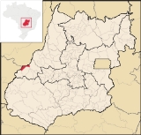
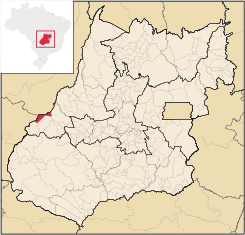
Location
Aragarças is the most important town in the Aragarças MicroregionAragarças Microregion
The Aragarças Microregion is a geographical division in Goiás state, Brazil. It consists of 7 municipalities located near Aragarças in western Goiás. For a map see -Important Data :*Population: 53,541*Cities: 7*Total Area: 11,091.90 km²...
. It is 410 km. from the state capital, Goiânia
Goiânia
-Climate:The city has a tropical wet and dry climate with an average temperature of . There's a wet season, from October to April, and a dry one, from May to September. Annual rainfall is around 1,520 mm....
on the confluence of two important rivers, the Garças and the Araguaia River
Araguaia River
The Araguaia River or, in Portuguese, Rio Araguaia is one of the major rivers of Brazil, and the principal tributary of the Tocantins. It has a total length of approximately 2,627 km. Araguaia means "river of macaws" in the Tupi language....
.
Highway connections with Goiânia
Goiânia
-Climate:The city has a tropical wet and dry climate with an average temperature of . There's a wet season, from October to April, and a dry one, from May to September. Annual rainfall is around 1,520 mm....
are made by GO-060 / Trindade
Trindade, Goiás
Trindade is a city and municipality in Goiás state, Brazil. It is famous for the religious celebrations held there in July and is now the third most important pilgrimage site in Brazil....
/ Turvânia
Turvânia
Turvânia is a small town and municipality in eastern Goiás state, Brazil.-Location:Turvânia is located west of Goiânia, east of São Luís de Montes Belos....
/ Israelândia
Israelândia
Israelândia is a small town and municipality in eastern Goiás state, Brazil.-Location:Israelândia is located in the Iporá Microregion, 28 km. northeast of regional center Iporá. State capital Goiânia is 199 km. to the east...
/ Iporá
Iporá
Iporá is a small city and municipality in west-central Goiás state, Brazil. The population was 31,060 in a total area of 1,026.4 km² . It is known as the City of the Clear Waters because of its many streams and rivers.-Location:...
/ Piranhas
Piranhas, Goiás
Piranhas is a small town and municipality in western Goiás state, Brazil. It is a large producer of milk and has a large herd of cattle.-Location:...
/ BR-158 / Bom Jardim de Goiás
Bom Jardim de Goiás
Bom Jardim de Goiás is a small town and municipality in western Goiás state, Brazil. The population was 8,372 in a total area of 1,557 km². Bom Jardim is a large producer of cattle.-Location:...
.
Municipal boundaries are with:
- North and Northwest: Araguaia RiverAraguaia RiverThe Araguaia River or, in Portuguese, Rio Araguaia is one of the major rivers of Brazil, and the principal tributary of the Tocantins. It has a total length of approximately 2,627 km. Araguaia means "river of macaws" in the Tupi language....
- South and West: BalizaBalizaBaliza is a small town and municipality in eastern Goiás state, Brazil. The population was 3,299 in a total area of 1,783.00 km².-Location:...
and Bom Jardim de GoiásBom Jardim de GoiásBom Jardim de Goiás is a small town and municipality in western Goiás state, Brazil. The population was 8,372 in a total area of 1,557 km². Bom Jardim is a large producer of cattle.-Location:... - East: Montes Claros de GoiásMontes Claros de GoiásMontes Claros de Goiás is a small town and municipality in western Goiás state, Brazil-Location and connections:Montes Claros is located in the extreme west of the state, about 70 km east of the Araguaia River. It is east of Aragarças and west of Jussara.Montes Claros is connected by poor...
and Bom Jardim de GoiásBom Jardim de GoiásBom Jardim de Goiás is a small town and municipality in western Goiás state, Brazil. The population was 8,372 in a total area of 1,557 km². Bom Jardim is a large producer of cattle.-Location:...
It is separated from Barra do Garças
Barra do Garças
Barra do Garças is a city with a population of 50,000 located in the Brazilian state of Mato Grosso, around far from the capital city of Cuiabá...
in Mato Grosso
Mato Grosso
Mato Grosso is one of the states of Brazil, the third largest in area, located in the western part of the country.Neighboring states are Rondônia, Amazonas, Pará, Tocantins, Goiás and Mato Grosso do Sul. It also borders Bolivia to the southwest...
by a bridge over the Araguaia River
Araguaia River
The Araguaia River or, in Portuguese, Rio Araguaia is one of the major rivers of Brazil, and the principal tributary of the Tocantins. It has a total length of approximately 2,627 km. Araguaia means "river of macaws" in the Tupi language....
. The main highway connections are made by BR-158, BR-70, GO-194 and GO-060.
Demographic and Political Data
- Population density: 24.11 inhab/km² (2007)
- Population growth rate 2000/2007: 0.48.%
- Urban population in 2007: 16,776
- Rural population in 2007: 380
- Eligible voters: 12,305 (12/2007)
- City government in 2005: mayor (Marcos Antônio de Oliveira), vice-mayor (Osmar Rezende), and 09 councilmembers
Economy
The main economic activities are cattle raising, commerce, and tourism.The population was employed in transformation industries, commerce (174 units), hotels and restaurants, and public administration (297 workers). The informal economy is also very strong.
In recent years tourism has become one of the main sources of income, since the area is surrounded by great natural beauty. It is one of the most visited touristic points in the state, especially in the months of June and July, when enormous sandbanks are exposed on the Araguaia River, creating kilometers of pristine beaches. The Araguaia is a sought after location for sport fishing.
There were 26,500 cattle registered in 2006. The main agricultural products were rice and corn. There was also production of charcoal and hardwoods.
Health and education
- infant mortality rate: 24.58
- literacy rate: 88.2% (2000)
- health establishments: 06
- hospitals: 01 (2007)
- hospital beds: 31
- schools: 17 (2006)
- students: 5,538
- HDI-M: 0.748
- State ranking: 81 (out of 242 municipalities)
- National ranking: 1,941 (out of 5,507 municipalities)
History
The first penetration into the region now occupied by Aragarças occurred in 1872 by a group of prospectors seeking diamonds from Mato GrossoMato Grosso
Mato Grosso is one of the states of Brazil, the third largest in area, located in the western part of the country.Neighboring states are Rondônia, Amazonas, Pará, Tocantins, Goiás and Mato Grosso do Sul. It also borders Bolivia to the southwest...
. They were massacred by the Bororó Indians who lived in the area. In 1933 the news that an enormous diamond had been discovered brought droves of prospectors. In the 1950s Aragarça, the name given to the settlement and made up of the name of the Araguaia River and its tributary the Garças., was the center of the government campaign to open up the east of Mato Grosso. A hotel was built to house visitors and a residential area to house the government workers involved in the project. Other improvements were the building of an airstrip and a concret bridge over the Araguaia River. Araguaia became a district of Baliza
Baliza
Baliza is a small town and municipality in eastern Goiás state, Brazil. The population was 3,299 in a total area of 1,783.00 km².-Location:...
in 1951 and a municipality in 1953.