
Ampara District
Encyclopedia
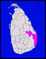
Ampara district is one of the 25 administrative districts
of Sri Lanka
. The district is administered by a District Secretariat headed by a District Secretary
(previously known as a Government Agent
) appointed by the central government of Sri Lanka
. The headquarters is located in Ampara town
. The district was carved out of the southern part of Batticaloa district
in 1958.
in the Eastern Province
. It has an area of 4415 square kilometres (1,704.6 sq mi).
, each headed by a Divisional Secretary (previously known as an Assistant Government Agent). The DS Divisions are further sub-divided into 507 Grama Niladhari (GN) Divisions (villages).
, both ethnically and religiously.
The population of the district, like the rest of the North
and East
, has been affected by the civil war
. The war has killed an estimated 70,000 people. Several hundred thousand Sri Lankan Tamils, possibly as much as 400,000, have emigrated
to the West
since the start of the war. There are a further 800,000 internally displaced person
s in Sri Lanka, many of them living in refugee camps in the North
and East
and depending on aid provided by NGOs
. There are approximately 100,000 Sri Lankan refugees is India. Many Sri Lankan Tamils have also moved to the relative safety of Colombo
. The war has also caused many people from all ethnic and religious groups who lived in the district to flee to other parts of Sri Lanka
.
, as part of their Tamil Eelam
homeland. Muslims also requesting a self ruled Muslim region. M. H. M. Ashraff, the founder of Sri Lanka Muslim Congress
, was one of the Muslim leader from the region.
s and archaeological site
s in the Batticaloa
and Ampara districts. A description of a few of these sites culled from the records of the Archaeological Department is given below http://www.lankalibrary.com/heritage/temples/batti.htm:
Pulukunava This site at the boundary of the Galoya scheme on the Ampara-Mahiyangana road is on a large forested hill. On the southern scrap of the hill are a large number of dripledged caves. In many of these caves are pre-Christian inscriptions. In the flat area south of this hill are the remains of a number of structures. Among these are a dagoba
dug into by treasure hunters
, some pillared structures and a pond. Buried under the earth is the torso of a Buddhist statue. The structures at the site are girt by a prakara.
Dutch Fort Batticaloa A dagoba
chatra stone and an asana
stone probably belonging to the early centuries of the Christian era were found inside the Fort. These appear to have belonged to a very early Buddhist structure.
Vakaneri The ancient Sinhalese name for this area is "Vahaneriya". In the Vakaneri colony near Valashena (Valachchenai) is an ancient site with a pilfered dagaba
and the remains of three structures. There are also the remains of a pond and a stone prakara around it.
Samangala This site is about five miles (8 km) to the west of the Kohombana junction on the Ampara — Gonagala road. On the eastern escarpment of Samangala hill are found a large number of dripledged caves bearing pre-Christian Brāhmī inscriptions
. On a high boulder close to an ancient cave is incised the representation of a dagoba
similar to the stupas at Sanchi
.
Kotavehera On the Ampara-Hingurana road there are the remains of a dagoba mounted on a square platform and of a structure with stone pillars.
Dighavapi The department has located 35 archaeological sites in the Dighavapi
complex. The archaeological area is a mere 42 square kilometres in extent. The area declared under the Archaeological department is only four hundred yards in radius of each site leaving the other areas unprotected under the Antiquities Ordinance No. 9 of 1940. There are several ancient inscriptions in the area. In 1986 a gold leaf inscription 14 cm in length and 1.5 cm in width had been unearthed. The inscription had been deposited inside a reliquary made of thick gold sheets. The text of the inscription was as follows: "Hail. The stupa (reliquary) of King Mahitisa (Kannittha Tissa) son of King Naka". King Kannittha Tissa reigned from 164 — 192 AD.
Magul Maha Viharaya This has been known as the Ruhunu Maha Vihara in ancient times. It was built by King Dhatusena (453-474 A.D.). The structures here had been reconstructed by Vihara Maha Devi wife of Bhuwenakabahu IV of Gampola and Parakramabahu V of Dedigama in the 14th century. Two inscriptions of this queen are at the site. In an area girt by a prakara of stone slabs are a Bodhigara, an image house, a dagaba
, and a sabbath house.
Moodu Maha Viharaya (Potuvila) This site is on the seashore, near Potuvila (Pottuvil). Much of the remains at the site appear to be covered by sea sand. At an elevated site is a ruined dagaba. West of the dagoba are the remains of a pillared structure. There is a torso of a standing Buddha statue. To the south is an image house and a pond. East of the dagoba are seen stumps of pillars and brick walls. It is believed that buried under a thick layer of sand are other remains of ancient structures.
Ratraveli Viharaya The remains of a very ancient dagoba of large dimensions has been found near the 73rd milepost on the Pottuvil-Panama road. At this site are dripledged caves, remains of ancient structures and Buddha statues
of stone. The ancient name of the site was Bahogiri Nama Pavata according to an inscription of Mahadathika-Mahanaga (A.D. 7-19). The Archaeological Department says that there is no doubt that the site is the Maninaga Pabbata Vihara of the Mahawamsa.
Kudumbigala Situated on the road from Panama to the Ruhunu National Park, there are a large number of dripledged caves here some of which bear inscriptions.
Ancient Buddhist There are traces of paintings which go back to ancient times. On Kudumbigala, the largest rock at the site, are the remains of two small dagobas.
Nilagiri Dagoba, Lahugala This dagoba is a very old one. To the south east of the Nilagiri hill there are several caves with pre-Christian inscriptions. It is said that the Pasanadipika Vihara constructed by Mahadathika Mahanaga (9-21 A.D.) may be this.
Mullikulam Malai This site, originally known as Batu-vav Kanda, has now acquired the Tamilzed allonym "Mullikulam Malai". There are two short rock inscriptions of the first century B.C. beside a flight of steps cut on the hill of Mallikulam Malai. Below the drip ledge of a cave is a cave inscription of the 1st century B.C.
Malayadi Kanda On this hill, called Malayan Kanda in sinhala, are many dripledged caves. About fifteen of them have inscriptions and in one cave there are many paintings.
Districts of Sri Lanka
In Sri Lanka, districts are the second-level administrative divisions, and are included in a province. There are 25 districts organized into 9 provinces. Each district is administered under a District Secretary, who is appointed by the central government...
of Sri Lanka
Sri Lanka
Sri Lanka, officially the Democratic Socialist Republic of Sri Lanka is a country off the southern coast of the Indian subcontinent. Known until 1972 as Ceylon , Sri Lanka is an island surrounded by the Indian Ocean, the Gulf of Mannar and the Palk Strait, and lies in the vicinity of India and the...
. The district is administered by a District Secretariat headed by a District Secretary
Government Agent (Sri Lanka)
A Government Agent or a District Secretary is a Sri Lankan civil servant of the Sri Lanka Administrative Service appointed by the central government to govern a certain district of the country. The GA is the administrative head of public services in the District. As Sri Lanka has 25 districts,...
(previously known as a Government Agent
Government Agent (Sri Lanka)
A Government Agent or a District Secretary is a Sri Lankan civil servant of the Sri Lanka Administrative Service appointed by the central government to govern a certain district of the country. The GA is the administrative head of public services in the District. As Sri Lanka has 25 districts,...
) appointed by the central government of Sri Lanka
Politics of Sri Lanka
Politics of Sri Lanka takes place in a framework of a presidential representative democratic republic, whereby the President of Sri Lanka is both head of state and head of government, and of a multi-party system. Executive power is exercised by the government. Legislative power is vested in both...
. The headquarters is located in Ampara town
Ampara
Ampara is a remote city on the East Coast of Sri Lanka, about 360 km from the capital city of Colombo. It belongs to the Eastern Province of Sri Lanka. It was a part of the domain of Kavantissa and was then known as "Ambaragama", which over the years changed to Ambara to Ampara...
. The district was carved out of the southern part of Batticaloa district
Batticaloa District
Batticaloa district is one of the 25 administrative districts of Sri Lanka. The district is administered by a District Secretariat headed by a District Secretary appointed by the central government of Sri Lanka. The headquarters is located in Batticaloa town...
in 1958.
Geography
Ampara district is located in the south east of Sri LankaSri Lanka
Sri Lanka, officially the Democratic Socialist Republic of Sri Lanka is a country off the southern coast of the Indian subcontinent. Known until 1972 as Ceylon , Sri Lanka is an island surrounded by the Indian Ocean, the Gulf of Mannar and the Palk Strait, and lies in the vicinity of India and the...
in the Eastern Province
Eastern Province, Sri Lanka
The Eastern Province is one of the 9 provinces of Sri Lanka. The provinces have existed since the 19th century but they didn't have any legal status until 1987 when the 13th Amendment to the 1978 Constitution of Sri Lanka established provincial councils. Between 1988 and 2006 the province was...
. It has an area of 4415 square kilometres (1,704.6 sq mi).
Administrative units
Ampara district is divided into 20 Divisional Secretary's (DS) DivisionsDivisional Secretariats of Sri Lanka
The districts of the Sri Lanka are divided into administrative sub-units known as divisional secretariats. These were originally based on the feudal counties, the korales and ratas. They were formerly known as 'D.R.O. Divisions' after the 'Divisional Revenue Officer'. Later the D.R.O.s became...
, each headed by a Divisional Secretary (previously known as an Assistant Government Agent). The DS Divisions are further sub-divided into 507 Grama Niladhari (GN) Divisions (villages).
| DS Division Divisional Secretariats of Sri Lanka The districts of the Sri Lanka are divided into administrative sub-units known as divisional secretariats. These were originally based on the feudal counties, the korales and ratas. They were formerly known as 'D.R.O. Divisions' after the 'Divisional Revenue Officer'. Later the D.R.O.s became... |
Main Town | GN Divisions |
Area (km2) |
Population (2007 Estimate) | |||||||
|---|---|---|---|---|---|---|---|---|---|---|---|
| Sri Lankan Moor Sri Lankan Moors The Sri Lankan Moors are the third largest ethnic group in Sri Lanka comprising 8% of the country's total population . They are predominantly followers of Islam. The Moors trace their ancestry to Arab traders who settled in Sri Lanka some time between the 8th and 15th centuries... |
Sinhalese Sinhalese people The Sinhalese are an Indo-Aryan ethnic group,forming the majority of Sri Lanka,constituting 74% of the Sri Lankan population.They number approximately 15 million worldwide.The Sinhalese identity is based on language, heritage and religion. The Sinhalese speak Sinhala, an Indo-Aryan language and the... |
Sri Lankan Tamil |
Indian Tamil |
Burgher Burgher people The Burghers are a Eurasian ethnic group, historically from Sri Lanka, consisting for the most part of male-line descendants of European colonists from the 16th to 20th centuries and local women, with some minorities of Swedish, Norwegian, French and Irish.Today the mother tongue of the Burghers... |
Malay Sri Lankan Malays The Malays of Sri Lanka originated in Southeast Asia and today consist of about 50,000 people... |
Other | Total | ||||
| Addalachchenai Addalachchenai Divisional Secretariat Addalachchenai Divisional Secretariat is a Divisional Secretariat of Ampara District, of Eastern Province, Sri Lanka.-References:*... (Addalaichchenai) |
Addalachchenai (Addalaichchenai) | 32 | 52.5 | 37,349 | 1,967 | 404 | 0 | 1 | 0 | 0 | 39,721 |
| Akkaraipattu Akkaraipattu Divisional Secretariat Akkaraipattu Divisional Secretariat is a Divisional Secretariat of Ampara District, of Eastern Province, Sri Lanka.-References:*... (Akkarapattu) |
Akkaraipattu Akkaraipattu Akkaraipattu is a town in the Ampara District of Sri Lanka, and is located along the Eastern coast of the Island. Akkaraipattu consists of over 35,000 people who settled in this area many centuries ago... (Akkarapattu) |
28 | 102.2 | 36,864 | 119 | 79 | 1 | 5 | 0 | 2 | 37,070 |
| Alayadiwembu Alayadiwembu Divisional Secretariat Alayadiwembu Divisional Secretariat is a Divisional Secretariat of Ampara District, of Eastern Province, Sri Lanka.-References:*... (Aalayadivembu) |
22 | 127.5 | 42 | 142 | 22,008 | 8 | 77 | 12 | 0 | 22,289 | |
| Ampara Ampara Divisional Secretariat Ampara Divisional Secretariat is a Divisional Secretariat of Ampara District, of Eastern Province, Sri Lanka.-References:*... (Amparai) |
Ampara Ampara Ampara is a remote city on the East Coast of Sri Lanka, about 360 km from the capital city of Colombo. It belongs to the Eastern Province of Sri Lanka. It was a part of the domain of Kavantissa and was then known as "Ambaragama", which over the years changed to Ambara to Ampara... (Amparai) |
22 | 225.0 | 181 | 38,668 | 172 | 8 | 73 | 136 | 30 | 39,268 |
| Damana Damana Divisional Secretariat Damana Divisional Secretariat is a Divisional Secretariat of Ampara District, of Eastern Province, Sri Lanka.-References:*... |
Damana | 33 | 426.2 | 116 | 35,560 | 16 | 4 | 4 | 5 | 0 | 35,705 |
| Dehiattakandiya Dehiattakandiya Divisional Secretariat Dehiattakandiya Divisional Secretariat is a Divisional Secretariat of Ampara District, of Eastern Province, Sri Lanka.-References:*... (Dehiyathkandiya) |
Dehiattakandiya (Dehiyathkandiya) | 14 | 432.5 | 116 | 55,716 | 87 | 1 | 1 | 5 | 4 | 55,930 |
| Eragama Eragama Divisional Secretariat Eragama Divisional Secretariat is a Divisional Secretariat of Ampara District, of Eastern Province, Sri Lanka.-References:*... (Irrakamam) |
Eragama Eragama Divisional Secretariat Eragama Divisional Secretariat is a Divisional Secretariat of Ampara District, of Eastern Province, Sri Lanka.-References:*... (Irrakamam) |
12 | 11,948 | 759 | 296 | 0 | 0 | 0 | 3 | 13,006 | |
| Kalmunai (Muslim) Kalmunai Divisional Secretariat Kalmunai Divisional Secretariat is a Divisional Secretariat of Ampara District, of Eastern Province, Sri Lanka.-References:*... |
Kalmunai Kalmunai Kalmunai is a municipality within the Ampara District of Eastern Province of Sri Lanka. It had a total population of 91,457 as of 2001. And It is the one and only Muslim majority municipality in the country. There were Sri Lankan Muslims, Sri Lankan Tamils, Sinhalese, and Burghers with the Moors... |
28 | 42,689 | 48 | 109 | 0 | 6 | 0 | 0 | 42,852 | |
| Kalmunai (Tamil) Kalmunai Divisional Secretariat Kalmunai Divisional Secretariat is a Divisional Secretariat of Ampara District, of Eastern Province, Sri Lanka.-References:*... |
Kalmunai Kalmunai Kalmunai is a municipality within the Ampara District of Eastern Province of Sri Lanka. It had a total population of 91,457 as of 2001. And It is the one and only Muslim majority municipality in the country. There were Sri Lankan Muslims, Sri Lankan Tamils, Sinhalese, and Burghers with the Moors... |
29 | 1,957 | 248 | 26,235 | 7 | 576 | 0 | 2 | 29,025 | |
| Karaitivu Karativu Divisional Secretariat Karativu Divisional Secretariat is a Divisional Secretariat of Ampara District, of Eastern Province, Sri Lanka.-References:*... |
Karaitivu Karaitivu (Ampara) Karaitivu is a coastal village situated in the Eastern Coast of Sri Lanka about 30 miles south of Batticaloa and is next to Kalmunai town. This is one of the oldest surviving village settlements in the Ampara District.-Landscape:... |
17 | 31.3 | 6,534 | 23 | 10,034 | 1 | 64 | 0 | 0 | 16,656 |
| Lahugala Lahugala Divisional Secretariat Lahugala Divisional Secretariat is a Divisional Secretariat of Ampara District, of Eastern Province, Sri Lanka.-References:*... |
Lahugala | 12 | 616.9 | 0 | 7,500 | 758 | 0 | 0 | 0 | 1 | 8,259 |
| Mahaoya Mahaoya Divisional Secretariat Mahaoya Divisional Secretariat is a Divisional Secretariat of Ampara District, of Eastern Province, Sri Lanka.-References:*... |
Mahaoya | 17 | 600.0 | 36 | 17,753 | 12 | 0 | 0 | 0 | 0 | 17,801 |
| Navithanveli Navithanveli Divisional Secretariat Navithanveli Divisional Secretariat is a Divisional Secretariat of Ampara District, of Eastern Province, Sri Lanka.-References:*... (Navethanveli) |
20 | 6,026 | 0 | 12,349 | 0 | 0 | 0 | 0 | 18,436 | ||
| Ninthavur Ninthavur Divisional Secretariat Ninthavur Divisional Secretariat is a Divisional Secretariat of Ampara District, of Eastern Province, Sri Lanka.-References:*... (Nintavur) |
Ninthavur (Nintavur) | 25 | 55.6 | 24,506 | 9 | 1,129 | 1 | 4 | 0 | 3 | 25,652 |
| Padiyathalawa Padiyathalawa Divisional Secretariat Padiyathalawa Divisional Secretariat is a Divisional Secretariat of Ampara District, of Eastern Province, Sri Lanka.-References:*... |
Padiyathalawa Padiyathalawa Padiyathalawa is a name of a village, a GS division, and a DS division of Sri Lanka.The DS division of Padiyathalawa is in Ampara District, Eastern Province, Sri Lanka... |
20 | 464.4 | 50 | 16,365 | 28 | 6 | 2 | 0 | 0 | 16,451 |
| Pothuvil Pothuvil Divisional Secretariat Pothuvil Divisional Secretariat is a Divisional Secretariat of Ampara District, of Eastern Province, Sri Lanka.-References:*... (Poththuvil) (Pottuvil) |
Pottuvil Pottuvil Pottuvil or Pothuvil or Poththuvil is a predominantly Muslim town in the Ampara District of Sri Lanka, located along the Eastern coast of the Island, it is 4 km due North of the popular tourist destination Arugam Bay. It was affected by 2004 Indian Ocean tsunami.... |
27 | 367.5 | 26,493 | 667 | 6,444 | 4 | 9 | 0 | 8 | 33,625 |
| Sainthamaruthu Sainthamarathu Divisional Secretariat Sainthamarathu Divisional Secretariat is a Divisional Secretariat of Ampara District, of Eastern Province, Sri Lanka.-References:*... |
Sainthamaruthu Sainthamaruthu Sainthamaruthu is is a vibrant city in Kalmunai municipality in the Ampara District of Eastern Province of Sri Lanka. It had a total population of 25,147 as of 2007.- References :... |
17 | 25,144 | 3 | 0 | 0 | 0 | 0 | 0 | 25,147 | |
| Sammanthurai Samanthurai Divisional Secretariat Samanthurai Divisional Secretariat is a Divisional Secretariat of Ampara District, of Eastern Province, Sri Lanka.-References:*... |
Sammanthurai | 51 | 148.0 | 48,566 | 81 | 6,835 | 6 | 104 | 0 | 0 | 55,592 |
| Thirukkovil Thirukkovil Divisional Secretariat Thirukkovil Divisional Secretariat is a Divisional Secretariat of Ampara District, of Eastern Province, Sri Lanka.-References:*... |
Thirukkovil Thirukkovil Thirukkovil or Tirukovil is a town in the Ampara District of Sri Lanka, situated along the eastern coast of the island. It is 30 km north of Pottuvil and 35 km south of Kalmunai. In Tamil it translates to God's-temple. It was affected by 2004 Indian Ocean tsunami.It was under Batticaloa... |
22 | 190.6 | 0 | 27 | 24,934 | 11 | 0 | 0 | 0 | 24,972 |
| Uhana Uhana Divisional Secretariat Uhana Divisional Secretariat is a Divisional Secretariat of Ampara District, of Eastern Province, Sri Lanka.-References:*... |
Uhana | 59 | 415.6 | 13 | 53,222 | 19 | 0 | 3 | 5 | 0 | 53,262 |
| Total | 507 | 4,431.4 | 268,630 | 228,938 | 111,948 | 58 | 929 | 163 | 53 | 610,719 | |
Population
Ampara district's population was 610,719 in 2007. The district is one of the most diverse in Sri LankaSri Lanka
Sri Lanka, officially the Democratic Socialist Republic of Sri Lanka is a country off the southern coast of the Indian subcontinent. Known until 1972 as Ceylon , Sri Lanka is an island surrounded by the Indian Ocean, the Gulf of Mannar and the Palk Strait, and lies in the vicinity of India and the...
, both ethnically and religiously.
The population of the district, like the rest of the North
Northern Province, Sri Lanka
The Northern Province is one of the 9 provinces of Sri Lanka. The provinces have existed since the 19th century but did not have any legal status until 1987 when the 13th Amendment to the 1978 Constitution of Sri Lanka established provincial councils. Between 1988 and 2006 the province was...
and East
Eastern Province, Sri Lanka
The Eastern Province is one of the 9 provinces of Sri Lanka. The provinces have existed since the 19th century but they didn't have any legal status until 1987 when the 13th Amendment to the 1978 Constitution of Sri Lanka established provincial councils. Between 1988 and 2006 the province was...
, has been affected by the civil war
Sri Lankan civil war
The Sri Lankan Civil War was a conflict fought on the island of Sri Lanka. Beginning on July 23, 1983, there was an on-and-off insurgency against the government by the Liberation Tigers of Tamil Eelam , a separatist militant organization which fought to create an independent Tamil state named Tamil...
. The war has killed an estimated 70,000 people. Several hundred thousand Sri Lankan Tamils, possibly as much as 400,000, have emigrated
Sri Lankan Tamil diaspora
The Sri Lankan Tamil Diaspora refers to the global diaspora of the people of Sri Lankan Tamil origin. It can be said to be a subset of the larger Sri Lankan as well as Tamil diaspora....
to the West
Western world
The Western world, also known as the West and the Occident , is a term referring to the countries of Western Europe , the countries of the Americas, as well all countries of Northern and Central Europe, Australia and New Zealand...
since the start of the war. There are a further 800,000 internally displaced person
Internally displaced person
An internally displaced person is someone who is forced to flee his or her home but who remains within his or her country's borders. They are often referred to as refugees, although they do not fall within the current legal definition of a refugee. At the end of 2006 it was estimated there were...
s in Sri Lanka, many of them living in refugee camps in the North
Northern Province, Sri Lanka
The Northern Province is one of the 9 provinces of Sri Lanka. The provinces have existed since the 19th century but did not have any legal status until 1987 when the 13th Amendment to the 1978 Constitution of Sri Lanka established provincial councils. Between 1988 and 2006 the province was...
and East
Eastern Province, Sri Lanka
The Eastern Province is one of the 9 provinces of Sri Lanka. The provinces have existed since the 19th century but they didn't have any legal status until 1987 when the 13th Amendment to the 1978 Constitution of Sri Lanka established provincial councils. Between 1988 and 2006 the province was...
and depending on aid provided by NGOs
Non-governmental organization
A non-governmental organization is a legally constituted organization created by natural or legal persons that operates independently from any government. The term originated from the United Nations , and is normally used to refer to organizations that do not form part of the government and are...
. There are approximately 100,000 Sri Lankan refugees is India. Many Sri Lankan Tamils have also moved to the relative safety of Colombo
Colombo
Colombo is the largest city of Sri Lanka. It is located on the west coast of the island and adjacent to Sri Jayawardenapura Kotte, the capital of Sri Lanka. Colombo is often referred to as the capital of the country, since Sri Jayawardenapura Kotte is a satellite city of Colombo...
. The war has also caused many people from all ethnic and religious groups who lived in the district to flee to other parts of Sri Lanka
Sri Lanka
Sri Lanka, officially the Democratic Socialist Republic of Sri Lanka is a country off the southern coast of the Indian subcontinent. Known until 1972 as Ceylon , Sri Lanka is an island surrounded by the Indian Ocean, the Gulf of Mannar and the Palk Strait, and lies in the vicinity of India and the...
.
Ethnicity
| Year | Sri Lankan Moor Sri Lankan Moors The Sri Lankan Moors are the third largest ethnic group in Sri Lanka comprising 8% of the country's total population . They are predominantly followers of Islam. The Moors trace their ancestry to Arab traders who settled in Sri Lanka some time between the 8th and 15th centuries... |
Sinhalese Sinhalese people The Sinhalese are an Indo-Aryan ethnic group,forming the majority of Sri Lanka,constituting 74% of the Sri Lankan population.They number approximately 15 million worldwide.The Sinhalese identity is based on language, heritage and religion. The Sinhalese speak Sinhala, an Indo-Aryan language and the... |
Sri Lankan Tamil | Indian Tamil | Others | Total | ||||||
|---|---|---|---|---|---|---|---|---|---|---|---|---|
| No. | % | No. | % | No. | % | No. | % | No. | % | No. | % | |
| 1963 Census | 97,621 | 46.11% | 61,996 | 29.28% | 49,185 | 23.23% | 1,312 | 0.62% | 1,618 | 0.76% | 211,732 | 100.00% |
| 1971 Census | 126,365 | 46.35% | 82,280 | 30.18% | 60,519 | 22.20% | 1,771 | 0.65% | 1,670 | 0.61% | 272,605 | 100.00% |
| 1981 Census | 161,568 | 41.54% | 146,943 | 37.78% | 77,826 | 20.01% | 1,411 | 0.36% | 1,222 | 0.31% | 388,970 | 100.00% |
| 2001 Census | 244,620 | 41.25% | 236,583 | 39.90% | 109,188 | 18.41% | 715 | 0.12% | 1,891 | 0.32% | 592,997 | 100.00% |
| 2007 Estimate | 268,630 | 43.99% | 228,938 | 37.49% | 111,948 | 18.33% | 58 | 0.01% | 1,145 | 0.19% | 610,719 | 100.00% |
| Source: | ||||||||||||
Religion
Ampara is said to be a stronghold of Srilankan Muslim politics and it is claimed by the Liberation Tigers of Tamil EelamLiberation Tigers of Tamil Eelam
The Liberation Tigers of Tamil Eelam was a separatist militant organization formerly based in northern Sri Lanka. Founded in May 1976 by Vellupillai Prabhakaran, it waged a violent secessionist and nationalist campaign to create an independent state in the north and east of Sri Lanka for Tamil...
, as part of their Tamil Eelam
Tamil Eelam
Tamil Eelam , is the name given by certain Tamils in Sri Lanka and the Sri Lankan Tamil diaspora to the independent state which they aspire to create in the north and east of Sri Lanka. Tamil Eelam has no official status or recognition by any other state or authority...
homeland. Muslims also requesting a self ruled Muslim region. M. H. M. Ashraff, the founder of Sri Lanka Muslim Congress
Sri Lanka Muslim Congress
The Sri Lanka Muslim Congress is a political party in Sri Lanka. The party was formed at a meeting held at Kattankudy in 1981 by a small study group of local Eastern Province political leaders....
, was one of the Muslim leader from the region.
Buddhist historical sites
Archaeological Department have identified 55 ancient Buddhist shrineShrine
A shrine is a holy or sacred place, which is dedicated to a specific deity, ancestor, hero, martyr, saint, daemon or similar figure of awe and respect, at which they are venerated or worshipped. Shrines often contain idols, relics, or other such objects associated with the figure being venerated....
s and archaeological site
Archaeological site
An archaeological site is a place in which evidence of past activity is preserved , and which has been, or may be, investigated using the discipline of archaeology and represents a part of the archaeological record.Beyond this, the definition and geographical extent of a 'site' can vary widely,...
s in the Batticaloa
Batticaloa
Batticaloa is a city in the Eastern province of Sri Lanka. It is the seat of the Eastern University of Sri Lanka. It is on the east coast, south by south east of Trincomalee, and is situated on an island.-Etymology:...
and Ampara districts. A description of a few of these sites culled from the records of the Archaeological Department is given below http://www.lankalibrary.com/heritage/temples/batti.htm:
Pulukunava This site at the boundary of the Galoya scheme on the Ampara-Mahiyangana road is on a large forested hill. On the southern scrap of the hill are a large number of dripledged caves. In many of these caves are pre-Christian inscriptions. In the flat area south of this hill are the remains of a number of structures. Among these are a dagoba
Stupa
A stupa is a mound-like structure containing Buddhist relics, typically the remains of Buddha, used by Buddhists as a place of worship....
dug into by treasure hunters
Treasure hunting
Treasure hunting is the physical search for treasure which has been a notable human activity for millennia. -In modern times:In recent times, the early stages of the development of archaeology included a significant aspect of treasure hunt; Heinrich Schliemann's excavations at Troy, and later at...
, some pillared structures and a pond. Buried under the earth is the torso of a Buddhist statue. The structures at the site are girt by a prakara.
Dutch Fort Batticaloa A dagoba
Stupa
A stupa is a mound-like structure containing Buddhist relics, typically the remains of Buddha, used by Buddhists as a place of worship....
chatra stone and an asana
Asana
Asana is a body position, typically associated with the practice of Yoga, originally identified as a mastery of sitting still, with the spine as a conduit of biodynamic union...
stone probably belonging to the early centuries of the Christian era were found inside the Fort. These appear to have belonged to a very early Buddhist structure.
Vakaneri The ancient Sinhalese name for this area is "Vahaneriya". In the Vakaneri colony near Valashena (Valachchenai) is an ancient site with a pilfered dagaba
Stupa
A stupa is a mound-like structure containing Buddhist relics, typically the remains of Buddha, used by Buddhists as a place of worship....
and the remains of three structures. There are also the remains of a pond and a stone prakara around it.
Samangala This site is about five miles (8 km) to the west of the Kohombana junction on the Ampara — Gonagala road. On the eastern escarpment of Samangala hill are found a large number of dripledged caves bearing pre-Christian Brāhmī inscriptions
Brāhmī script
Brāhmī is the modern name given to the oldest members of the Brahmic family of scripts. The best-known Brāhmī inscriptions are the rock-cut edicts of Ashoka in north-central India, dated to the 3rd century BCE. These are traditionally considered to be early known examples of Brāhmī writing...
. On a high boulder close to an ancient cave is incised the representation of a dagoba
Stupa
A stupa is a mound-like structure containing Buddhist relics, typically the remains of Buddha, used by Buddhists as a place of worship....
similar to the stupas at Sanchi
Sanchi
Sanchi is a small village in Raisen District of the state of Madhya Pradesh, India, it is located 46 km north east of Bhopal, and 10 km from Besnagar and Vidisha in the central part of the state of Madhya Pradesh. It is the location of several Buddhist monuments dating from the 3rd...
.
Kotavehera On the Ampara-Hingurana road there are the remains of a dagoba mounted on a square platform and of a structure with stone pillars.
Dighavapi The department has located 35 archaeological sites in the Dighavapi
Dighavapi
Deegavapi or Dighavapi , or Digavapi is a Buddhist sacred shrine and an archaeological site in the Ampara District of Sri Lanka, boasting of historical records dating back to the third century before CE. The name itself means, in Pali and in Sanskrit, Long Tank...
complex. The archaeological area is a mere 42 square kilometres in extent. The area declared under the Archaeological department is only four hundred yards in radius of each site leaving the other areas unprotected under the Antiquities Ordinance No. 9 of 1940. There are several ancient inscriptions in the area. In 1986 a gold leaf inscription 14 cm in length and 1.5 cm in width had been unearthed. The inscription had been deposited inside a reliquary made of thick gold sheets. The text of the inscription was as follows: "Hail. The stupa (reliquary) of King Mahitisa (Kannittha Tissa) son of King Naka". King Kannittha Tissa reigned from 164 — 192 AD.
Magul Maha Viharaya This has been known as the Ruhunu Maha Vihara in ancient times. It was built by King Dhatusena (453-474 A.D.). The structures here had been reconstructed by Vihara Maha Devi wife of Bhuwenakabahu IV of Gampola and Parakramabahu V of Dedigama in the 14th century. Two inscriptions of this queen are at the site. In an area girt by a prakara of stone slabs are a Bodhigara, an image house, a dagaba
Stupa
A stupa is a mound-like structure containing Buddhist relics, typically the remains of Buddha, used by Buddhists as a place of worship....
, and a sabbath house.
Moodu Maha Viharaya (Potuvila) This site is on the seashore, near Potuvila (Pottuvil). Much of the remains at the site appear to be covered by sea sand. At an elevated site is a ruined dagaba. West of the dagoba are the remains of a pillared structure. There is a torso of a standing Buddha statue. To the south is an image house and a pond. East of the dagoba are seen stumps of pillars and brick walls. It is believed that buried under a thick layer of sand are other remains of ancient structures.
Ratraveli Viharaya The remains of a very ancient dagoba of large dimensions has been found near the 73rd milepost on the Pottuvil-Panama road. At this site are dripledged caves, remains of ancient structures and Buddha statues
Buddharupa
Buddharūpa is the Sanskrit and Pali term used in Buddhism for statues or models of the Buddha.-Commonalities:...
of stone. The ancient name of the site was Bahogiri Nama Pavata according to an inscription of Mahadathika-Mahanaga (A.D. 7-19). The Archaeological Department says that there is no doubt that the site is the Maninaga Pabbata Vihara of the Mahawamsa.
Kudumbigala Situated on the road from Panama to the Ruhunu National Park, there are a large number of dripledged caves here some of which bear inscriptions.
Ancient Buddhist There are traces of paintings which go back to ancient times. On Kudumbigala, the largest rock at the site, are the remains of two small dagobas.
Nilagiri Dagoba, Lahugala This dagoba is a very old one. To the south east of the Nilagiri hill there are several caves with pre-Christian inscriptions. It is said that the Pasanadipika Vihara constructed by Mahadathika Mahanaga (9-21 A.D.) may be this.
Mullikulam Malai This site, originally known as Batu-vav Kanda, has now acquired the Tamilzed allonym "Mullikulam Malai". There are two short rock inscriptions of the first century B.C. beside a flight of steps cut on the hill of Mallikulam Malai. Below the drip ledge of a cave is a cave inscription of the 1st century B.C.
Malayadi Kanda On this hill, called Malayan Kanda in sinhala, are many dripledged caves. About fifteen of them have inscriptions and in one cave there are many paintings.
Local government
Ampara district has 18 local authorities of which one is a Municipal Council, one is an Urban Councils and the remaining 16 are Pradeshya Sabhas.| Local Authority | Elected Members |
Area (km2) |
Population |
|---|---|---|---|
| Addalaichchenai Pradeshya Sabha | 9 | 94.50 | 43,499 |
| Akkaraipattu Pradeshya Sabha | 11 | 64.22 | 39,148 |
| Alayadivembu Pradeshya Sabha | 9 | 129.20 | 26,175 |
| Amparai Urban Council | |||
| Damana Pradeshya Sabha | |||
| Dehiyatakandiya Pradeshya Sabha | |||
| Kalmunai Municipal Council | 19 | 22.80 | 100,427 |
| Karaitivu Pradeshya Sabha | 5 | 8.60 | 18,435 |
| Lahugala Pradeshya Sabha | |||
| Maha Oya Pradeshya Sabha | 10 | 697.80 | 17,801 |
| Namal Oya Pradeshya Sabha | 9 | 105.10 | |
| Navethanveli Pradeshya Sabha | |||
| Nintavur Pradeshya Sabha | 7 | 42.90 | 28,247 |
| Padiyatalawa Pradeshya Sabha | |||
| Pottuvil Pradeshya Sabha | 9 | 269.00 | 31,995 |
| Sammanthurai Pradeshya Sabha | 12 | 198.40 | 75,257 |
| Thirukkovil Pradeshya Sabha | 9 | 212.12 | 29,860 |
| Uhana Pradeshya Sabha | 15 | 415.00 | 60,071 |
| Source: | |||
See also
- Place names in Sri Lanka
- List of Archaeological Protected Monuments in Sri Lanka